Quick Field Data
- UNESCO Inscription: 1999 (Darjeeling Himalayan) · Criteria (ii), (iv), extended in 2005 (Nilgiri Mountain) and 2008 (Kalka-Shimla)
- Scale & Footprint: 88.99 hectares across three active hill railways: Darjeeling Himalayan (5.34 hectares), Nilgiri Mountain (4.59 hectares) and Kalka-Shimla (79.06 hectares)
- Access & Ticketing: Operated as working passenger zones of Indian Railways (Northeast Frontier, Southern and Northern zones); advance reserved seats via Indian Railways booking portals are essential for vistadome, toy-train and deluxe tourist runs
- Arrival Logistics: The three widely separated hill railways have no single central hub. Travellers arrive at regional plains junctions near Siliguri/New Jalpaiguri (West Bengal), Kalka (Haryana/Himachal Pradesh), and Mettupalayam (Tamil Nadu) via their respective regional Indian airports or rail corridors.
Darjeeling Himalayan Railway Loops, Reverses and Hill Cart Road
Opened in phases between August 1880 and 4 July 1881 and inscribed first by UNESCO on 5 December 1999, the Darjeeling Himalayan Railway (DHR) pioneered mountain passenger rail on an ultra-slim 610-millimetre (2-foot) narrow gauge. Travellers arriving from Calcutta at Siliguri in 1878 finished the climb to Darjeeling's tea estates in horse-drawn tonga carts. Franklin Prestage of the Eastern Bengal Railway then proposed a steam tramway along the dusty Hill Cart Road. Following approval from Bengal Lieutenant Governor Ashley Eden's committee in 1879, Gillanders, Arbuthnot and Company laid tracks to Tindharia by March 1880. The line opened from Siliguri to Kurseong in August 1880 and reached Darjeeling in July 1881. Between 1962 and 1964, engineers extended the plains base 6 kilometres to meet broad-gauge mainlines at New Jalpaiguri (NJP).
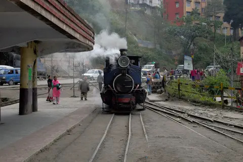
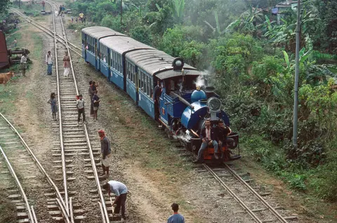
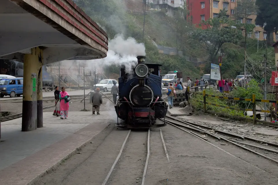
Over its 88.48-kilometre route from New Jalpaiguri (100 metres) to Darjeeling (around 2,100 to 2,200 metres), the line climbs past Ghum station at 2,258 to 2,260 metres, India's highest railway station. En route it passes Siliguri Town, Siliguri Junction, Sukna, Rangtong, Tindharia, Gayabari, Mahanadi, Kurseong, Tung, Sonada, Rongbull and the tea depot at Jorebungalow. Rather than boring long rock tunnels, engineers used four to six zig-zag reversing stations and three to four spiral loops. This eased steep bankings to around 1 in 23 to 1 in 31 (uniformly 1 in 28 after 1882 alignments). Notable loops include the tight 21-metre-radius curve at Loop 4 (Agony Point) and the 1919 Batasia Loop 5 kilometres below Darjeeling facing Kangchenjunga. Earlier loops 1 and 2 near Sukna and Rangtong were swept away by 1991 and 1942 floods. Running directly beside National Highway 110 (Hill Cart Road), trains pass tea warehouses and roadside shopfronts at 20 to 25 kilometres per hour. Engines sound shrill whistles continuously while climbing past landmarks like Sensation Corner and backing across a busy street out of the dead-end station at Kurseong.
Heritage traction defines the ride. Sharp, Stewart and Company with the North British Locomotive Company supplied 34 B-Class 0-4-0ST saddle-tank steam locomotives between 1889 and 1925. Of these, 12 survived in service or overhaul by 2005 to haul daily Darjeeling-Ghum Joy Rides and Darjeeling-Kurseong Red Panda runs. Six 1997 NDM-6 diesel locomotives, with three more slated for 2025, handle longer scheduled trains and modern vistadome coaches introduced on 25 August 2021 after an 18-month suspension. By 1910 the line carried 174,000 passengers and 47,000 tons of goods, and it supported military logistics during World War II. It survived major 1897, 1899 and 1934 tremors plus 1988 to 1989 Gorkhaland disruptions while keeping historical shops active at Tindharia. There, locomotive No. 787 underwent oil trials before plinth display at Siliguri Junction, while No. 794 moved to Matheran and No. 778 entered preservation in Britain.
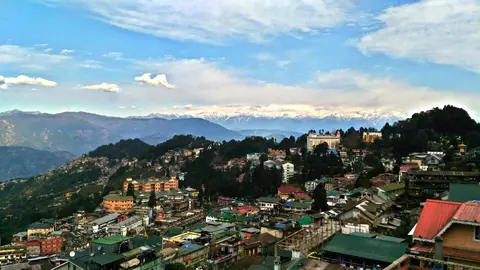
Nilgiri Mountain Railway Abt Rack Traction and Monsoon Bridges
Added to the World Heritage serial site in 2005, the Nilgiri Mountain Railway (NMR) runs 45.88 kilometres on a single metre-gauge track (1,000 millimetres) through the Nilgiri Hills of Tamil Nadu in southern India. First proposed in 1854 to replace slow bullock carts and pack horses, construction did not begin until 1891 under the Madras Railway, later the South Indian Railway Company and now India's Southern Railway zone. Services opened as far as Coonoor in June 1899 and reached Udagamandalam (Ooty) in October 1908. Climbing from 326 metres at Mettupalayam to 2,203 metres at Ooty, the single-track line counts 250 bridges, 15 road over-bridges and 16 tunnels (the longest measuring 97 metres).
Technical necessity separates Nilgiri from India's other hill lines: it remains the only rack-and-pinion railway in the country. After crossing 7.2 kilometres of level adhesion track from Mettupalayam to Kallar, the steep ascent up to Coonoor averages a 1 in 24.5 gradient (steepest 1 in 23). This climb requires central Abt double-bar rack rails between the running rails. Special steam locomotives engage toothed pinions onto the rack bars on the steep climb, relying on four separate braking systems. Two hand brakes serve shunting, one gripping wheel tyres normally and the second engaging grooved surfaces on the pinion axle inside rack sections, while two air brakes control steep descents. Uphill trains take roughly 290 minutes (4.8 hours) and downhill descents take 215 minutes (3.6 hours), though heavy monsoon rainfall triggers periodic landslips.
Kalka-Shimla Railway Viaducts, Barog Tunnel and Gauge Revisions
Inscribed on 8 July 2008 as the third UNESCO component, the Kalka-Shimla Railway (KSR) runs 96.6 kilometres through the Siwalik Hills of Himachal Pradesh. It climbs from Kalka (656 metres) to Shimla (2,075 to 2,076 metres), the summer capital of British India from 1864. First mooted in 1847, the route was surveyed repeatedly in 1884, 1885, 1892, 1893 and 1895 after the broad-gauge Delhi-Kalka line opened in 1891. Engineers rejected a 1 in 12 rack plan in favour of a 1 in 25 or 1 in 33 adhesion alignment. Construction began in 1898 under the private Delhi-Ambala-Kalka Railway Company, led by Chief Engineer Herbert Septimus Harington and contractor Sujan Singh Hadaliwale. Initially laid on 610-millimetre tracks, Indian Army pressure for strategic capacity prompted a contract revision on 15 November 1901 widening the gauge to 762 millimetres (2 feet 6 inches). Viceroy Lord Curzon dedicated the 95.68-kilometre trunk on 9 November 1903, followed by state purchase on 1 January 1906 and a 1909 Shimla Goods extension.
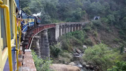
Rather than zig-zags, Kalka-Shimla conquered 1,419 metres of vertical rise through sheer civil engineering across 20 stations passing Dharampur, Solan, Kandaghat, Taradevi, Barog, Salogra, Jutogh and Summerhill. The route counts 912 to 919 curves, the sharpest 48 degrees at a 37.47-metre radius, alongside 864 to 988 bridges including the five-tier stone arched gallery Bridge No. 226. Trains traverse 102 active tunnels out of 103 to one hundred and seven built, anchored by the 1,144-metre Barog Tunnel (No. 33). Trains climb via loops at Taksal, Gumman and Dharampur past a 20-million-year-old Miocene plant-stem fossil bed at Koti station (with neighbouring fossil sites at Kumarhatti, Kasauli from 1864 and Jagjit Nagar). Early Sharp, Stewart 0-4-2T locomotives and thirty Hunslet and North British 2-6-2T Class K and K2 engines worked in tandem with short-lived 1928 Kitson-Meyer articulated locos and 1935 Henschel ZF engines before regular steam ended in 1971. Succeeding diesel fleets introduced Arnold Jung ZDM-1 diesels (1955), MaK ZDM-2 diesels (1960s) and 522-kilowatt ZDM-3 diesel-hydraulics built in 1970 to 1982 and 2008 to 2009. From 1908 onward, lightweight 33-by-7-foot steel bogie carriages topped with aluminium roofs lifted train capacity from four to six coaches. Today, trains run with winter snow cutters and glass-roofed railcars across named expresses including the Shivalik Deluxe Express, Himalayan Queen, Kalka Shimla Express, Rail Motor and ten-carriage Shivalik Queen.
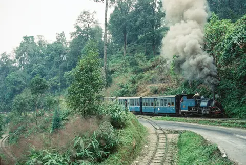
Operational Preservation Across Three Indian Mountain Ranges
All three UNESCO lines remain active public transit corridors owned by India's Ministry of Railways and protected under the 1989 Railway Act and 1971 Public Premises Act rather than frozen museum lines. Daily passenger timetables keep local towns linked to foothill broad-gauge junctions while supporting historic workshops at Tindharia, Mettupalayam and Kalka that still fabricate small-gauge springs, axle boxes and boiler fittings from nineteenth-century blueprints. Track gangs and engineers at the Research Designs and Standards Organisation continuously rebuild stone retaining walls and clear hillside drainage channels after monsoon rockfalls, earthquakes and storm washouts such as the 2023 North India floods along Kalka-Shimla. While Nilgiri and Kalka-Shimla maintain active Property Management Plans addressing infrastructure and encroachment, Darjeeling awaits a fully endorsed Conservation Management Plan. Two fellow narrow-gauge lines, the 19.97-kilometre 610-millimetre Matheran Hill Railway in Maharashtra and the 163.72-kilometre 762-millimetre Kangra Valley Railway in Himachal Pradesh, stand on India's tentative heritage list outside the three currently inscribed railways, demonstrating how broadly mountain rail engineering adapted across India's hill districts.
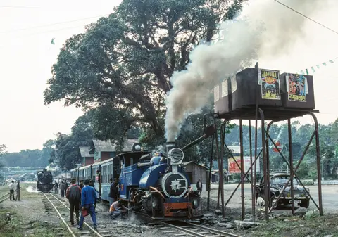
Three Inscribed Hill Railway Zones and Ticketing Rules
Because thousands of kilometres separate West Bengal, Tamil Nadu and Himachal Pradesh, travellers select one or more lines individually rather than connecting between them in a single day.
| Complex Zone | Key Highlights | Access & Ticket Rule |
|---|---|---|
| Darjeeling Himalayan Railway (West Bengal) | 88.48 km 610 mm gauge, Ghum summit at 2,258 to 2,260 m, Batasia Loop, Agony Point, Tindharia workshops and B-Class steam engines | Indian Railways reservation required for Joy Rides, Red Panda steam runs and NJP-Darjeeling expresses; station museums at Kurseong and Ghum |
| Nilgiri Mountain Railway (Tamil Nadu) | 45.88 km metre-gauge Abt rack track from Mettupalayam to Ooty via Kallar and Coonoor across 250 bridges and 16 tunnels | Advance reserved seating critical for the morning uphill Mettupalayam-Ooty service; unreserved classes fill early at Coonoor |
| Kalka-Shimla Railway (Himachal Pradesh) | 96.6 km 762 mm gauge, 102 active tunnels including 1,144 m Barog Tunnel, Bridge No. 226 and 20 stations up to Shimla | Separate booking per train class (Shivalik Deluxe, Rail Motor, Himalayan Queen or Passenger); broad-gauge Delhi trains connect directly at Kalka |
Three Trackside Engineering Details Across the Mountain Lines
First, watch the undercarriage and central rail between Kallar and Coonoor on the Nilgiri Mountain Railway. Between the outer metre-gauge rails sits a twin-blade toothed Abt rack bar bolted to sleepers, allowing steam locomotive pinions to bite directly into steel teeth so heavy coaches neither slip backward climbing 1 in 23 grades nor run away descending.
Second, walk or ride into the spiral loop at Batasia 5 kilometres below Darjeeling, where the 610-millimetre track circles a landscaped memorial ridge for Gorkha soldiers, dropping steadily without abrupt reversing switches while opening panoramic views toward Kangchenjunga.
Third, observe the stone masonry piers of Bridge No. 226 along the Kalka-Shimla ascent and the tapering aluminium roofs of its bogie passenger coaches. Rising in five stacked arched tiers like a Roman aqueduct, the viaduct bridges a narrow gorge where sharp 48-degree curvature forced engineers to minimise coach weight as early as 1908.
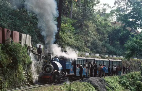
Weather Windows, Reservations and Wider Indian Rail Links
Monsoon storms between summer and early autumn frequently trigger landslides and temporary suspensions on all three lines, especially across the Nilgiri ghats and Siwalik foothills, while winter brings clear Himalayan views from Darjeeling and occasional snow-cutter clearance at Shimla. Clear spring and late-autumn mornings offer reliable departures and long mountain visibility, provided tickets on heritage steam cars or glass-roofed rail motors are booked well ahead through Indian Railways channels.
Because the three inscribed lines sit at opposite corners of India, each connects naturally to regional broad-gauge trunks rather than one single airport (Jabalpur Airport JLR lies 76 kilometres from the serial listing's central geographic reference point). Travellers combining northern and eastern rail corridors can anchor broader itineraries from our Varanasi destination guide, 340 kilometres from that central serial coordinate, and compare further engineering landmarks across South Asia inside our UNESCO World Heritage Atlas.