Quick Field Data
- UNESCO Inscription: 2014 (Ref. 1459), transnational serial cultural road system across Argentina, Bolivia, Chile, Colombia, Ecuador and Peru; Criteria (ii), (iii) and (iv).
- Scale & Footprint: 3,642.8067 hectares encompassing 273 component sites (137 component areas and 308 associated archaeological sites spanning 616.06 kilometres of conserved road) selected from a >30,000-kilometre Andean network.
- Access & Ticketing: Managed under national heritage ministries and rural community custodianship under a 2012 six-nation Management Strategy; check national booking rules for permit-regulated tracks such as Peru's Inca Trail.
- Arrival Logistics: Major flights serving Peru's central highlands arrive at Alejandro Velasco Astete International Airport (CUZ) near Cusco, 156 kilometres east of the Apurímac midpoint and 117 kilometres from Machu Picchu.
Four Imperial Roads Radiating From Cusco Across Tawantinsuyu
Stretching across snow-capped mountain passes above 6,000 metres, tropical rainforest slopes, fertile highland basins and arid coastal deserts, the Qhapaq Ñan (meaning royal road in Quechua) formed pre-Columbian South America's most advanced transport system. Incorporating earlier networks built by the Wari culture in north-central Peru and the Tiwanaku culture in Bolivia, the Inca Empire expanded the grid to its 15th-century height across Tawantinsuyu. Without relying on wheeled vehicles, this vast state artery unified nearly two million square kilometres inhabited by roughly 12 million people across modern Colombia, Ecuador, Peru, Bolivia, Chile and Argentina. Scholarly estimates span 23,000 to over 40,000 kilometres, while UNESCO selected 273 representative sites spread across more than 6,000 kilometres.
All four cardinal highways radiated directly outward from the central plaza of Cusco, capital of Tawantinsuyu, called Cozco (literally Earth's navel according to chronicler Inca Garcilaso de la Vega). Chinchaysuyu pushed northward along routes measuring three to sixteen metres wide through major administrative centres including Vilcashuamán, Xauxa, Tarmatambo, Pumpu, Huánuco Pampa, Cajamarca and Huancabamba in Peru, continuing through Ingapirca, Tomebamba and Riobamba to Quito in Ecuador and Colombia's Los Pastos (Nariño Department). Regarded by the Incas as the primary Qhapaq Ñan trunk, this highland sierra spine measured 5,658 kilometres from Quito southward all the way to Mendoza in Argentina.
Southward from Cusco, Qollasuyu divided into twin arms skirting the eastern and western shores of Lake Titicaca before converging across Bolivia's Altiplano. Continuing onward across the Atacama Desert and Diaguita lands, Qollasuyu reached both Mendoza in Argentina and the Maipo River near Santiago in Chile, marking the empire's southernmost frontier. Westward, transverse Contisuyu routes dropped rapidly across steep western ecological tiers from Cusco toward Pacific valleys in Arequipa, Moquegua and Tacna. Meanwhile, lesser-known Antisuyu branches descended eastern Ceja de Jungla ridges toward Amazonian provinces, including a 470-kilometre corridor recently surveyed from Huánuco Pampa eastward.
Linking these four provinces required two parallel north-south trunks joined by more than twenty transverse mountain roads. The eastern sierra spine traversed high-altitude puna grasslands above 4,000 metres, rising over 5,000 metres on extreme passes, purposefully hugging straight open plateaux above densely settled valley bottoms to keep official movement swift. Meanwhile, the western coastal road ran inland along desert foothills from Tumbes near Ecuador southward, roughly outlining the alignment of today's Pan-American Highway. Together, both axes channelled up to 40,000 people, armies, llama trains and precious cargo smoothly across extreme continental relief.
Tambos, Qullqas, Chasqui Relays, and High-Pass Masonry Engineering
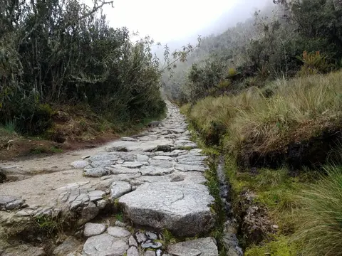
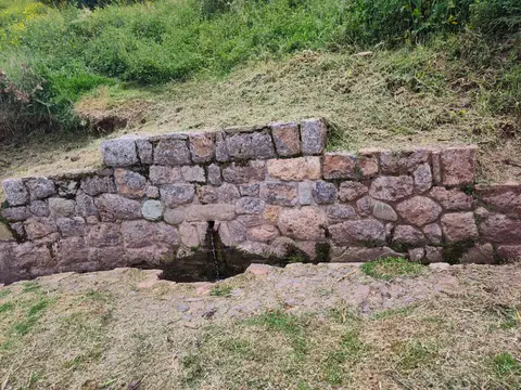
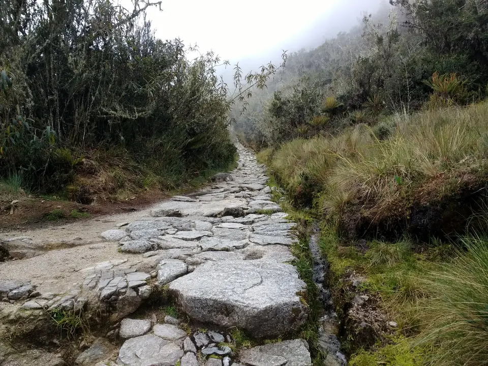
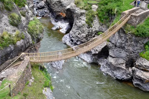
Constructing a continuous road network across 5,000 of the Andes' 7,000-kilometre mountain spine demanded skilled civil engineering tailored locally to mud, granite, desert sand and snow. Builders adjusted local stone types, paving flat segments in fitted cobblestones, carving rock staircases up vertical cliffs, raising stone embankment causeways across flooded Lake Titicaca shores near Chucuito and cutting drainage ditches and pipes to stop monsoon erosion. Where rivers sliced deep canyons, engineers hung braided fibre suspension spans such as Peru's living Q'eswachaka bridge or strung tarabita cable crossings above rushing torrents. Rather than forcing one rigid blueprint across dissimilar terrain, imperial engineers standardised key drainage and width grades while honouring regional materials.
Official roadside facilities transformed steep stone trails into an efficient communications and supply machine. At regular short intervals stood compact huts for chasquis, relay runners sprinting messages and small imperial bundles briskly across mountains. At single-day walking intervals rose tambos offering overnight shelter, cooked rations and paddocks for llama pack caravans carrying metals, textiles, maize, feathers, wood, coca and prized tropical spondylus shell (muyu). Frontier boundaries and newly incorporated territories additionally stationed stone pukaras (fortresses) watching critical mountain passes.
Equally vital were state warehouse complexes known as qullqas (collcas), positioned strategically along cool, dry Altiplano heights ideal for preserving grain and maize long term. Huánuco Pampa alone preserves 497 stone collcas boasting a combined storage capacity of 37,100 cubic metres capable of sustaining 12,000 to 15,000 inhabitants and imperial forces. Even larger storage clusters stood at Cotapachi near Cochabamba in Bolivia, where 2,400 collcas lined remote high-altitude plains far from major villages. Scholarly research by John Hyslop explains that Incas aligned main puna roads along cold open uplands specifically to bypass settled valley populations, sustain direct imperial communications and anchor rapid intermediate military control zones. Hyslop notes that official state traffic (soldiers, porters, nobles and llama trains) held priority, with ordinary subjects travelling primarily by permission while also sustaining some undocumented private movement along rural paths.
Five centuries after imperial collapse, the Qhapaq Ñan still leaves measurable socio-economic imprints across Andean communities. A 2021 academic study documented higher wages, nutrition and school attainment among populations living within 20 kilometres of historic Inca road lines compared with distant districts. Rural families across Peru, Bolivia and neighbouring nations continue following reciprocal labour customs rooted in Andean cosmovision, renewing bridges, sharing local trade markets and speaking Quechua and Aymara along mountain stretches. Far from static stone ruins, preserved road corridors continue tying remote villages together.
Six-Country Stewardship, Seismic Hazards, and Community Guardians
Safeguarding 273 dispersed sites across six sovereign jurisdictions ranks among UNESCO's most ambitious cooperative conservation efforts. Between 2010 and 2012, Argentina, Bolivia, Chile, Colombia, Ecuador and Peru signed joint declarations culminating in the high-level Management Strategy of 29 November 2012. Moving from a Paris-based nomination committee to regional coordination networks backed by a technical secretariat in Peru, participating governments align national heritage statutes across diverse provinces and seven regional frameworks. GIS mapping projects help planners visualise functional relationships linking isolated preserved road segments back to the unified 30,000-kilometre imperial network.
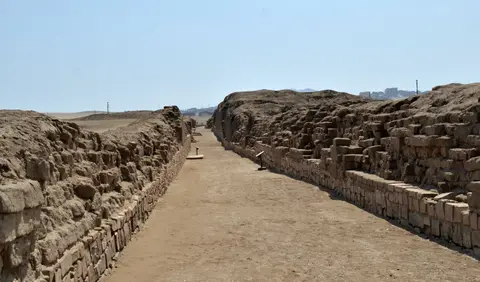
Local rural communities stand at the absolute centre of daily road preservation across high Andean plateaux. On active village stretches, community custodians manage decisions directly, repairing washed-out drainage ditches and drystone retaining walls using original local earth and rock rather than jarring modern cement. At prominent archaeological sanctuaries like Pachacamac or Chucuito, professional conservators apply non-invasive stone stabilisation respecting original fabrics. Because many segments lie across remote rural pastures free of modern roads, isolation has protected original paving stones and open 360-degree viewsheds along summit ceremonial sites across many kilometres in all directions.
Still, fragile integrity across fragmented stretches requires constant vigilance against agriculture, urban highway expansion and earthquakes. Farming plots encroaching across unmarked earthen road traces risk erasing historic stone borders unless cultivated safely under local stewardship pacts. Across seismically active Andean ridges, major earthquakes threaten elevated tambo walls, qullqa storehouses and ceremonial terraces, making disaster risk planning and monitoring urgent priorities. Meanwhile, modern development around mountain horizons demands strict visual buffer safeguards so pylons or mining tracks never fracture summit sightlines.
Growing heritage tourism brings both livelihood opportunities and path erosion risks across well-known Peruvian corridors. While remote Argentine passes like Abra del Acay or Bolivian Altiplano segments see minimal visitor footfall, popular highland tracks near Cusco demand strict permitting and trail caps to protect original flagstones. Rural villagers increasingly express interest in community-driven tourism sharing living oral histories, ancestral weaving and mountain hospitality directly with visitors. Balancing modest interpretive facilities with community ownership preserves authentic Andean life together with ancient stone engineering.
Access Zones Along the Qhapaq Ñan Andean Road Network
Consult any qhapaq ñan map carefully before planning multi-country logistics, since 137 inscribed component areas span thousands of kilometres from southern Colombia to central Chile. Check national heritage park permits well ahead for regulated highland trekking corridors.
| Complex Zone | Key Highlights | Access & Ticket Rule |
|---|---|---|
| Cusco and Machu Picchu Trails | Fitted stone flagstones, coastal/highland passes and Inca Trail segments near Machu Picchu. | Regulated strictly by Peru's Ministry of Culture; licensed tour operators and advance official trail permits are mandatory. |
| Huánuco Pampa and Northern Sierra | 497 collca storehouses, expansive Chinchaysuyu imperial plaza and high puna road alignments in central Peru. | Remote highland road access from Huánuco; open archaeological plains with minimal modern visitor infrastructure. |
| Lake Titicaca and Altiplano | Raised stone causeways at Chucuito, island road branches and wide Bolivian warehouse corridors. | Accessible by regional roads from Puno or La Paz; local community customs govern agricultural edge paths. |
| Coastal and Southern Spurs | Walled Inca avenue at Pachacamac near Lima, Abra del Acay passes in Salta and Atacama desert segments. | Varying national rules across Peru, Argentina and Chile; verify site entry desks and desert road weather locally. |
Three Engineering Details Across Coastal and Altiplano Segments
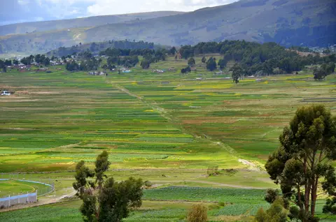
- Raised Stone Causeways Over Wetlands at Chucuito: Inspect elevated masonry embankments near Lake Titicaca engineered specifically to keep royal llama caravans moving dryly above seasonal rises in lake water levels.
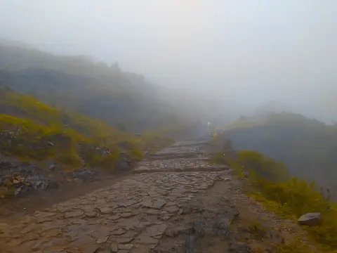
- Cross-Channel Stone Drains and Fitted Staircases: Examine highland paved trails near Cusco and Apurímac where transverse stone channels divert fierce mountain storm runoff away from retaining walls and stepped cliff stairs.
- High-Altitude Collca Storehouses at Huánuco Pampa: Observe rows of ventilated rectangular stone warehouses aligned deliberately along windswept Altiplano ridges where cold dry air preserved maize and grain supplies long term.
Planning Inca Trail Hikes and Highland Routes Through Cusco
For trekkers researching the inca trail to machu picchu, understanding how famous Cusco footpaths connect to the broader Qhapaq Ñan enriches every mountain pass. Running along stone-paved Chinchaysuyu and highland feeder trails, the classic inca trail hike attracts global walkers checking inca trail elevation profiles rising across thin Andean air above 4,000 metres. Travellers comparing the permit-capped inca trail vs salkantay trek or booking regulated inca trail tours must verify official Peruvian government seasonal maintenance rules ahead of travel, checking current inca trail closed or inca trail closure notices directly rather than relying on outdated third-party blogs.
Questions over how long to walk inca trail routes and how to read a detailed inca trail map depend directly on the specific official route option and guided pace authorised by licensed Peruvian operators. Visitors preferring accessible day walks without multi-day camping can experience the Qhapaq Ñan effortlessly at Pachacamac's coastal road near Lima, Chucuito's embankment along Lake Titicaca or Huánuco Pampa's vast stone plaza. Carrying sun protection, rain layers and gradual altitude acclimatisation days in Cusco makes walking high stone paths safe across dry Andean winter months.
International travellers exploring Peruvian segments of the Qhapaq Ñan typically fly into Alejandro Velasco Astete International Airport (CUZ) near Cusco, situated 156 kilometres east of the site's Apurímac reference midpoint and 117 kilometres southeast of Machu Picchu. From Cusco, regional roads and mountain railways radiate straight toward sacred valley trailheads, Apurímac bridges and Lake Titicaca. Explore further pre-Columbian highways and archaeological landscapes across South America inside our UNESCO World Heritage Atlas.