Quick Field Data
- UNESCO Inscription: 2005 · Criterion (viii) · Natural Heritage · Ref. 1186
- Scale & Footprint: 20,015 hectares (covering a 200-square-kilometre or 77-square-mile fossil-bearing valley) designated as a strictly protected World Heritage Zone inside Egypt's wider Wadi El-Rayan Protected Area
- Access & Ticketing: Administered by the Nature Conservation Sector of Egypt's Environmental Affairs Agency; entry requires protectorate fees, prearranged guided tour registration and strict prohibition of vehicles beyond designated outer perimeter trails
- Arrival Logistics: Situated in Faiyum Governorate roughly 150 kilometres (93 miles) southwest of central Cairo (129 kilometres straight-line from Cairo) and approximately one hundred and forty-six kilometres from Cairo International Airport (CAI). Closer Sphinx International Airport (SPX, about one hundred and ten kilometres) carries limited scheduled passenger routes.
Eocene Marine Formations and Differential Cliff Erosion
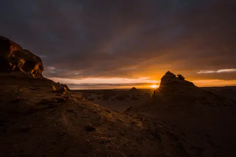
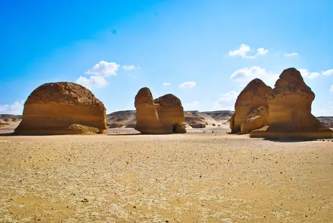
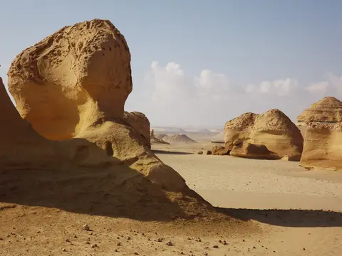
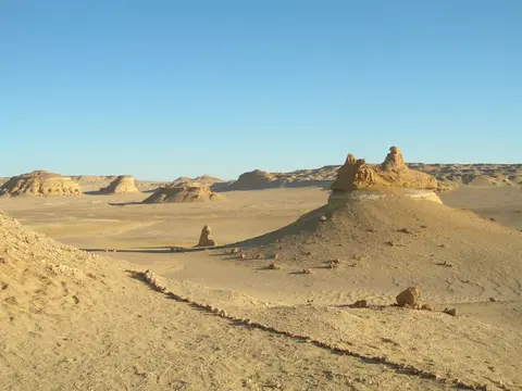
Hidden behind the iron-stained escarpment of Garet Gohannam (Mountain of Hell, whose rugged western cliffs glow deep red under the setting sun), Wadi Al-Hitan lies inside Egypt's Western Desert. Known as Whale Valley, the site preserves an open geological textbook of the Middle to Late Eocene epoch, dating to roughly 40 to 41 million years ago. At that time, shallow coastal bays along the southern margin of the ancient Tethys Ocean submerged northern Egypt, depositing marine muds, open-shoreline sands and shell-rich lagoonal carbonates. Persistent desert wind and rare water erosion sculpted these sediments into steep desert cliffs and flat-topped mesas across 20,015 hectares of Faiyum Governorate. Set within the wider scenic terrain of the Wadi El-Rayan Protected Area, the basin exposes broad expanses of fossil-bearing rocks whose clarity and accessibility allow geologists to read prehistoric marine habitats directly from weathered desert slopes. Unlike remote sites buried beneath thick vegetation or dense soil, desert deflation leaves whole skeletal columns resting at the surface across an intact desert basin.
Three primary sedimentary rock units divide the valley stratigraphy into distinct marine water-depth zones. Across the lower, flatter eastern terrain beyond the main public park lies the Gehannam Formation, composed of open-marine mudstones packed with isolated shark teeth and deeper-water remains dated to 40 to 41 million years ago. Rising directly into the signature yellowish cliffs and freestanding mesas of the valley stands the Birket Qarun Formation, made of yellowish open-marine sandstones that hold the highest concentration of fossil whale skeletons. Breaking the otherwise uniform yellow sandstone walls runs a distinctive white marker horizon packed with preserved fossil animal burrows (formerly interpreted by geologists as mangrove roots) topped directly by a thin dark layer of black mudstone.
Capping the highest cliff escarpments around the valley sits the Qasr el Sagha Formation, alternating dark mudstones with limestone beds packed with marine shells laid down in a shallow coastal lagoon environment. Following the yellow sandstone cliffs of the Birket Qarun Formation eastward reveals their gradual lateral transition into finer mudstones of the Gehannam Formation. Walking the valley floor allows visitors and geologists to observe ancient seabed slope gradients transitioning from shallow coastal shoals out into deeper open-marine waters within a few kilometres.
Basilosaurus, Dorudon and the Aquatic Mammal Assemblage
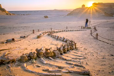
Although isolated earlier cetacean bones occur elsewhere on Earth, no site matches Wadi Al-Hitan in sheer fossil density, completeness and desert exposure: palaeontologists have documented 1,500 marine vertebrate fossil skeletons within a 200-square-kilometre basin, preserving evidence of millions of years of coastal marine life. Here lie articulated skeletons of the extinct archaeocete suborder Archaeoceti, preserving the decisive evolutionary chapter when ancient mammals abandoned terrestrial walking to become ocean-going whales. While their streamlined bodies already suited marine propulsion, their powerful skulls retained primitive tooth patterns similar to carnivorous land mammals, and their skeletons retained small hind legs, feet and toes with five-fingered flippers on the forelimbs, an anatomical combination previously unknown in archaeocetes. Together with surrounding marine vertebrate and plant fossils, these early whales document a decisive biological shift across ancient coastal waters rather than isolated bones washed offshore.
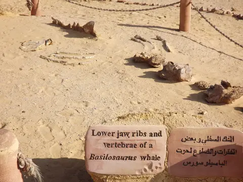
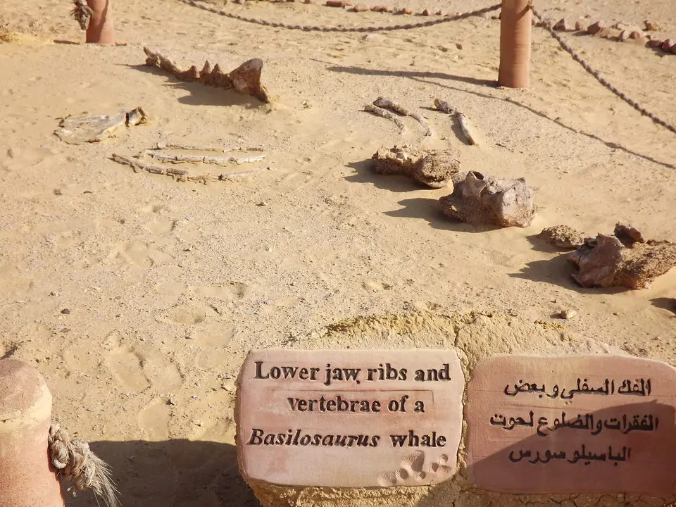
Two cetacean genera dominate public and research exposures across the sand floor, joined by rarer remains of at least two additional whale species. The giant carnivorous Basilosaurus reached up to 21 metres in serpentine length, with exceptional skeletons preserved so completely in desert sediment that fossilised stomach contents survive intact inside the ribcage. Living in the same Middle to Late Eocene coastal waters was the smaller 3- to 5-metre whale Dorudon. While several partial and complete skeletal remains lie exposed under protective desert shelters along public paths, most specimens remain shallowly buried in wind-scoured strata where natural erosion gradually uncovers new bones, revealing how both predatory whale species lived along shallow embayments.
Fossil diversity across Wadi Al-Hitan reconstructs an entire Eocene coastal ecosystem rather than whales in isolation. Three species of fossil sirenians (sea cows) display primitive anatomical traits not found in modern sea cows, with grazing dentition adapted to coastal seagrasses and marine plants also preserved in the strata. Bones of the primitive proboscidean elephant Moeritherium appear in nearshore deposits as well. Marine reptiles include crocodiles, sea turtles and sea snakes, while abundant bony fish, sharks and rays are represented chiefly by isolated small teeth plus a conspicuous 1.8-metre sawfish rostrum laid out along the park path. In 2021, palaeontologists identified the oldest known pelican fossil from late Eocene layers here, complementing a large fossilised tree log riddled with tubular shipworm burrows. Dense pavements of disc-shaped nummulite fossils coat desert flats where fallen boulders weather out packed with fossil shells, while whale bones remain comparatively rare in the shell-rich rock units.
Desert Discovery History, Wildlife and Vehicle Restrictions
Scientific discovery began during winter surveys in 1902 to the following year, when the first fossil whale skeletons were recorded in the remote Faiyum desert depression. Because shifting sands and unpaved desert tracks crossing open sand kept travel arduous, Wadi Al-Hitan attracted relatively little outside attention for roughly 80 years. During the 1980s, wider availability of four-wheel-drive vehicles opened the valley to off-road desert excursions and fossil collectors who removed loose bones. Urgent Egyptian conservation campaigns moved to halt unmonitored looting and protect exposed skeletal matrices before irreversible loss occurred. Park planners also laid out pedestrian boardwalks and shaded protective shelters separating foot traffic from fragile fossil strata across the public park.
Today Wadi Al-Hitan enjoys stringent statutory protection under Egyptian Law 102/1983 for Nature Protectorates, which explicitly designates geological formations as protected elements, and Prime Ministerial Decree No. 2954/1997 integrating the valley inside the state-owned Wadi El-Rayan Protected Area (WRPA). Under the updated World Heritage Zone management plan (2008 to 2013), the Nature Conservation Sector (NCS) of the Egyptian Environmental Affairs Agency coordinates an on-site planning team responsible for annual work plans and conservation monitoring. Strict non-motorised zoning permits no vehicles inside the World Heritage Zone. Visitors are limited to prearranged guided tours along marked desert footpaths, wooden walkways, shaded fossil shelters and a small outer desert campsite, supplemented increasingly by zero-impact foot and camel treks. Careful management guidelines also require maintaining an adequate outer buffer zone against wider desert traffic, training dedicated field staff and monitoring visitor impacts annually. Plans further uphold international best-practice scientific standards around active fossil research and restrict construction to minimal low-intrusion site infrastructure supporting sustainable desert tourism.
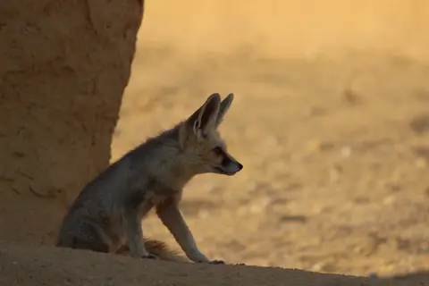
Annual visitation remains low at roughly 1,000 four-wheel-drive travellers reaching the reserve perimeter, mostly international visitors camping on winter weekends. Fragile surface skeletons still demand constant vigilance, underscored by a disputed July 2007 incident. Egyptian authorities alleged off-road diplomatic vehicles entered a restricted zone and damaged part of an exposed whale fossil, while the Belgian government disputed responsibility. Beyond fossils, the desert dunes and nearby Wadi El-Rayan lakes sustain 15 desert plant species, 19 reptile species, 36 breeding bird species and roughly 15 wild mammal species. Resident wildlife includes dorcas gazelle, striped hyena, caracal, Cape hare, Egyptian wolf, red fox, Egyptian mongoose, African wildcat and African leopard. Nocturnal fennec foxes also regularly patrol near the valley campsite after dark, offering quiet desert wildlife observation along the protected reserve edges.
Complex Access Zones and Protected Trails in Wadi Al-Hitan
Visitor access operates through clear zoning inside Wadi El-Rayan Protected Area, separating outer desert vehicle approaches from pedestrian-only paleontological exposures and scientific research zones.
| Complex Zone | Key Highlights | Access & Ticket Rule |
|---|---|---|
| Wadi El-Rayan Gate & Desert Approach Track | Unpaved Faiyum desert track curving past Garet Gohannam (Mountain of Hell) toward the World Heritage Zone perimeter | Protected-area admission checkpoint at reserve entry; high-clearance four-wheel-drive vehicles required up to outer car park |
| World Heritage Core Walkways & Shelters | In-situ articulated Basilosaurus and Dorudon skeletons, 1.8-metre sawfish rostrum, fossil shipworm log and wooden protective boardwalks | Strictly pedestrian-only access along prescribed trail lines under guided rules; zero off-trail walking or fossil touching permitted |
| Birket Qarun & Qasr el Sagha Cliff Margin | Stratified yellow sandstone buttes, white animal-burrow marker layer, black mudstones and shell-rich lagoon limestone caps | Viewed along outer marked scenic trails; active scientific excavation zones remain closed to unescorted entry |
| Outer Desert Campsite & Visitor Facilities | Low-impact visitor shelter infrastructure, interpretation displays and small winter overnight camp outside sensitive fossil strata | Overnight stays require advance coordination under Nature Conservation Sector camping protocols |
Three Geological and Fossil Features to Spot in Whale Valley
Walking the prescribed sand trails with an eye for rock horizons and bone anatomy clarifies why palaeontologists consider this basin unique among global Eocene marine exposures:
- Vestigial Hind Limbs on Articulated Basilosaurus Skeletons: Examine the hip region of exposed Basilosaurus vertebral columns under the valley shelters. Delicate pelvic and rear limb bones, no longer able to bear body weight on land, combine with streamlined bodies and carnivorous land-mammal dentition as physical proof of whale ancestry from four-legged terrestrial mammals.
- The White Animal-Burrow Horizon Inside Birket Qarun Cliffs: Scan the vertical faces of the yellow sandstone buttes to spot the continuous pale white band sandwiched below dark black mudstone. Once misread as mangrove roots, these preserved burrows mark shifts in ancient coastal seafloor oxygen and sedimentation above deeper-water mudstones.
- Disc-Shaped Nummulite Pavements and Fossil Shipworm Wood: Look down along permitted trail shoulders to find coin-like discoidal nummulite shells littering weathered sandstone flats, plus the large petrified log perforated by ancient marine shipworm tunnels and fossil seagrasses linking terrestrial shores to shallow coastal lagoon strata.
Seasonal Timing and Connecting Wadi Al-Hitan with Cairo
Because the Western Desert basin lacks natural shade across exposed sand flats and sandstone ledges, winter and early spring (from autumn cooling through March) offer the safest, clearest conditions. Cool months suit walking the fossil circuit, inspecting surrounding Eocene cliffs, observing sunset glow on Garet Gohannam and spotting nocturnal fennec foxes around evening campsites. Summer daytime heat climbs sharply across dark mudstone basins, making midday desert hiking hazardous and reinforcing why desert foot and camel treks operate predominantly during cool months.
Situated approximately one hundred and forty-six kilometres from Cairo International Airport (CAI) and 129 kilometres straight-line from Cairo, Wadi Al-Hitan runs cleanly as a dedicated desert excursion paired with our Cairo destination guide. Closer Sphinx International Airport (SPX, about one hundred and ten kilometres) carries limited scheduled passenger routes. Plan vehicle permits and local desert guide bookings ahead through Egyptian Nature Protectorate channels before leaving Faiyum. Explore additional fossil basins, ancient coastlines and evolutionary World Heritage landscapes inside our UNESCO World Heritage Atlas.