Quick Field Data
- UNESCO Inscription: Natural World Heritage Site (Ref. 1195), inscribed in 2005 under Criteria (vii) and (viii).
- Scale & Footprint: 122,712 hectares (including 10,746 hectares of marine waters) linking Geirangerfjord and Nærøyfjord 120 km apart within a 500-kilometre fjord belt between Stavanger and Åndalsnes.
- Access & Ticketing: Mountain overlooks, village roads, and public trails stay open without fees. Any Geirangerfjord cruise, kayak hire, or Geiranger to Hellesylt car ferry requires separate operator tickets.
- Arrival Logistics: Ålesund Airport (AES) sits 124 km northwest as the main coastal air hub, while Ørsta-Volda Airport, Hovden (HOV) lies 88 km away with limited routes. Ålesund lies 115 km northwest.
Glaciated Crystalline Walls and Serial Fjord Geography
Located northeast of Bergen along Norway's dramatic western seaboard, Geirangerfjord and Nærøyfjord serve as global reference points for glacial fjord formation. Fjord, a Norwegian term describing a deep sea inlet flooding a glacier-carved valley between towering cliffs, reaches maximum vertical expression here across 122,712 hectares, including 10,746 hectares of marine waters. Although separated overland by 120 km inside Norway's 500-kilometre western fjord zone extending from Stavanger in the south to Åndalsnes in the northeast, both arms rank among the least hydroelectric-altered among Norway's 200 western fjords.
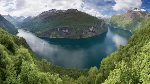
During the Pleistocene ice ages of the Quaternary era, immense glaciers gouged narrow, winding troughs deep into ancient crystalline rocks before melting seas inundated the basins. Today, crystalline rock walls climb almost straight out of the Norwegian Sea up to 1,400 metres high while descending as deep as 500 metres below sea level. Those steep ice-polished and wave-polished sides present natural three-dimensional cross-sections through deep bedrock rarely matched elsewhere on Earth.
Together, Geirangerfjord and Nærøyfjord preserve contrasting geological morphologies spanning an entire inner fjord ecosystem. Visitors sailing through or hiking surrounding catchment plateaus encounter submerged rock basins, prominent sill thresholds, moraine ridges, glacial till beds, hanging valleys, slide scars, and avalanche fans. Postglacial isostatic rebound continues lifting Norway's crust slowly following ice retreat, shaping distinctive agnor or fish-hook valleys carved when river drainage reversed during deglaciation.
Unlike transboundary marine sites divided across multiple legal systems, single-state Norwegian governance streamlines protection under the Norwegian Nature Diversity Act and Planning and Building Act. While private landowners hold 85 percent of the land, County Councils, Borough Councils, and County Governors bound their cooperation through a formal Declaration of Intent backing IUCN Category V protected landscapes and strict nature reserves. Close environmental scrutiny governs two active mineral sites nearby: an external peridotite quarry close to Geirangerfjord slated for eventual restoration, and underground anorthosite mining visible from Nærøydalen roads, where strict environmental impact rules guard against visual or shipping harm.
Geirangerfjord, Seven Sisters Waterfalls, and Cliffside Farms
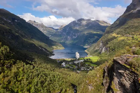
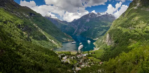
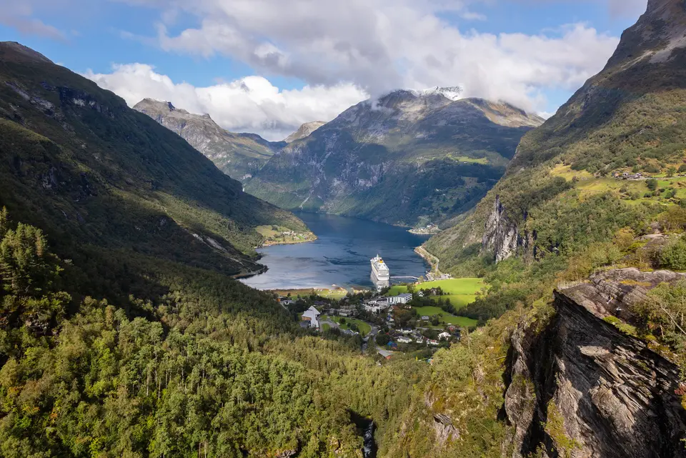
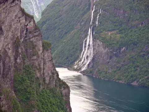
In the Sunnmøre region of Møre og Romsdal county inside Stranda Municipality, Geirangerfjorden runs 15 km inland as a dramatic branch off Sunnylvsfjorden and Storfjorden, known as the Great Fjord. At its eastern head lies the small village of Geiranger, built right where the Geirangelva river flows out of mountain valleys into green fjord waters. Because vertical rock strata plunge almost directly into the water with scarcely any level shore, free-flowing rivers from high glaciers and alpine lakes leap over cliff lips in foaming cascades.
Two famous waterfalls face off across Geirangerfjord Norway roughly midway between Geiranger and the outer bend. On the northern cliff, the Seven Sisters Falls splits across seven slender streams plunging down dark rock, facing The Suitor (known in Nynorsk as Friaren) directly opposite on the southern wall, linked in folklore as a suitor forever wooing the sisters across the channel. Nearby, the Bridal Veil waterfall glides delicately over a jagged rock crest, appearing like sunlit lace against dark gneiss when caught by afternoon sun, while upper road lookouts at Flydalsjuvet and Ørnesvingen capture dramatic perspectives for Geirangerfjord photos.
Clinging to narrow grassy benches far above the ship channel stand abandoned transhumant mountain farms preserved partly through volunteer restoration by Storfjordens venner. Writer Magdalene Thoresen, mother-in-law of playwright Henrik Ibsen, described these precipitous ledges vividly, marveling at paths winding along dizzying cliffs and narrow bridges pinned straight into solid mountain stone with iron bolts and rings. Hikers today can walk out along mountain paths from Geiranger village up to Skageflå farm overlooking the falls, whereas neighbouring Knivsflå and Blomberg demand small boat landings.
Protecting this narrow marine corridor has repeatedly required resisting industrial encroachment, including past disputes over hanging high-voltage power lines across the fjord. Natural slope instability also poses serious geohazards actively monitored by Norwegian scientists beneath comprehensive risk-preparedness plans. Specifically, the unstable mountain flank at Åkerneset above Sunnylvsfjorden is slowly detaching and threatens to collapse into deep water. Such a slide could generate a megatsunami reaching Geiranger and Hellesylt in roughly ten minutes, a real geohazard dramatised in the 2015 Norwegian disaster film The Wave (Bølgen). International film audiences also saw both fjords inspire the animated landscapes of Arendelle in 2013's Frozen.
Visitor traffic remains concentrated along the narrow inner channels during a relatively brief summer cruise season, demanding careful management to safeguard fjord air and water quality. Unlike transboundary coastal World Heritage areas spanning multiple countries, single-state governance simplifies Norwegian coordination through advisory committees and a regularly meeting management council. Comprehensive long-term management plans pair improved geological monitoring with strict environmental assessments before any mining, quarrying, or protective infrastructure changes proceed inside either valley.
Nærøyfjord Narrows and Mountain Links Toward Bergen
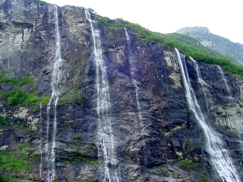
One hundred and twenty kilometres south inside Aurland Municipality in Vestland county, Nærøyfjord forms the narrowest inner arm branching off Aurlandsfjord and the mighty Sognefjord system. Measuring around 17 km long, Nærøyfjord pinches down to barely 250 metres wide at its narrowest bend and remains under 500 metres wide south of Bakka village. Towering mountain ridges rise up to 1,761 metres above sea level on either flank, standing just 3 km apart from summit to summit across a shadowed deep-water trench.
At the innermost head of the fjord lies Gudvangen, where the Nærøydalselvi river enters sea water out of steep Nærøydalen valley. Older Norwegian topographical descriptions noted shallow water across the threshold near Bakka before the trench plunges deeper further inward, helping explain how severe cold winters occasionally froze Nærøyfjord solid. Both in the 1920s and again in 1962, scheduled coastal boats halted at the ice margin unable to push through to inner piers. Early printed accounts appeared in Amund Helland's classic Norges land og folk series, and National Geographic's Destinations Rated survey later ranked Norway's fjord region first globally.
Encircled by protected nature reserves spanning Aurland, Voss, Vik, and Lærdal municipalities, the fjord sustains intact ecosystems rising swiftly from marine kelp beds and seals through broadleaf woodlands to alpine meadows and snowfields. Although historic cliffside farms and tiny hamlets enrich human interest along steep shores, scholarly assessments emphasise that international conservation treats Geirangerfjord and Nærøyfjord first as dynamic natural and geological landscapes rather than cultural monuments. Travellers weighing things to do Geirangerfjord or planning Geirangerfjord from Bergen excursions find two distinct regional experiences. Southern Nærøyfjord connects smoothly with mountain railways out of Bergen via Flåm and boat cruises to Gudvangen, while northern Geirangerfjord pairs naturally with Sunnmøre coastal ferries and Norway's zero-emission fjord vessel rules scheduled for 2026.
Sailing lengthwise through Geirangerfjorden aboard the Fjord1 Nordvestlandske car ferry between Geiranger and Hellesylt doubles as one of western Norway's simplest sightseeing crossings without private boat charters. On land, walking paths out of Geiranger village give fit hikers direct overland access to Skageflå farm perched above the fjord, while boat excursions serve more isolated Knivsflå and Blomberg ledges. Combining a slow vessel crossing with an elevated road ascent up Ørnesvingen or Flydalsjuvet reveals how waterfall mist, glacial ledges, and sheer bedrock walls interlock across both arms.
Across both valleys, alpine vegetation shifts steadily with altitude from tidal kelp and meadow grasses through broadleaf birch groves and coniferous belts up to barren glacial summits. Free-flowing rivers race down hanging valleys from snowfields and glacial lakes straight into saline basins, sustaining coastal porpoises, seals, and marine wildlife beneath steep forested spurs. Although modern roads connect Geiranger, Gudvangen, and Flåm smoothly to coastal towns, strict planning controls under municipal development plans protect the narrow cliff edges from intrusive resorts or dams. Visitors who allow an overnight stop beside quiet fjord piers experience calm early-morning reflections before daytime sightseeing boats enter either narrow channel. Stepping ashore along quiet village lanes around Gudvangen, Bakka, or Geiranger reveals how sheer walls shape light, weather, and mountain transport across western Norway.
Access Zones Across Geirangerfjord and Nærøyfjord
Separated by 120 km of alpine terrain, exploring Geirangerfjord & Nærøyfjord splits naturally into four coastal hubs and overlooks.
| Complex Zone | Key Highlights | Access & Ticket Rule |
|---|---|---|
| Geiranger and Flydalsjuvet Overlooks | Inner fjord village, Geirangelva valley mouth, Flydalsjuvet cliff terrace, and Ørnesvingen bends. | Public mountain roads and viewpoints stay free to visit, though summer parking is tightly regulated. |
| Seven Sisters and Skageflå Corridor | Seven Sisters, Suitor, and Bridal Veil falls plus restored cliff farms above Geirangerfjorden. | Hiking to Skageflå from Geiranger is free; Geirangerfjord cruise boats and ferry rides need tickets. |
| Gudvangen and Nærøyfjord Channel | 250-metre fjord narrows near Bakka, hanging valleys, and Gudvangen pier beneath 1,761-metre peaks. | Shoreline paths in Gudvangen stay open freely, while Flåm to Gudvangen cruises require operator tickets. |
| Hellesylt and Aurlandsfjord Gateways | Geiranger to Hellesylt car ferry route, Åkerneset monitoring zone, and rail links via Flåm. | Fjord1 car ferries and regional buses operate on seasonal schedules requiring passenger or vehicle fares. |
Polished Crystalline Walls, Hanging Valleys, and Cliff Farms
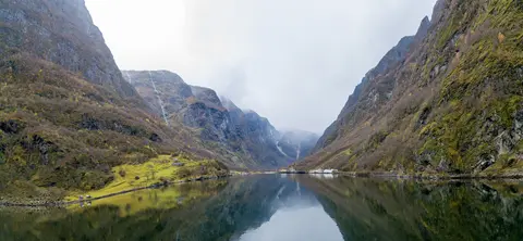
Observing Geirangerfjord photos from ship decks or cliff terraces brings out three striking natural and cultural details.
- Submerged glacial walls meeting 1,400-metre peaks: Notice how bare crystalline cliffs dive almost vertically past the shoreline down to 500 metres underwater without wide alluvial beaches.
- Paired opposite cascades at Seven Sisters and The Suitor: Mid-fjord, compare seven white ribbons dropping over the northern precipice against the single powerful spout directly facing them across narrow water.
- High terraced ledges holding abandoned mountain farms: Scan forested cliff shelves far above the ferry wake to spot restored timber huts at Skageflå and Knivsflå perched above sheer drops.
Best Time to Visit Geirangerfjord, Logistics, and Ålesund Pairings
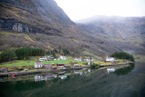
Choosing the best time to visit Geirangerfjord or nearby Geiranger centres on late spring through early autumn, when snowmelt swells the Seven Sisters waterfalls and high mountain passes stay open. Summer brings maximum ferry departures between Geiranger and Hellesylt operated by Fjord1 Nordvestlandske, lively sea kayaking, and long Nordic daylight, though large cruise ships concentrate visitors along compact quays during the brief warm season. Early autumn thins vessel traffic while lighting birch woodlands gold before winter snow closes elevated passes and quietens village roads.
Figuring out how to get to Geirangerfjord from Bergen or coastal towns is easiest through western Norway's regional gateways. Air arrivals land at Ålesund Airport (AES), 124 km northwest of the central fjord zone, while regional Ørsta-Volda Airport, Hovden (HOV) lies 88 km away with limited domestic routes; southern Nærøyfjord travellers also approach overland from Bergen via Flåm rail and Gudvangen cruises. Pairing steep Sunnmøre fjord walls with coastal harbour architecture in Ålesund, 115 km northwest, ties maritime life directly to glacial nature, and wider northern sites await in the UNESCO World Heritage Atlas.