Quick Field Data
- UNESCO Inscription: 2023 (Ref. 1695), cultural landscape in Epirus Region, northwestern Greece; Criterion (v).
- Scale & Footprint: 46 traditional Zagorochoria stone villages spread across roughly 989.8 square kilometres in the Municipality of Zagori, with around 93 percent lying within North Pindus National Park.
- Access & Ticketing: Protected under Law 3028/2002, Presidential Decrees of 1979 and 1995, and North Pindus National Park management; villages and footpaths remain open, though seasonal gorge conditions require local trail checks.
- Arrival Logistics: Primary commercial flights arrive at Corfu Ioannis Kapodistrias International Airport (CFU), 85 kilometres west near Corfu (83 kilometres). Closer Ioannina King Pyrrhus National Airport (IOA) sits 23 kilometres south with more limited schedules.
Molossian Origins, Autonomous Leagues, and Zagori Stone Villages
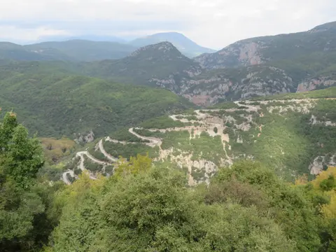
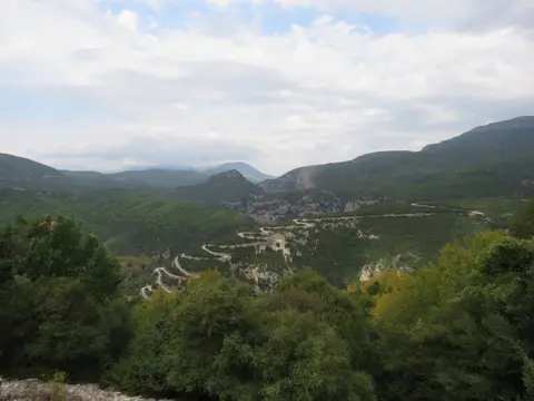
Shaped like an upturned triangle across the western Pindus Mountains in Greece's Epirus region, the Zagori Cultural Landscape unites 46 limestone villages inside dramatic river canyons. Ioannina borders the southern tip, Mount Mitsikeli (1,810 metres) frames the southwest, the Aoos river north of Mount Tymphe marks the north and the Varda river runs southeast toward Mount Mavrovouni (2,100 metres) near Metsovo. Archaeological layers inside Kleidi Cave along the Voidomatis River reveal epipaleolithic human traces dating 17,000 to 10,000 years ago. Later, classical Molossian communities settled here between the ninth and fourth centuries BC, leaving stone house foundations, cemeteries and cyclopean walls at Skamneli. Known in antiquity for fierce mastiff flocks guarding herds against bears and wolves, the Molossian royal lineage counted Olympias, mother of Alexander the Great, and Hellenistic king Pyrrhus.
Byzantine centuries deepened settlement across these steep valleys, giving the district a name likely derived from Slavic Zagore, meaning beyond the mountains. Imperial endowments established early sanctuaries such as the Monastery of Votsa near Greveniti, the seventh-century Monastery of the Transfiguration near Kleidonia under Emperor Constantine IV Pogonatus and the 1028 Monastery of St John of Rogovou near Tsepelovo. During the 14th century, Zagori supplied soldiers to Ioannina's garrison while Ioannina shielded mountain communities from regional raids under the Despotate of Epirus. After periods under Byzantine, Serbian and Latin control, Ioannina and fourteen original Zagori villages entered a formal treaty with Ottoman Sultan Murad II in 1430. Signed with Sinan-Pasha in 1431, this pact established the autonomous Zagorisian League.
Known under Ottoman governance as Voiniko and later expanded by the 1670 Surutia privileges until rescinded in 1868, local autonomy barred Ottoman troops from crossing Zagori's borders. Resident elders formed an elected Council called Demogerontia under a governor known as Vekylis, supplying Sipahi cavalry horsemen and annual tribute while maintaining self-rule. Eastern Aromanian settlements joined in 1480 and Western Zagori entered in the 17th century, growing the league to 60 villages by 1678. Over subsequent centuries, Orthodox Albanian Arvanite groups, Roma musicians and blacksmiths and Sarakatsani nomadic shepherds settled locally, contributing loanwords across roughly 30 percent of regional toponyms while adopting shared village life.
Prosperity between the 17th and 19th centuries transformed remote Zagori stone villages through an extraordinary diaspora remittance economy. Zagorisian merchants travelling across Romania, Ukraine, Russia, Central Europe and Constantinople funded public works back home rather than leaving mountain families isolated. Wealthy expatriates financed drystone cobbled paths, ornate water fountains, stone-arched bridges, boys' and girls' schools, watermills and richly decorated mansions known as archontika. Walking through Monodendri, Aristi, Tsepelovo or Vitsa today still reveals Byzantine and Ottoman Balkan vernacular stonework seldom preserved intact elsewhere.
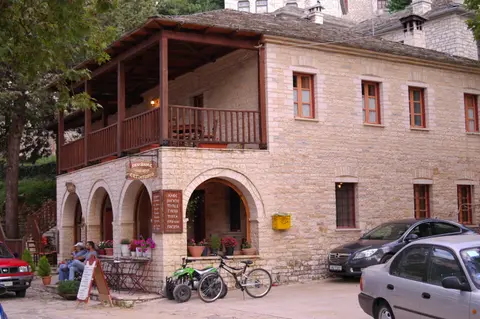
Zagorochoria Village Squares, Limestone Mansions, and Sacred Forests
Each traditional settlement among the 46 Zagorochoria villages centres around an open stone square shaded by an old plane tree. Serving as social hub, religious gathering point and civic forum, the central square anchors narrow cobbled lanes climbing steep slopes via stone staircases adapted directly to mountain gradients. Residential houses and communal mansions rely almost entirely on hand-dressed local limestone masonry paired with timber beams and slate roofing. Surrounding many settlements sit sacred forests carefully maintained by local villagers to shield hillside buildings from landslides, hold moisture and preserve timber supplies.
Until modern motor roads opened in the 1950s, an interconnected trail network of drystone footpaths and arched masonry bridges bound the entire basin into one political and social unit. Expats funded durable limestone arched bridges during the 18th century to replace vulnerable timber crossings swept away by winter snowmelt along the Voïdomatis and Aoos tributaries. Near the southern village of Kipi cluster several classic single- and multi-arch stone bridges, including Kokkori Bridge, linked along scenic stone mule paths toward Monodendri and Vitsa. Today, hiking mountain trails along those historic corridors remains one of the clearest ways to understand how rural communities overcame rugged isolation.
Covering nearly 1,000 square kilometres yet holding roughly 3,400 residents across the municipality, Zagori averages only 3.4 inhabitants per square kilometre compared with 73.8 across Greece. Municipal headquarters sit in Asprangeloi, while villages such as Papingo, Vikos, Aristi, Koukouli, Vradeto, Tsepelovo and Monodendri function as popular trailheads. Strict Presidential Decrees issued in 1979 and amended in 1995 govern villages built before 1923 under Zones A and B, forcing even modern renovations to preserve limestone walls and slate roofs. Meanwhile, declaring the whole village ensemble a historical site ensures licensed oversight by the Ephorate of Antiquities of Ioannina and regional monument services.
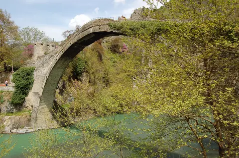
Vikos Gorge Karst Geology, Stone Bridges, and Depopulation Pressures
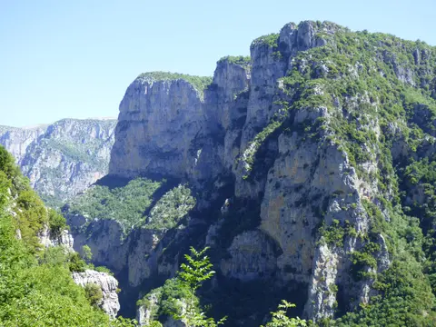
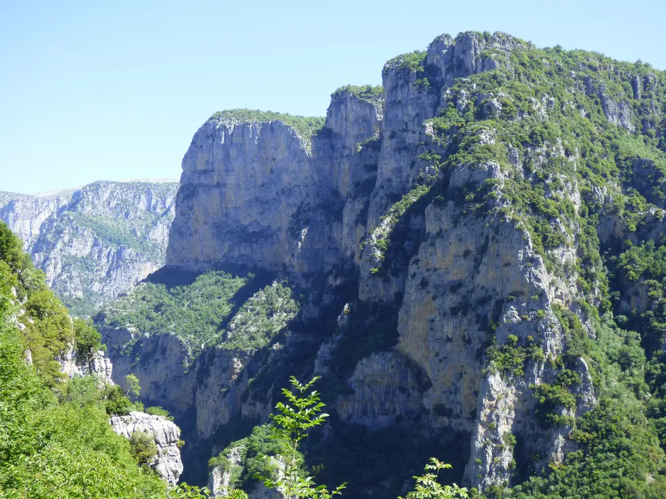
Carving across the southern slopes of Mount Tymphe inside North Pindus National Park, the Vikos Gorge forms Zagori's defining natural monument. Extending roughly 32 kilometres in length with a protected 12-kilometre park core stretching from Monodendri to Vikos village, the canyon drops between 120 and 1,350 metres deep. Width narrows from 2,500 metres near upper rims down to just a few metres along shadowed limestone walls, earning recognition in the Guinness Book of Records as the deepest canyon worldwide relative to width. Over millions of years, the seasonal Vikos Stream and permanent Voidomatis River cut downward through stratified rock layers.
Exposed canyon walls present a vertical geological cross-section through ancient marine and glacial epochs. Upper walls from zero to 200 metres consist of younger Eocene limestone, middle bands down to 700 metres reveal Campanian strata and deeper rock below 700 metres exposes Jurassic and Cretaceous limestone over grey Jurassic dolomite. Sedimentary studies along the Voidomatis basin trace three Middle and Late Pleistocene glaciation phases down to the Last Glacial Maximum 20,000 to 22,000 years ago. Underground karst conduits dissolve rainwater away from most upper trails until impervious rock forces icy Voidomatis springs back into daylight near Vikos village.
Microclimates inside this near-virgin canyon sheltered unique medicinal herbs and rare alpine wildlife over centuries. Historically, local herbalists famous across Greece as Vikos doctors (Vikoiatri) harvested species such as lemon balm, spearmint, St John's wort, mountain tea (Sideritis raeseri), elder and Dictamnus albus following ancient recipes by Hippocrates and Dioscorides. Today, 2,500 dried local plant specimens fill the natural history museum in Koukouli village, while rare chamois (Rupicapra rupicapra) shelter across remote cliffs like the Megas Lakos side ravine.
Despite statutory safeguards under Law 3028/2002 and National Park Agency management, Zagori faces acute demographic and pastoral challenges. Outward migration has thinned year-round village populations, while declining livestock grazing and abandoned terraced agriculture allow natural reforestation to swallow historic open pastures. Maintaining drystone walls, cobbled staircases and multi-arch stone bridges requires skilled traditional masons plus careful infrastructure upgrades for village water supply, drainage and vehicle parking. Balancing rural tourism growth with authentic vernacular preservation guides the Municipality of Zagori's holistic Management Plan.
Sustaining Zagori's architectural and natural balance also relies on strict zoning rules enacted decades ahead of modern tourism pressures. Adopted in 1979 and amended in 1995, the Presidential Decree for Zagori classifies traditional buildings predating 1923 into Zone A and Zone B tiers according to conservation state, supported by an Urban Control Zone overseen by municipal town planners and regional monument services. Linguists examining 3,546 regional placenames also note that around 70 percent carry modern Greek mediation while roughly 30 percent preserve Aromanian, Slavic, Albanian and Turkish roots. Supporting skilled masonry training, rural grazing and community-led heritage boards keeps these 46 villages intact across future generations.
Access Zones Across Zagori Villages and Vikos Gorge
Planning by valley cluster helps visitors link zagori villages and vikos gorge lookouts smoothly without backtracking over winding mountain spurs. Always check North Pindus National Park trail notices and winter road advisories before descending into canyon beds.
| Complex Zone | Key Highlights | Access & Ticket Rule |
|---|---|---|
| Monodendri and Oxia Rim | 15th-century village square, Molossian settlements toward Vitsa, canyon descent path and Oxia natural viewpoint (8 kilometres out). | Open village lanes and paved spur road to Oxia; wear sturdy trail boots for steep limestone switchbacks into the gorge. |
| Kipi and Stone Bridges | Cluster of 18th-century diaspora-funded single- and multi-arch limestone bridges linked by drystone cobbled mule trails. | Free pedestrian access along signed valley paths; watch for slippery damp cobblestones after mountain rainstorms. |
| Vradeto and Beloi Overlook | Elevated eastern rim stone village, famous rock-built stepped staircase and eastern Beloi canyon viewing terrace. | Accessible by road or traditional stone steps from Kapesovo; carry water along exposed limestone rim walks. |
| Voidomatis Springs and Papingo | Permanent emerald river springs emerging at the northern gorge mouth, climbing trails toward Vikos and twin Papingo villages. | Core zone of North Pindus National Park; respect strict flora protection, camp rules and cliff-chamois sanctuary zones. |
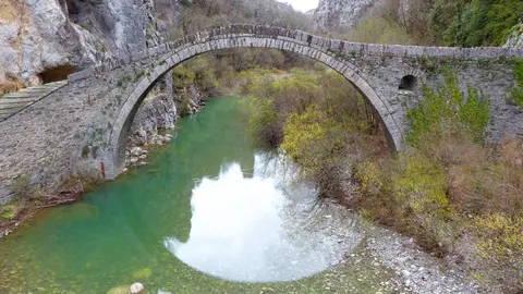
Three Limestone and Engineering Details Across Zagorochoria
- Drystone Mule Staircases Linking Steep Villages: Walk the stepped stone paths connecting hillside villages like Vradeto or descending from Monodendri to observe interlocking limestone treads laid directly into mountain rock without modern concrete.
- Diaspora-Funded Single-Arch Masonry Bridges: Inspect the slender, high-cambered limestone arch of Kokkori Bridge near Kipi, engineered during the 18th century to survive furious Voidomatis snowmelt floods cleanly.
- Koukouli Herbarium and Plane-Tree Plazas: Pause inside traditional village squares built around broad plane trees, then step into Koukouli's natural history museum housing 2,500 dried plants harvested historically by local Vikos doctors.
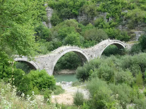
Timing a Zagori Stone Bridges Hike From Corfu and Ioannina
Understanding zagori villages map geography helps sequence scenic overlooks, cobbled villages and canyon trails comfortably across two to four days. Spring fills rushing tributaries beneath stone bridges near Kipi and awakens mountain wildflowers across Pindus slopes, while autumn brings crisp skies and warm foliage along stone squares. Summer enables full-length hikes descending from Monodendri down the 12-kilometre core Vikos Gorge toward Voidomatis springs and Papingo, whereas winter snowfall can block upper mountain spurs.
Splitting itineraries between central Monodendri, the Kipi stone bridges belt and northern Aristi-Papingo minimises long mountain drives across curved Epirus ridges. Choosing short morning loops such as a zagori villages & stone bridges hike around Kipi pairs easily with afternoon road climbs to the Oxia or Beloi gorge viewpoints. Visitors seeking deeper botanical context can include Koukouli's dried-herb museum together with traditional tavernas in Tsepelovo or Asprangeloi, staying mindful that remote villages keep quiet seasonal rhythms.
Travellers arriving from abroad generally fly into Corfu Ioannis Kapodistrias International Airport (CFU), 85 kilometres west near Corfu (83 kilometres), before crossing by ferry to Igoumenitsa and driving inland into Epirus. Closer Ioannina King Pyrrhus National Airport (IOA) sits just 23 kilometres south of the Zagori border, though scheduled domestic flights remain far more limited than Corfu's international network. Discover additional European mountain settlements and rural landscapes in our UNESCO World Heritage Atlas.