Quick Field Data
- UNESCO Inscription: 2026 (Ref. 1719), mixed World Heritage site spanning Thessaly and Central Macedonia across Larissa and Pieria, Greece; Criterion (x).
- Scale & Footprint: 18,938-hectare protected serial zone enclosing Greece's oldest national park (39.88 square kilometres, founded 9 June 1938) and a 1981 UNESCO Biosphere Reserve across a 500-square-kilometre massif.
- Access & Ticketing: Trail corridors start around Litochoro and Prionia with staffed alpine refuges along upper ridges; check official Olympus National Park notices for seasonal trail rules, weather alerts and refuge reservations.
- Arrival Logistics: Major commercial flights arrive at Thessaloniki Macedonia International Airport (SKG), 62 kilometres northeast, while regional Kozani National Airport Filippos (KZI) sits 54 kilometres away with limited schedules. Nearest Hub: Corfu (222 kilometres southwest).
Mount Olympus Elevation, Mytikas Summit, and Neotectonic Geology
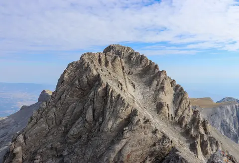
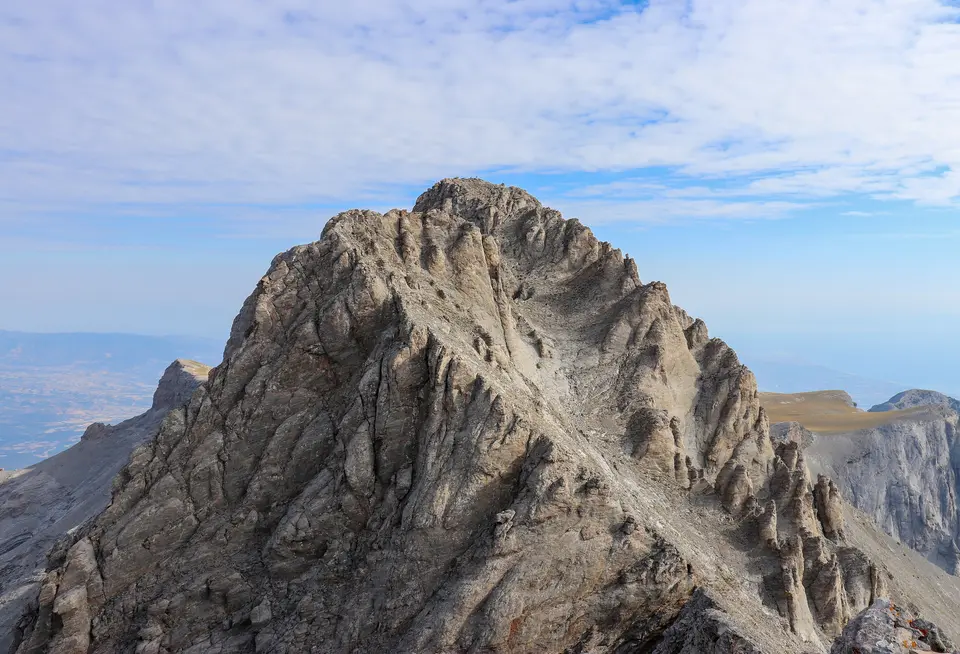
Rising abruptly just 18 kilometres inland from the Thermaic Gulf of the Aegean Sea, Mount Olympus dominates northern Greece across the historic frontier between Thessaly and Macedonia. Its roughly circular 500-square-kilometre massif measures 80 kilometres in circumference and averages 26 kilometres across, counting 52 distinct peaks cut by deep ravines. Mount Olympus Greece elevation culminates at Mytikas, meaning nose and also called Pantheon, which reaches 2,917.727 metres (9,572.60 feet) as the highest summit in Greece. Across the wider Balkan Peninsula, only one peak stands taller, giving this coastal tower striking topographic prominence above nearby plains.
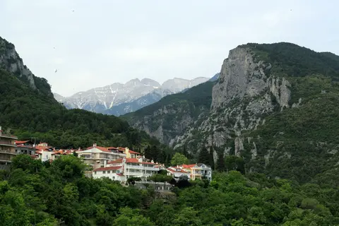
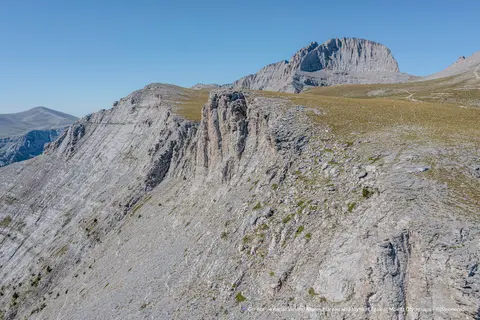
Seen from the eastern gateway town of Litochoro, the skyline splits into a sharp rock V separating twin summit spires. On the left rises Mytikas, while immediately right stands Stefani, known in Greek mythology as Thronos Dios or the Throne of Zeus at 2,911.11 metres. Stefani presents the steepest mountain face on the massif, demanding exposed scrambling over its sharply rising final 200 metres. Southward along the ridge, Skolio climbs to 2,905.2 metres and curves around a 200-degree arc framing Megala Kazania, a sheer western amphitheatre cavity measuring 700 metres deep and 1,000 metres around.
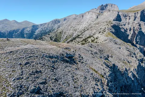
Additional summits topping 2,000 metres surround the central limestone walls in broader domes and high ridges. These include Aghios Antonios at 2,815 metres, Profitis Ilias at 2,803 metres, Toumpa at 2,801 metres and Kalogeros at 2,700 metres. On the northern flank between Stefani and Profitis Ilias spreads the Muses' Plateau at 2,550 metres, while the alpine tundra of Bara occupies 2,350 metres near the centre of the massif. Eastward below the main crown, steep parallel rock folds called Zonaria drop toward narrower gullies named Loukia that guide experienced climbers toward the summit.
Sedimentary rocks laid down 200 million years ago inside a shallow Mesozoic sea form the mountain's geological backbone. Tectonic uplift exposed the massif before Pleistocene glaciers around one million years ago sculpted glacial cirques, high plateaus and broad alluvial fans down toward the coast. Eastern slopes from 200 to 2,000 metres consist of Upper Triassic dolomitic limestones, whereas western and southern walls from 1,200 to 2,000 metres date to the Paleocene or Cretaceous. Jurassic limestones cap the 2,000-to-2,918-metre Mytikas crest, flanked by western gneiss bands and northwestern Eocene flysch, with detailed specimens displayed at the Geological Museum of Mount Olympus in Leptokarya.
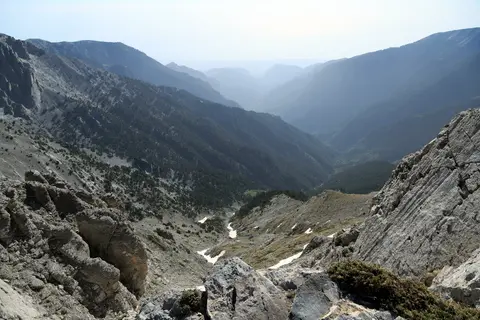
Ongoing neotectonic uplift drives fierce river incision across the limestone flanks, leaving karstic sinkholes, olistolith rock fields and dramatic gorges. The Mavrologos-Enipeas gorge cuts 14 kilometres through the eastern massif from high springs at Prionia to the Aegean coast past Litochoro. Matching trenches include the 13-kilometre Mavratzas-Sparmos ravine near Bara and the 13-kilometre Ziliana gorge marking the southern natural border against Lower Olympus. To the northwest, the Makryrema stream separates the main massif from the adjacent Voulgara range.
Greek Mythology, Ancient Dion, and Byzantine Mountain Heritage
Long before modern mountaineers charted a mount olympus greece map, classical poets placed the palace halls of the Twelve Olympian Gods high above its cloud-wreathed ridges. Hesiod and Homer invoked Olympus across the Iliad and Odyssey as the heavenly seat ruled by Zeus, accompanied by the Graces and nine Muses born along the Pierian foothills. By the fifth century BC, historian Herodotus firmly equated the Pan-Hellenic home of the gods with this Thessalian summit rather than lesser peaks bearing the same name across the Mediterranean. Ancient Greeks imagined divine dwellings sheltered inside its high gorges and stormy debates echoing from Mytikas.
In historical antiquity, the mountain frontier guarded vital corridors between Thessaly and the rising Kingdom of Macedon from the fourth to second centuries BC. Five kilometres from the sea on the fertile eastern plain sits Dion, the sacred Macedonian sanctuary city dedicated to Zeus and the Twelve Olympians. Excavations active since 1928 across Dion's 200-hectare archaeological park expose Classical, Hellenistic and Roman temples, streets and sanctuaries outside the city ramparts, paired with sculptures in the local museum. Further coastal and foothill landmarks include Pimblia and Leivithra linked with Orpheus, the Macedonian tombs of Katerini and Korinos, Byzantine Louloudies and ancient Pydna where Roman legions defeated Macedon in 168 BC.
Later centuries turned steep ravines and high plateaus into refuges for spiritual devotion and armed resistance. At 2,803 metres atop Profitis Ilias stands a 16th-century stone chapel dedicated to the Prophet Elias, recognised as the highest-elevation chapel of Orthodox Christianity. Along the coast near ancient Heracleia rises medieval Platamon Castle, erected between the seventh and tenth centuries AD to command the southern Macedonian passage. Westward across the foothills stand the Agia Triada Sparmou Monastery and rural villages such as Kokkinopilos, Petra, Vrontou, Sykaminea, Karya and Pythion.
During Ottoman rule, rugged Olympus gorges sheltered Greek klephts and armed armatoloi militias, starting with a second regional armatoliki organised under Kara Michalis in 1489. Villages such as Livadi served as operational seats under commanders including Panos Zidros, Nikotsaras, Giorgakis Olympios and the Lazaioi family, though reprisals destroyed allied Milia in the late 17th century. Modern conflict returned during April 1941, when Hellenic Army units fought beside New Zealand and Australian troops against German invaders. Resistance fighters held mountain strongholds until 1944 before the opening clashes of the Greek Civil War reached Litochoro in 1946.
Vegetation Belts, Glacial Refugia, and Balkan Chamois Habitats
Extreme vertical relief rising swiftly from mild Aegean shores creates compressed climatic and ecological belts that explain Mount Olympus's Criterion (x) recognition. Porous dolomitic limestone absorbs rainfall rapidly and warms quickly under sunlight, giving lower elevations drier microclimates than wetter highland ridges. Because Pleistocene ice never erased every wooded valley, the massif functioned as a vital glacial refugium preserving ancient forest flora across Europe's climatic swings. Today it ranks as an important hotspot for Mediterranean plant biodiversity and endemic species.
Four stacked vegetation zones follow elevation cleanly from foothill shrubland up to windswept alpine stone. Between 300 and 500 metres, dry Xirokampi slopes support evergreen maquis featuring holm oak (Quercus ilex), Greek strawberry tree (Arbutus andrachne) and kermes oak (Quercus coccifera). Higher belts from 600 to 1,400 metres sustain mixed beech and silver fir forests dominated by European beech (Fagus sylvatica), Bulgarian fir (Abies borisii-regis), oriental hornbeam (Carpinus orientalis) and black pine (Pinus nigra pallasiana). From 1,400 metres up to 2,500 metres, hardy Bosnian pine (Pinus heldreichii) forms Europe's highest forest tree line above alpine grasslands and rocky crags.
Protected wildlife populations thrive inside this 18,938-hectare World Heritage perimeter and the core 39.88-square-kilometre national park founded on 9 June 1938. Surveys document 32 mammal species, anchored by an important Greek refuge population of Balkan chamois (Rupicapra rupicapra balcanica) estimated at 50 to 70 individuals in 2009. Wolves, golden jackals, wildcats, wild boars, beech martens, edible dormice, greater horseshoe bats and Geoffroy's bats also inhabit wooded slopes and limestone caves. Ornithological inventories recorded 108 bird species by 2008, spanning golden eagles, wallcreepers, three-toed woodpeckers, Egyptian vultures, Alpine swifts, ortolan buntings and Cretzschmar's buntings.
Dual designation as Greece's oldest national park in 1938 and a UNESCO Man and the Biosphere Reserve on 15 December 1981 paved the way for 2026 mixed World Heritage inscription. Park managers regulate camping, vehicular road corridors and high-elevation refuge footprints so rising climber footfall avoids eroding fragile alpine turf above 2,500 metres. Educating hikers on limestone trail etiquette protects sensitive plant habitats while keeping traditional foothill settlements connected to mountain conservation.
Access Zones Across the Wider Mount Olympus Massif
Planning things to do at Mount Olympus Greece requires matching fitness and equipment to distinct elevation belts from coastal foothills up to exposed Jurassic summit stone. Verify seasonal refuge openings and weather forecasts locally before committing to upper ridge approaches.
| Complex Zone | Key Highlights | Access & Ticket Rule |
|---|---|---|
| Litochoro and Enipeas Gorge | Eastern gateway town 100 kilometres from Thessaloniki, canyon bridges, mountain trails and Prionia trailhead springs. | Open public trailheads rising from Litochoro toward Prionia; carry proper footwear, water and mountain maps. |
| Muses' Plateau and Summit Arc | Mytikas (2,917.7 metres), Stefani, Skolio, Profitis Ilias chapel, Megala Kazania cirque and alpine refuges. | Technical high-mountain terrain with exposed rock pitches; book staffed mountain refuges ahead and monitor alpine storms. |
| Dion and Coastal Pieria Plain | 200-hectare Dion archaeological park, classical sanctuaries, Dion museum and seaside Platamon Castle. | Paved road access along the fertile eastern plain; verify site admission and museum schedules on official notices. |
| Western Villages and Leptokarya | Geological Museum in Leptokarya, Agia Triada Sparmou Monastery, Kokkinopilos and Ziliana gorge boundary. | Accessible by regional mountain roads circling western foothills; check seasonal monastery entry norms locally. |
Three Geological and Alpine Details on Mount Olympus
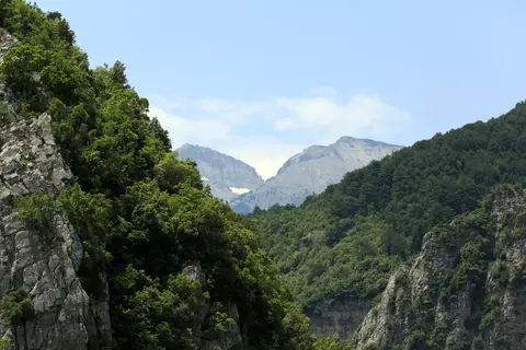
- Horizontal Karst Folding and Loukia Gullies Below Mytikas: Approaching the eastern rock faces reveals parallel strata layers known as Zonaria crossing steeply pitched Loukia couloirs carved by ice and meltwater.
- Highest European Tree Line at 2,500 Metres: Along approaches toward the Muses' Plateau, twisted Bosnian pines persist higher above sea level than anywhere else on the continent before giving way abruptly to tundra grasslands.
- Sedimentary Alluvial Fans Between Litochoro and Coast: Descending toward the Aegean plain exposes vast aprons of crushed glacial limestone washed down from Pleistocene ice-melt torrents over the past million years.
Mount Olympus Greece Hike Planning, Timing, and Airport Links
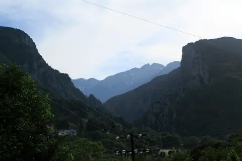
Assess mount olympus greece hike difficulty carefully before choosing between canyon day walks and multi-day summit climbs. Gentle lower trails wind up the Enipeas Gorge from Litochoro or link Dion's ancient shrines with coastal Platamon Castle without technical exposure. Climbing above the 2,500-metre tree line to Mytikas summit, however, involves steep elevation gain, loose limestone scree, sudden electrical storms and exposed scrambling routes through Loukia gullies or below Stefani. Organised mountain refuges let hikers divide steep ascents into two days, avoiding rushed descents in afternoon cloud.
Timing determines safety and clarity across every elevation belt on the mountain. Snowpacks linger deep inside Megala Kazania and high summit chutes long after warm spring weather arrives along the Thermaic Gulf beaches. Dry summer and early autumn windows typically open clear ridge trails to Skolio and Mytikas, though early starts remain wise before midday heat or afternoon mountain squalls develop. Shoulder seasons still reward lower walks through Xirokampi maquis, beech-fir forests and coastal archaeological parks without summer crowds.
Travellers researching how to get to Mount Olympus in Greece or how to get to Mount Olympus from Athens can reach the eastern foothills easily by motorway and rail corridors running north toward Macedonia. International visitors typically fly into Thessaloniki Macedonia International Airport (SKG), 62 kilometres northeast of the massif, before continuing overland via Thessaloniki to Litochoro or Dion. Kozani National Airport Filippos (KZI) sits 54 kilometres away with more limited regional connections, while northern Greece itineraries sometimes pair mainland peaks with island hubs such as Corfu (222 kilometres southwest). Explore further mixed mountain and cultural landscapes in our UNESCO World Heritage Atlas.