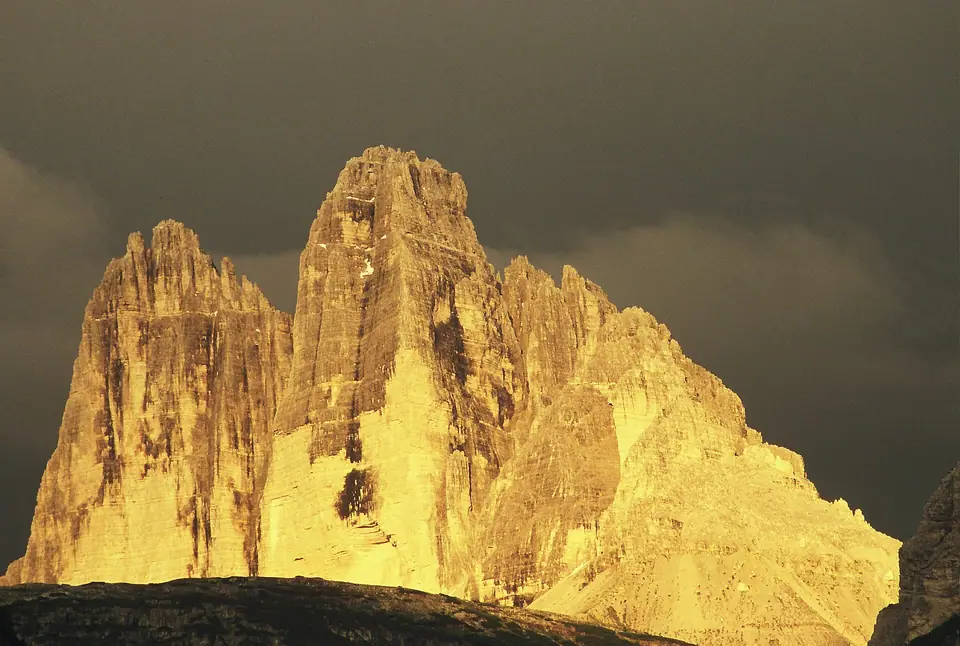
Photo: Otto Schemmel at German Wikipedia · CC BY-SA 2.0 de
Tre Cime di Lavaredo and Cadini di Misurina
Mandatory toll-road plate bookings, Shuttle Bus 444 from Dobbiaco, Trail 101 counterclockwise circuit, and Cadini Trail 117.
Few stone summits across Europe hold silhouette presence matching Tre Cime di Lavaredo (Drei Zinnen in German). Sharp pale limestone towers erupt starkly above grey talus bowls: central Cima Grande rises to 2,999 metres, framed nicely by wide western Cima Ovest (2,973 metres) and slim eastern Cima Piccola (2,857 metres). Because paved toll asphalt lifts drivers high up to Rifugio Auronzo at 2,320 metres, walkers begin right amid open rock terraces.
High road elevation removes gruelling woodland climbs, yet brisk ridge chill and tight vehicle access catch unprepared guests off guard. Reserving mandatory access online beforehand and walking counterclockwise transforms a crowded hotspot into a crisp alpine walk.
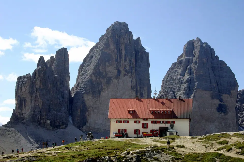
Auronzo toll-road bookings and Shuttle Bus 444
Turning north past tranquil Lake Misurina brushes tiny Lake Antorno before climbing steep tarmac bends up toward Rifugio Auronzo car yards. Casual pay-at-the-gate entries have stopped during busy warmer months. Every private driver must obtain a timed digital reservation via Auronzo's official booking system (pass.auronzo.info), linking exact vehicle licence plates to a twelve-hour access slot.
Highway wardens inspect digital bookings beside lower Lake Antorno barriers and turn unbooked cars around promptly without spare day slots. Visitors travelling by regional rail instead book dedicated Shuttle Bus 444 departing Dobbiaco train platforms past quiet Lake Landro up onto Auronzo ridges. Keep firmly in mind that local Südtirol Guest Passes pay routine valley lines yet never replace pre-purchased digital seats aboard Bus 444.
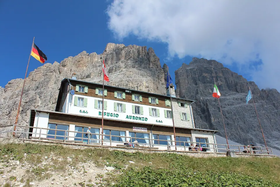
Counterclockwise circuit along Trail 101 and Trail 105
Asphalt parking plateaus around Rifugio Auronzo stare straight up at sunlit southern limestone shoulders, hiding sheer shaded northern walls out behind broad gravel cols. Strolling counterclockwise from Auronzo turns the mountain theatre inside out.
Walk eastward out along broad firm pale gravel on Trail 101 passing stone Cappella degli Alpini and cosy Rifugio Lavaredo toward airy Forcella Lavaredo at 2,454 metres. Rounding rocky Forcella Lavaredo unlocks dramatic shaded northern rock towers leaping skyward above pale scree fields. Continue gently downward along open limestone benches toward red-roofed Rifugio Locatelli (Dreizinnenhütte at 2,405 metres), perched atop a breezy grassy saddle directly facing the monumental north walls.
Looped returns curve steadily west over pale rock bowls, wild mountain ponds, and green pastures past Malga Langalm via Trail 105, finishing roughly ten kilometres over three hours thirty minutes to four hours thirty minutes. Splitting direction counter-clockwise reserves the dramatic north-wall horizon straight ahead for hours rather than glancing awkwardly backward.
Bracing gusts regularly sweep over exposed rock cols even while warm sunshine heats sheltered timber patios down inside town valleys. Layering wool mid-tops underneath light weatherproof jackets keeps afternoon hikers comfortable across stony ridge benches stretching beyond refuge doorways. Carrying hot herbal tea and salted nuts in side pack pockets sustains hikers smoothly between spaced mountain stops.
Pause across calm gravel rises beside glassy glacial ponds overlooking rolling Malga Langalm pastures well away from crowded car parks. Resting feet atop warm boulders while marmots whistle across grassy hillsides turns steady trail climbs into unhurried mountain days.
Grippy mountain outsoles stay indispensable across shifting white carbonate grit carpeting steeper corners across western limestone saddles. Descending later toward peaceful evergreen walks ringing Lake Misurina eases tired knees gently ahead of dinner across nearby mountain hubs.
| Tre Cime Leg | Trail Number & Path Style | Key Altitude Check | Terrain & Pacing Notes |
|---|---|---|---|
| Auronzo to Forcella Lavaredo | Trail 101 eastward | 2,454 m windy col | Wide gentle pale gravel road easy for warming up cold legs |
| North Face Shelf to Locatelli | Trail 101 continuing west | 2,405 m Dreizinnenhütte | Open rocky bench beneath towering sheer cliff shadows |
| Malga Langalm Return Slope | Trail 105 curving back west | Mountain tarns & west crest | Fewer crowds with a brisk closing pull up gravel rises |
| Cadini di Misurina Spur | Trail 117 southbound out-and-back | Narrow spire belvedere | Short exposed ledge track demanding careful dry-rock footing |
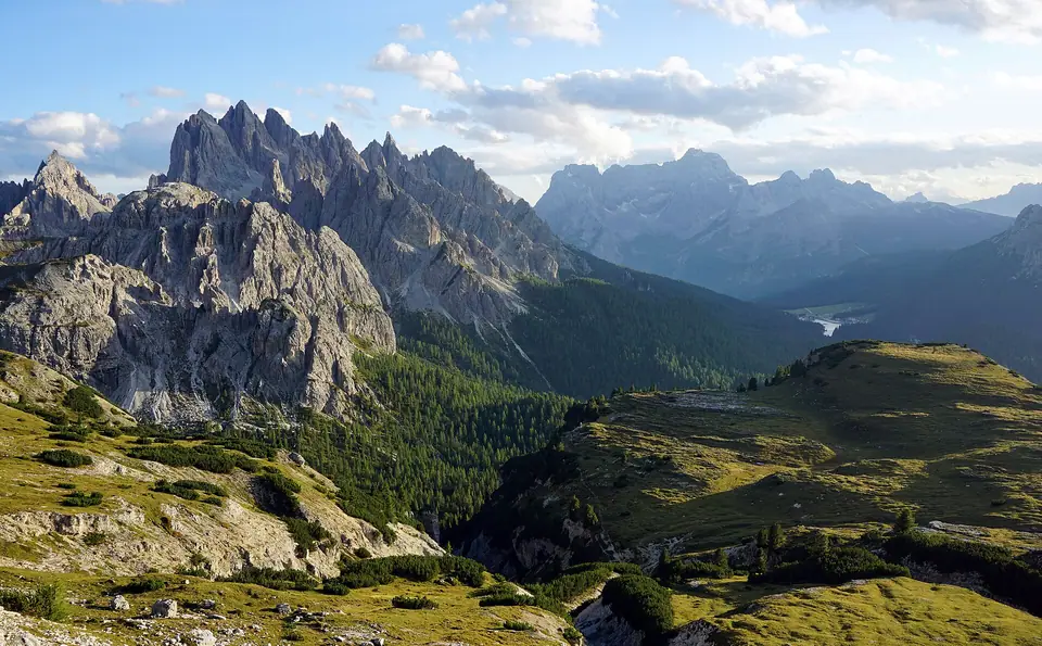
Exposed Trail 117 out to Cadini di Misurina
Heading straight south right opposite Rifugio Auronzo's car yards branches a memorable exposed spur peering directly at spiky limestone crags of Cadini di Misurina. Following Trail 117 along opening reaches of Sentiero Bonacossa guides agile hikers thirty to thirty-five minutes each way (roughly 1.5 kilometres outward) onto an airy stone fin suspended above sheer scree drops.
Assess personal comfort beside unprotected drops realistically before edging past smooth starter shelves. Narrow dusty tracks hug tilted grass slopes with scant passing margin when oncoming groups intersect along rocky bends. Turn back promptly in damp low fog, morning frost, or slick street trainers, whereas experienced climbers packing sturdy grippy scree boots sometimes continue along protected steel cables toward Rifugio Fonda Savio at 2,367 metres.
Treating steep gravelly corners patiently spares anxious walkers unnecessary stress high above scree chutes. Wait securely inside small rock recesses whenever arriving groups pass down from exposed bends rather than crowding soft outer grass rims. Even short pauses beside broad lower benches frame towering Cadini spires clearly against sunny southern horizons.
Carry warm glove liners and wind shells easily within reach around exposed rocky spurs where sudden afternoon valley drafts sweep sharp chill straight across narrow ridgelines.
Dawn timing, free approach paths, and Lake Misurina
Tidy arrival planning keeps trails serene and helps hikers finish ridge climbs safely ahead of afternoon storms:
- Clear barriers early: Early morning slots skip hot midday queues and beat rapid convective rain clouds forming fast over eastern crests after noon.
- Try toll-free foot approaches: Fit ridge walkers avoid car gates altogether ascending steep forest trails upward out from Val Fiscalina past Rifugio Fondo Valle, or climbing wooded paths from quiet Lake Antorno.
- Pack dry layers and hut cash: Carry spare water, fleece jackets, and folded euro notes inside dry pockets for busy dining counters inside Rifugio Locatelli whenever mountain storms drop mobile terminals offline.
- Cool legs down beside Lake Misurina: Drop south afterward for calm flat boardwalk loops around pine-rimmed Lake Misurina ahead of transferring toward Cortina hubs or restful eastern stays.
Where it is
- 1Tre Cime di Lavaredo and Cadini di Misurina
- Treviso Airport (TSF) · about 108 km from here in a straight line
- Directions in Google Maps
Stations and taxi ranks: OpenStreetMap. Airports: OurAirports. Distances are in a straight line.
Traveller tips
Real advice from people who have been to the Dolomites. Every tip is read by our team before it goes live.
No tips yet. Been here? Yours could be the first.
Thank you! Your tip will appear here after a quick review.
More in the Dolomites
Continue exploring the Dolomites with related neighbourhood, food, and planning guides