


























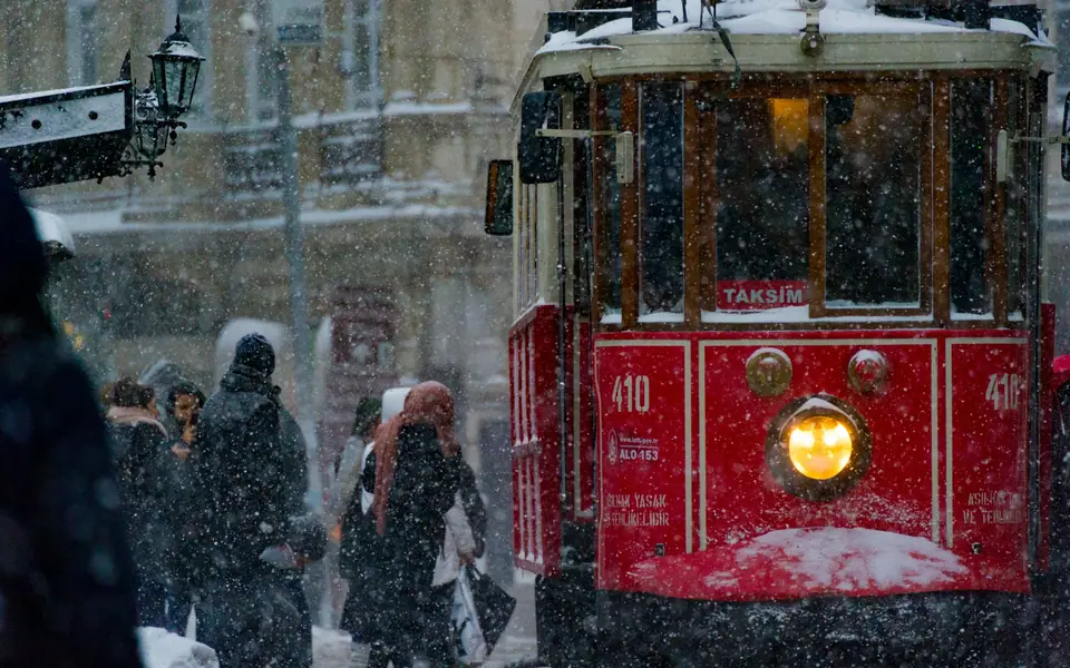
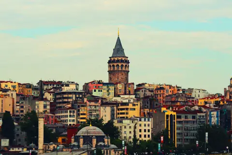
Photo by Randy Tarampi on Unsplash
How to Get to Istanbul: IST vs SAW Airports, Metro & Istanbulkart
Comparing Istanbul's two intercontinental airports, step-by-step metro and coach transfers, and how the rechargeable Istanbulkart works on trams and ferries.
Before booking an airport transfer or choosing a hotel, check the three-letter IATA code on your airline ticket. Istanbul is served by two major international airports located on opposite continents. More than eighty kilometres of highway across the Bosphorus bridges separate the two terminals. Both airports now connect directly into the urban rail network via dedicated underground metro lines. Twenty-four-hour express coach networks also serve the central hotel hubs. Once you reach the historic districts, the integrated municipal transit system makes cars unnecessary.
Istanbul Airport (IST, European Side) vs Sabiha Gökçen Airport (SAW, Asian Side)
Knowing which airport you are flying into determines whether you enter the city from the northern Black Sea coast or the southeastern Anatolian shore:
- Istanbul Airport (IST) / M11 Metro & Havaist Coaches: IST sits 40 kilometres northwest in Arnavutköy near the Black Sea and serves as the global hub of Turkish Airlines. Follow the red U signs (meaning Ulaştırma, transport) 300 metres outside the terminal exit to board the high-speed automated M11 metro line. Eastbound trains run to Kağıthane (24 minutes, connecting to the M7 metro) and terminate at Gayrettepe (30 minutes). There, underground escalators link directly to the green M2 metro line south to Taksim, Şişhane (for Galata and Karaköy), and Vezneciler (for Beyazıt and the Grand Bazaar). Westbound M11 trains run to Arnavutköy and Halkalı, linking with the Marmaray suburban rail corridor. With heavy suitcases, official Havaist coaches depart from Level -2 outside arrivals around the clock. They serve Aksaray/Beyazıt (for Sultanahmet), Taksim, Beşiktaş, and Kadıköy in 50 to 90 minutes depending on bridge traffic.
- Sabiha Gökçen Airport (SAW) / M4 Metro & Havabus Coaches: SAW sits 40 kilometres southeast in Pendik on the Asian side and serves Pegasus Airlines and AJet. The pink M4 metro line departs directly beneath the terminal. It reaches Ayrılık Çeşmesi in 48 minutes and terminates at Kadıköy pier in 52 minutes. To reach the European Historic Peninsula by rail without road traffic, step off the M4 at Ayrılık Çeşmesi. Walk two minutes across the platform to board a westbound Marmaray train through the Bosphorus seabed tunnel. You reach Sirkeci station (right below Topkapı Palace and Sultanahmet) in four minutes, or continue one stop to Yenikapı for the M2 metro to Taksim. On the surface, white Havabus shuttle coaches depart outside arrivals for Kadıköy (40 minutes) and Taksim (60 to 90 minutes).
How the rechargeable Istanbulkart works vs single-use Unlimited City Cards
Public transport across Istanbul is unified under a contactless smartcard system managed by BELBİM and the Istanbul Metropolitan Municipality:
- Anonymous Red Istanbulkart (Anonim İstanbulkart) / Tourist Istanbul City Card: Purchase a standard reloadable red Istanbulkart from the yellow-and-blue Biletmatik vending machines at either airport metro station, ferry piers, or tram stops. The physical card carries a small one-time deposit fee and can be topped up using Turkish lira banknotes or contactless bank cards. It works on all metro lines, the T1 and T5 trams, F1 and F2 funiculars, Marmaray trains, municipal buses, and Şehir Hatları commuter ferries. Up to five passengers can share a single anonymous Istanbulkart by tapping it sequentially at the turnstile. Multi-day unlimited tourist passes sold at automated kiosks cost much more and rarely pay off unless you take eight or more rides every day.
- Marmaray Distance-Based Fare Refunds (İade Cihazı): Standard metro lines charge a flat single fare, whereas the 76.6-kilometre Marmaray commuter line from Halkalı to Gebze charges by distance. The turnstile deducts the maximum full-line fare when you tap in at the entry gate. After a short hop such as the undersea crossing between Sirkeci and Üsküdar or Ayrılık Çeşmesi, tap your card on the blue İade Cihazı (refund validator) beside the exit gates. That quick tap immediately returns the unused distance balance to your card.
Navigating the core lines: T1 Tram, F1 & F2 Funiculars, and Commuter Ferries
Once settled into your hotel, three rail corridors and the ferry network handle almost every sightseeing journey without touching a road vehicle:
- T1 Kabataş to Bağcılar Tramway. This modern low-floor surface tram forms the sightseeing spine of European Istanbul. It runs from Kabataş (ferry piers and Dolmabahçe Palace) through Tophane (Istanbul Modern and Galataport) and Karaköy before crossing the Galata Bridge to Eminönü. From the waterfront it climbs past Sirkeci, Gülhane, Sultanahmet, Çemberlitaş, and Beyazıt-Kapalıçarşı (Grand Bazaar). Keep bags zipped in front of you during peak midday hours.
- F1 and F2 Underground Funiculars (Tünel). Because Beyoğlu sits on a steep ridge sixty metres above the water, walking uphill from the tram stops is tiring. At Karaköy, board the historic F2 Tünel funicular, inaugurated in 1875 as the world's second-oldest subterranean urban railway after London's Underground. Its 573-metre cable climb reaches Beyoğlu (Şişhane and the southern end of İstiklal Avenue) in 90 seconds. At Kabataş, the modern F1 funicular climbs underground to Taksim Square in under three minutes.
- Şehir Hatları Municipal Ferries (Vapur, vah-POOR). Yellow-funneled commuter ferries link Eminönü, Karaköy, Kabataş, and Beşiktaş on the European side with Üsküdar and Kadıköy on the Asian side for a regular Istanbulkart tap, as detailed in our Bosphorus ferry guide.
Intercity trains, coaches, and Turkish visa entry rules
High-speed YHT trains operated by TCDD Taşımacılık connect Istanbul with Ankara (four and a half hours), Eskişehir, and Konya. Trains call at Söğütlüçeşme (adjacent to Kadıköy on the Asian side) and select departures serve Bakırköy and Halkalı on the European side. Overnight international sleeper trains from Sofia and Bucharest arrive at Halkalı. Long-distance intercity coaches use the massive Esenler Otogarı on the M1A metro line or Alibeyköy Cep Otogarı on the T5 tram. Turkey lies outside the European Union and Schengen zone. Citizens of the UK, EU, and US enjoy visa-free tourist entry for up to 90 days within a 180-day period. Nationalities requiring an electronic visa should apply exclusively through the official government portal at evisa.gov.tr. Carry a passport valid for at least 150 days (six months recommended) beyond arrival.
Where it is
- 1Istanbul
- Istanbul Sabiha Gökçen International Airport (SAW) · about 30 km from Istanbul in a straight line
- Directions in Google Maps
Stations and taxi ranks: OpenStreetMap. Airports: OurAirports. Distances are in a straight line.
Traveller tips
Real advice from people who have been to Istanbul. Every tip is read by our team before it goes live.
No tips yet. Been here? Yours could be the first.
Thank you! Your tip will appear here after a quick review.
More in Istanbul
Continue exploring Istanbul with related neighbourhood, food, and planning guides
Hagia Sophia Guide: Gallery Tickets, Entrance Route & Mosaics
Istanbul, Turkey
Grand Bazaar Istanbul Guide: Walking Route, Gates & Bargaining
Istanbul, Turkey
Bosphorus Cruise Guide: Şehir Hatları Ferries, Routes & Palaces
Istanbul, Turkey
Where to Stay in Istanbul: Sultanahmet, Karaköy, Beyoğlu & Kadıköy
Istanbul, Turkey
