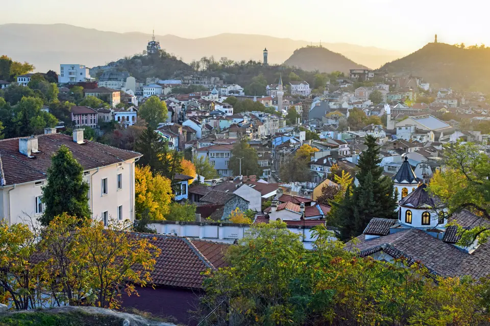
Photo: Jocelyn Erskine-Kellie from London, UK · CC BY-SA 2.0
Plovdiv: Six Hills, Layers & Practical Basics
Orientation across six syenite hills, Thracian to Ottoman history, Schengen entry, and Bulgaria euro currency inside historic Plovdiv.
Plovdiv occupies a natural crossing on the Upper Thracian Plain where isolated syenite rock hills breach flat alluvium south of the Maritsa river. Centuries of builders stacked new walls directly atop older foundations instead of shifting townsites outward. That compression places Roman stonework right beside Ottoman mosques and timber mansions inside postcode 4000.
Walking uphill from the modern shopping spine carries visitors straight back to sixth-millennium BC layers on Yasa Tepe and fourth-millennium BC settlements on Nebet Tepe. Plovdiv serves as Bulgaria's second-largest city today. Careful planning helps visitors sidestep Monday museum closures and protect ankles on steep rounded cobblestones.
Six Surviving Syenite Hills Across the Maritsa Plain
Locals still call their city the Town of the Seven Hills. Quarry gangs demolished Markovo Tepe during the 1930s to cut granite blocks for street paving. Six volcanic syenite intrusions remain standing today across the river basin.
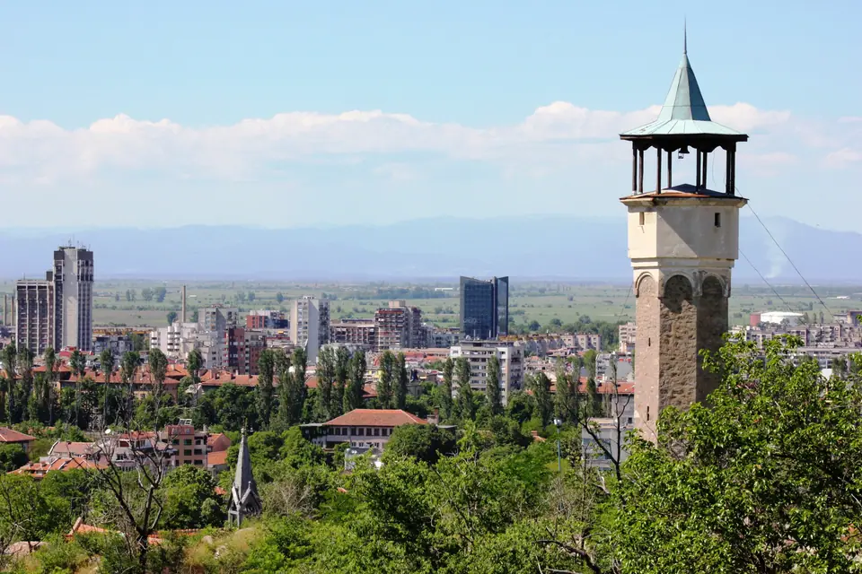
On the eastern side rises Trimontium, the famous Three Hills massif uniting Dzhambaz Tepe (212 metres), Nebet Tepe (207 metres), and Taksim Tepe (195 metres). West of the old citadel stand Sahat Tepe with its 17.5-metre stone clock tower rebuilt in 1812 and pine-clad Bunardzhika crowned by the 1957 Alyosha monument. Farther west rises forested Dzhendem Tepe, standing as Plovdiv's highest surviving hill at 285.5 metres.
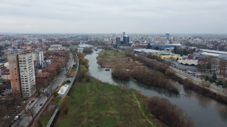
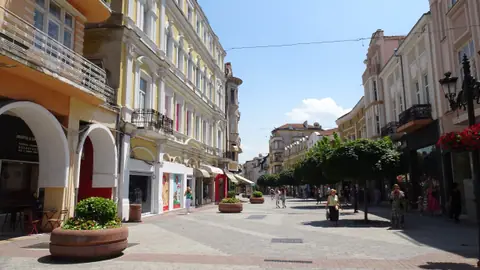
South across the flat plain at roughly 164 metres elevation, the dark ridge of the Rhodope Mountains catches winter snow and summer thunderclouds. Plovdiv sits roughly 144 to 150 kilometres southeast of Sofia across wide agricultural fields. Commercial shops hug the level valley floor between Sahat Tepe and Trimontium. Guests walking along Knyaz Alexander I Street enjoy smooth pavements until turning east up the stone steps of the Three Hills heritage reserve.
From Thracian Eumolpias to Philippopolis and Trimontium
Prehistoric settlement on Nebet Tepe dates back around 4000 BC before Thracian tribes fortified the summit as Eumolpias in the twelfth century BC. In 342 BC, Philip II of Macedon captured the stronghold, settled roughly two thousand Macedonians, and named the town Philippopolis. Later classical geographers still praised its defensive command over the plain.
Roman annexation under Emperor Claudius in AD 46 rebranded the provincial seat Trimontium, meaning City of Three Hills. Imperial engineers wrapped marble theatres, public baths, a forum, and a racecourse around the syenite saddles, later strengthened by Marcus Aurelius. Following sixth-century Justinianic wall repairs, early Christian bishops paved monumental basilica floors across central archaeological squares.
Medieval Bulgarian, Byzantine, and Crusader armies disputed the citadel repeatedly until Ottoman forces arrived around 1363 to 1371. Positioned astride the great highway linking Belgrade with Istanbul, the town soon drew busy trade caravans. Bulgarian, Greek, Armenian, Turkish, and Jewish merchants shared workshops and courtyard lanes for roughly five centuries.
Ottoman Filibe, Eastern Rumelia and 6 September 1885
Ottoman chroniclers knew the strategic crossroads as Filibe. Guilds built vaulted caravanserais, stone mosques, and covered weighing yards north of Dzhumaya Square. When caravan wealth surged across the eighteenth and nineteenth centuries, master builders raised overhanging Revival mansions across Trimontium slopes.
After Russian forces entered the city in January 1878, the Treaty of Berlin drew an awkward diplomatic compromise. Plovdiv became capital of autonomous Eastern Rumelia rather than joining the new Bulgarian principality immediately. Seven years later, on 6 September 1885, local forces proclaimed peaceful unification in Saedinenie Square. Today Bulgaria marks 6 September as both Unification Day and the official Day of Plovdiv.
In 1892, Swiss landscape gardener Lucien Chevallaz planted lush gardens south of the centre for the First Bulgarian Exhibition. Over a century later, chosen in September 2014, Plovdiv held Bulgaria's inaugural European Capital of Culture title in 2019. Travellers charting overland Balkan itineraries regularly connect Plovdiv directly with Belgrade and southern Athens.
Euro Currency, Schengen Borders and Six Urban Districts
Bulgaria entered full Schengen land border controls on 1 January 2025 after lifting air and sea passport checks in March 2024. Coaches and trains crossing Greek and Romanian borders now roll onward without routine frontier passport queues. Non-EU visitors still observe ninety-day Schengen rules on passports issued within ten years and valid three months past departure.
On 1 January 2026, Bulgaria adopted the euro as sole official legal tender. Supermarkets, museum desks, hotels, and urban ticket machines clear strictly in euros today. Card readers accept major bank cards cleanly across downtown shops, though keeping small euro coins helps at independent bakeries and Kapana stalls.
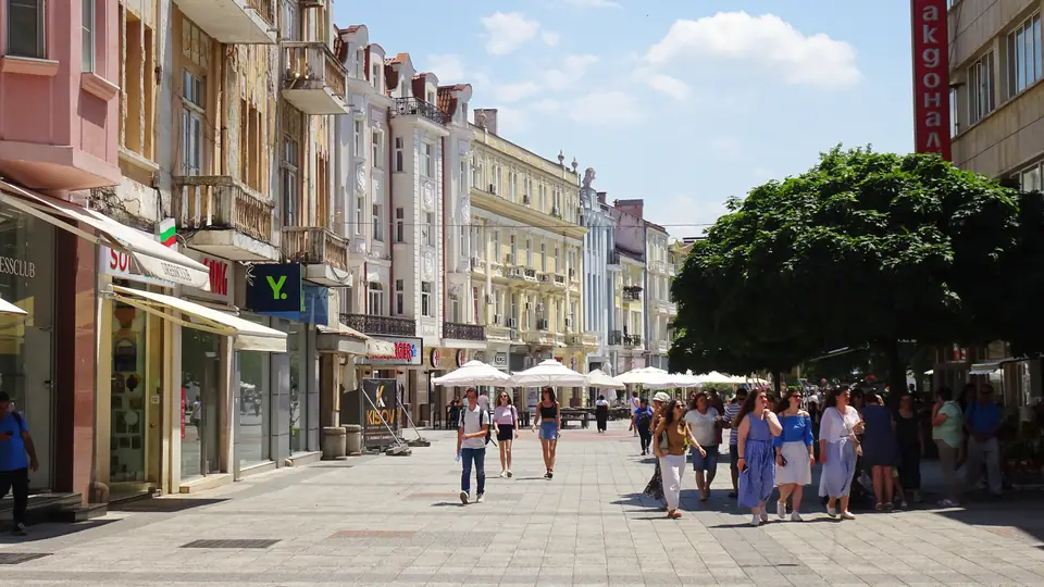
Municipal maps organize Plovdiv across 101.98 square kilometres into six numbered boroughs called rayoni: Tsentralen, Iztochen, Zapaden, Severen, Yuzhen, and Trakia. Postcode 4000 anchors downtown Tsentralen, wrapping the 1.75-kilometre Knyaz Alexander I pedestrian promenade, the Old Town, and Kapana. Six bridges link this south-bank core to Karshiyaka across the Maritsa.
Public tap water is safe to drink across city hotels, garden spigots, and street mineral taps. Urban trolleybuses ceased operating in 2012, leaving walks and numbered motorbuses as daily choices. Dial 112 anywhere in Bulgaria for English emergency dispatchers. Rely on licensed metered cabs, carry photo identification daily, protect valuables on transit corridors, and note minor local seismic awareness.
Comfortable two-day stays follow the compact downtown footprint effortlessly once you match seasonal rainfall against hill climbs and fair weeks. Before locking bags or dates, review our Plovdiv weather calendar, check rail arrivals from Sofia, and compare quarter slope grades across Centralen, Kapana, and Karshiyaka.
Where it is
- 1Plovdiv
- Sofia Airport (SOF) · about 125 km from Plovdiv in a straight line
- Directions in Google Maps
Stations and taxi ranks: OpenStreetMap. Airports: OurAirports. Distances are in a straight line.
Traveller tips
Real advice from people who have been to Plovdiv. Every tip is read by our team before it goes live.
No tips yet. Been here? Yours could be the first.
Thank you! Your tip will appear here after a quick review.
More in Plovdiv
Continue exploring Plovdiv with related neighbourhood, food, and planning guides