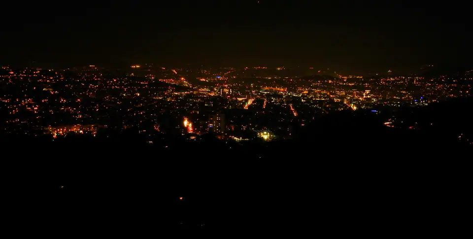
Photo: qwesy qwesy · CC BY 3.0
Stuttgart in the Kessel: Vineyards, Rack Rails and Steel
Orientation inside Stuttgart's kettle valley: vineyards, mineral springs, hillside stairs, cogwheel rail, and basin driving bans.
Approach Stuttgart by highway from the north or southwest and the city barely shows itself. Downtown hides inside a steep horseshoe bowl known locally as the Talkessel (TAHL-kes-sel, literally "kettle valley"). Elevations start near 207 metres by the Neckar river in Bad Cannstatt and climb steeply to 549 metres atop Bernhartshöhe in Vaihingen. Every rim except the northeast opens onto forest ridges or terraced vineyard slopes.
This enclosed floor shaped the town from around 950 AD, when Duke Liudolf of Swabia founded a royal horse stud called Stutengarten. Counts, dukes, and kings of Württemberg ruled from downtown squares until 1918. Over the twentieth century, the former horse pasture grew into an industrial hub now holding roughly 605,663 residents across 207 square kilometres.
Wartime bombing changed Stuttgart's skyline as sharply as its terrain. Across 53 air raids, peaking on 12 September 1944, roughly 57.7 percent of building stock suffered destruction. Post-war municipal crews hauled broken masonry up to the western rim and stacked it into Birkenkopf. Carved sandstone cornices still protrude through wooded paths near the summit, turning a rubble pile into the valley's finest outdoor viewing mound.
Hillside Stäffele, Vineyards and Mineral Springs
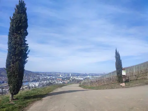
Rather than grading steep valley walls flat, winegrowers terraced the sunny inner slopes centuries ago. Commercial vineyards still span more than 400 hectares inside city limits. Growers work tight plots bordered by stone dry-walls along Untertürkheim, Rotenberg, Uhlbach, and downtown ridges. That agricultural patchwork softens the transition between downtown office avenues and suburban hilltop forests.
To climb those steep terraces daily, labourers built outdoor stone stairways known locally as Stäffele (SHTEF-eh-leh). More than 400 public staircases remain open today, linking valley tram stops straight to high villa streets. Combined, those outdoor steps exceed 20 kilometres in total length and give locals their light-hearted nickname, Stäffelesrutscher.
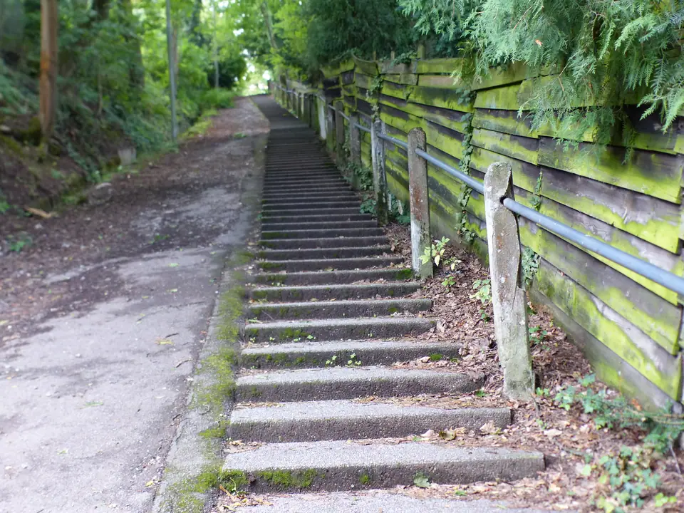
Pick well-known climbs such as the Eugenstaffel or Sünderstaffel when exploring on foot. Ten minutes after stepping away from Königstraße shop windows, traffic hum disappears behind orchard walls and weathered sandstone railings. On clear mornings, each landing opens wide views over red tiled roofs toward the distant Swabian Jura hills. Ridge parks including Killesberg, Bopser, and Birkenkopf catch steady valley breezes whenever mid-afternoon heat hangs heavy below.
Down on the flatter eastern edge in Bad Cannstatt lies an older natural asset beneath the gravel. More than 250 mineral springs push roughly 19 to 22 million litres of warm iron-rich water upward every day. Those reserves rank second in Europe behind Budapest. Three distinct thermal bathhouses, MineralBad Cannstatt, Das Leuze, and Mineralbad Berg, pipe that mineral water straight into steaming year-round outdoor pools.
Two Mountain Railways on Standard Transit Tickets
Stuttgart's steep valley rim shapes daily public transit just as visibly as its parks. Regular VVS urban tickets operate two mechanical hill railways every day rather than running them purely as weekend tourist novelties. Both routes remain stitched tightly into commuter schedules linking residential ridge estates with central tram interchanges.
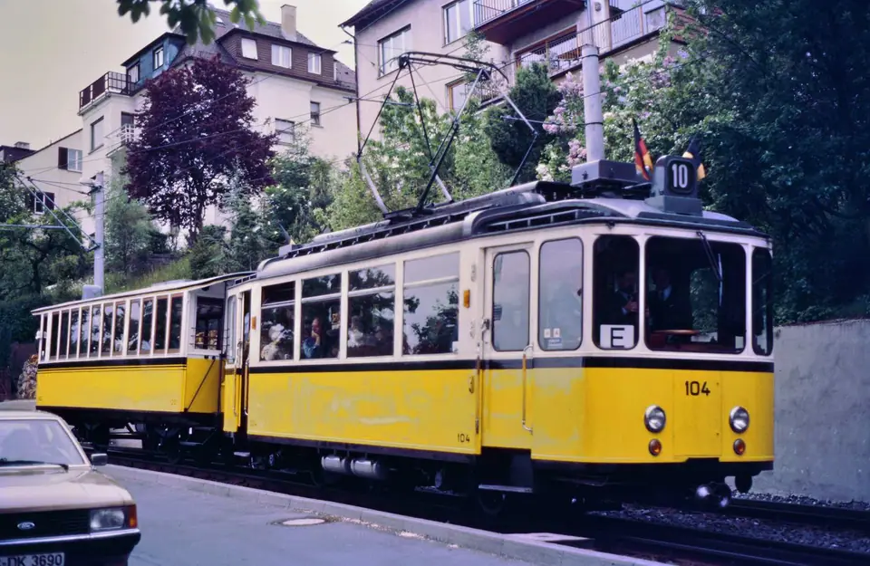
Inaugurated on 23 August 1884, Stadtbahn Line 10 is known to every resident as the Zacke. It stands as Germany's only remaining rack railway integrated into regular urban service. Yellow electric cars engage a central toothed cog rail at Marienplatz (266 metres) and grind up a 2.2-kilometre slope toward Degerloch (465 metres). Gradients reach 17.8 percent past the Wielandshöhe outlook. Commuting cyclists hook bicycles onto an open flatcar pushed ahead of the cab, called the Lore, then ride forest trails back down into town.
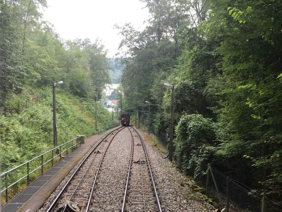
Further west in Heslach runs Line 20, the historic Standseilbahn funicular opened on 30 October 1929. Its pair of counterbalanced teak-panelled wooden cars climb 536 metres up a 28.3 percent cable gradient. Passengers rise 87 metres from Südheimer Platz into leafy woodland around the hillside Waldfriedhof cemetery in roughly ten minutes. Linking those historic climbs with valley U-Bahn stops makes ridge walks and museum days effortless without burning morning energy.
Basin Driving Rules and Ground Realities
Low-emission zone warning: Stuttgart enforces a permanent citywide Umweltzone requiring a Category 4 green windscreen badge (Umweltplakette) on every car, including foreign rentals. Euro 4 and older diesels are banned throughout the municipality. Euro 5 diesels face bans inside the central kleine Umweltzone covering the basin, Bad Cannstatt, Feuerbach, and Zuffenhausen. Out-of-town diesel drivers holding valid VVS transit proof may reach listed outer Park+Ride hubs like Vaihingen, Degerloch Albstraße, or Sommerrain directly from edge highways, though skipping a car inside town avoids every fine.
Non-EU visitors enter Germany under the Schengen 90/180-day framework. Initial entry runs through EU Entry/Exit System (EES) passport and biometric checks at borders. Inside Baden-Württemberg, plan groceries around strict Sunday quiet rules (Sonntagsruhe). Supermarkets and department stores close completely on Sundays, whereas morning bakeries, rota pharmacies, and Hauptbahnhof concourse markets remain open.
Keep euro notes and coins in your pocket even if you prefer contactless cards. Independent bakeries, Markthalle snack stalls, and seasonal Besen wine taverns often require cash for small orders. When eating at sit-down tables, round bills up by 5 to 10 percent verbally directly with your server. Never leave spare coins sitting behind on tablecloths as a tip. Give downtown a calm pace by stepping into shaded park clearings around Schlossgarten and Rosensteinpark whenever street noise rises.
Walking across the basin quickly teaches why locals speak about "above" and "below" the rim rather than north and south. Downtown plazas stay warm and sheltered under stone walls, yet riding the hill railways up onto open rim pastures immediately puts windproof jackets back into use.
Where it is
- 1Stuttgart
- Stuttgart Airport (STR) · about 10 km from Stuttgart in a straight line
- Directions in Google Maps
Stations and taxi ranks: OpenStreetMap. Airports: OurAirports. Distances are in a straight line.
Traveller tips
Real advice from people who have been to Stuttgart. Every tip is read by our team before it goes live.
No tips yet. Been here? Yours could be the first.
Thank you! Your tip will appear here after a quick review.
More in Stuttgart
Continue exploring Stuttgart with related neighbourhood, food, and planning guides