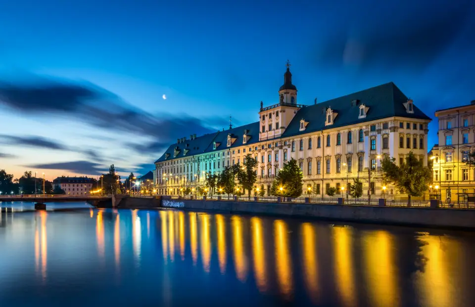
Photo: Jar.ciurus · CC BY-SA 3.0 pl
Bridges Over the Oder: Reading Wrocław's River Islands
Understanding Wrocław through its Oder channels, multi-crown past, 1945 border transformation, University Baroque rooms and daily basics.
Approach central Wrocław on foot and paved squares keep giving way to steel bridge decking. Four smaller tributaries, the Oława, Ślęza, Bystrzyca and Widawa, join the wide River Odra (Oder) inside city limits. Their braided channels divide twelve urban islands across a flat 292.81-square-kilometre municipality sitting 105 to 155 metres above sea level. Poles call this river web Miasto Stu Mostów, the City of a Hundred Bridges. Well over a hundred road spans, rail viaducts and footbridges stitch quiet chestnut islands straight onto dense town blocks.
Roughly 672,601 permanent residents live across this wide lowland river basin today. River embankments carry subtle clues to sudden shifts across Central European borders. Rather than memorising dates, watch how stone crests, street grids and relocated libraries register each change of rule. A medieval Piast stronghold grew into a Bohemian trade hub, a Habsburg university town, a Prussian metropolis, and a Polish academic centre rebuilt from post-war ruin.
From Bohemian Vratislav to the 1945 Lwów Transfer
Tenth-century Piast rulers raised timber fortifications on island ground at Ostrów Tumski, gaining a Catholic bishopric in AD 1000. Across the river stream, merchants laid out regular streets under 13th-century Magdeburg charters. The town passed to the Bohemian Crown in 1335 as Vratislav. Habsburg monarchs inherited power in 1526, and Prussia seized the region as Breslau in 1741. Each administration altered street signs without erasing the busy water crossroads below.
That multi-century urban fabric shattered violently during the final spring of the Second World War. Declared Festung Breslau in 1944, the fortified garrison held out through an 80-day Soviet siege before surrendering on 6 May 1945. Roughly 60 to 70 percent of city buildings lay ruined or gutted by artillery and fire. Under post-war border agreements, German residents departed west. Displaced Polish families and scholars settled among the rubble from eastern borderlands, led prominently by former inhabitants of Lwów.
Along with arriving settlers came treasured library crates carried west across changing borders. Between 1945 and 1946, rail wagons transferred manuscripts and rare volumes from the 1817 Ossoliński National Institute (Ossolineum) into monastic Baroque halls near the Odra. Today its courtyard links Wrocław's museums and archives directly back to Lwów scholarship.
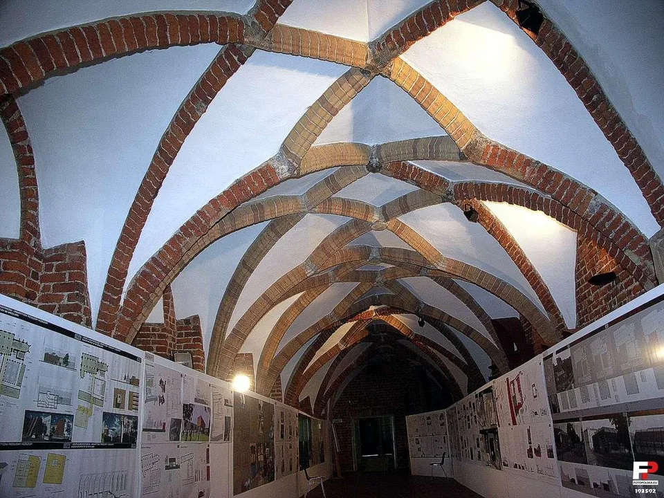
Patient restoration unfolded across decades along the damaged riverfront. Polish masons and art historians salvaged surviving brick vaults and rebuilt gabled merchant rows facade by facade. Rescued Baroque sandstone portals now stand beside recreated medieval brickwork around the historic square.
Twelve Islands, Four Tributaries and the 1997 Flood
Walking north off the market square reveals how tightly neighbourhood rhythm tracks river channels. Narrow Wyspa Piasek, Wyspa Słodowa, Bielarska, Młyńska, Daliowa and Tamka sit wedged between stone sluices and chestnut footbridges. Meanwhile, historic Ostrów Tumski lost its encircling side stream long ago and joins the northern riverbank seamlessly. On clear evenings, students gather on Malt Island lawns looking back toward Gothic cathedral spires above passing river barges.
Water shaped and tested modern Wrocław during the July 1997 Millennium Flood, when extreme summer rain inundated roughly 40 percent of the urban grid.
Known across Poland as Powódź tysiąclecia, that 1997 disaster prompted sweeping civil engineering across the Odra basin. Reinforced earthen levees, widened flood-relief canals and modernised weir gates now protect inner streets. Broad engineered embankments double smoothly as sunny running tracks and cycle promenades. Walk those rebuilt river walls to link central market halls cleanly toward brick tenements across the north bank.
Crossing Młyński Bridge or Piaskowy Bridge changes street noise immediately. Heavy tram lines south of the channel soften into willow branches, green mill races and calm park benches.
Leopoldina Vaults, Astronomical Meridian and Botanical Walls
Towering cleanly above the river curve rises the Baroque main building of the University of Wrocław, established in 1702 by Habsburg Emperor Leopold I. Jesuit architect Christophorus Tausch designed the dramatic 171-metre-long riverside elevation stretching boldly beside the embankment. Stepping inside off busy riverside cobbles shifts the mood from bright water glare to carved timber pews and marble pilasters. Its ceremonial jewel, Aula Leopoldina, dazzles visitors climbing off quiet stone stairs. Johann Christoph Handke painted its illusionistic ceiling vaults between 1728 and 1732. Franz Mangoldt carved gilded stucco figures framing its raised imperial lectern.
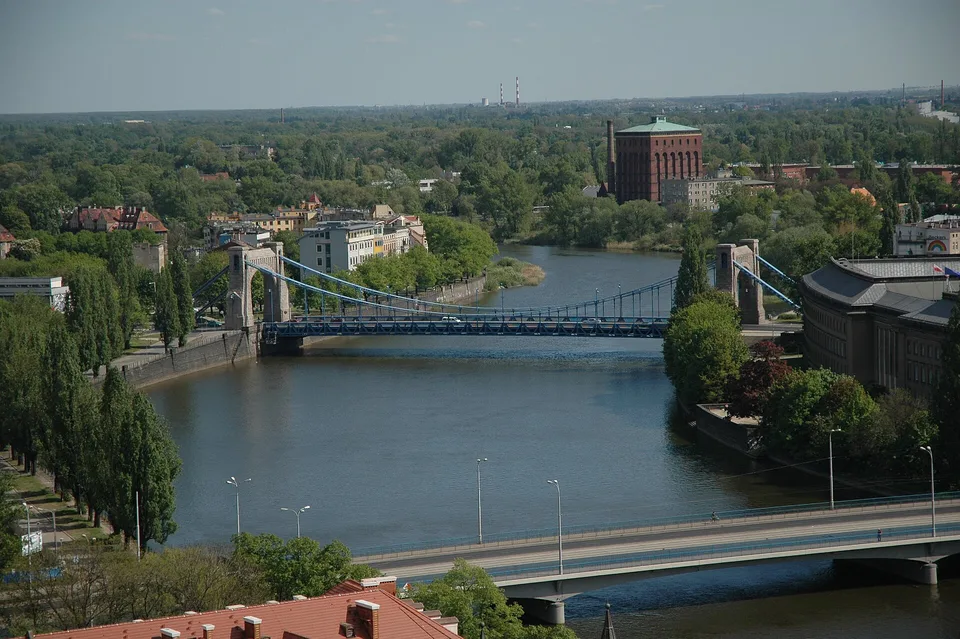
Climb past imperial staircases onto the open viewing terrace atop the 42-metre Wieża Matematyczna (Mathematical Tower). Here astronomer Longinus Anton Jungnitz built an observatory in 1791 right beneath four allegorical rooftop statues. A brass meridian line cuts directly across the stone floor inside. Outside on the breezy deck, visitors trace church gables, lock gates and the Old Town Hall spire cleanly in morning light. Even short pauses here show how tight river bends pin old parishes within view of modern boulevards.
Practical city routines stay uncomplicated once river orientations click. Poland keeps the Polish złoty rather than the euro. Contactless bank cards and phone wallets work everywhere from on-board tram screens to small produce booths. Municipal tap water meets EU drinking quality standards straight from hotel taps. Polish retail rules close major supermarkets on non-shopping Sundays except on designated niedziele handlowe calendar dates, leaving smaller corner convenience shops and station groceries open near traditional milk bars. Café patios along the Odra stay lively through mild evenings from central Old Town lanes out to quiet brick suburbs.
Non-EU visitors arriving overland from Kraków or Prague follow Schengen border rules, needing passports issued within 10 years and valid at least 3 months past departure. Pack sturdy flat-soled walking shoes for weathered granite cobbles across bridges and courtyard lanes. Street-level crossings run level and step-free along main avenues, letting walkers cover major river islands easily without private cars or expensive taxis.
Where it is
- 1Wrocław
- Copernicus Wrocław Airport (WRO) · about 11 km from Wrocław in a straight line
- Directions in Google Maps
Stations and taxi ranks: OpenStreetMap. Airports: OurAirports. Distances are in a straight line.
Traveller tips
Real advice from people who have been to Wrocław. Every tip is read by our team before it goes live.
No tips yet. Been here? Yours could be the first.
Thank you! Your tip will appear here after a quick review.
More in Wrocław
Continue exploring Wrocław with related neighbourhood, food, and planning guides