Quick Field Data
- UNESCO Inscription: Inscribed in 2000 (Ref. 908) as a Natural site under Criterion (viii).
- Scale & Footprint: Protects 1,216 hectares of key geological formations across a 1,600-square-kilometre volcanic archipelago of seven main inhabited islands plus islets 30 to 80 kilometres north of Sicily.
- Access & Ticketing: Island ports, lower coastal footpaths, and whitewashed town centres remain open free. Guided high-altitude ascents on Stromboli and Vulcano crater routes follow strict municipal and civil protection safety limits checked locally.
- Arrival Logistics: Major commercial flights land at Catania-Fontanarossa Airport (CTA, 114 kilometres south), while closer Reggio Calabria Airport (REG, 77 kilometres southeast) runs limited regional routes. High-speed hydrofoils and ferries link Sicilian ports with Palermo (144 kilometres west).
Subduction Volcanism and the Birth of Strombolian and Vulcanian Science
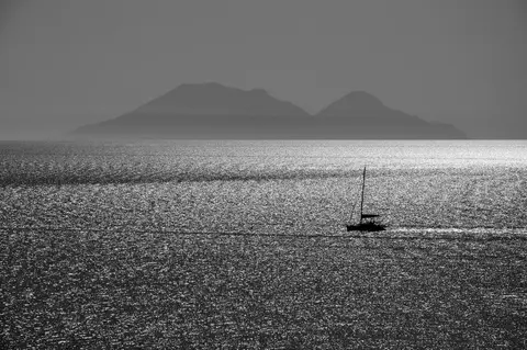
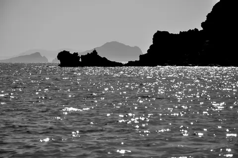
Rising 30 to 80 kilometres off Sicily's northern coast in the Tyrrhenian Sea, the aeolian islands italy form an active volcanic arc over 140 kilometres long. Known locally as Isole Eolie (aeolian islands in italian) or sometimes the Lipari group after their largest island, the chain comprises seven main inhabited peaks plus uninhabited rocks such as Basiluzzo, Strombolicchio, Dattilo, and Lisca Bianca. Lipari covers 37.5 square kilometres, followed by Salina (26.8), Vulcano (21.2), Stromboli (12.6), Filicudi (9.5), Alicudi (5.2), and Panarea (3.4), with Monte Fossa delle Felci on Salina reaching the highest summit at 962 metres.
Geologically, the seven islands crown an immense submarine volcano province rooted on the Tyrrhenian Basin floor up to 3,600 metres deep, sharing tectonic origins with Ustica and submerged volcanoes including Magnani, Vavilov, Marsili, and Palinuro. Subduction of the African continental shelf beneath the Eurasian Plate feeds rising magma that sculpted these visible cones over 260,000 years. Today, permanent resident numbers stand near 14,224 in 2011 and 15,419 in 2019 estimates across the archipelago, though May to September visitors swell seasonal totals to roughly 600,000 annual arrivals drawn to steaming fumaroles, thermal waters, and steep black volcanic ridges.
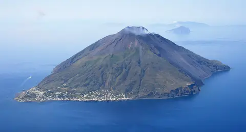
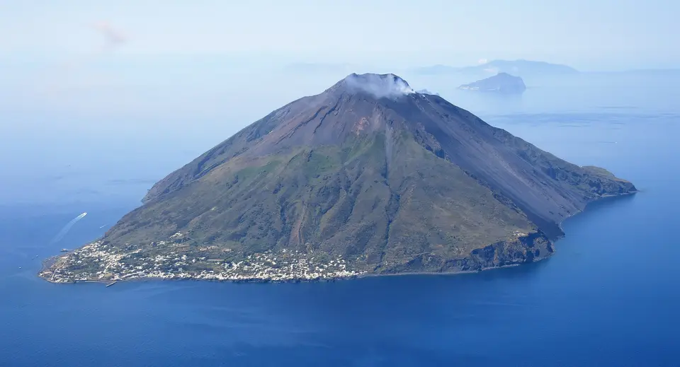
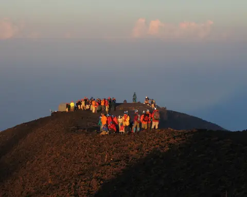
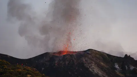
Studied intensively by naturalists since the eighteenth century, this single archipelago gave Earth science two foundational eruption categories. Vulcano, closest to the Sicilian coast, named Vulcanian eruptions after violent gas-and-ash explosions such as the 19-month outbreak from Fossa crater starting in August 1888 that killed several sulphur miners. Northeastward, Stromboli, called Strongyle by Greeks for its conical shape and nicknamed the Lighthouse of the Mediterranean, rises 926 metres above sea level (over 2,700 metres from the sea floor). Active almost continuously for 2,000 to 5,000 years, Stromboli defines Strombolian volcanism through rhythmic bursts of glowing tephra bombs every few minutes or hours. Over 13,000 years, repeated collapses shaped its Sciara del Fuoco chute, while modern activity includes a deadly September 1930 blast that killed six people and effusive flows in 2002, 2003, 2007, and 2013 to 2014. More recently, intense explosions struck in July and August 2019 (throwing a 2,000-metre ash column), followed by a joint civil protection alert with Mount Etna on 4 July 2024.
Scientific monitoring relies on instruments such as multi-component gas analysers that track pre-eruptive degassing to predict rising magma. Beyond volcanology, Stromboli entered European literary and film culture. Jules Verne set the conclusion of his 1864 novel at Stromboli, while Roberto Rossellini directed his 1950 film on the island starring Ingrid Bergman.
Neolithic Obsidian Trade, Lipari's Citadel, and Homeric Winds
Long before modern geologists landed on these beaches, volcanic glass drew prehistoric Mediterranean sailors to aeolian islands sicily shores. Around 5000 BC, Neolithic migrants from Sicily settled at Castellaro Vecchio on Lipari, quarrying shiny black obsidian for razor-sharp blades traded across the Mediterranean. During the Bronze Age, Mycenaean voyagers reached the archipelago and villages flourished at Capo Graziano on Filicudi, Castello on Lipari, and Capo Milazzese on Panarea. Additional Bronze Age settlements prospered at Serro dei Cianfi and Portella on Salina, linking Greece to British tin trade routes until Italic invasions destroyed villages around 1250 BC and burned Ausonian sites in the late ninth century BC. Later, Greek writers and Homer's Odyssey tied Lipari to Aeolus, divine keeper of the winds, inspiring aeolian islands odyssey traditions around Odysseus's wind-filled leather bag and Virgil's Cyclopes forge legends.
In 580 BC, Greek colonists exiled from Rhodes and Knidos under survivors of Pentathlos established Lipara on Castello rock, battling Etruscans at sea and leaving thick fourth- and fifth-century BC fortification walls visible in Lipari's Diana necropolis district. After Carthaginian alliances and a 394 BC struggle involving Dionysius of Syracuse plus a 304 BC raid by Agathocles, Roman forces captured Lipara in 252 to 251 BC during the First Punic War and turned it into a thermal spa and imperial exile retreat. Christian tradition adopted Saint Bartholomew after his relics washed ashore in AD 264, before Aghlabid raids in 836 and 839 depopulated the town until Norman ruler Roger II restored Benedictine settlement and re-established the cathedral in 1131.
Devastation struck again on 30 June 1544, when 180 Ottoman vessels led by Hayreddin Barbarossa, accompanied by French galleys under Captain Polin documented by French priest Maurand, captured Lipari's citadel and enslaved thousands before Spanish authorities ransomed survivors and repopulated the town. In 1556, Holy Roman Emperor Charles V built massive Spanish fortress ramparts atop the ancient Greek acropolis, creating a walled refuge that protected residents until nineteenth-century piracy ceased. Spared fatalities during eastern Sicily's 1693 earthquake, Lipari gained prosperity from malvasia grapes, capers, fruit, and fishing while Archduke Ludwig Salvator of Austria chronicled the archipelago across eight volumes between 1893 and 1896. Though international newspapers falsely claimed on New Year's Day 1909 that the islands sank beneath the sea, twentieth-century politics turned Lipari into a Bourbon and Fascist penal colony holding exiles like Emilio Lussu, Curzio Malaparte, and Carlo Rosselli. After Allied capture in August 1943, those former prison halls became the Aeolian Archaeological Museum researched extensively by Madeleine Cavalier and Luigi Bernabò Brea.
Architectural Limits, Whitewashed Pumice Homes, and Island Conservation
Administratively, all islands except Salina belong to the comune of Lipari inside the Metropolitan City of Messina, while verdant aeolian islands salina territory splits across three municipalities: Malfa, Leni, and Santa Marina Salina. Lipari Island itself holds 12,794 permanent residents as of 2026 (with 51.1 percent male, 48.9 percent female, and 11.0 percent international-born residents from 2025 counts), rising toward 20,000 residents each summer across Lipari town and the villages of Pianoconte, Quattropani, Acquacalda, and Canneto. Stromboli houses roughly 500 year-round inhabitants clustered in San Bartolo, San Vincenzo, and remote Ginostra, where traditional Sicilian-derived Aeolian dialect remains spoken daily.
Strict planning regulations protect the built character of these volcanic islands against high-rise overdevelopment. New construction stays tightly limited, and restored homes must preserve traditional cubist whitewashed forms built from indigenous stone, lava, light pumice, and volcanic tufo around broad vine-shaded terraces. On Lipari, whose last volcanic eruption occurred in AD 1220, extensive white pumice slopes long supplied global exports and framed the closing scenes of Paolo and Vittorio Taviani's 1984 film Kaos, leaving pumice slopes ending roughly one metre above the sea. International heritage monitoring closely watched both pumice quarry closures and proposals for four new harbours to safeguard World Heritage integrity through 2020 and beyond. Today, strict conservation rules keep whitewashed volcanic settlements compact inside steep coastal slopes while allowing geologists, mariners, and island farmers to share fertile volcanic hillsides safely. Two centuries after early naturalists first documented these craters, the islands remain active field stations for studying volcanic island growth and marine erosion.
Access Zones Across Lipari, Stromboli, Vulcano, and Salina
Planning things to do aeolian islands splits naturally by island ferries and volcanic alert boundaries. Because seven distinct volcanic islands span open Tyrrhenian waters, visitors pick one central hub such as Lipari or Salina and hop by hydrofoil between active craters and quiet coves.
| Complex Zone | Key Highlights | Access & Ticket Rule |
|---|---|---|
| Lipari Castello Acropolis & Museum. | 1556 Spanish fortress atop Greek and Bronze Age strata, Saint Bartholomew Cathedral, Diana walls, and the Aeolian Archaeological Museum. | Citadel streets and exterior bastions open free on foot. Museum exhibition halls require regional cultural heritage tickets. |
| Stromboli Volcano & Sciara del Fuoco. | Two active summit craters above 926-metre Strongyle, continuous Strombolian explosions, boat-viewable lava slide, and Ginostra footpaths. | Lower village lanes and coastal viewpoints open free. High crater ascents depend on civil protection alerts and mandatory licensed guides. |
| Vulcano Gran Cratere & Thermal Coast. | Fossa volcanic cone shaped by the 1888 Vulcanian eruption, steaming sulphur fumaroles, and mineral coastal springs near Sicily. | Harbour streets and coastal areas open free on foot. Crater rim trails require local safety passes and close during elevated gas emissions. |
| Salina, Panarea, Filicudi & Alicudi. | 962-metre Monte Fossa delle Felci on Salina, Bronze Age village ruins at Capo Graziano and Capo Milazzese, and car-free cliff walks. | Village paths and archaeological promontories open free on foot. Verify inter-island ferry timetables before crossing to western outer islands. |
Three Volcanic and Architectural Details Across the Aeolian Islands
- Obsidian Flakes and White Pumice Slopes on Lipari: Examine the pale quarry cliffs north of Lipari town beside Canneto and dark glassy fragments in the Aeolian Archaeological Museum. Lipari's late eruptions ejected both glistening black obsidian prized by 5000 BC toolmakers and lightweight white pumice mined down toward the sea.
- Sciara del Fuoco Collapse Scar on Stromboli: Look across Stromboli's northwestern flank from offshore boats or coastal lookouts near San Vincenzo. Over 13,000 years of repeated sector collapses carved this steep horseshoe chute that channels incandescent rockfalls and glowing lava flows cleanly down into the sea.
- Modular Tufo Cube Houses and Terraces: Walk through Ginostra on Stromboli or traditional quarters on Lipari and Salina. Strict local building rules mandate boxy whitewashed masonry formed from local lava, tufo, and pumice with flat rainwater-catching terraces shaded by trellised malvasia vines and caper bushes.
Best Time to Visit the Aeolian Islands and Ferry Gateways From Palermo
Selecting the best time to visit aeolian islands revolves around calm Tyrrhenian seas and comfortable hiking air on exposed volcanic cones. From May through September, warm dry weather connects island ports smoothly by hydrofoil and boat tours while seasonal hospitality services run full timetables, though late spring and early autumn avoid peak July and August ferry crowding. Winter storms occasionally interrupt crossings to smaller islands like Alicudi, Filicudi, and Ginostra, and active volcanic alerts on Stromboli or Vulcano can close summit footpaths at short notice even during sunny summer weeks. Staying three or four days lets visitors combine Lipari's acropolis museum and white pumice shorelines with evening boat views beneath Stromboli, fumarole walks on Vulcano, and verdant mountain hikes across Salina.
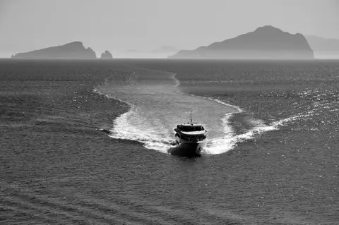
Travellers working out how to get to aeolian islands depart primarily by hydrofoil or vehicle ferry from northern Sicilian ports, chiefly Milazzo across from Vulcano, or seasonal crossings along Sicily's northern coast. Understanding how to get to aeolian islands from palermo is easy via coastal rail or highway connections from Palermo eastward to Milazzo or summer direct hydrofoils departing Palermo's harbour. Commercial international flights arrive at Catania-Fontanarossa Airport (CTA, 114 kilometres south), whereas closer Reggio Calabria Airport (REG, 77 kilometres) handles fewer regional flights. Pair volcanic island crossings with western Sicily via our Palermo guide (144 kilometres) or explore more geological heritage in the UNESCO World Heritage Atlas.