Quick Field Data
- UNESCO Inscription: Inscribed in 2013 (Ref. 1427) as a Natural site under Criterion (viii).
- Scale & Footprint: Covers 19,237 uninhabited hectares of strict integral reserve inside a 26,220-hectare buffer zone within Parco dell'Etna, across a volcanic massif spanning 1,190 square kilometres with a 140-kilometre base.
- Access & Ticketing: Marked forest trails in lower park areas open free on foot. Buffer-zone cableways, ski lifts, and guided four-wheel-drive routes toward the observatory require paid admission, while summit zones close whenever active volcanic hazards dictate.
- Arrival Logistics: Major commercial flights land directly at Catania-Fontanarossa Airport (CTA, 33 kilometres south), offering immediate approaches up Etna's flanks and onward travel across Sicily toward Palermo (149 kilometres northwest).
Submarine Origins, Valle del Bove Collapse, and Plate Tectonics
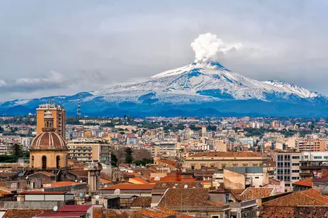
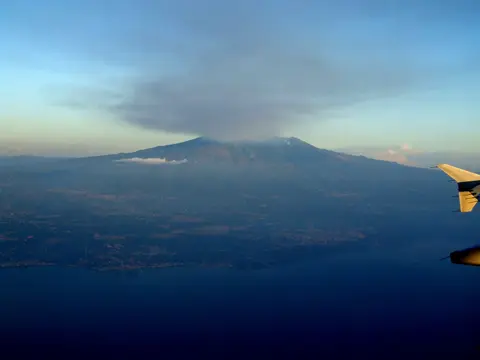
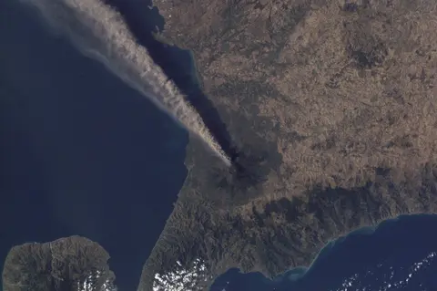
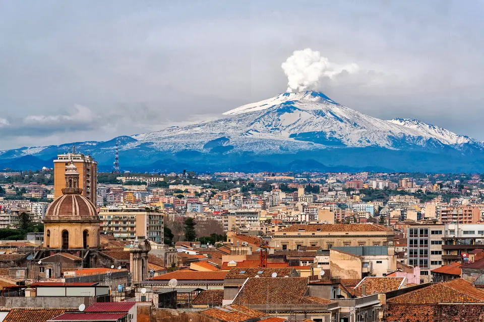
Rising between Catania and Messina on Sicily's eastern coast, Mount Etna dominates the convergent boundary where the African Plate descends beneath the Eurasian Plate. Covering 1,190 square kilometres with a 140-kilometre basal circumference, it stands roughly two and a half times taller than Mount Vesuvius as the largest of Italy's four active volcanoes. Across the European and North African region west of the Black Sea, only Mount Teide on Tenerife rises higher. Summit eruptions reshape Etna's height continuously: the southeastern crater peaked at 3,357 metres in 2021 before summer 2024 explosions built the Voragine crater up to 3,403 metres.
Volcanological studies trace Mount Etna's earliest activity roughly 500,000 years back to submarine vents erupting off Sicily's ancient coastline. About 300,000 years ago, magma broke out southwest of the modern summit before central volcanism shifted to the present axis around 170,000 years ago. Alternating explosive blasts and effusive lava flows stacked the first major stratovolcano edifice, interrupted periodically by summit collapses forming wide calderas. Between 35,000 and 15,000 years ago, unusually violent eruptions drove vast pyroclastic flows, leaving extensive ignimbrite sheets and dropping ash 800 kilometres north past modern Rome.
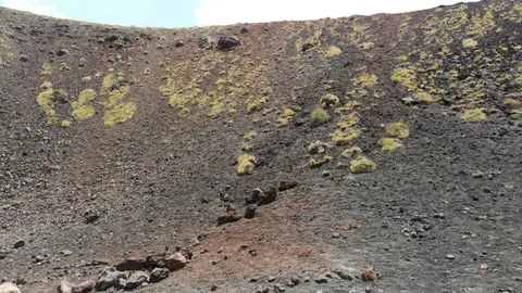
Two monumental collapses still carve Mount Etna's upper terrain today. Research published in 2006 indicates the eastern flank failed catastrophically roughly 8,000 years ago in a sector collapse resembling the 1980 eruption of Mount St. Helens. That giant landslide carved the vast Valle del Bove depression and triggered a tsunami across the eastern Mediterranean, while leaving sheer valley walls where geologists examine exposed prehistoric lava strata. Later, about 2,000 years ago, a summit collapse formed the Piano Caldera, since almost filled by young lavas yet still visible as a slope break beneath the main summit cone as the entire volcano creeps seaward at 14 millimetres annually.
Twenty-Seven Centuries of Documented Mount Etna Eruptions
Classical and modern chroniclers have logged every major mount etna eruption across at least 2,700 years, preserving one of volcanology's longest continuous historical records. Diodorus Siculus cited an outbreak around 1400 BCE, and an eruption in 396 BCE reportedly stalled Carthaginian troops marching toward Syracuse during the Second Sicilian War. A violent Plinian summit blast in 122 BCE buried Catania under heavy tephra and collapsed house roofs, leading Roman officials to grant Catania a ten-year tax exemption. Later writers such as Virgil in the Aeneid and Chinese traveller Rabban Bar Sauma on 18 June 1287 added eyewitness accounts. Roman records also connected an eruption in 44 BCE with Mediterranean crop failures, though modern volcanologists trace that famine primarily to Mount Okmok early the following year.
Mediterranean names reflect Etna's unceasing fire across successive cultures. Greek aitho means to burn, Phoenician attuna translates as furnace, Arabic Jabal al-Nar means Mountain of Fire, and Sicilian Muncibbeddu or Italian Mongibello pairs Romance and Arabic words for mountain or recalls Vulcan's Latin title Mulciber. Classical poets trapped the monster Typhon and placed Hephaestus's or Vulcan's forges beneath the crater. Later, Breton storytellers accompanying Norman forces moved King Arthur's legendary subterranean court inside Mongibel. Their tales shaped twelfth-century chronicles by Gervase of Tilbury and Caesarius of Heisterbach, the Occitan romance Jaufre, and Messina Strait mirages called Fata Morgana.
Geologically, every mount etna volcano eruption follows one of two patterns. Summit blasts issue from five main vents: the Northeast Crater, Voragine, Bocca Nuova, and two openings in the Southeast Crater Complex. Though explosive and visually dramatic, summit events seldom threaten populated valleys. Flank eruptions pose far greater risk because lava breaks through more than 300 lateral vents down to 350 or 450 metres above sea level. Around AD 1030, flows from Monte Ilice travelled 10 kilometres to build a coastal lava delta near Santa Tecla and Stazzo north of Acireale, while a 1160 or 1224 Mascalucia fissure poured into Ognina just north of Catania.
Etna's worst historic flank crisis began on 11 March 1669, destroying at least ten southern villages before hitting Catania's walls five weeks later on 15 April. Those ramparts deflected most molten rock seaward into the harbour while one breach entered western Catania behind the Benedictine monastery without reaching the town centre. Contemporary Italian and English accounts detailed precise building and farmland losses without confirming exaggerated fatality myths. Since 1600, at least 60 flank eruptions have scarred the slopes, nearly half since the start of the twentieth century. Recent activity brought flank outbreaks in 2001, 2002 to 2003, 2004 to 2005, and 2008 to 2009. Summit episodes followed in 2006, 2007 to 2008, January to April and July to October 2012, December 2018, February 2021, and summer 2024.
Volcanic Soils, Peripheral Vineyards, and Integral Reserve Governance
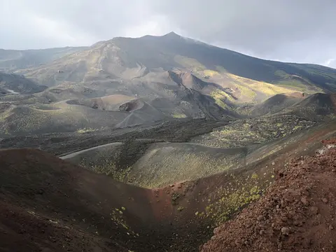
Established as Parco dell'Etna Regional Nature Park by Sicilian presidential decree in May 1987, the mountain balances conservation with heavy visitor interest and agriculture. Its World Heritage core protects 19,237 uninhabited hectares as an integral reserve, wrapped by a 26,220-hectare buffer zone. Following a public land acquisition programme finished in 2010, regional and municipal bodies own 97.4 percent of the core zone, whereas 56.6 percent of the buffer zone remains privately owned. Nine overlapping Natura 2000 habitats cover 77 percent of the reserve, protecting endemic alpine flora and pioneering ecosystems as volcanic ash weathers into fertile soil feeding orchards and vineyards down toward the Plain of Catania.
Ente Parco dell'Etna coordinates protection jointly with Sicily's State Forests authority and the Regional Corps of Forest Rangers under a long-term management plan and Triennial Intervention Programmes. Designated a United Nations Decade Volcano due to nearby population density, the uninhabited core holds no paved roads and permits no construction beyond maintenance of the high-altitude INGV observatory, over 50 seismic monitoring stations, basic mountain refuges, and narrow forestry tracks. Locked gates restrict motor vehicles strictly to rangers, researchers, and authorised four-wheel-drive excursions running from buffer tourism stations to the observatory. Dogs are prohibited inside the integral reserve, mountain biking and horse or donkey safaris require advance authorisation, low-intensity summer grazing stays regulated, and forest crews conduct selective thinning to reduce wildfire risk as regional climates warm.
Two busy tourism zones sit immediately outside those reserve gates inside the 26,220-hectare buffer area. Both hubs hold car parks, mountain huts, hotels, cafes, information desks, a passenger cableway, winter chair and drag ski lifts, and kiosks booking guided hikes, four-wheel-drive routes, or authorised horse and donkey safaris. Because natural volcanic hazards constantly threaten high-altitude facilities, access to the summit craters may be prohibited officially for safety even when buffer viewpoints stay open. Park planners continually balance high seasonal visitor demand against trail erosion, forest fire vigilance, and clear boundary marking across public and private slopes. Together, the barren volcanic cones, cinder craters, lava caves, and colonising endemic alpine plants turn the protected mountain into a natural outdoor classroom for Earth scientists and biologists worldwide.
Access Zones Across Mount Etna Regional Nature Park
Planning things to do mount etna depends on volcanic alert levels and whether visitors explore free lower trails or book high-altitude buffer transport. Two developed tourism zones inside the 26,220-hectare buffer house car parks, mountain huts, cafes, a cableway, ski lifts, and excursion desks.
| Complex Zone | Key Highlights | Access & Ticket Rule |
|---|---|---|
| Lower Buffer Foothills & Silvestri Craters. | Accessible dormant flank craters, cooled historic lava streams, car parks, visitor information points, cafes, and mountain huts. | Road entry and short rim walks around Silvestri Craters stay free. Check mountain weather and wear sturdy footwear. |
| Buffer-Zone Cableway & Ski Lift Stations. | Passenger cableway, winter chair and drag lifts, and departure kiosks for guided summit-area drives and licensed animal treks. | Lift passages and guided excursion packages require paid tickets checked directly on official lift and park operator sites. |
| Valle del Bove & Mid-Altitude Forest Tracks. | Gated mountain tracks, basic shelters, solar seismic telemetry posts, and sheer collapse amphitheatre views into stratified lava layers. | Pedestrians walk marked trails free without dogs. Private motor vehicles remain barred behind locked forestry gates. |
| Summit Craters & INGV Observatory Zone. | Voragine, Bocca Nuova, Northeast Crater, Southeast Crater Complex, and the scientific monitoring observatory high on the cone. | Controlled strictly by civil protection alerts. Access above lower altitudes frequently shuts during eruptions or requires licensed guides. |
Three Geological and Eruptive Features on Mount Etna's Slopes
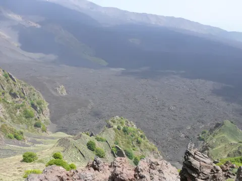
- Stratified Collapse Walls in Valle del Bove: Stand along the eastern ridge overlooking Valle del Bove to read Mount Etna's vertical history. Because the massive collapse roughly 8,000 years ago sliced deep into the volcano's flank, exposed cliff bands reveal centuries of alternating lava flows and ash beds.
- Lateral Scoria Cones and Subterranean Lava Tubes: Inspect the rounded Silvestri Craters and surrounding flank fissures across the upper buffer zone. Rather than venting solely at the summit, Etna pierces its flanks through over 300 lateral vents that build cinder cones and hollow lava caves underground.
- Continuous Seismic Monitoring Above the Treeline: Watch for compact solar-powered instrument posts tucked among dark basalt ridges toward the INGV observatory. More than 50 seismic stations track ground inflation and tremors around the clock, directly guiding when park rangers open or close upper trails.
Best Time to Visit Mount Etna and Travelling From Catania or Palermo
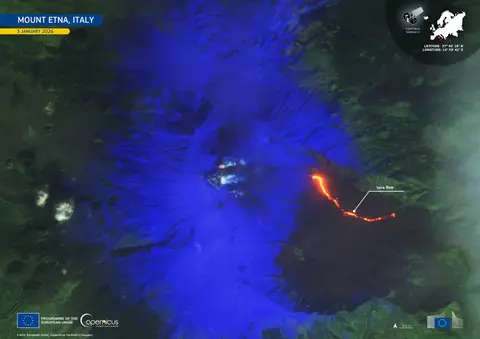
Deciding the best time to visit mount etna balances warm trail conditions against alpine weather high on the volcano. Late spring through early autumn delivers clear Mediterranean views from the craters down to Catania and the Ionian coastline, though chilly winds demand layered jackets and closed hiking boots even in midsummer. Winter snow covers high lava fields, shifting recreational focus to buffer-zone chair and drag ski lifts when high crater trails ice over or close for volcanic vigilance. Travellers checking news of a mount etna last eruption should always confirm active hazard notices with Ente Parco dell'Etna before setting off up the mountain. Even when summit trails close, lower buffer tracks, dormant flank craters, and cooled lava fields remain accessible year-round.
Answers to how to get to mount etna start at Catania-Fontanarossa Airport (CTA), positioned just 33 kilometres south of the massif. Knowing how to get to mount etna from catania is straightforward by hire car, regional public bus services, or guided tour buses ascending from Catania into buffer-zone trailheads and lift bases, explaining why is mount etna worth visiting even on a short Sicilian stay. Half-day and full-day routes climb past lower vineyards and orchards before reaching barren volcanic gravel at the buffer-zone stations. Multi-stop island itineraries pair eastern Sicily's volcano cleanly with Palermo (149 kilometres northwest) and neighbouring cultural landmarks across our UNESCO World Heritage Atlas.