Quick Field Data
- UNESCO Inscription: Inscribed in 1999 (Ref. 941) as a Cultural site under Criteria (i), (ii), (iii), and (iv).
- Scale & Footprint: Encompasses two separated Peloponnese archaeological citadels 20 kilometres apart across the Argolis plain: Mycenae (32 hectares at its 1350 BC peak) and Tiryns (20 to 25 hectares inside a 750-metre citadel perimeter).
- Access & Ticketing: Both fenced archaeological complexes and the Archaeological Museum of Mycenae require paid entry tickets checked through Hellenic Ministry of Culture channels. Walking paths weave across hills and ruins with stepped approaches.
- Arrival Logistics: Major commercial flights land at Athens Eleftherios Venizelos International Airport (ATH, 107 kilometres northeast). Closer Kalamata Airport (KLX, 94 kilometres southwest) offers limited regional flights. Overland corridors link east to Athens (90 kilometres).
Shaft Graves, Linear B Tablets, and Late Bronze Age Mycenae
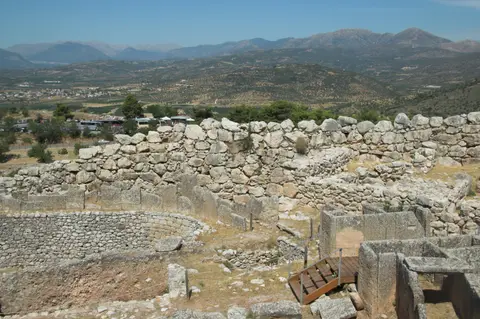
Rising on a 274-metre hill in the northeastern Argive plain, mycenae greece commands routes toward Corinth 48 kilometres north, Argos 11 kilometres south, and the coast 19 kilometres inland. Between roughly 1600 and 1100 BC, this hilltop stronghold gave its name to the entire Mycenaean civilisation across southern Greece, Crete, the Cyclades, and parts of southwest Anatolia. Ancient Greek traditions traced the pre-Greek name Mukanai to legendary founder Perseus plucking a mushroom (mykes) or losing his sword scabbard cap, while Homer tied the city to the nymph Mycene. Archaeological finds reach back into Early Neolithic times around 5000 BC through Rainbow Ware ceramics. Later, continuous Early Helladic (3200 to 2000 BC, divided into EH I, EH II, and EH III) and Middle Helladic (2050 to 1550 BC) settlements expanded beneath the palace floors and around Kalkani hill's freshwater well. Early cist burials dug on the western slope already sat inside Mycenae's earliest circuit wall around 1800 BC. By the sixteenth century BC, Mycenae emerged as the leading military and economic citadel of the Aegean world.
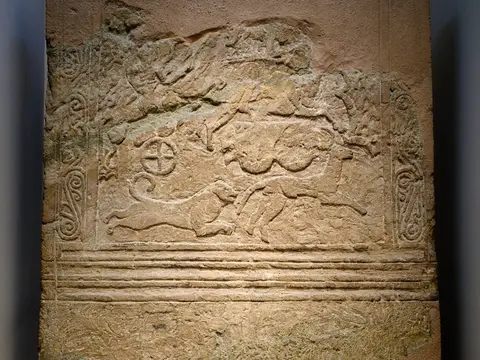
Royal wealth surged dramatically during the transition to the Late Helladic age between 1650 and 1500 BC. Beyond the later west wall, Grave Circle B preserved ten cist graves and deeper shaft graves topped by mounds and stelae. Inside what became the walled enclosure, Grave Circle A held six sixteenth-century BC shaft graves containing nine women, eight men, and two children buried with the Mask of Agamemnon, the Cup of Nestor, the Silver Siege Rhyton, and inlaid bronze swords and daggers. Chemical silver analysis points to wide Mediterranean networks, while an Egyptian scarab bearing Queen Tiye's name (wife of Amenhotep III) in the Room of the Idols echoes Egyptian inscriptions naming Mukana.
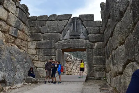
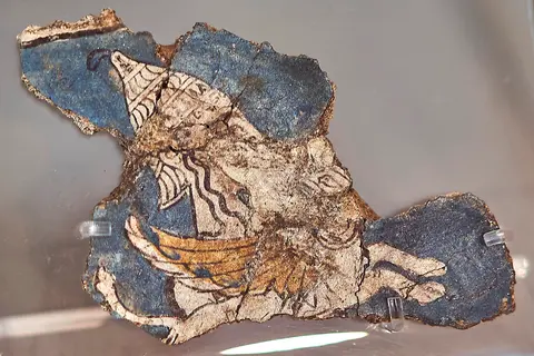
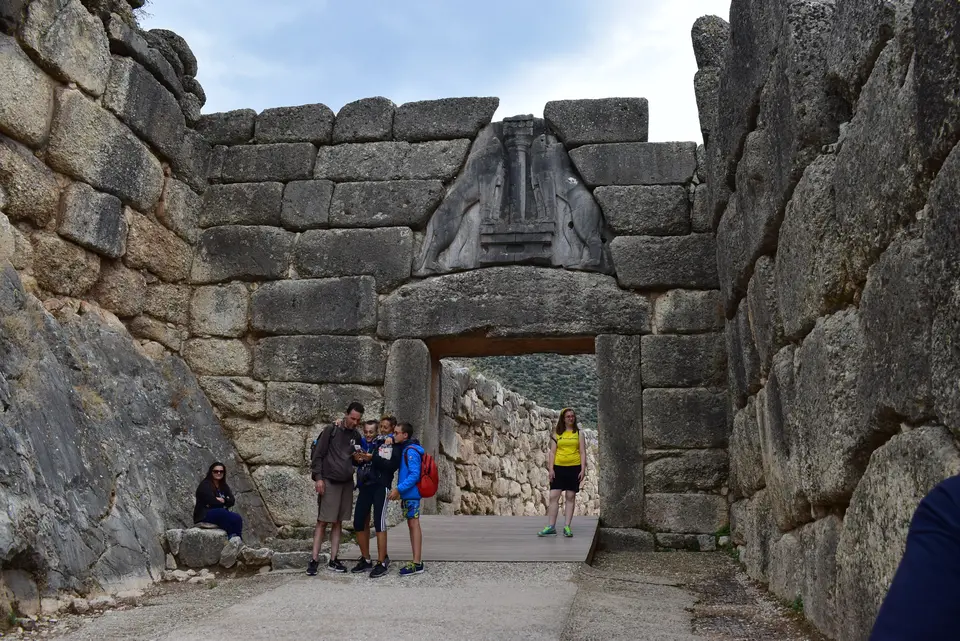
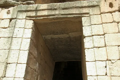
Around 1350 BC, when the citadel and lower town held roughly 30,000 residents across 32 hectares, builders enclosed the hill behind massive Cyclopean limestone walls. Successive hilltop palaces rose around a grand courtyard and four-column megaron throne room decorated with painted wall and floor frescoes. Monumental beehive (tholos) tombs replaced shaft burials across three architectural phases mapped by Alan Wace, culminating around 1250 BC in Group III tombs including the colossal Treasury of Atreus, the Tomb of Clytemnestra, and the Tomb of the Genii. During the same mid-thirteenth-century BC expansion, builders pushed the western Cyclopean circuit out to wrap Grave Circle A behind the carved Lion Gate. Nearby rose an undecorated north postern gate plus workshops such as the House of the Oil Merchant and House of Shields before destruction swept the palace around 1150 BC.
Both citadels hold enduring significance as cradles of written mycenaean greek records and epic storytelling. Excavated clay tablets inscribed in Linear B preserve the earliest surviving bureaucratic inventories in an early Greek dialect together with royal storage lists. Centuries after the Bronze Age collapse, Mycenae and Tiryns remained inseparable from Homer's Iliad and Odyssey, tied respectively to Agamemnon, Clytemnestra, Electra, Orestes, and Heracles, making mycenaean greece central to three millennia of European poetry and drama.
Cyclopean Masonry, Water Tunnels, and Heracles Legends at Tiryns
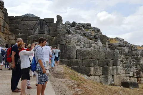
Standing roughly 15 to 20 kilometres south of Mycenae on a low limestone outcrop near the Argolic Gulf, Tiryns demonstrates equally daring Bronze Age defence across seven millennia of occupation. Beneath the later Mycenaean courtyard, archaeologists uncovered a massive Early Helladic circular structure 28 metres in diameter built from concentric cross-cutting stone walls reaching 45 metres overall thickness under fire-baked clay roof tiles. Rebuilt across three Late Helladic phases ending around 1300 to 1200 BC, the surviving citadel enclosed a 750-metre perimeter whose towering limestone walls earned Homer's epithet of mighty-walled Tiryns. Even in antiquity, Pausanias marvelled that two mules pulling together could scarcely move its smaller stones, repeating myths that giant Cyclopes from Lycia built the walls for king Proetus, tying Tiryns, Argos, and Mycenae to mythical founders Proetus, Acrisius, and Perseus.
Standing up to seven metres high today against an estimated original nine to ten metres, Tiryns's outer walls originally reached up to 13 metres in places. Those limestone ramparts normally measure six to eight metres thick and swell to an astonishing 17 metres where vaulted passages slice straight through the stonework. A stout transverse wall splits the hill into a southern royal palace plateau and a northern lower refuge area designed to shelter townsfolk during sieges. Beyond the citadel, an urban settlement covered 20 to 25 hectares with roughly 10,000 inhabitants near 1300 BC, growing toward 15,000 around 1150 BC after palace collapse. In that post-palatial era, someone concealed gold and silver objects plus a Minoan signet ring inside a bronze cauldron known as the Tiryns Treasure.
Inside the upper palace, visitors trace the royal megaron measuring 11.8 by 9.8 metres, entered through a two-columned portico and three-door prodomos into a hearth hall framed by four wooden columns and alabaster slabs carved with relief rosettes. Because later Argive rulers sought sole dominance over legendary heroes, Argos systematically destroyed both Mycenae and Tiryns in 468 BC despite 400 Tirynthian hoplites having fought at Plataea in 480 BC. According to Pausanias and Strabo, survivors were absorbed into Argos or moved away to found coastal Halieis. Centuries later, Pausanias recorded Tiryns completely deserted, leaving an intact Bronze Age fortress later overlaid by an eighth-century BC Geometric temple to Hera.
From Pausanias and Vandeyk to Schliemann and Dörpfeld Excavations
Rediscovering mycenae began in 1700, when Venetian military engineer Francesco Vandeyk surveyed the Morea for Francesco Grimani and matched Pausanias's classical description of the Lion Gate directly to the overgrown ruins. Serious fieldwork accelerated in the nineteenth century. At Tiryns, Alexandros Rizos Rangavis and Friedrich Thiersch dug trial trenches in 1831 before Heinrich Schliemann returned to dig both sites. Schliemann unearthed Grave Circle A at Mycenae with Panagiotis Stamatakis in 1876 and nearly tore down Tiryns's palace walls mistaking them for medieval construction before conducting thorough digs in 1884. Systematic scientific stratigraphy subsequently arrived under Wilhelm Dörpfeld, Georg Karo, and Greek archaeologist Apostolos Arvanitopoulos, who unearthed the 1915 Tiryns Treasure while Karo was absent during the First World War.
Modern conservation safeguards keep both sites legible and structurally sound for visitors walking through open-air ruins. Protected under Greek Antiquities Law No. 3028/2002 plus ministerial decrees from 1956, 1964, and 1991, both sites answer to the Hellenic Ministry of Culture through the Ephorate of Antiquities of Argolis, which preserves surrounding agricultural zones against urban encroachment. A Scientific Committee for Mycenae formed in 1999 improved pathways, signage, and structural stabilisation. That effort culminated in opening the Archaeological Museum of Mycenae in 2003, complementing flagship gold treasures displayed in Athens's National Archaeological Museum. Between 1998 and 2005, joint European Union and Greek state restorations also stabilised Tiryns's limestone fortifications using reversible techniques matching original Bronze Age construction.
Access Zones Across the Citadels of Mycenae and Tiryns
Planning what to see in mycenae greece means splitting time between four interconnected stops. Visitors walk Mycenae's hillside acropolis, outer tholos tombs, and site museum before driving south across the Argolid plain to Tiryns.
| Complex Zone | Key Highlights | Access & Ticket Rule |
|---|---|---|
| Mycenae Citadel & Lion Gate. | Monumental Lion Gate, Cyclopean circuit walls, Grave Circle A, royal megaron courtyard, Cult Centre, and north postern gate. | Fenced hillside archaeological park requiring paid admission. Wear sturdy walking shoes across uneven limestone ramps and steps. |
| Treasury of Atreus & Outer Tholoi. | Colossal beehive vault of the Treasury of Atreus, Grave Circle B, Tomb of Clytemnestra, and extra-mural merchant houses. | Included on the main Mycenae entry pass, positioned along the access road just south of the citadel car park. |
| Archaeological Museum of Mycenae. | 2003 site museum displaying local fresco fragments, Linear B casts, pottery sequences, and Bronze Age reconstructions. | Adjoining the citadel entrance gate on the main Mycenae ticket. Verify current opening schedules on official ministry portals. |
| Cyclopean Citadel of Tiryns. | Massive 8-metre-thick limestone ramparts, vaulted triangular siege tunnels, royal megaron floor, and underground spring stairs. | Separate ticketed archaeological site beside the Argolid valley road roughly 20 kilometres south of Mycenae. |
Three Mycenaean Engineering and Funerary Details on Site
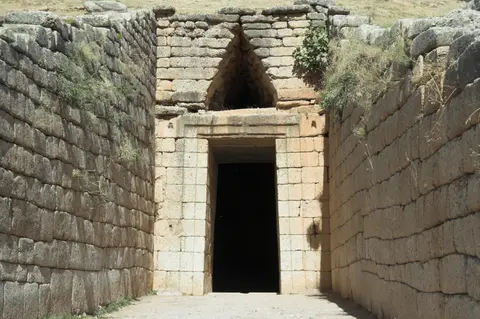
- Corbelled Relieving Triangles Over Stone Lintels: Look directly above the Lion Gate entrance and the colossal doorway of the Treasury of Atreus at Mycenae. Builders stacked overlapping stone courses to form a hollow triangular space above each horizontal lintel beam, directing massive wall weight downward into thick door jambs so stone lintels would not snap.
- Vaulted Siege Galleries Inside Tiryns's Seventeen-Metre Walls: Walk into the eastern and southern casemate corridors cut inside Tiryns's perimeter wall. Masons stacked enormous unshaped boulders outward until opposing rows met in steep pointed triangular vaults, creating sheltered storage chambers and protected battle posts inside walls up to 17 metres thick.
- Concealed Subterranean Water Tunnels at Both Citadels: Trace the stepped underground cistern passage inside Mycenae's northeastern extension and the twin western spring tunnels descending beneath Tiryns's fortification wall. Both citadels engineered hidden rock-cut passages reaching outside groundwater springs so defenders could draw fresh water unseen during prolonged sieges.
Best Time to Visit Mycenae and Travelling From Athens
Determining the best time to visit mycenae means balancing Peloponnesian summer heat against crisp spring and autumn light across open limestone hills. Because Mycenae's 274-metre acropolis and Tiryns's bare mound offer little overhead shade, spring wildflowers and mild autumn breezes make climbing steep citadel ramps and examining tholos tombs comfortable throughout the day. Midsummer visits remain rewarding if travellers walk the hill early before afternoon sun bakes the exposed stone terraces, packing water, hats, and grippy soles for polished Bronze Age limestone steps. Setting aside a full day covers all four zones without rushing up steep dromos corridors.
Travellers asking how to get to mycenae from athens follow major Peloponnesian motorway and regional road or coach links southwest across the Isthmus of Corinth for roughly 90 to 120 kilometres into Argolis. International flights normally use Athens Eleftherios Venizelos International Airport (ATH, 107 kilometres northeast), whereas regional Kalamata Airport (KLX, 94 kilometres southwest) runs fewer seasonal services. Ongoing preservation along ancient road corridors connecting Mycenae with Prosymna and the Argive Heraion helps frame how closely allied Bronze Age settlements linked across the plain. Combining Mycenae, Tiryns, and the Treasury of Atreus takes one full excursion day out of Athens (90 kilometres), leaving time to explore further classical antiquities throughout our UNESCO World Heritage Atlas.