Quick Field Data
- UNESCO Inscription: 2002 (Ref. 1061), mixed cultural and natural World Heritage site in Campeche State, Mexico (extended over the tropical forests); Criteria (i), (ii), (iii), (iv), (ix) and (x).
- Scale & Footprint: 331,397 hectares inside a 391,788-hectare buffer zone spanning the entire 7,300-square-kilometre Calakmul Biosphere Reserve, containing 6,750 mapped structures across Calakmul's 20-square-kilometre urban zone.
- Access & Ticketing: Administered jointly by CONANP for protected reserve forests and INAH for archaeological monuments; check official reserve gates and INAH checkpoint fees on entry.
- Arrival Logistics: Nearest major commercial flights arrive at Manuel Crescencio Rejón International Airport (MID) near Mérida, 320 kilometres north. Cross-country overland corridors extend 749 kilometres west toward Oaxaca.
Snake Kingdom Rivalry With Tikal Across the Petén Basin
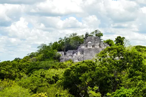
Hidden deep within southern Campeche's tropical forests just 35 kilometres north of the Guatemalan border, the ancient Maya city of Calakmul ranks among the largest capitals ever uncovered across the northern Petén Basin. Biologist Cyrus L. Lundell spotted the overgrown pyramids from the air on 29 December 1931 while working for the Mexican Exploitation Chicle Company, reporting the discovery to Sylvanus G. Morley at Chichén Itzá in March 1932. Lundell coined the modern name Calakmul from Yucatec Maya terms meaning City of the Two Adjacent Pyramids. Ancient inscriptions instead identify the core as Ox Te' Tuun (Place of Three Stones) and Chiik Naab', capital of the Kaanul or Snake Kingdom.
Occupying a natural 35-metre-high limestone dome levelled artificially beside the vast 34-by-8-kilometre El Laberinto seasonal bajo swamp, Calakmul thrived from the Middle Preclassic period (around 500 BC) until around AD 1000. At its Late Classic peak, an estimated 50,000 residents packed its 20-square-kilometre urban footprint (with density reaching 1,000 per square kilometre in the core and 420 across a 122-square-kilometre periphery). Controlling 20 secondary cities such as La Muñeca, Uxul, Oxpemul, Balakbal and Naachtun, the Kaan regional state covered roughly 13,000 square kilometres and supported an estimated 1.75 million total inhabitants.
Hieroglyphic texts across Maya lowlands feature Calakmul's snake-head Emblem Glyph (read Kaan, borne by rulers titled k'uhul kaanal ajaw) more widely than any rival city, including Tikal. Earlier dynastic roots trace back to Preclassic Mirador Basin capitals like El Mirador (38 kilometres south) and Nakbe, linked by ancient raised sacbé causeways extending onward to El Tintal (68 kilometres southwest). Before the seventh century AD, Calakmul's monuments actually displayed a bat glyph while the Snake title appeared eastward at Dzibanché, suggesting the Kaan dynasty shifted west to Calakmul for stronger strategic reach. From that central base, Calakmul governed allied centres as far as 150 kilometres away.
Classic Maya political history revolved around an intense superpower struggle pitting Calakmul against Tikal to the south. Whereas Tikal's dynasties felt heavy Teotihuacan influence and emphasised single male rulers, Calakmul's monuments frequently elevated female lineage and joint rule by king and queen. From the mid-sixth century through the late seventh century, Calakmul outmanoeuvred Tikal through encircling diplomatic alliances until Tikal struck back decisively in battle in AD 695. Half a century later, further defeats shattered Calakmul's allies, and after ruler Yuknoom Took K'awiil in the eighth century the old bat emblem resurfaced ahead of the ninth- and tenth-century Classic Maya collapse.
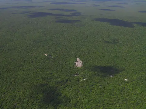
Triadic Structure II, El Laberinto Bajo, and Rio Bec Facades
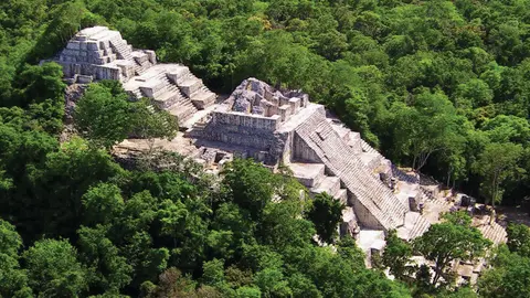
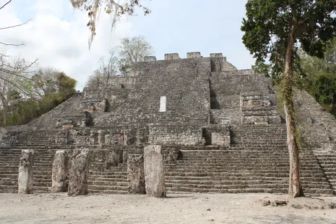
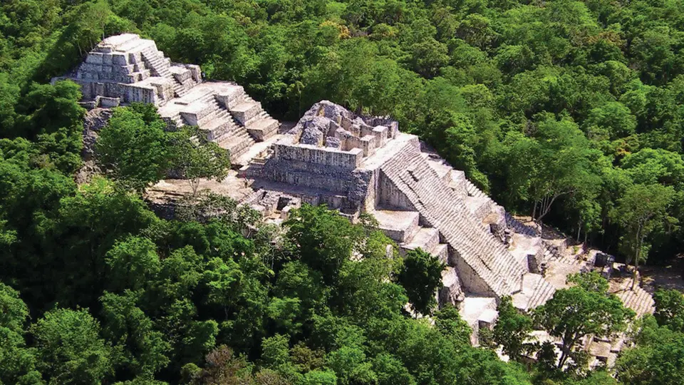
Spread across two square kilometres of central monumental stone architecture, Calakmul preserves 6,750 documented ancient structures together with 120 relief-carved hieroglyphic stelae illuminating dynastic diplomacy and territorial control. Towering over the heart of the city stands Structure II, a colossal triadic temple pyramid rising more than 45 metres above the forest floor. Built sequentially by layering newer masonry shells directly over earlier Preclassic and Classic shrines, Structure II ranks among Mesoamerica's tallest ancient pyramids. Excavators uncovered four elite tombs inside its masonry core, rich with jade funeral masks, ear spools and polychrome pottery vessels.
Adjacent palaces, court plazas and Structure I at Calakmul, together with major temples at nearby Uxul, revealed intact painted stucco friezes and murals depicting royal ceremonies such as maize brew offerings. Noble tombs uncovered across Calakmul and Uxul also preserved elaborate jade funeral masks, ear spools and polychrome pottery vessels. Beyond ceremonial pyramids, ancient engineers mastered the inhospitable karst terrain through a complex 22-square-kilometre Inner Calakmul hydraulic belt. Gullies, canals, quarries, stone-lined chultunes and artificially modified aguadas captured seasonal rainwater off limestone ridges into the El Laberinto marshland. Meanwhile, fertile swamp margins yielded abundant agricultural crops and sharp flint nodules worked on small bajo islands. Beyond Calakmul proper, carved hieroglyphic stelae at Champerico, Altamira and Cheyokolnah trace wide diplomatic alliances and regional trade across neighbouring lowlands.
Regional stone architecture across the wider 331,397-hectare World Heritage area captures two contrasting Maya traditions side by side. Classic Petén monumental architecture dominates Calakmul, Yaxnohcah and Balakbal through massive limestone palace compounds and soaring pyramid temples. Farther toward the northeastern edge during the Late Classic period (around AD 600 to 900), builders forged the inventive Río Bec style, distinguished by steep non-functional twin pyramid towers and stone mosaic facades carved into giant zoomorphic monster mouths. After AD 800, Río Bec decorative motifs spread as far southwest as El Tigre and east to Kohunlich in Quintana Roo.
Today, centuries of silent abandonment preserve archaeological context lost at heavily colonised Maya settlements elsewhere in Mexico. After rural populations dropped to roughly ten percent during the Terminal Classic collapse, no modern towns, paved highways or industrial farms displaced ancient house mounds or agricultural terraces. Visitors walking forest trails between Structure II and distant plazas encounter unlooted quarry depressions, raised inter-site sacbés and eroded stelae resting where Maya rulers left them over a millennium ago. Combined with sister cities like Oxpemul (20 kilometres north) and La Muñeca (25 kilometres northeast), Calakmul illuminates an entire pre-Hispanic urban network.
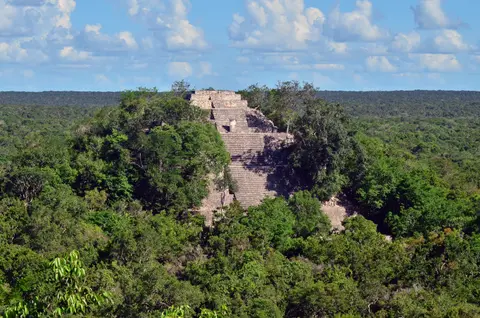
Selva Maya Forest Resilience, Wildlife Corridors, and CONANP Care
Protecting Calakmul requires safeguarding living tropical wilderness just as rigorously as limestone Maya temples. Occupying the heart of the second largest tropical forest expanse in the Americas after the Amazon, the 331,397-hectare site and 391,788-hectare buffer zone match the full boundaries of the 1989 Calakmul Biosphere Reserve, originally conceived by researchers at Campeche's Autonomous University (CIHS/UAC). Falling within the Mesoamerica biodiversity hotspot, this unbroken forest connects ecological corridors across southern Mexico, northern Guatemala and Belize inside the trinational Selva Maya.
Biologists treat Calakmul's woodlands as a living record of millennial human-forest co-evolution rather than untouched virgin jungle. Today's tree composition across mature humid and sub-humid stands reflects ancient Maya agroforestry selection blended with natural regeneration after urban collapse. Native communities living outside core boundaries in the buffer zone still sustain traditional management customs rooted in those ancestral land practices. Equally, porous limestone karst, seasonal droughts, wild fires and Caribbean hurricanes forced Calakmul's plants and wetland wildlife to evolve exceptional drought resilience crucial for studying regional climate adaptation.
Because ancient Maya aguadas and chultunes still retain seasonal water across permeable karst soils, wildlife gathers around archaeological depressions during dry winter months. Calakmul holds the highest mammal diversity anywhere in the Maya region, shielding two of Mexico's three primate species, two of four edentates and five of six Mexican wildcat species. Jaguars, pumas and wide-ranging birds of prey roam unbroken canopy paths together with seasonally migrating parrots, waterfowl, bats and butterflies. This deep forest silence makes encountering spider monkeys or ocellated turkeys near pyramid staircases an ordinary part of exploring the calakmul biosphere reserve.
Federal agencies coordinate legal stewardship across roughly 90 percent federally owned land inside Campeche's forests. Established in 1989 as a Natural Protected Area, the biosphere falls under Mexico's National Commission of Natural Protected Areas (CONANP), while archaeological ruins remain protected under Mexico's 1972 Federal Monuments Law enforced by INAH. Following the 2014 renomination expanding UNESCO coverage from 3,000 hectares of Calakmul ruins to 331,397 hectares of mixed cultural and forest territory, managers work continuously to strengthen joint INAH-CONANP planning, governance and visitor logistics. Maintaining strict corridor protection prevents highway sprawl and timber clearing from fragmenting jaguar ranges or damaging buried Maya terraces.
Access Zones Across Calakmul Archaeological Zone and Reserve
Navigating the vast calakmul archaeological zone requires leaving main Campeche highways well behind along long forest access corridors. Verify park gate opening notices and federal checkpoint rules at Conhuás before driving deep into the biosphere reserve.
| Complex Zone | Key Highlights | Access & Ticket Rule |
|---|---|---|
| Great Plaza and Central Acropolis | Monumental ceremonial core, carved royal hieroglyphic stelae, ballcourt alignments and palace complexes. | INAH archaeological entry fees and CONANP reserve wristbands apply; stay strictly on signed pedestrian jungle trails. |
| Structure I and Structure II | 45-metre triadic Structure II pyramid with four royal tombs and Structure I mural reproduction museum context. | Accessible by foot from the central visitor trail; follow current INAH stairway rules regarding climbing pyramid tiers. |
| El Laberinto and Outer Sacbés | 34-by-8-kilometre seasonal bajo swamp edge, stone causeways, flint workshops and ancient aguada reservoirs. | Located on outer trails and forest margins; visitors must follow guided routes and keep clear of flooded seasonal marsh edges. |
| Calakmul Biosphere Forest Corridors | Selva Maya karst canopy, wildlife-sustaining aguadas, primates and regional sites such as Uxul and Río Bec zones. | Managed strictly by CONANP; overnight camping or off-trail wildlife tracking requires licensed biosphere permits and guides. |
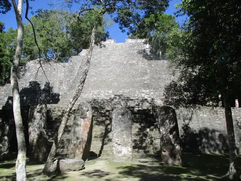
Three Urban and Ecological Details Inside Calakmul Campeche
- Stacked Preclassic and Classic Phases Inside Structure II: Climbing or gazing up the steep limestone terraces of the 45-metre triadic pyramid reveals how successive Maya dynasties encased older temples beneath grander Kaan Dynasty masonry shells.
- Rainwater Aguadas and Chultunes Feeding Forest Wildlife: Look beside depressed limestone hollows along approach tracks where artificial Maya rainwater ponds still trap moisture during dry months, anchoring modern jungle survival for deer, monkeys and wildcats.
- Hieroglyphic Stelae Recording Queen and King Co-Rule: Examine weathered carved limestone monuments around the Great Plaza bearing Snake Dynasty emblem glyphs and rare royal portraits celebrating joint rulership between queens and kings.
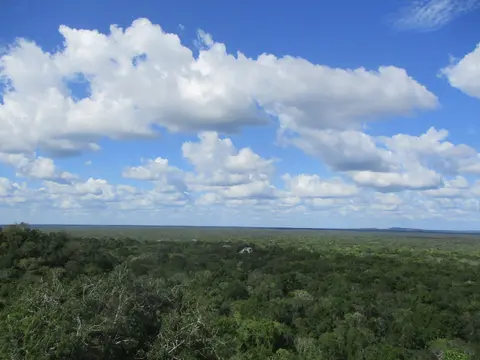
How to Visit Calakmul Maya Ruins Safely Across Campeche
Planning how to visit calakmul begins with factoring its remote southern Campeche setting into Yucatán Peninsula road itineraries. Located well off coastal resort circuits, exploring calakmul maya ruins demands packing plenty of drinking water, sun protection, insect repellent and fuel before turning off the main highway into the dense reserve forest. Dry winter and early spring months keep forest access tracks firmer and reduce midday humidity when walking between distant pyramids and palace courtyards.
Travellers asking is it safe to visit the mayan ruins in mexico should pair common-sense remote-forest preparation with current official national government travel advisories for Campeche State. Inside the calakmul biosphere reserve, road safety means driving cautiously at low speeds along narrow single-lane asphalt through active wildlife crossings and observing CONANP daylight exit curfews. Joining licensed local guides on a structured calakmul mayan ruins tour deepens understanding of Kaan dynasty stelae, Río Bec comparisons and canopy wildlife without losing bearings among thousands of unexcavated jungle mounds.
Most international visitors reach southern Campeche by flying into Manuel Crescencio Rejón International Airport (MID) near Mérida, 320 kilometres north, before driving south via Campeche city or Chetumal highways. Long overland itineraries linking southern Mexico's pre-Hispanic capitals also extend 749 kilometres west toward Oaxaca. Discover additional mixed natural and archaeological sites across Latin America inside our UNESCO World Heritage Atlas.