Quick Field Data
- UNESCO Inscription: Ref. 791 · Cultural Site · Inscribed 1996 · Criteria (i), (ii), (iii)
- Scale & Footprint: Serial site covering 2,059.8 hectares across Uxmal and the neighbouring Ruta Puuc cities of Kabah, Labna, and Sayil within the 7,500-square-kilometre Puuc hills
- Access & Ticketing: Managed by Mexico's National Institute for Anthropology and History (INAH) under the 1972 Federal Law and 1994 buffer decree; visitor entry passes and museum access are sold at the site gate, so check the official INAH portal before travelling
- Arrival Logistics: 62 kilometres south of Merida on the western Yucatan Peninsula and 77 kilometres from Manuel Crescencio Rejon International Airport (MID)
Puuc Stonework, Chultunoob, and the Ruta Puuc Network
Rising out of rolling limestone uplands 62 kilometres south of Merida, Uxmal anchored the 7,500-square-kilometre Puuc region (named from the Yucatec Maya word for hill or chain of low mountains) in southwestern Yucatan state. Unlike flat northern limestone plains dotted with natural sinkhole cenotes that provide reliable year-round groundwater, the Puuc hill chain sits far above deep aquifers and lacks open surface rivers or lakes. To sustain an urban population estimated between 20,000 and 25,000 inhabitants at its peak, Maya builders carved extensive hydraulic systems featuring hundreds of bell-shaped underground rainwater cisterns known as chultunoob beneath plastered courtyards and plazas, capturing seasonal storm runoff for dry-month survival.
Historical chronicles and physical dates illuminate how quickly this agrarian settlement evolved into a regional capital. Sixteenth-century Yucatec Maya records collected in The Books of Chilam Balam placed Uxmal's founding late in the 10th century AD. However, archaeological stratigraphy and radiocarbon testing demonstrate that core ceremonial buildings and chultunoob reservoirs were constructed earlier, primarily between AD 700 and 1000 across the 8th to 10th centuries. Its Yucatec Maya name (Ooxmaal) translates widely as three times built, referencing successive construction episodes. An alternative etymology links the name to Uchmal, meaning what is to come, paired with legends calling it an invisible city erected in a single night.
That precarious reliance on seasonal rainfall places Chaac, the Maya god of rain and lightning, at the visual centre of Puuc art. Puuc architects perfected a disciplined two-part facade division across palaces and temples. Lower wall zones remain smooth, unadorned surfaces built from carefully dressed limestone veneer blocks interrupted solely by rectangular doorways. Above a projecting medial moulding, the upper frieze turns into a tightly fitted stone mosaic assembled from hundreds of individually sculpted pieces. Carved elements include vertical colonnettes evoking traditional Maya hut reed walls, trapezoidal panels imitating thatched roofs, feathered serpents with open jaws, and cascading Chaac masks whose curved snouts symbolise storm rays. Central Mexican Nahua motifs linked with Quetzalcoatl and Tlaloc merge smoothly into local Puuc traditions, reflecting long-distance trade and cultural exchange across Rio Bec, Chenes, and central Mexico. This iconography also signals diplomatic reach linking major centres such as Palenque, Chichen Itza, Calakmul, Caracol, Xunantunich, and Tikal.
Uxmal functioned as the anchor of a linked regional system rather than an isolated city. Raised white limestone processional causeways called sacbes linked complexes within Uxmal and reached outward across the hills toward peer settlements, including a direct sacbe connecting Uxmal to Kabah, the region's second-largest centre and home to the mask-encrusted Codz Pop. The serial UNESCO designation extends protection across Uxmal, Kabah, Sayil (noted for its multi-tiered Palace), and Labna (famed for its Gateway Arch), documenting late Maya socio-political hierarchy across the western Yucatan.
Elliptical Pyramids and Venus Alignments at Uxmal
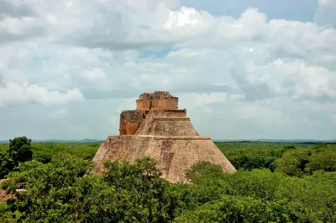
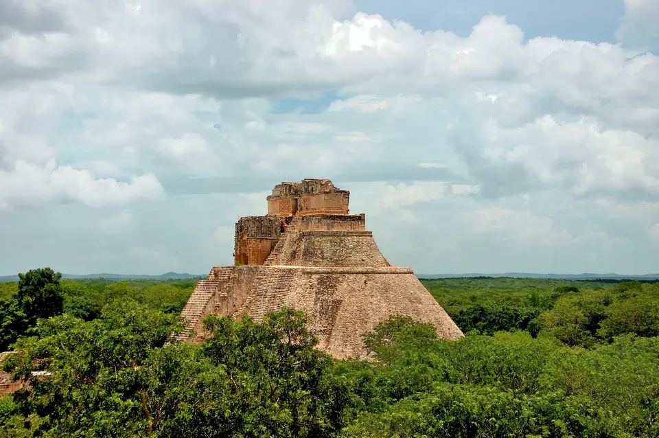
Unlike pre-Hispanic settlements stamped onto rigid geometric street grids, Uxmal moulds its monumental complexes around hilly terrain contours and precise astronomical sightlines. Towering over the eastern approach, the five-level Pyramid of the Magician (El Adivino, locally called the House of the Dwarf) stands apart from standard Maya pyramids because its stepped tiers follow a curved oval or elliptical ground plan. As in other Mesoamerican cities, successive rulers raised new temple sanctuaries over buried predecessors, shifting the newer upper pyramid slightly eastward so the older western temple face remains clearly exposed beneath the summit shrine. Yucatec Maya oral tradition, popularised internationally in John Lloyd Stephens's 1841 book Incidents of Travel in Central America, Chiapas, and Yucatan, recounts that a dwarf raised by a witch built the entire five-tier temple in one night to pass trials imposed by Uxmal's governor.
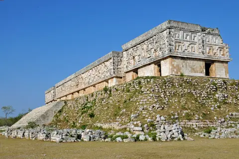
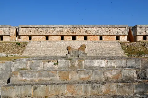
South of the central plazas, the Governor's Palace crowns an enormous three-level artificial terrace covering more than 1,200 square metres and displaying one of the longest unbroken stone facades in pre-Columbian Mesoamerica. Measured surveys reveal calculated astronomical siting: oriented along an azimuth of roughly 118 degrees, the building looks toward the main pyramid of Cehtzuc nearly 5 kilometres southeast. Observed from Cehtzuc, Venus as evening star reached its maximum northerly extreme once every 8 years during late April or early May. It set precisely behind the northern edge of the Governor's Palace to announce the coming rainy season. Sculptors carved that calendar directly into the limestone mosaic, embedding nearly 400 four-lobed Venus glyphs within Chaac masks across the upper facade. Eight bicephalic serpents frame the main entrance, and bar-and-dot numerals recording the number 8 adorn two corner Chaac masks at the northern end.
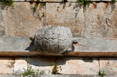
Directly beside the northwest corner of the Governor's Palace platform perches the compact House of the Turtles, named for a line of carved stone turtles spaced evenly along its upper cornice moulding, linking earth and water symbolism in Maya thought. Farther south stretches the less extensively excavated Southern Complex, anchored by the massive Great Pyramid and the stepped perforated roof-comb wall known as the Pigeon House.
Royal Governance, Ballgames, and Stone Conservation
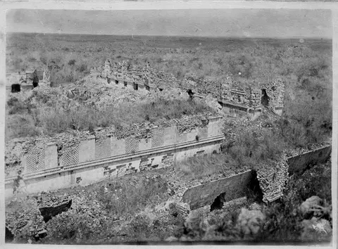
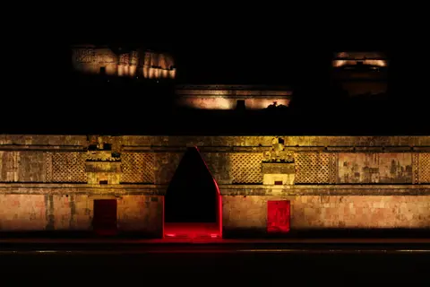
Dated hieroglyphic vaults anchor Uxmal's political zenith cleanly to the opening decade of the 10th century. The Nunnery Quadrangle, named by 16th-century Spaniards struck by its courtyard ring of cell-like chambers, consists of four long palatial buildings placed on graded terrace elevations around a vast rectangular court built between AD 900 and 1000. Painted vault capstones recovered inside the complex carry partial calendrical inscriptions corresponding to AD 906 and 907 during the governance of ruler Chan Chahk'ahk Nalajaw. Because archaeological excavations uncovered formal processional entryways, strict elevation hierarchies, and an absence of domestic cooking hearths, scholars identify the quadrangle as a non-residential royal council complex where lords convened to collect tribute, debate policy, and issue judicial sentences.
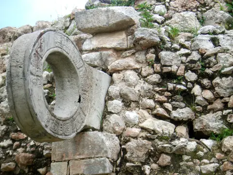
Lying along the main ceremonial corridor between the Nunnery Quadrangle and the Governor's Palace sits Uxmal's primary Ballcourt. Carved stone inscriptions record its dedication in AD 901 by Chan Chak K'ak'nal Ajaw (historically read as Lord Chac before glyph decipherment). Two medium-sized masonry platforms bound the playing alley where ritual ballgames dramatised celestial trajectories and cosmic contests between day and night or underworld and sky deities. Severe weathering led Mexican conservators to remove the original carved stone scoring rings into protected storage and install faithful stone reproductions on the court walls. Elsewhere on site, an encircling defensive town wall reflects late Terminal Classic conflict against rising regional rivals shortly before Uxmal was abandoned by its urban population after the 10th century and reverted to a periodic pilgrimage shrine until Spanish conquest.
Because the Puuc hills sit far from coastal industrial sprawl, preservation across Uxmal, Sayil, and Labna remains exceptionally clear when checked against late 19th- and early 20th-century field photographs and drawings. Sylvanus G. Morley drafted a comprehensive site map in 1909 (documenting structures overlooked by earlier surveyors), and formal Mexican conservation reports started in 1913 and 1914. In 1927 the Mexican government launched its first structural stabilisation effort, followed in 1930 by Frans Blom's Tulane University expedition. Blom's team produced full-scale plaster moulds of the Nunnery Quadrangle used to construct a temporary replica at the 1933 Chicago World's Fair, with original casts still residing in Tulane's Middle American Research Institute. Systematic consolidation resumed in 1936 under Jose Erosa Peniche, adhering strictly to original lime mortar and 1964 Venice Charter anastylosis rather than speculative rebuilding. Yet stone degradation never pauses completely. Microbiological sampling across dark interior chambers at Uxmal and Kabah detects dense phototrophic biofilms of Xenococcus, Gloeocapsa, and Synechocystis cyanobacteria. These organisms pair with Aureobasidium and Fusarium fungi slowly colonising shaded limestone surfaces.
Visitor Sectors Across Uxmal and Its Sister Towns
Although site lands overlap the Municipality of Santa Elena and the private Hacienda Uxmal estate (the latter covering most of the 1994 buffer zone), Mexico's 1972 Federal Law places all archaeological monuments firmly under public ownership. Field guardianship rests with INAH's Yucatan Regional Centre (staffed on site by 22 guardians and maintenance specialists), while urban and environmental oversight involves SEDESOL. The State Cultural Institute runs the 1986 visitor museum (with 25 permanent staff), as authorities prioritise completing a unified Ruta Puuc management plan linking local, state, and federal stewardship.
| Complex Zone | Key Highlights | Access & Ticket Rule |
|---|---|---|
| Northern Precinct & Nunnery Quadrangle | Oval five-level Pyramid of the Magician, four-building Nunnery Quadrangle, and painted AD 906 to 907 vault contexts | Covered by main INAH gate admission; climbing fragile pyramid stairs is barred to protect lime mortar and stone veneers |
| Governor's Palace Terrace & Ballcourt | Governor's Palace Venus alignment, Two-Headed Jaguar platform, House of the Turtles, and AD 901 Ballcourt | Walkable via open gravel paths; original carved ballcourt rings sit in protected curation with replicas mounted on walls |
| Southern Complex & Site Museum | Great Pyramid, Pigeon House roof comb, 1986 site museum, and evening light-and-sound plaza viewpoints | Southern trails climb steeper unshaded terraces; evening sound-and-light presentations operate under separate ticketing |
| Kabah, Sayil & Labna (Ruta Puuc) | Codz Pop mask wall at Kabah, three-storey Sayil Palace, and monumental Gateway Arch at Labna | Separate INAH site entry fees apply at each Puuc sister town south of Uxmal; private car or tour transport is practical |
Three Architectural Signatures Along the Puuc Facades
Walking south from the Nunnery Quadrangle past the Ballcourt onto the Governor's Palace esplanade lets visitors examine three concrete engineering traits built directly into Uxmal's limestone masonry.
- Two-Part Veneer Wall Engineering: Examine exposed wall sections to see how Puuc masons poured thick rubble-and-lime concrete cores and clad them with thin, wedged limestone facing slabs. Plain lower ashlar panels shed monsoon rain cleanly, while deeply carved stone mosaics overhead create dramatic shadow relief across Chaac masks without compromising structural load lines.
- The Bar-and-Dot Numeral Eight and Venus Glyphs: Inspect the northern corner Chaac masks and central entrance frieze on the Governor's Palace. Nearly 400 four-lobed Venus symbols set inside rain-god faces combine with bar-and-dot 8 numerals to encode the eight-year evening-star cycle matching the palace's 118-degree orientation toward Cehtzuc.
- Corbelled Vault Interiors and Shade Biofilms: Peer into shaded chamber doorways along the Nunnery Quadrangle to trace Maya corbelled stone vault geometry without crossing protective ropes. Low interior light retains dampness that nurtures green-black cyanobacteria and stone-degrading fungi, showing why barriers guard interior plasterwork from breath humidity and touch.
Arrive as early in the morning as possible to study western and eastern facades before fierce midday sun washes out delicate limestone relief. Visitors may recall the famous rainstorm that broke during Queen Elizabeth II's 27 February 1975 sound-and-light inauguration just as the Maya prayer to Chaac sounded across the courtyard. Pair western Yucatan's Puuc corridor with colonial and indigenous stone traditions further south in our Oaxaca travel guide or explore more ancient urban sites across the UNESCO World Heritage Atlas.