Quick Field Data
- UNESCO Inscription: 1999 (Ref. 895), cultural fortified port in Campeche State, Mexico; Criteria (ii) and (iv).
- Scale & Footprint: 181-hectare uneven coastal polygon enclosing 45 hectares within historic defensive walls, divided into dense heritage Area A and transitional Area B.
- Access & Ticketing: Protected by a 1986 Federal Decree under Mexico's INAH and municipal conservation bylaws; walled colonial streets are open to pedestrians, while bastion museums and hilltop redoubts require separate entry tickets.
- Arrival Logistics: Primary commercial flights arrive at Manuel Crescencio Rejón International Airport (MID) in Mérida, 152 kilometres northeast, with Cancún International Airport (CUN) 404 kilometres east. Local Ingeniero Alberto Acuña Ongay Airport (CPE) sits five kilometres southeast with limited regional schedules, while Oaxaca lies 722 kilometres southwest.
Can Pech Origins, Pirate Raids, and Hexagonal Bastion Defences
Standing on the calm Bay of Campeche along Mexico's Gulf Coast, San Francisco de Campeche occupies the former Maya chiefdom capital of Can Pech (Ah-Kim-Pech). On Sunday 22 March 1517, Francisco Hernández de Córdoba's Cuban expedition reached the coast here, marking one of the earliest European landings on the Yucatán Peninsula as chronicled by Bernal Díaz del Castillo. In need of fresh water, Spanish crews came ashore on the feast of Saint Lazarus, lit copal incense with the local Maya ruler and retreated swiftly before gathering warriors ahead of fierce combat farther west at Chakán Putum.
Systematic Spanish conquest under Adelantado Francisco de Montejo spanned three difficult campaigns from 1527 to 1547. After an aborted coastal outpost named Salamanca de Campeche in 1531 and Maya resistance forcing withdrawal in 1534, Montejo's family established San Francisco de Campeche permanently in 1540 atop Can Pech. Serving immediately as launching port for founding Mérida (1542) and campaigns into Chiapas and Guatemala, Campeche later weathered a coordinated Maya rebellion on 8 November 1546. Franciscan friars, first arriving briefly in 1535 and returning in 1540, built an early convent to evangelise Yucatán without competition from rival religious orders.
Commercial importance soon turned the colonial port into the second largest Gulf town after Mérida along the strategic Spain-Havana-Campeche-Veracruz sea lane. Ships loaded local salt, thriving shipyard vessels and prized dye-wood known as palo de Campeche sourced from great regional estates like Uayamón, Xanabchakán and Mucuychacán. Because Spanish Crown trade monopolies banned colonies from trading freely abroad, relentless European piracy struck Campeche throughout the 16th and 17th centuries. Early measures such as logwood licensing taxes in 1616, coast-guard fleets ordered by King Felipe IV in 1629 and a local garrison formed under Mayor Centeno Maldonado failed to deter buccaneers. Earlier colonial governance reforms under the 1542 New Laws and King Felipe II's 1547 charter had also shaped rural Crown jurisdictions receiving wax and cotton blanket tributes.
Notorious pirates including John Hawkins, Francis Drake, Henry Morgan, Jean David Nau (El Olonés) and Jean Lafitte haunted Gulf waters around Campeche. Buccaneers sacked the town repeatedly in 1633 and 1663, while Morgan looted two richly laden commercial frigates right inside the bay in January 1661. Worst of all, Dutch pirate Laurens de Graaf (Lorencillo), who had previously fought filibusters for Spain, captured Campeche and twenty nearby settlements for two months in 1685. Pursued closely by three armed Spanish frigates with cannons, he escaped only after dumping stolen silver and jewels into the sea to gain speed. Those devastating attacks forced Spanish military engineers to build Campeche's monumental hexagonal bastion wall between 1686 and 1704.
Checkerboard Colonial Streets, Barrios, and Coastal Redoubts
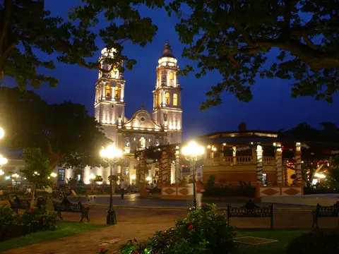
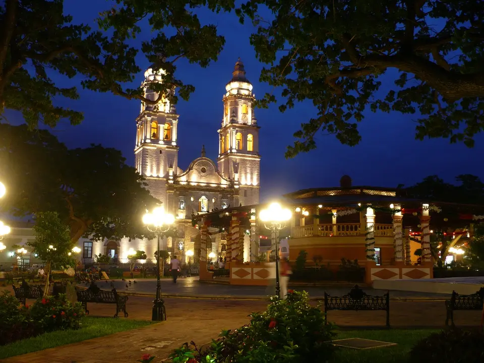
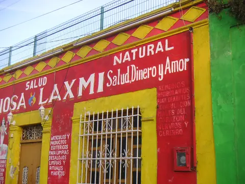
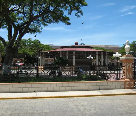
Engineered around a standard Spanish colonial chequerboard grid, San Francisco de Campeche ranks beside Quebec City as one of the rare North American cities preserving most of its historic fortifications intact. Surrounding the sea-facing Plaza Mayor (Plaza de Armas), where a central justice column once stood beside the municipal palace and jail, civic and religious monuments rose smoothly in Renaissance, Baroque and eclectic styles. Major landmarks include the Cathedral of the Immaculate Conception, Royal Audience, municipal archives and the 19th-century Toro Theatre. Nearly 1,000 documented heritage structures stand inside the 181-hectare protected polygon, while outside the 45-hectare walled core distinct colonial wards preserved clear ethnic footprints.
While Spanish colonists resided inside the ramparts and expanded into early central blocks, indigenous Maya residents inhabited original pre-Hispanic settlements across the surrounding barrios of San Francisco and Siete de Agosto. Guadalupe barrio preserves a historic church approaching five centuries old, whereas central Mexican Naboríos allied with Spanish expeditions occupied San Román and African residents lived inside the Santa Ana and Santa Lucía wards. Even after King Felipe II strengthened indigenous personal freedoms and created a Yucatán town hall in 1547 following friars' protests against encomienda abuses, these traditional barrios shaped Campeche's urban fabric for generations.
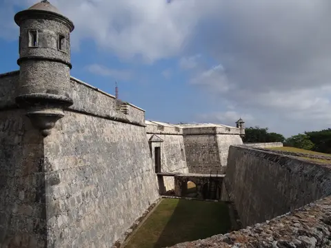
Military architects designed the 1686 to 1704 fortification circuit as an irregular stone hexagon linking eight corner bastions and four fortified city gates directly to sea level. To cover coastal approaches beyond the curtain walls, later engineers added hilltop masonry forts at either end of town: the Redoubt of San José on the eastern ridge and the Redoubt of San Miguel on the western ridge. Three coastal shore batteries (San Lucas, San Matías and San Luis) completed overlapping cannon crossfire across the Gulf anchorage. In 1893, civic modernisers demolished a seaside section of wall to open ocean breezes toward the central square, converting the old Plaza Mayor into a shaded garden.
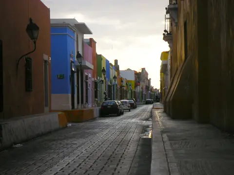
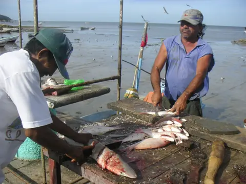
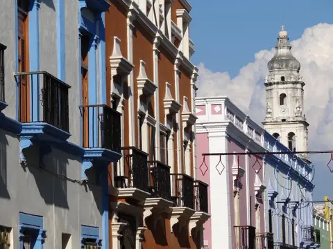
Twentieth-century economic quietness spared Campeche's colonial architecture from destructive concrete towers that reshaped busier Gulf ports. Today, walking from coastal promenades through preserved landward gates reveals brightly painted single-storey townhouses, vaulted arches, wrought-iron grilles and intact defensive parapets. Traditional regional music, coastal seafood cooking, local crafts and dances still thrive inside residential streets, keeping historic family customs woven closely with colonial masonry. Together, both walled centre and outer hillside forts form an unusually cohesive Spanish Caribbean defence network.
Pastel Facade Conservation, INAH Decrees, and Living Urban Barrios
Comprehensive statutory preservation shields Campeche's 181-hectare historic zone against modern commercial encroachment. Following Mexico's 1972 Federal Law on Monuments and Archaeological Zones and its 1975 implementing regulations, a landmark 1986 Presidential Decree formally designated the Historic Monuments Area under federal oversight by the National Institute of Anthropology and History (INAH). Any exterior or interior intervention within Area A (the dense monumental core) and Area B (its protective transitional frame) requires prior INAH technical authorisation using traditional lime-plaster and masonry techniques. State heritage agencies founded in 1998 and elevated into the State Secretary of Culture in 2009 collaborate closely with municipal urban-image departments.
Local municipal regulations updated through 2005 and 2009 Partial Programmes coordinate federally funded restoration work across historic facades, drainage and pedestrian lighting. However, heritage planners stress the urgency of extending clear legal safeguards over excluded 16th- and 17th-century outer barrios such as Santa Ana, Santa Lucía and Chapel, omitted from the 1986 Presidential Decree. Controlling highway traffic corridors entering the historic core also helps protect delicate lime stucco and cobbled street foundations from vibration. Steady conservation funding from Mexico's Congress via cultural and social development agencies supports ongoing masonry upkeep across residential blocks.
Understanding campeche mexico population scale explains why the city retains such a relaxed atmosphere compared with mega-resorts along Cancún's Riviera. In the 2010 census, San Francisco de Campeche recorded 220,389 urban residents within a wider municipality of 259,005 inhabitants, keeping historic downtown streets calm and walkable. Visitors exploring colourful avenues frequently ask about campeche mexico safe conditions and local beaches along the bay. Travellers should always consult current official national government travel advisories regarding Campeche State before departure, while noting that Campeche's shallow Gulf shore is best appreciated along its breezy seafront promenade rather than clear Caribbean reef beaches.
For cultural explorers asking what is campeche mexico known for beyond pirate legends, its preserved colonial walls provide an ideal quiet base across southern Yucatán. Every restored bastion hosts cultural collections, archaeological displays or coastal viewpoints linking colonial maritime history straight back to ancient Maya Can Pech. Balancing residential community life inside quiet neighbourhood streets ensures San Francisco de Campeche stays an authentic living port rather than an artificial open museum. Keeping traditional craft shops, fishing wharves and family homes active inside the walls sustains long-term architectural care.
Access Zones Across Campeche Mexico's Fortified Historic Centre
Following any campeche mexico map makes touring the compact 45-hectare walled hexagon and flanking hillside redoubts easy across one or two days. Check individual INAH bastion museum schedules locally before climbing elevated fort terraces.
| Complex Zone | Key Highlights | Access & Ticket Rule |
|---|---|---|
| Walled Historic Centre and Plaza Mayor | Cathedral of the Immaculate Conception, Toro Theatre, pastel colonial facades and preserved landward city gates. | Open pedestrian streets and shaded central park year-round; museums and cultural theatres charge posted local fees. |
| Hexagonal Bastions and Ramparts | Eight remaining corner bastions and connecting stone curtain walls from the 1686 to 1704 anti-piracy system. | Public wall walks and restored bastion interiors; verify INAH opening notices and museum entry charges at each bastion. |
| San Miguel and San José Redoubts | Hilltop western and eastern fortresses plus coastal San Lucas, San Matías and San Luis shoreline batteries. | Reached by short road transfers along coastal ridges; San Miguel houses archaeological museum exhibits under INAH tickets. |
| Traditional Colonial Barrios | Historic indigenous and multicultural quarters including San Francisco, Guadalupe, San Román, Santa Ana and Santa Lucía. | Open residential neighbourhoods outside the old wall trace; respect active parish churches and local resident privacy. |
Three Military Engineering Details Along Campeche's Ramparts
- Pentagonal Bastions Projecting From the Curtain Wall: Walk along the intact landward fortifications to see angular corner bastions engineered without blind spots so defenders could sweep every approaching ditch with crossfire.
- Hilltop Redoubts Framing Coastal Batteries: Drive out to the west-hill Fort of San Miguel and east-hill San José to observe how elevated forts guarded inland approaches while shoreline batteries targeted anchored pirate fleets.
- Single-Storey Lime-Plaster Urban Chequerboard: Look down long straight avenues running from the sea promenade toward interior city gates to note uniform roof heights and recessed shuttered windows designed for Gulf breezes.
How to Travel to Campeche Mexico From Mérida and Oaxaca
Considering is campeche worth visiting comes down to appreciating calm colonial streetscapes, military history and Gulf Coast fishing culture away from heavy Yucatecan resort crowds. Checking campeche mexico weather helps time outdoor fort walks comfortably, as tropical coastal warmth stays pleasant during drier winter months when walking unshaded ramparts and climbing western hill forts feels brisk rather than humid. Travellers researching campeche mexico beaches along the Campeche Mexico state coast should treat the historic port primarily as a walled architectural hub paired with calm sunset Gulf views rather than deep reef swimming.
Organising how to travel to campeche mexico depends on regional Yucatecan flights or overland highway links across southeastern Mexico. Travellers checking campeche mexico airport options typically fly into Manuel Crescencio Rejón International Airport (MID) near Mérida, 152 kilometres northeast, or Cancún International Airport (CUN), 404 kilometres east. Closer Ingeniero Alberto Acuña Ongay International Airport (CPE) lies just five kilometres southeast with limited regional schedules. Travellers asking how far is campeche from mexico city often connect via Mérida flights or continue overland across southern states toward Oaxaca (722 kilometres southwest). Explore further Spanish colonial ports and fortress towns across the Americas in our UNESCO World Heritage Atlas.