Quick Field Data
- UNESCO Inscription: Serial Cultural World Heritage Site (Ref. 1725), inscribed in 2025 under Criteria (i) and (iv).
- Scale & Footprint: 19,598 hectares across four serial components linking the Quiberon peninsula, Carnac, La Trinité-sur-Mer, Locmariaquer, Arzon, and Gulf of Morbihan islands including Gavrinis.
- Access & Ticketing: Perimeter paths around the Carnac stone rows stay viewable freely year-round. Fenced interiors run seasonal guided tours and paid Carnac stones tickets, while Gavrinis tomb uses pre-booked boats from Larmor-Baden.
- Arrival Logistics: Nantes Atlantique Airport (NTE) lies 116 km southeast as the major hub. Rennes-Saint-Jacques Airport (RNS) sits 110 km northeast with limited flights, and Bordeaux sits 358 km south.
Granite Alignments of Ménec, Kermario, and Kerlescan
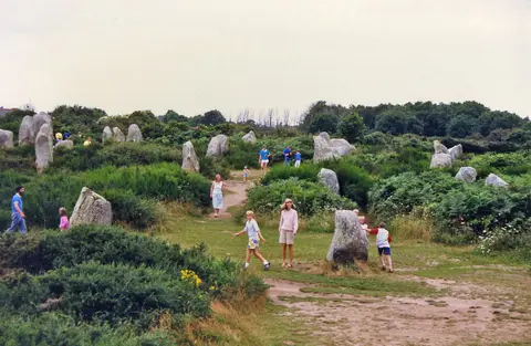
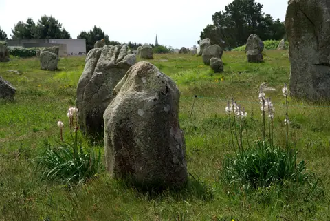
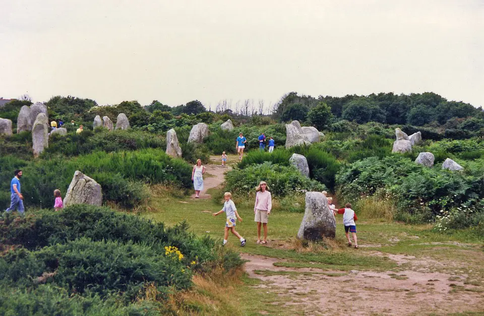
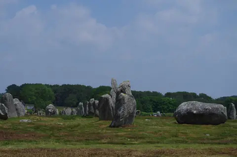
Travellers asking where are the Carnac stones discover an extraordinary megalithic concentration along southern Brittany's Morbihan coast between the Quiberon peninsula and the Gulf of Morbihan. Known locally in Breton as Steudadoù Karnag, these prehistoric rows, burial mounds, single menhirs, and stone tombs were erected successively between approximately 5000 and 2300 BCE, with major standing rows raised mainly around 4500 to 3300 BCE. Hewn from local granite outcrops that once blanketed the coastal plateau, more than 3,000 standing stones make Carnac stones France the densest megalithic ensemble known on Earth.
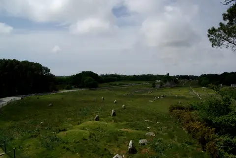
Rather than scattering haphazardly across pasture, the main standing avenues hug a coastal contour line roughly 20 metres above sea level. Three primary alignment sectors survive around Carnac, probably once united in a single coastal ribbon before rural roads and quarrying split them into separate fields. Together with passage tombs and mounds across neighbouring communes, they display deliberate visual links between monuments, natural hills, and sea channels.
At the western end stands the Ménec alignment, comprising 11 converging rows across 1,165 by 100 metres anchored by a western cromlech circle of 71 stone blocks, noted by researcher Alexander Thom together with a ruined eastern ring. Tallest at roughly 4 metres high on the broad western edge, stones taper down to 0.6 metres along the mid-span before gaining height again toward the eastern end. Continuing eastward, Kermario, translated as House of the Dead, arranges 1,029 stones across 10 columns stretching roughly 1,300 metres, ending near a stone circle spotted in aerial surveys.
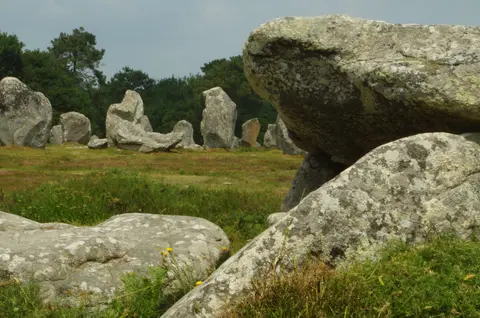
Further east lies Kerlescan, grouping 555 granite pillars across 13 lines spanning 800 metres in length and ranging from 80 centimetres to 4 metres high next to a western circle of 39 stones and traces of a northern ring. Across the border in La Trinité-sur-Mer, the smaller Petit-Ménec group winds beneath woodland canopy cloaked in moss and ivy. Walking from west to east across all four sectors reveals clear shifts in spacing, height, and stone density.
Carnac Stones History, Theories, and Lost Megaliths
Uncovering Carnac stones history means separating centuries of Breton folklore from radiocarbon archaeology. Christian legend claimed the rigid lines were pagan soldiers turned to stone by Pope Cornelius, while local Arthurian tales insisted Merlin the Wizard petrified an advancing Roman legion. Radiocarbon dates from associated burials and hearths prove the stones predate Rome by three millennia, belonging squarely to Brittany's Neolithic transformation.
Archaeologists continue refining Carnac stones theories around both who raised the rows and what the Carnac stones purpose entailed. While Neil Oliver's television work suggested Mesolithic coastal hunters raised early rows before Neolithic farmers built Stonehenge, mainstream research attributes the monumental boom to Neolithic communities shaping a shared ritual frontier between settled territory and sea. Engraved axes, croziers, staffs, and curved throwing weapons carved onto stone slabs reinforce symbols of prestige rather than everyday farm boundary markers.
Modern visitors viewing fenced avenues soon learn about Carnac stones destroyed over recent centuries. Farmers and road crews repeatedly broke up exposed menhirs for street paving and building stone, while villagers converted unroofed stone dolmens, whose protective earth mounds had washed away, into chicken coops, sheep pens, and bread ovens. Brittany's acidic soil also dissolved ancient bones inside chambered dolmens such as Er-Roc'h-Feutet near the Chapelle de La Madeleine, leaving granite frames without skeletal remains.
Today, French Heritage, Environment, and Town Planning laws protect the remaining ensemble through listed monument rules, Carnac's Outstanding Heritage Site zone, and municipal Local Urban Plans paired with regional Territorial Coherence Schemes. Forty-one percent of the monuments carry listed historical status, while around a quarter sit in public ownership managed through national directorates DRAC, DREAL, and DRAAF with Paysages de mégalithes. Oversight relies on a Steering Committee (COPIL) as decision-making body and a Technical Committee (COTECH) handling field operations. Minimal conservation intervention restricts reconstruction strictly while shielding fragile coastal turf from urban sprawl, afforestation, and rising sea levels.
Carnacéen Tumuli, Alpine Jade, and Gavrinis Passage Art
Standing near the linear rows are three monumental mid-fifth-millennium BCE burial mounds collectively named the Carnacéen tumuli: Saint-Michel at Carnac, Tumiac at Arzon, and Mané-er-Hroëk at Locmariaquer. Each giant mound sealed a single stone tomb housing one high-ranking individual surrounded by astonishing imported wealth. Polished stone axeheads carved from green jade quarried in the Italian Alps rest next to turquoise and variscite beads called callaïs, transported across the Bay of Biscay by boat from southwestern Iberia.
Some Alpine jadeite blades measure up to 46 centimetres long and would have demanded over a thousand hours of grinding and polishing after crossing mountain passes to Atlantic Brittany. Archaeologists draw clear parallels with roughly contemporary fifth-millennium elites at Varna in Bulgaria, where Grave 43 likewise paired gold regalia with an Alpine jade axe, and with later passage graves at Newgrange in Ireland or Michelsberg enclosures in central Europe. Together, these grave goods show Morbihan leaders commanding long-distance maritime networks five thousand years ago.
Saint-Michel tumulus, constructed between 5000 and 3400 BCE, measures 125 by 60 metres at the base and climbs 12 metres high using 35,000 cubic metres of earth and stone. René Galles sank vertical 8-metre shafts in 1862 before Zacharie Le Rouzic excavated further between 1900 and 1907, exposing 15 stone cists, pottery, jade axes, and callaïs jewellery now displayed in Carnac's Museum of Prehistory beneath a 1926 chapel rebuilding a 1663 sanctuary. Dated to 4790 to 4530 BCE, Tumiac on the Rhuys peninsula carries the nickname Caesar's mound because local tradition claims Julius Caesar watched his 56 BCE war against the Veneti from its summit. Explored in 1853 through a summit pit still visible today and again in 1934, this 15-metre clay mound measures 50 metres across and encloses a rectangular chamber measuring 4.40 by 2.40 metres beneath a 4.80-metre quartz slab. Grave finds of 11 jadeite axes, 26 fibrolite axes, and 249 callaïs beads are now preserved in Vannes.
At Locmariaquer, Mané-er-Hroëk lifts a 100-by-60-metre mound 8 metres above natural ground, concealing a 5-by-3-metre vault explored in 1863 by the Polymathic Society of Morbihan. That chamber yielded 106 precious stone axes, 49 callaïs beads, and nine pendants next to a broken engraved stele, while nearby Moustoir mound, or Er Mané, preserves an 85-metre chamber tomb flanked by a 3-metre menhir. Off Larmor-Baden, the 750-by-400-metre granite islet of Gavrinis carries historic spellings Guirv Enes and Guerg Enes from an Old Breton word for wrath rather than goat island. Its passage tomb rose around 4200 to 4000 BCE while still joined to the mainland, before sealing under burnt wood and sand around 3000 BCE.
Studying these alignments and tombs together demonstrates why the World Heritage ensemble operates as an integrated cultural network rather than isolated stone curiosities. Intervisibility across coastal ridges, shared Atlantic shipping lanes bringing callaïs from Iberia, and reused monumental stones connecting Locmariaquer to Gavrinis all point to dense regional coordination across more than two millennia of Neolithic change. Museum displays in both Carnac and Vannes now house the delicate jade blades and beads recovered during historical excavations, allowing travellers to examine fine craftsmanship indoors after walking the wind-swept stone avenues.
First excavated in 1835 and studied further by Le Rouzic around 1930, researchers in the 1960s and 1970s, and Charles-Tanguy Leroux in the 1980s, Gavrinis shelters a 50-metre dry-stone cairn packed with internal retaining ranks. Inside its 14-metre corridor, 23 of 29 vertical orthostat slabs carry swirling zigzags, lozenges, axes, staffs, croziers, shields, and horned motifs. In 1984, archaeologists discovered that the 17-ton ceiling slab over its 2.5-metre square chamber bears hidden top-face carvings of a bull and an axe matching ceiling stones at Table des Marchands and Er Vinglé 4 km away in Locmariaquer. Together those three slabs once formed a single 14-metre decorated pillar broken deliberately and reused across three tombs, echoing Locmariaquer's fallen 20.6-metre Grand Menhir of Er Grah, while part of the passage also appears as a replica at Bougon museum in Deux-Sèvres.
Access Zones Across Carnac, Locmariaquer, and the Gulf of Morbihan
Dividing the 19,598-hectare serial designation into four manageable areas makes exploring Carnac stones photos viewpoints and island tombs simple.
| Complex Zone | Key Highlights | Access & Ticket Rule |
|---|---|---|
| Ménec, Kermario, and Kerlescan Rows | Three core granite alignments, stone circles, wooded Petit-Ménec, and Maison des Mégalithes. | Outer lanes offer free perimeter viewing all year, while inner rows require guided Carnac stones tickets. |
| Saint-Michel Tumulus and Carnac Museum | 12-metre Neolithic mound capped by chapel and museum galleries displaying Alpine jade axes. | Mound footpaths are freely walkable, while Carnac Prehistory Museum galleries require paid admission. |
| Locmariaquer and Mané-er-Hroëk | 20.6-metre broken Grand Menhir of Er Grah, Table des Marchands, and Mané-er-Hroëk tomb. | Main Locmariaquer megalithic enclosure charges entry tickets under seasonal site rules. |
| Gavrinis Island and Rhuys Peninsula | Carved 14-metre Gavrinis passage tomb and Tumiac burial mound at Arzon. | Gavrinis entry requires pre-booked ferry tickets from Larmor-Baden; Tumiac paths stay open. |
Tapering Menhir Rows, Orthostat Spirals, and Recycled Slabs
Walking between the stone avenues and Gulf islands highlights three construction habits that mark Morbihan's prehistoric builders.
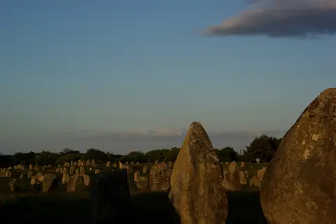
- West-to-east height tapering along rows: Strolling eastward down Ménec or Kermario reveals boulders dropping systematically from tall four-metre western blocks down to knee-height markers toward the far eastern end.
- Continuous carving across Gavrinis orthostats: Inside the 14-metre island passage, note how swirling arcs, croziers, and axes completely pack 23 vertical stone faces from ground socket to ceiling lintel.
- Concealed carvings atop Gavrinis's roof slab: When standing inside the chamber, recall that its 17-ton capstone displays upside-down bull and axe reliefs broken from an older Locmariaquer monument.
How to Get to Carnac Stones, Seasonal Planning, and Bordeaux Pairings
Figuring out how to get to Carnac stones works smoothly by French rail and Atlantic road links. High-speed trains reach nearby Auray station before local buses and roads drop south into Carnac and La Trinité-sur-Mer. Long-distance flyers land at Nantes Atlantique Airport (NTE) 116 km southeast as the major hub, whereas Rennes-Saint-Jacques Airport (RNS) lies 110 km away with fewer scheduled international routes.
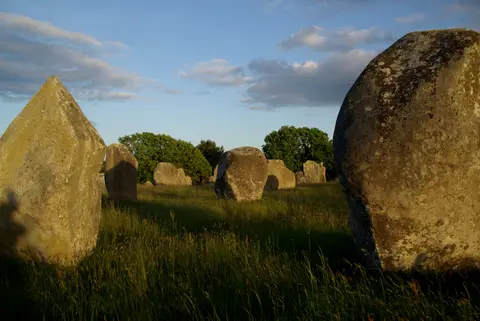
Spring and early autumn bring crisp Atlantic light over pale granite rows, mild walking weather along open coastal heaths, and far easier availability for Gavrinis boat crossings and Carnac stones tickets than busy summer months. Because rising sea levels already submerge older coastal stones and windblown sand constantly shifts around Gulf inlets, sticking to boardwalks and stone lanes protects delicate turf around the menhirs. Travellers exploring France's western heritage arc can pair Brittany's prehistoric coastline with urban architecture in Bordeaux, 358 km south, or inspect comparative Neolithic sanctuaries across the UNESCO World Heritage Atlas.