Quick Field Data
- UNESCO Inscription: Inscribed in 2011 (Ref. 1371) as a Cultural site under Criteria (ii), (iv), and (v).
- Scale & Footprint: Encompasses 30,745 hectares along Mallorca's northwestern coastal cordillera, stretching southwest from Serra de Na Burguesa northeastward toward Pollença and Cala Sant Vicenç.
- Access & Ticketing: Mountain roads, signed Dry-Stone Route trails, public village squares, and coastal landings open free year-round. Rural estate museums, monasteries like Lluc, and private historic estates set separate local entry fees checked on official estate sites.
- Arrival Logistics: Major commercial flights land at Palma de Mallorca Airport (PMI, 20 kilometres south of the range). Alternative island hubs include Menorca Airport (MAH, 131 kilometres) and Ibiza Airport (IBZ, 148 kilometres), linking across the Balearic Sea toward Ibiza (143 kilometres southwest).
Karst Peaks, Wet Microclimates, and Endemic Mallorcan Mountain Wildlife
Running southwest to northeast like a steep limestone wall parallel to Mallorca's northwestern coast, the serra de tramuntana mountains define both the physical spine and rural character of the Balearic Islands. Inscribed under UNESCO heritage protection on 27 June 2011, this 30,745-hectare mountain zone forms an abrupt orographic barrier rising almost sheer from Mediterranean coves. Puig Major crowns the range at 1,436 metres as the highest summit in the Balearic Islands, accompanied nearby by Penyal de Migdia at 1,398 metres and Puig de Massanella at 1,364 metres. Beneath these karst summits, rainwater dissolves deep limestone shafts including Cova de sa Campana, Mallorca's deepest cave descending 358 metres with an underground lake sitting 334 metres below surface.
Elevation and coastal orientation generate a dramatically wetter microclimate across the serra de tramuntana mountain range than elsewhere on Mallorca. While drier southern and eastern island lowlands receive under 400 millimetres of annual rainfall, these northern peaks catch up to 1,507 millimetres per year, bringing cooler temperatures and occasional winter snowfall on upper passes. That moisture sustains dense botanical diversity including 25 endemic plant species and seven plants unique exclusively to Mallorca. Hardy Balearic oak woodlands, wild olive trees, maple, yew, boxwood, and strawberry trees shelter aromatic rosemary, lavender, thyme, rockrose, broom, everlastings, garrigue scrub, and delicate cliff rock violets.
Wildlife thrives inside steep limestone gorges and forest pockets buffered from coastal resort sprawl. Terrestrial vertebrates include pine marten, weasel, genet, and hedgehog, while fresh rocky mountain streams support rare amphibians such as the endemic Majorcan midwife toad (Alytes muletensis). Overhead, powerful Mediterranean air currents carry ospreys, booted eagles, Eleonora's falcons, black vultures, barn owls, and scops owls above coastal seabird colonies of gulls and cormorants. Across southern ridges, Serra de Na Burguesa extends these protected limestone crests downward while northern cliffs drop straight into turquoise coves around Cala Sant Vicenç near Pollença. Further mid-range, the high Coll de Cal Reis saddle separates Puig Major's western ridge from the eastern side peak of Moleta de Cals Reis above the winding descent to Sa Calobra. Together these limestone folds shelter deep river gorges, natural springs, and forested crags spanning Mallorca's entire northwestern shore.
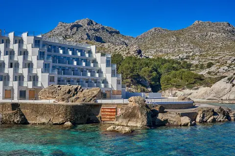
Arabic Qanats, Feudal Posesiones, and Dry-Stone Terrace Engineering
Rather than untamed wilderness, serra de tramuntana mallorca forms a living agricultural monument shaped by two distinct cultural traditions colliding in the Middle Ages. Millennia of farming on rocky, water-scarce hillsides demanded extraordinary engineering before steep inclines could nourish gardens or villages. Islamic settlers transformed valley hydrology by excavating subterranean qanats, gently sloped underground tunnels harvesting mountain springs together with surface canals, ditches, stone water mills, and lined storage basins. Following the Christian conquest of Mallorca in the thirteenth century, Catalan feudal rulers redistributed land into small farmsteads and large rural estates called posesiones.
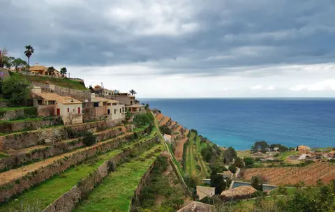
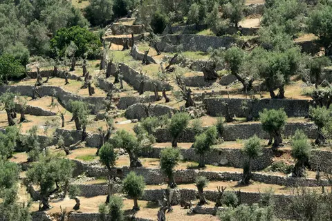
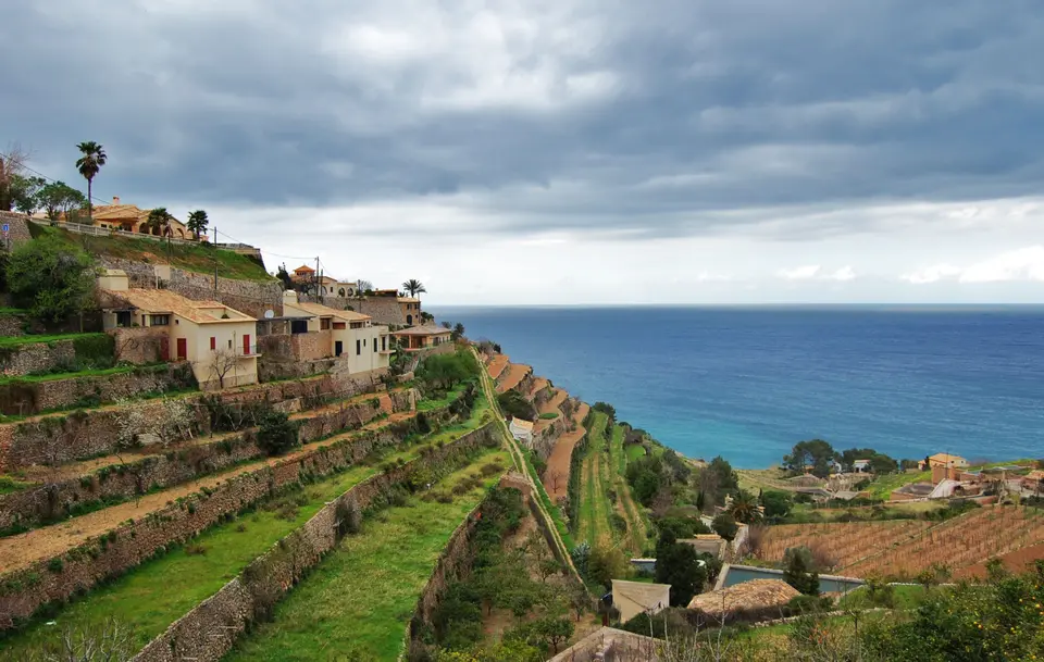
Together, Arabic water management and Christian estate division produced a seamless multi-tiered land pattern tailored to scarce soil and rainfall. High rocky crests served as rough grazing commons above strips of managed woodland supplying timber, acorns, and charcoal. Beneath the tree line, stone-walled agricultural terraces, built without mortar by fitting split limestone blocks by hand, turned nearly vertical hillsides around Fornalutx, Biniaraix, and Cala d'Estellencs into stable flat plots for olive groves, vegetables, and fruit orchards. Flatter lower basins held vineyards and grain fields for reaping, ensuring every elevation band yielded food without stripping fragile hillside soils. Sophisticated stone drainage conduits built behind every retaining wall channel sudden downpours safely away before terraced earth can wash into the sea.
This centuries-old engineering survives only through active masonry skills and continuous rural maintenance. Traditional knowledge for building and repairing dry-stone retaining walls, cobbled pack-mule paths, lime kilns, and stone shelters receives formal support through an island school of dry-stone masonry established specifically to keep traditional craft alive against changing rural economics. Villages, parish churches, mountain sanctuaries, coastal defensive towers, lighthouses, and small stone outbuildings punctuate the terraced slopes and reinforce every estate's agricultural structure. Rather than serving urban ornament, every stone element answers strict topographic necessity, demonstrating lasting human adaptation to challenging limestone terrain.
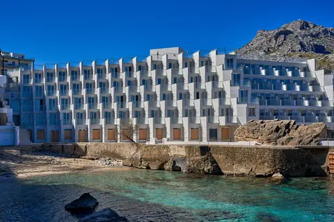
Mountain Villages, Coastal Coves, and Heritage Safeguards Across Mallorca
Travellers exploring things to do in serra de tramuntana encounter a mosaic of historic villages, religious sanctuaries, and historic rural estates woven naturally into the terraced slope. Inland sanctuaries around Lluc and Escorca sit near mountain crossroads, while Fornalutx, Biniaraix, Orient in Bunyola, Ullarò, Galilea, and artistic Deià cluster stone houses tightly above terraced olive groves and shaded stream beds. Further west along the coast, Archduke Ludwig Salvator's nineteenth-century historic estate near Deià preserves coastal pinewoods, cliffside lookouts, and cobbled mule paths praised by generations of writers and painters. Down by the water, fishing landings like Cala d'Estellencs expose tilted red Triassic Buntsandstein beds and lighter rock strata directly beneath hand-stacked dry-stone orchards.
Strong layered legal protections guard this cultural landscape against encroaching holiday construction. Early recognition arrived in 1972 when Spain declared the area a protected scenic landscape under Decree 984/1972, followed by Spain's 1985 Historic Heritage Act and the 1991 Balearic Natural Spaces Act. Under the 1998 Balearic Historic Heritage Act, regional authorities designated Items of Cultural Interest (Bien de Interés Cultural) across Deià, Pollença, Lluc, Escorca, and initiatives for Biniaraix, Ullarò, and Galilea. Spatial coordination now relies on the 2004 Mallorca Spatial Plan, the 2007 Natural Resources Plan, and 2008 special protection plans for Archduke Ludwig Salvator's estate, the Dry-Stone Route, and the Artà-Lluc Route. Created in 2010, a regional cultural landscape consortium brings together the Balearic government, the Council of Mallorca, and local community representatives to align environmental protection with water-system preservation.
Even with strict regional planning, sustainable stewardship remains delicate. Progressive tourism growth places pressure on narrow mountain roads, historic estate economies, and water tables across the populated surrounding buffer zone, matching the territorial district's boundaries. In response, rural estates and small village hotels collaborate with conservation authorities to favour low-impact walking, cycling, birdwatching, and environmental education, reinforcing traditional olive cultivation so terraced stone walls stay actively repaired rather than slipping into abandonment. Preserving active agriculture together with careful visitor access helps rural hamlets resist rapid coastal urbanisation across the island. Ongoing heritage monitoring also seeks stronger legal inventory protection specifically for fragile historic stone mills and rural waterworks.
Access Zones Along Mallorca's Northwestern Mountain Range
Spanning 30,745 hectares parallel to Mallorca's northwestern coast, these mountains divide logically into coastal road corridors, terraced village valleys, high karst passes, and long-distance cobbled footpaths. Most villages and roadside viewpoints stay open freely, while private estates and sanctuaries regulate indoor access.
| Complex Zone | Key Highlights | Access & Ticket Rule |
|---|---|---|
| Cala d'Estellencs & Southern Ridges. | Coastal dry-stone terraces above boat landings, exposed Triassic rock strata, Serra de Na Burguesa slopes, and Galilea hamlet. | Village paths and coastal access roads open free year-round. Park outside narrow village cores where street signs restrict cars. |
| Deià, Fornalutx & Biniaraix Valleys. | Dry-stone olive terraces, cobbled hillside paths, Archduke Ludwig Salvator's coastal estate, and village stone lanes above valley gardens. | Cobbled footpaths and town squares stay open free on foot. Private historic estates and small museums charge separate admission. |
| Coll de Cal Reis & Sa Calobra Saddle. | Mountain pass below Puig Major and Penyal de Migdia linked to the winding Ma-2141 descent toward Sa Calobra cove. | Public mountain road remains free to drive or cycle. Watch closely for coach traffic and road cyclists on tight hairpin bends. |
| Lluc, Escorca & Cala Sant Vicenç. | Sanctuary complex of Lluc, Artà-Lluc and Dry-Stone Route trails, Cova de sa Campana karst country, and northern coves near Pollença. | Waymarked trails and coastal coves open free on foot. Sanctuary museums and rural estate gardens confirm access via official local notices. |
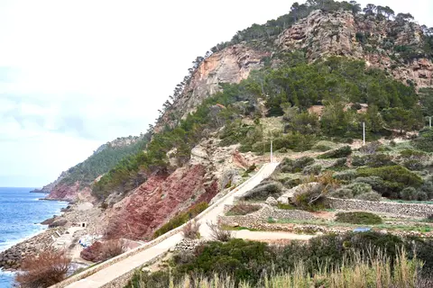
Three Hydraulic and Masonry Details in Mallorca's Tramuntana
- Mortar-Free Dry-Stone Retaining Walls Around Fornalutx: Pause along terraced olive groves near Fornalutx or Biniaraix to examine weathered limestone blocks stacked tightly without cement. Gaps between fitted stones let storm runoff filter smoothly through wall faces, relieving hydrostatic pressure so winter cloudbursts up to 1,507 millimetres never burst terraces downhill.
- Arabic Qanat Tunnels and Linked Storage Basins: Trace narrow stone irrigation channels running along terrace steps near hillside farms and water mills. Engineered under medieval Islamic rule to harvest mountain springs inside underground qanats, these stone troughs distribute scarce water fairly across successive terrace tiers and estates.
- Hairpin Engineering on the Ma-2141 at Coll de Cal Reis: Look down from the Coll de Cal Reis saddle beneath Puig Major where the Ma-2141 spirals sharply toward Sa Calobra. Built across sheer limestone topography without tunnels through every ridge, the serpentine alignment mirrors centuries of cobbled mule-track switchbacks adapted to modern mountain travel.
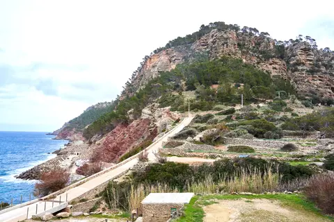
Seasonal Walking and Driving Conditions Across Northern Mallorca
Anyone asking how to get to serra de tramuntana benefits from the mountain chain's immediate proximity to Palma de Mallorca Airport (PMI), located just 20 kilometres south across the central island plain. From Palma's road network, short drives or regional public buses enter southern slopes near Bunyola and Orient or climb northwest toward Estellencs, Deià, and Pollença. Cyclists and motorists planning a serra de tramuntana drive along the winding mountain spine or down the famous Ma-2141 from Coll de Cal Reis to Sa Calobra should start early to avoid midday congestion on narrow hairpin bends.
For mountain hiking along the cobbled Dry-Stone Route or the Artà-Lluc corridor, spring and autumn bring mild mountain air, green terraces, and steady stream flow without summer heat or winter chill. Because higher peaks around 1,436-metre Puig Major catch cooler weather and occasional winter snow, walkers should pack windproof layers and sturdy lugged boots even when coastal coves feel warm. Multi-day itineraries link quiet inland sanctuaries at Lluc with terraced villages such as Fornalutx and Biniaraix, pairing pine-clad passes with sheltered coastal coves like Cala Sant Vicenç. Rural hotels and historic estates host guided cultural and wildlife programmes year-round while encouraging gentle visitor habits along narrow village streets. Traditional estate farms continue pressing mountain olives and tending ancient carob and fruit orchards on terraced ledges, anchoring rural livelihoods inside the protected valleys. Stone villages and historic estates preserve a living cultural relationship between rugged cliffs, mountain springs, and Mediterranean farming. From Palma de Mallorca Airport (PMI) or nearby Menorca (MAH, 131 kilometres) and Ibiza (IBZ, 148 kilometres), travellers can pair Mallorca's mountain terraces with Ibiza (143 kilometres) or explore additional Spanish landscapes in the UNESCO World Heritage Atlas.