Quick Field Data
- UNESCO Inscription: Transboundary Natural World Heritage Site (Ref. 1314), inscribed in June 2009 (Netherlands and Germany) and extended in 2011 and June 2014 (Denmark) under Criteria (viii), (ix), and (x).
- Scale & Footprint: 1,143,403 hectares across a 500-kilometre coastal arc (roughly 10,000 square kilometres overall) stretching from Den Helder in the Netherlands past German estuaries to Skallingen in Denmark.
- Access & Ticketing: Mainland beaches, sea dikes, and coastal parks stay freely open, while island ferries, seal boat tours, and guided low-tide mudflat walks carry operator fares.
- Arrival Logistics: Bremen Airport (BRE) sits 127 km south as the nearest listed hub for Germany's central coast, and coastal rail routes link directly northwest out of Hamburg, 166 km southeast.
Intertidal Mudflat Arc Across Three Nations
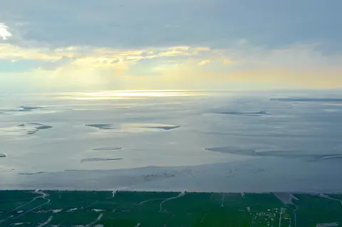
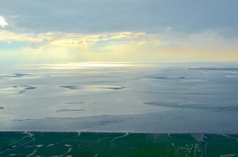
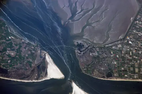
Stretching along the southeastern North Sea from Den Helder in the northwestern Netherlands past Germany's river estuaries to Skallingen in Denmark, the Wadden Sea ranks as Earth's largest unbroken intertidal mudflat system. Known as Waddenzee in Dutch, Wattenmeer in German, Vadehavet in Danish, Waadsee in West Frisian, and di Heef in North Frisian, the zone takes its name from the Dutch and Frisian word wad, meaning mud flat. Sheltered behind the chain of low-lying Frisian Islands and bordered in the Netherlands by the Afsluitdijk separating the freshwater IJsselmeer, these shallow flats form a complex mosaic of transitional zones between land, ocean, and freshwater estuaries.
Across that 500-kilometre shoreline, physical forces and biological activity build distinct habitats including deep tidal channels, sandy shoals, sea-grass meadows, dense mussel beds, shifting sandbars, bare mudflats, salt marshes, estuaries, wide outer beaches, and coastal dunes. Facing the open North Sea, outer islands carry tall windswept dunes and broad sandy beaches, whereas inner leeward shores slope gently onto quiet tidal flats. Across northern Germany and the neighbouring lowlands, these coastal flats and embanked polders form the Nordseeküste and Nordseemarschen, including the fertile Elbe Marshes shaped by centuries of human reclamation matching historic Frisia back to the Roman Iron Age and Middle Ages.
Earlier storm tides between the tenth and fourteenth centuries tore away coastal peatlands behind outer dunes, leaving surviving dune chains as the present Frisian Islands. Historic surges such as the Saint Marcellus floods of 1219 and 1362, the Burchardi flood of 1634, and the Christmas Flood of 1717 drowned thousands of coastal residents and permanently reshaped mainland bays. Later earthen dikes and road causeways drastically lowered human fatalities, leaving only rare local dike overtoppings in modern times while turning the region into one of the most heavily engineered yet ecologically functional tidal coastlines on Earth.
Even behind modern sea walls, cultural ties bind rural coastal villages directly to North Sea tides across the wider Wadden Sea Region, sometimes called the Wadden Coast or Waddenland. Regional documentation projects such as the LancewadPlan landscape heritage survey (2004 to 2007) and stakeholder work under the Wadden Sea Forum (2002 to 2023) record historic farmsteads, diking traditions, and coastal settlements shared from the Netherlands across Germany into Denmark. Meanwhile, waves and currents shift uninhabited barrier islands slowly eastward, eroding sand off western tips of Vlieland and Ameland while accreting new land on their eastern spits. Although flat gradients leave low coasts exposed to warming seas, field surveys show natural sediment accretion across most flats, especially along Wadden Sea Germany shores, currently outpacing the measured 3.7-millimetre annual sea-level rise.
Migratory Bird Flyways, Seals, and Marine Ecology
Beneath exposed low-tide sandbars thrives one of Earth's highest-biomass intertidal zones, hosting roughly 2,300 salt-marsh plant and animal species together with 2,700 marine and brackish species. Thirty bird species breed across outer dunes and marshes, led by recovering populations of white-tailed eagles and Eurasian spoonbills as well as gulls, terns, and herons. Even larger flocks pass overhead seasonally, turning the mudflats into an essential refuelling hub sustaining both the East Atlantic Flyway and the African-Eurasian migratory waterbird network.
Up to 6.1 million waterbirds gather simultaneously across mussel beds, sea-grass meadows, and tidal creeks, while 10 to 12 million birds pause annually to moult, feed, or overwinter. Beneath shallow channels swim grey seals, harbour seals, and the sea's sole resident cetaceans, harbour porpoises and white-beaked dolphins, which recolonised southwestern Dutch channels after earlier declines. Seasonal sightings of minke whales and North Atlantic humpback whales near Marsdiep, including a possible North Atlantic right whale off Texel in July 2005, recall earlier eras before medieval shore-based whalers hunted regional right whales and North Atlantic grey whales out of these waters. Marine biologists also anticipate eventual recovery of once-extinct resident bottlenose dolphins.
Long-term ecological shifts show why vigilant habitat protection remains critical across all three coastal countries. During the warmer Holocene climatic optimum, greater flamingos and Dalmatian pelicans frequented North Sea flats before cooling drove them southward, while damming along the historic Rhine estuary left roughly 90 percent of native species in the southwestern basin at risk. Today, rays, Atlantic salmon, and brown trout still inhabit tidal channels, and European sea sturgeon survive through active reintroduction programmes. Meanwhile, Denmark safeguards the world's sole natural population of houting (though taxonomic study continues over lost southern groups), while disease and the invasive Pacific oyster have largely displaced former native European oyster beds. Introduced marine algae, non-native plants, and smaller invasive organisms remain under close scientific watch.
Trilateral Protection Across National Parks
Protecting an unbroken 500-kilometre marine corridor across three nations demands steady international diplomacy rather than isolated local rules. The Netherlands, Germany, and Denmark began formal trilateral cooperation in 1978, signed a Joint Declaration in 1982, earned UNESCO Biosphere Reserve status in 1986, and adopted the Trilateral Wadden Sea Plan in 1997. Directed through the Common Wadden Sea Secretariat headquartered in Wilhelmshaven, national rules ban oil and gas extraction inside World Heritage boundaries. Strict environmental impact rules also govern offshore North Sea wind farms, harbour dredging, residential expansion, coastal defences, commercial fisheries, and dense maritime shipping lanes.
UNESCO inscribed the Dutch conservation area together with the Lower Saxony and Schleswig-Holstein national parks in June 2009, added Hamburg's coastal park through a 2011 extension, and incorporated Wadden Sea National Park Denmark in June 2014 to reach 1,143,403 hectares. Note that the city-state of Bremen remains outside the listing along the Weser estuary. Dedicated marine no-take zones, ecosystem-wide management connecting shipping with conservation, adequate long-term research budgets, and participatory planning involving local communities and conservation groups complement Ramsar wetland protections across all three states.
Managing human coastal pressures demands continuous balancing across densely populated European shores encircling this tidal basin. Port approaches serving busy merchant shipping corridors require periodic channel maintenance, while surrounding farmlands and coastal towns rely on reliable drainage networks and maintained sea dikes. Conservation authorities regulate commercial shellfish dredging strictly, restrict disruptive coastal construction, and monitor migratory roosting islands so nesting terns, plovers, and resting seals remain insulated from disturbance during sensitive breeding and pupping seasons.
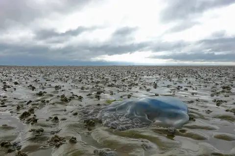
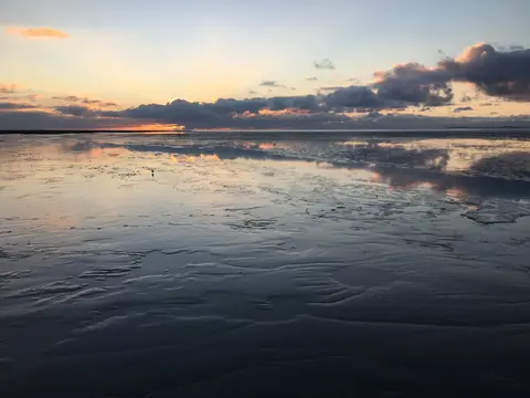
Across all three coastal languages, seasonal rhythm still rules daily life along barrier ferries and harbour towns. Low water pulls North Sea tides kilometres away from mainland seawalls twice every day, briefly exposing dark mussel reefs, branching tidal trenches, and damp ripples packed with invertebrates. Six hours later, rising North Sea swells cover the same flats under shallow brackish waters where flatfish and young herring shelter from deep-water predators.
Access Zones Across Dutch, German, and Danish Wadden Shores
Exploring Wadden Sea islands and mainland mudflat gateways divides cleanly into four accessible national sectors from west to east.
| Complex Zone | Key Highlights | Access & Ticket Rule |
|---|---|---|
| Dutch Conservation Area and West Frisian Islands | Den Helder ferry hub, Texel Marsdiep waters, Vlieland, Ameland dunes, and Afsluitdijk barrier. | Mainland dikes and beaches remain open freely, while island ferries and seal boats need tickets. |
| Lower Saxony and Hamburg Wadden Parks | Cuxhaven tidal flats, Wilhelmshaven secretariat coast, and East Frisian island beaches. | Shoreline promenades stay free, while guided low-tide mudflat hikes require paid ranger tickets. |
| Schleswig-Holstein Wadden Sea Germany | North Frisian islands like Föhr, broad mussel beds, salt marshes, and harbour seal banks. | Public coastal dikes and beaches stay free; island transport and boat safaris charge operator fares. |
| Wadden Sea National Park Denmark | Rømø sandy shores, Skallingen northern boundary, houting streams, and autumn migratory bird flocks. | Rømø causeway road and vast beaches stay open freely, with paid tickets for visitor exhibits. |
Tidal Creeks, Seal Sandbanks, and Mudflat Biology
Stepping out along low-tide dikes or watching exposed shoals from coastal ferries reveals three vivid physical details across the mudflat arc.
- Coiled lugworm castings on low-tide mud: Scan exposed sand and mud flats off Cuxhaven or Föhr as tidewater drains to spot dense carpets of spiralled sand casts pushed up by burrowing lugworms feeding on organic silt.
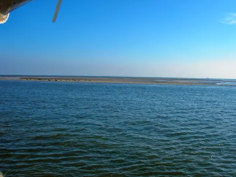
- Haul-out sandbanks between tidal channels: During calm low water off Texel or East Frisian shores, watch deep green tidal trenches expose pale sandbars crowded with resting harbour seals and larger grey seals.
- Eastward-migrating barrier island tips: Compare flat western surf beaches against sheltered eastern marsh hooks on islands such as Ameland and Vlieland to witness centuries of steady sediment migration in real time.
Best Time to Visit, Mudflat Safety, and Hamburg Connections
Choosing the best time to visit Wadden Sea coasts depends on bird migration rhythms and daily North Sea tidal forecasts. Many islands developed as popular seaside resorts during the nineteenth century, inspiring Erskine Childers's 1903 sailing novel The Riddle of the Sands and Else Ury's 1915 children's novel Nesthäkchen in the Children's Sanitorium. Summer warms barrier beaches for pleasure boating and guided low-tide mudflat walks, while spring and autumn flood coastal marshes with millions of staging geese and shorebirds. Never cross bare flats alone without a licensed guide, since swiftly rising tides fill deep tidal creeks behind walkers during routine things to do in Wadden Sea outings.
Those tidal walks reveal why three nations have sustained continuous diplomatic and scientific cooperation since 1978 across research, monitoring, and conservation policy. Joint frameworks coordinate national reserve rangers from Texel to Skallingen while preserving local fisheries, harbour maintenance, and coastal flood safety along historic Frisian polders. Outer island beaches battered by North Sea waves contrast dramatically with sheltered southern marsh margins where dense sea-grass beds, mussel reefs, and quiet mudflats nourish young fish, shellfish, and coastal bird colonies. Planning at least two tide cycles on any barrier island lets visitors experience both glistening low-tide flats and brimming high-water channels framing the Frisian horizon. Bringing waterproof boots, windproof outer layers, and tide tables from local visitor centres ensures safe coastal exploration whether cycling island dikes or boarding seal-watching boats out of Den Helder, Cuxhaven, or Danish ferry ports. Watching changing light cross tidal sandbars completes a memorable North Sea shoreline visit.
Learning how to get to Wadden Sea gateways or planning how to get to Wadden Sea National Park hubs works smoothly by European rail and ferry links. Dutch mainline trains reach Texel ferries at Den Helder, German regional trains serve Cuxhaven and Wilhelmshaven, and causeway roads connect straight onto Rømø in Denmark. Air passengers use Bremen Airport (BRE) 127 km south for Germany's central coast or follow coastal rail connections northwest out of Hamburg, 166 km southeast of the mudflats, pairing nicely with European reserves across the UNESCO World Heritage Atlas.