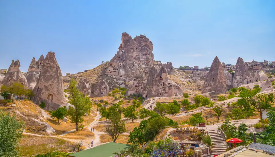
Photo by Tom Podmore on Unsplash
Cappadocia 2-Day Itinerary
A structured two-day route taking in sunrise balloon flights, early Christian rock churches, and deep underground settlements.
A short stay in Cappadocia requires careful coordination because the landscape is vast and public transport links are dispersed. The regional name Kapadokya means land of beautiful horses in Turkish. The soft volcanic tuff across this plateau allowed ancient societies to carve complex subterranean refuges and monastic settlements directly into the terrain. Planning a balanced two-day visit means pairing early aerial viewpoints with deep valley rambles and subterranean retreats.
Weather plays a central role in how local travel plans unfold. Taking time to review our complete Cappadocia Travel Guide: What to Know Before You Go can help clarify transport logistics before setting out across the region.
Morning balloon flights across the valleys
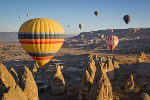
Starting early is essential in Cappadocia. Hot air balloon flights in the region last between one and one and a half hours, drifting over the intricate geological formations at sunrise. Takeoff areas are located around Göreme, Uçhisar, Çat, and the village of Çavuşin. These distinct launch sites allow pilots to catch gentle morning breezes drifting across the valley floors.
Flight operations do not take place automatically. Balloon flights in Cappadocia can operate an average of 220 days per year when weather conditions permit. Every single flight requires explicit clearance based on safety parameters. Hot air balloon tours require permission issued after an assessment of weather conditions by the Directorate General of Civil Aviation Nevşehir Coordination Office.
Wind speeds and rainfall determine whether the coordination office grants launch permissions. If your tour is cancelled due to adverse weather on the opening morning, operators generally attempt to reschedule passengers for the subsequent dawn. Those looking into specific flight preparations can check our Cappadocia Hot Air Balloon Guide for logistical details.
Exploring early Christian rock settlements
After landing, spend your initial midday exploring the rock-cut sanctuaries that defined Byzantine monastic life. Göreme Open Air Museum and Zelve Open Air Museum preserve monasteries, churches, meeting places, and houses dating from the 4th to the 11th century CE. Travellers can examine detailed wall paintings and structural carvings in these sanctuaries, with comprehensive background available in our Göreme Open Air Museum Guide.
The soft tuff allowed monks and communities to carve functional communal architecture without quarrying stone blocks. These durable troglodyte complexes provided shelter, community halls, and sacred worship chambers insulated from harsh seasonal temperatures. For official ticket details and visiting guidelines, check the official site before walking over from nearby village centres.
Afternoon walking routes through Gül and Meskendir
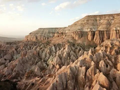
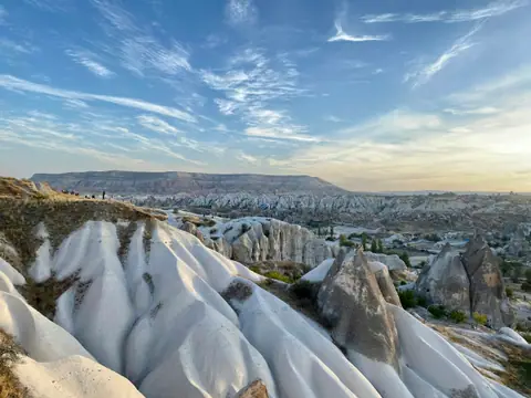
As the daylight softens in the late afternoon, heading out on foot reveals Cappadocia’s eroded topography from ground level. A trail loop runs between Gül Valley and Meskendir Valley. Following this path takes walkers past weathered pinnacles, abandoned cave dwellings, and quiet orchards set deep within the gullies.
The natural gradient between Gül Valley and Meskendir Valley offers clear perspectives on how rainwater and wind carved channels through volcanic deposits. Walking this loop requires sturdy footwear because loose gravel lines the base of the gullies. Carrying sufficient drinking water is sensible since pathside amenities are limited along the dirt tracks.
Descending into the Derinkuyu subterranean village
Day two leads underground to experience the defensive engineering of Cappadocia. The eight-story Derinkuyu Underground Village, built thanks to the geological formation of Kapadokya, has been used to escape from enemies for a long time. It served as a self-contained refuge capable of sustaining long periods of isolation.
Derinkuyu is truly a city with partitions such as the kitchen, living room, and place of worship. Its subterranean halls and chapels reflect the austere beauty and secrecy of early Christianity, between the 4th and 8th centuries. When outside forces moved across central Anatolia, local farmers retreated below ground to wait out danger behind thick rock barriers.
The defensive engineering at Derinkuyu was remarkably advanced. This structure featured massive stone doors to seal off internal passages, a complex ventilation system, and deep wells to ensure self-sufficiency during extended sieges. GoTürkiye describes the underground cities as a secure, temporary refuge against military threats. Travellers comparing different excavation sites should read our guide on Cappadocia Underground Cities: Derinkuyu or Kaymaklı? to assess accessibility and layout differences.
Continuing through Güzelyurt to Ihlara Valley
A broader southern excursion incorporates the scenic gorge of Ihlara along with historic towns. The 2-day Ihlara Valley and underground cities route covers 230 km, linking regional settlements across an expansive circuit. Those following this route by car can explore the heritage of Güzelyurt along the way.
Begin an architectural detour at Red Church, a striking 6th-century monument located just outside the town of Güzelyurt. This free-standing masonry church demonstrates construction techniques distinct from the typical rock-carved sanctuaries of the central valleys. In addition to Red Church, travellers exploring Güzelyurt can visit Bell Church and High Church situated within the historic settlement.
Walking rock-cut churches along the Melendiz river
Ihlara Valley is a verdant canyon cut deep into the plateau by the Melendiz river. Its steep walls provided sanctuary for hermits and early monastic groups who carved decorative chapels directly into the cliff faces. Among the many rock-cut churches in the Ihlara Valley, two stand out as the most popular: the Ağaçaltı Church and the Yılanlı Church.
These sites contain ancient narrative frescoes depicting biblical scenes along barrel-vaulted ceilings. Shaded paths run parallel to the flowing river between church access stairs. Following the canyon path to its terminus brings travellers to Selime Cathedral at the valley’s far end, where the rock has been shaped into a vast, dramatic complex. This massive monastic site features towering columns, basilical halls, and living quarters carved entirely out of a single mountain spur.
Craft traditions in the pottery district of Avanos
Any spare afternoon hours on a two-day itinerary can be spent discovering local craft history. Avanos is a region in Cappadocia famous for making pottery. The craft has flourished here for generations, relying on the fine red silt deposited along the banks of the Kızılırmak river.
Artisans in Avanos continue to shape decorative vessels, pitchers, and domestic earthenware on foot-powered kick wheels. Visiting a traditional workshop offers practical insight into how raw river mud transforms into durable regional ceramics. Navigating these regional workshops and valley sights is straightforward when coordinating a rental vehicle, private transfers, or organized day tours across Nevşehir province.
Where it is
- 1Central Cappadocia
- Kayseri Erkilet International Airport (ASR) · about 60 km from the central Cappadocia in a straight line
- Directions in Google Maps
Stations and taxi ranks: OpenStreetMap. Airports: OurAirports. Distances are in a straight line.
Traveller tips
Real advice from people who have been to Cappadocia. Every tip is read by our team before it goes live.
No tips yet. Been here? Yours could be the first.
Thank you! Your tip will appear here after a quick review.
More in Cappadocia
Continue exploring Cappadocia with related neighbourhood, food, and planning guides