Narikala and Tbilisi Botanical Garden: Plan the Hill
Pair Narikala's high position above the Old Town with the botanical garden when the terrain and route suit your day.
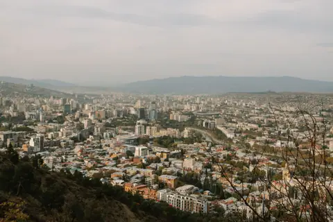
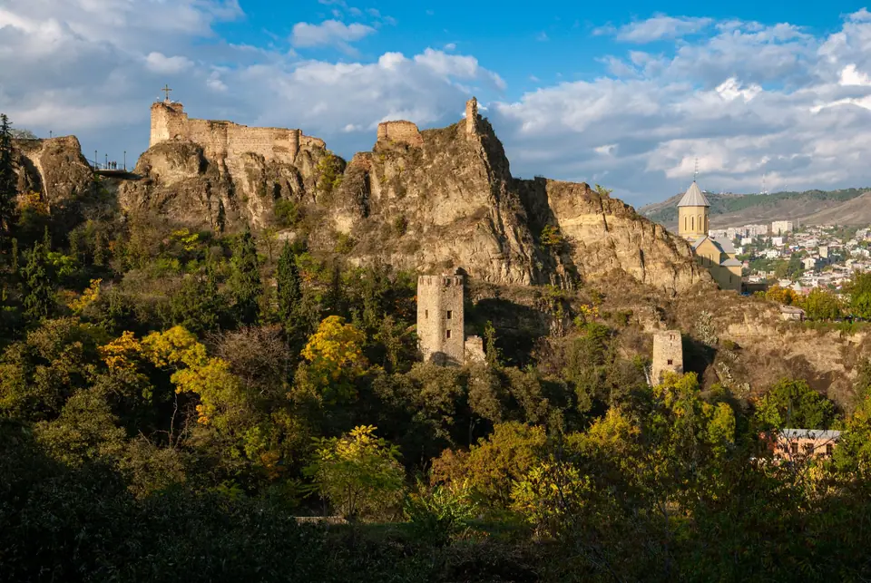
Narikala is most useful as a way to understand Tbilisi from above. The fortress occupies a ridge over the historic centre, and the view makes the relationship between the river, bath quarter and surrounding slopes immediately clearer. It is not a flat viewpoint reached by an effortless stroll. The approach involves elevation, and the right route depends on your mobility, weather and appetite for climbing. The Rike Park to Narikala ropeway is operated by Tbilisi Transport Company, but check current status before relying on it.
The botanical garden lies on the southern side of the same broad hillside landscape. It can pair naturally with Narikala for travellers who want both a built landmark and a longer green walk. The combination is less appealing if you have limited time, dislike uneven ground or are already tired from the Old Town. Decide whether the garden itself is a priority before committing to a long descent. Our things-to-do guide compares the city's viewpoints and museums.
Choose the ascent before you start
There are two broad approaches: walk uphill or use the ropeway from Rike Park when it is operating. Walking gives a gradual sense of the city and lets you stop along the way, but the slope can be demanding. The ropeway reduces some of that climb, though queues, closures or service changes can affect the plan. Confirm the current ticketing and operating information with TTC. Do not assume that a one-way ride solves both the ascent and return.
Wear shoes with grip whichever option you choose. Paths can include stone, steps and uneven sections. Carry water and allow time for a pause at the top rather than treating the visit as a quick photo. If the weather is hot, exposed and sunny conditions can make the climb more tiring. If it is wet, stone can become slippery. A less ambitious walk around the lower historic streets may be a better choice than pushing through an uncomfortable ascent.
Read the view, not just the skyline
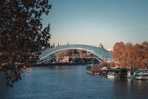
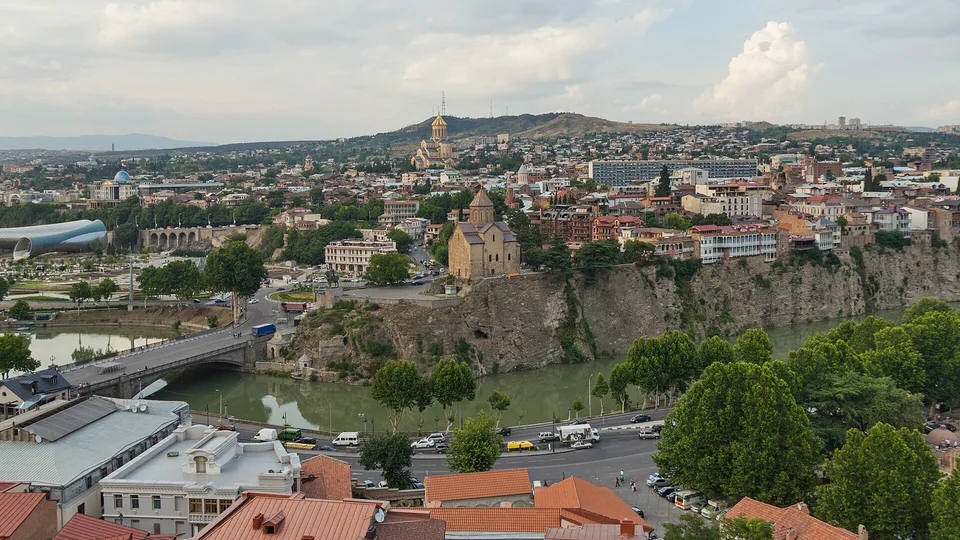
From the ridge, look for how the Mtkvari threads through the built-up valley. The old roofs sit close to the river, while newer buildings and broader streets spread beyond them. Metekhi and the bath district make useful visual anchors. The view is a map in three dimensions, showing why two landmarks may be close as the crow flies yet separated by a steep bank or crossing.
Use the viewpoint to plan the next leg. If you descend towards Abanotubani, you can return to the bath district and the gorge. If you cross towards Metekhi, you will be on the opposite bank and should follow that district's streets rather than trying to trace a straight line back. Our Old Town walk and Metekhi guide describe these different routes.
Where the garden fits
Tbilisi Botanical Garden provides a green contrast to the dense central streets. The official tourism authority identifies it as a city attraction. Check its current visitor information, entrances, route conditions and any maintenance notices before setting out. A garden map may show a short distance between two points, but paths and gradients determine the actual effort. Choose a route that leaves enough energy for the return.
Do not treat the garden as a shortcut between neighbourhoods unless the official map confirms that the gate and path you need are open. Entrances can be on different sides of the hillside, and arriving at the wrong gate can add an unnecessary climb. Confirm which entrance suits your route and how you will leave the area afterwards. If a little green space is your priority, select a shorter section and return along the same known path.
A practical half-day sequence
- Check the forecast, ropeway status and botanical garden visitor notices before leaving.
- Start from the approach that best matches your accommodation and energy level.
- Spend time at the fortress ridge and identify the river and districts below.
- Continue into the garden if the entrance and route work for your plan.
- Choose a clear exit and transport option before descending or crossing the valley.
This is a sequence, not a promise that every path is open or that a fixed duration will suit every visitor. Families with young children, travellers with mobility needs and anyone affected by heat should shorten the route. If you are travelling alone, keep your phone charged and tell someone your general plan before walking isolated paths. Follow posted instructions and do not leave marked routes to reach a better photograph.
Photography and respectful access
The ridge gives broad views, so a landscape photograph can include the fortress, rooftops and distant hills. Keep people and private property out of close shots unless you have permission. In the garden, stay on public paths and avoid damaging plants for a camera angle. The purpose of the visit is the view and landscape, not climbing walls or entering restricted areas.
For a stronger understanding of Tbilisi's heritage context, read the UNESCO Tentative List entry. It describes a proposed historic district, not a World Heritage inscription. For visitors wanting a different elevated perspective, Mtatsminda is another outing and should be planned separately rather than squeezed into the same climb. The seasonal guide explains why weather matters for exposed routes, while the itinerary helps fit the hill into a city stay.
Check the return route before starting the descent, especially if you plan to cross the river or meet a driver. The lower streets do not all lead to the same district, and a convenient-looking staircase may emerge far from your intended stop. Keep a map available, but follow posted path information before continuing. If the route is unclear, return by the way you came rather than exploring an unmarked path on a steep slope.
When to skip the combined route
Choose Narikala alone if you mainly want the city view. Choose the garden if green space is the priority and you are comfortable with its paths. Skip both for the day if weather, fatigue or mobility makes the terrain unsuitable. Tbilisi has cultural stops at lower elevations, including museums along Rustaveli, so an alternative does not mean losing the day. Our museum guide offers an indoor option.
Sources we checked
Where it is
- 1Narikala and Tbilisi Botanical Garden
- Tbilisi International Airport (TBS) · about 13 km from here in a straight line
- Directions in Google Maps
Stations and taxi ranks: OpenStreetMap. Airports: OurAirports. Distances are in a straight line.
Traveller tips
Real advice from people who have been to Tbilisi. Every tip is read by our team before it goes live.
No tips yet. Been here? Yours could be the first.
Thank you! Your tip will appear here after a quick review.
More in Tbilisi
Continue exploring Tbilisi with related neighbourhood, food, and planning guides