Quick Field Data
- UNESCO Inscription: 2002 (Ref. 1066), cultural river landscape across Rhineland-Palatinate and Hesse, Germany; Criteria (ii), (iv) and (v).
- Scale & Footprint: 27,250 hectares covering the 65-kilometre (40-mile) gorge section between Bingen, Rüdesheim am Rhein and Koblenz.
- Access & Ticketing: Open towns, riverside promenades and hiking trails; check individual fortress operators such as Marksburg and boat lines for current admission and cruise fares.
- Arrival Logistics: Closest airport Frankfurt-Hahn (HHN) lies 40 kilometres west, backed by major hubs Frankfurt Main (FRA) at 64 kilometres and Cologne Bonn (CGN) at 86 kilometres. Frankfurt sits 71 kilometres east.
Devonian Slate Gorge, Lorelei Myths, and Medieval River Trade
Cutting north through the Rhenish Slate Mountains, the Upper Middle Rhine Valley links the Oberrheingraben plain with the Lower Rhine basin. Stretching 65 kilometres between Bingen, Rüdesheim am Rhein and Koblenz, this 27,250-hectare cultural landscape occupies Rhineland-Palatinate and Hesse. Sedimentary slate beds known as Rhenish Facies formed during the Devonian period and underwent heavy folding during the Carboniferous before later tectonic uplift allowed the river to saw down between steep walls rising 200 metres high. Adjoining middle and upper valley terraces preserve older stages of the river's prehistoric bed, while steep sunlit rock faces generate a warm microclimate acting as a biological corridor for rare plants and species absent elsewhere in the region.
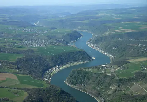
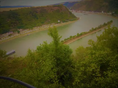
Entering through the southern Bingen Gate, or Binger Pforte, the river threads past sixty compact towns and villages before widening at the Lahnstein Gate into the Neuwied Valley. Through the 15-kilometre Bacharach reach toward Oberwesel, V-shaped side valleys cut across softer clay-slates before harder sandstone squeezes the current into dramatic bends. Narrowest and deepest of all lies the Loreley channel beside Sankt Goarshausen, where the water measures no more than 130 metres wide and plunges 20 metres deep. Along the western bank sit Bingen, Bacharach, Oberwesel, Sankt Goar, Boppard, Rhens and Koblenz, facing Rüdesheim, Assmannshausen, Lorch, Kaub, St. Goarshausen, Braubach and Lahnstein on the east shore.
Towering 132 metres above the right bank, the steep Lorelei slate cliff inspired shipwreck tales and German poetry from the tenth century onward. Old myths imagined dwarfs haunting caves in the cliff, while its name pairs the Rhine dialect word lureln (murmuring, after a small lost waterfall and roaring current echo) or lauern (lurking) with ley, meaning rock, before Germany's 1901 spelling reform changed y to i. In 1801, Clemens Brentano composed the ballad Zu Bacharach am Rheine in his novel Godwi, modelling his tragic Lore Lay figure on Ovid's Echo myth. Heinrich Heine transformed her into an alluring siren in his 1824 poem Die Lorelei, set to music by Friedrich Silcher in 1837 and Franz Liszt, though Nazi authorities later discredited Heine due to his Jewish heritage.
Literary reverberations stretched well beyond early German Romanticism across European music and poetry. Joseph von Eichendorff included Loreley in his 1812 novel Ahnung und Gegenwart, set to song by Robert Schumann in Liederkreis, Op. 39. Later French poet Guillaume Apollinaire adapted the motif in Alcools, subsequently quoted in the third movement of Dmitri Shostakovich's Symphony No 14. Modern musicians including Townes Van Zandt, Roxy Music, The Pogues, David Gray, Blackmore's Night, Fischer-Z and Ne Obliviscaris also kept the Lorelei legend in popular music. Crowned today by the 1930s Loreley Amphitheatre, the tight bend remains demanding for modern shipping, underscored when a barge carrying 2,400 tonnes of sulphuric acid capsized near the cliff on 13 January 2011 and halted Europe's busiest river lane.
Hilltop Castles, Steep Vineyards, and the Unconquered Marksburg
Because the Rhine served as Europe's vital north-south freight route since prehistoric times, customs posts and roughly 40 hilltop castles rose along the gorge over a millennium. River commerce turned towns inside the Holy Roman Empire into prosperous hubs before seventeenth-century wars, especially the Thirty Years' War, battered most fortresses into ruins. Later eighteenth-century sensibility toward wild nature drew European writers, painters and composers into the canyon, turning its ruined keeps into an emblem of Romanticism and Wagner's Götterdämmerung. After briefly forming a border with France before nineteenth-century Prussian annexation and castle restoration campaigns, only two of the 40 hill castles survived destruction (Marksburg and Maus Castle), and Marksburg above Braubach is the sole fortress that never fell into disrepair.
Noble freemen of Braubach first built a fortification around 1117 to guard the town and customs post, though hilltop Marksburg appears explicitly in 1231 records under the Lords of Eppstein, an influential dynasty producing archbishops of Mainz and Trier. Dendrochronology dates surviving timber beams in the base of its three-storey Staufer keep and original hall inside a triangular curtain wall to 1239, standing above twelfth-century Romanesque chapel foundations uncovered in 2014. When the Eppstein male line ended in 1283, Count Eberhard of Katzenelnbogen inherited Marksburg and expanded its defences, erecting the Gothic Saint Mark interior chapel around 1340 that gave the castle its modern name. After 1429, Landgraves of Hesse added artillery pointed bastions and round outer curtain towers around its striking butter-churn bergfried keep.
Modern conflicts tested Marksburg well into the twentieth century. Abolishing the Holy Roman Empire in 1806, Napoleon gave the fortress to his ally the Duke of Nassau, who converted it into a prison and disabled soldiers' home before Prussia seized Nassau in 1866. Sold in 1900 for a symbolic 1,000 Goldmarks to the German Castles Association (founded privately in 1899 to preserve historic castles across Germany), Marksburg has housed the organisation's headquarters since 1931 despite heavy US artillery damage from across the Rhine in March 1945. Even an international tribute appeared in the 1990s when builders erected a full-scale replica of Marksburg for the Ueno German Culture Village in Japan.
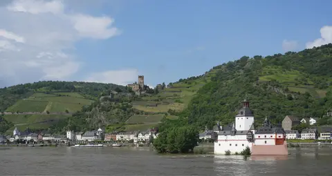
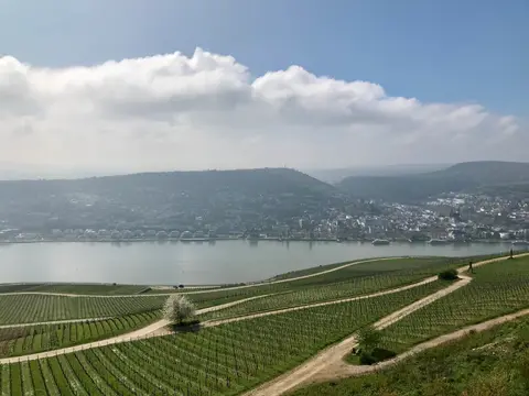
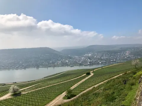
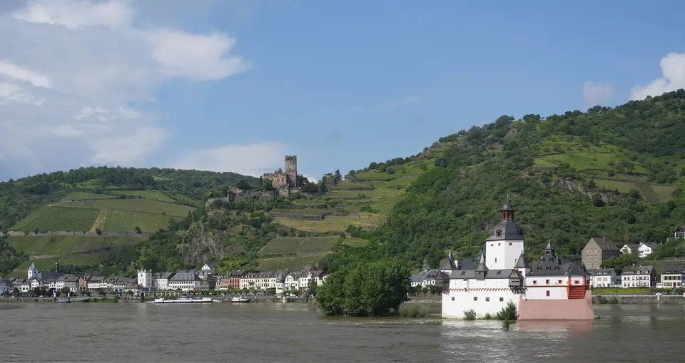
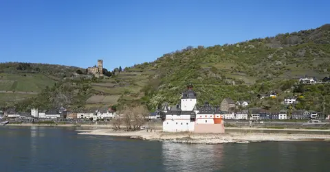
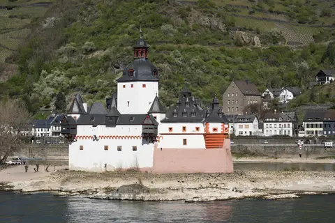
Meanwhile, across the gorge's steep south-facing slate slopes, dry-stone vineyard terraces cultivated for over a millennium sustain the Mittelrhein wine region plus Rheingau estates above Rüdesheim and Assmannshausen and Nahe slopes near Bingen. Constrained between vertical canyon walls and flood-prone banks, medieval river towns squeezed timber-framed merchant houses, customs gates and parish churches onto narrow riverside terraces. Below Kaub's hillside Gutenfels Castle, the white-walled island tollhouse of Pfalzgrafenstein rises straight from the river to show how medieval customs stations taxed passing barges.
Together, steep winegrowing ridges, tightly packed riverside settlements and forty hill fortresses create a coherent cultural landscape shaped by two millennia of shipping, agriculture and political frontier history. Even where seventeenth-century conflicts left castles roofless above towns like Bacharach and Oberwesel, intact village walls and parish spires preserve the historic rhythm of Rhine river travel.
Railway Noise, Slope Viticulture, and Heritage Management
Preserving a working transport artery through a narrow canyon brings persistent environmental and economic pressures. Double-track freight and passenger railway lines hugging both riverbanks make the Upper Middle Rhine Valley easy to reach by train yet create continuous railway noise pollution across the confined valley floor that UNESCO reports flag for mitigation. Simultaneously, steep slate-terrace vineyards demand arduous hand labour and careful retaining-wall maintenance, leaving historic slopes vulnerable to abandonment under modern agricultural markets.
Protection spans detailed statutory regimes across two German states. Rhineland-Palatinate enforces its 1978 Cultural Monuments Law, 1998 Building Ordinance, 2000 Forest Law, 2003 Planning Law, 2004 Water Law, 2005 Landscape Conservation Law and the 1978 Middle Rhine Landscape Protection Ordinance under oversight transferred to Koblenz's Structural and Approval Directorate in 2004. Hesse pairs its 1976 Monuments Law (amended 1986) with 2002 to 2006 building, forest, planning, water and nature statutes.
Guided by the November 1997 Rhine Valley Charter signed by river communities, local counties and state ministries have coordinated stewardship since 2005 through the Upper Middle Rhine Valley World Heritage Association. The association provides a full-time World Heritage manager and frames a sustainable Master Plan focused on four priorities. Joint initiatives work to repair dry-stone vineyard terraces, preserve historic fortresses, protect rare dry-slope flora and sustain viable local economies to prevent younger residents from leaving valley towns. Preserving traditional winegrowers' communities across Bingen, Bacharach, Kaub and Braubach keeps rural valley culture active rather than turning historic towns into seasonal facades.
Environmental protection also guards wildlife corridors clinging to warm slate ledges between riverfront settlements and upland woods. Because the south-facing canyon traps warmth far better than neighbouring plateaus, rare plants and heat-loving insects persist along dry rock walls and vineyard edges. Balanced grazing, careful wall rebuilding without concrete sealing and steady railway noise reduction remain ongoing management targets across both federal states.
Access Zones Along the Upper Middle Rhine Valley
Travellers explore the 65-kilometre corridor between Rüdesheim, Bingen and Koblenz using twin riverbank railways, car ferries and passenger riverboats. Check individual castle operators and boat companies ahead of departure for seasonal tour schedules and river landing stops.
| Complex Zone | Key Highlights | Access & Ticket Rule |
|---|---|---|
| Bingen & Rüdesheim Wine Slopes | Bingen Gate entrance, steep Rheingau and Mittelrhein terraced vineyards above Rüdesheim and Assmannshausen. | Town promenades and hillside vineyard paths open freely; check local ferry operators for river crossings. |
| Kaub & Bacharach Canyon | Pfalzgrafenstein island castle, hilltop Gutenfels, Bacharach medieval walls and fifteen-kilometre gorge narrows. | Village lanes are open year-round; Pfalzgrafenstein boat shuttle and castle entry require separate tickets. |
| Lorelei & Twin Towns | 132-metre Lorelei slate promontory, Loreley Amphitheatre, Sankt Goar and Sankt Goarshausen riverbanks. | Cliff viewpoints open year-round; verify seasonal event rules and visitor centre hours locally. |
| Braubach & Koblenz Reach | Unconquered Marksburg Castle with its butter-churn tower keep above Braubach, leading toward Koblenz. | Guided Marksburg fortress tours run on posted schedules; check official castle notices for tickets and parking. |
Three Landscape and Castle Details in the Rhine Gorge
- Marksburg's Butter-Churn Keep and Artillery Bastions: Notice the stepped silhouette of Marksburg's central tower rising above fifteenth-century Hessian round towers designed specifically to resist early gunpowder artillery.
- Devonian Slate Cliff Strata at the Lorelei: Examine exposed dark slate beds along the 132-metre promontory to see how ancient seafloor sediments folded tightly before the Rhine carved its deepest bend.
- Pfalzgrafenstein's Ship-Shaped Island Cutwater: Look upstream at the pointed prow-like southern stone wall of Pfalzgrafenstein Castle at Kaub, built to deflect rushing Rhine currents and winter ice floes.
Trains, Boat Cruises, Hiking Trails, and Routes From Frankfurt
Few European heritage corridors match the Upper Middle Rhine Valley for integrated rail, trail and river boat tour options. Twin regional railway lines run along both the west and east riverbanks, connecting Koblenz, Boppard, Sankt Goar, Oberwesel, Bacharach, Bingen, Rüdesheim, Kaub and Braubach with frequent stops. Travellers frequently pair a scenic Upper Middle Rhine Valley train ride in one direction with scheduled river cruises operated by lines such as Köln-Düsseldorfer, watching hillside vineyards and medieval keeps pass by from the river deck. Small car and foot ferries bridge the water between twin towns such as Sankt Goar and Sankt Goarshausen where no highway bridge crosses the central canyon.
Long-distance walkers follow elevated vineyard ridge hikes linking castle viewpoints above both riverbanks, while late-summer visitors gather in August at Koblenz and September at Sankt Goar for the annual Rhine in Flames firework boat convoys. Spring blossoms and autumn grape harvests also bring clear hiking visibility across the Mittelrhein and Rheingau slopes without peak mid-summer river traffic. Air arrivals reach the gorge conveniently via Frankfurt Main Airport (FRA) 64 kilometres east, Cologne Bonn Airport (CGN) 86 kilometres north or Frankfurt-Hahn Airport (HHN) 40 kilometres west. Frequent regional trains also link Frankfurt (71 kilometres east) directly with Rüdesheim, Bingen and Koblenz in roughly an hour. Explore additional European river landscapes inside our UNESCO World Heritage Atlas.