



























Photo: Wikimedia Commons · CC BY-SA 4.0
Cinque Terre Hiking Trails: Blue Trail, Sanctuary Paths & Rules
Navigating marked trails across the National Park, from paid coastal paths and free vineyard contours to the five hilltop Marian shrines.
Most visitors arrive in Liguria thinking of the Cinque Terre as a single coastal footpath linking five villages along the water's edge. In reality, the Parco Nazionale delle Cinque Terre maintains an intricate mountain trail network across numbered routes. The coastal railway opened in the nineteenth century, and the provincial road arrived in the twentieth century. For centuries, these cobbled mule tracks (mulattiere) and stone staircases (scalinate) served as the overland links. They connected the sea harbours with terraced vineyards, chestnut woods, and mountain passes. Trail tiers intersect with vertical sanctuary staircases across the park slopes. Understanding this grid lets you hike safely even when coastal erosion closes a lower cliff segment.
Hiking along these historic pathways requires a sensible approach to route selection and footwear. Coastal cliffs frequently suffer from ground movement, so alternate inland footpaths offer dependable detours. Walkers can easily spend several days traversing the dramatic landscape without retracing their steps.
How the three-tier trail numbering system works
Working with the Italian Alpine Club (CAI, Club Alpino Italiano), the National Park marked its paths clearly. Red-and-white horizontal blazes appear painted on rocks and wooden signposts at junctions. Every route falls into one of three geographical tiers:
- The Lower Coastal Spine: Sentiero Verde-Azzurro (SVA2). This path links the five villages closest to the sea. It requires a paid Cinque Terre Trekking Card, plus a timed supplement on the Via dell'Amore.
- The Mid-Slope Contour and Vertical Sanctuary Paths. Completely free of charge year-round, these historic stone staircases climb from each village to hillside Marian sanctuaries. They also run horizontally across the middle vineyard terraces, such as the scenic route between Volastra and Corniglia.
- The High Apennine Watershed Crest: Alta Via delle Cinque Terre (AV5T). This free long-distance trek runs along the mountain ridge separating the coast from the inland Vara Valley. It connects Portovenere all the way northwest to Levanto.
Understanding which routes require passes prevents unexpected delays at trail checkpoints. Wandering higher up the slopes gives hikers access to quiet woodland paths, uncrowded villages, and sweeping coastal vistas without purchasing day cards.
| Trail Name | Start & End Villages | Route Profile | Ticket & Access Status |
|---|---|---|---|
| Via dell'Amore (SVA2 South) | Riomaggiore to Manarola | Flat paved coastal walk | Cinque Terre Card plus timed supplement |
| Via Beccara | Riomaggiore to Manarola | Steep hillside stone steps | Free open trail |
| Volastra Vineyard Route | Manarola to Corniglia | Contour through hillside vines | Free open trail |
| Blue Trail Central (SVA2) | Corniglia to Vernazza | Coastal trail via Prevo | Paid Cinque Terre Trekking or Treno Card |
| Blue Trail North (SVA2) | Vernazza to Monterosso | Steep coastal steps | Paid Cinque Terre Trekking or Treno Card |
| Punta Mesco Ridge | Monterosso to Levanto | Ridge walk past hermitage ruins | Free open trail |
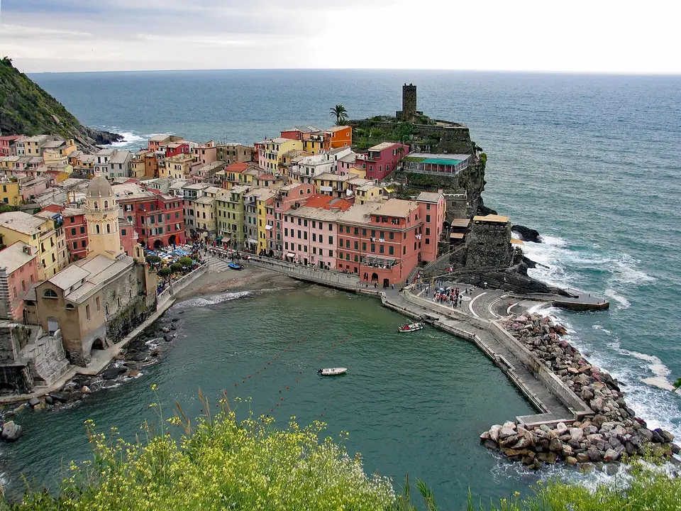
Hiking the paid Sentiero Verde-Azzurro (Blue Trail): Monterosso to Corniglia
The two northern segments of the Sentiero Verde-Azzurro (SVA2) deliver the classic coastal experience most walkers picture when planning their trip. Remember that Carabinieri Forestali rangers and checkpoint attendants inspect shoes at the ticket booths. You must wear the closed, lug-soled footwear detailed in our Cinque Terre packing guide.
Between Monterosso al Mare and Vernazza, the path is narrow, sunny, and step-heavy. Starting from Monterosso involves a steep initial climb up rough sandstone steps around Punta Corone. After the climb, the path levels out through lemon groves and crosses a medieval stone bridge over the Acquapendente stream. Hiking in the reverse direction from Vernazza to Monterosso spreads the climb more gradually and puts the steep steps at the downhill end.
Between Vernazza and Corniglia, the trail is wider and gentler. The path climbs past the southern watchtower of Vernazza through olive terraces to Prevo. From that hamlet, it descends gradually to the Church of San Pietro in Corniglia. The vistas across the Ligurian Sea reward the physical effort on warm afternoons.
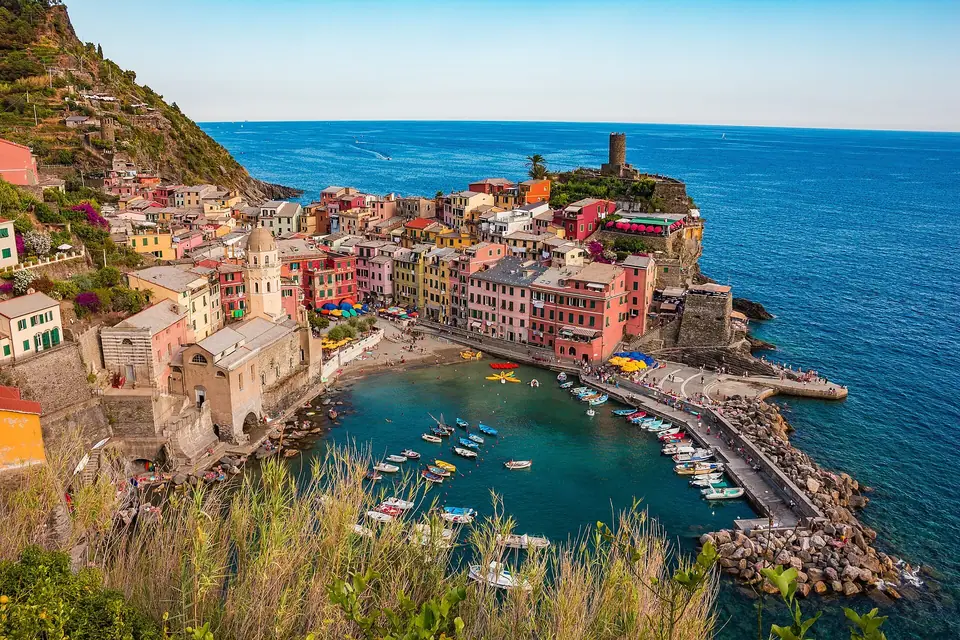
Bridging Manarola to Corniglia: The Volastra vineyard contour
The low cliffside section of the Sentiero Verde-Azzurro between Manarola and Corniglia remains closed due to sea-cliff instability below the railway line. Hikers therefore link the two middle villages via the upper vineyard route through Volastra.
You can climb the stone steps directly from Manarola up to Volastra. Alternatively, save your knees for the contour walk by riding the green-and-yellow ATC minibus from Manarola to Volastra. The bus ride is included free with your Cinque Terre Card. From the Sanctuary of Nostra Signora della Salute in Volastra, the trail contours almost level across the hillside high above the sea.
You walk on narrow stone ledges through the heroic Sciacchetrà vineyards. Along the way, you step across the steel rails of the harvest monorails before dropping through shaded holm-oak woods into Corniglia. This route provides open views over the terraced slopes that define the regional agricultural traditions.
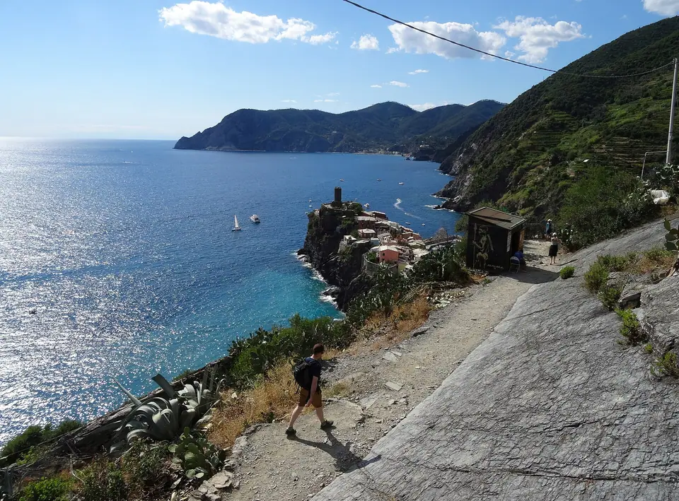
The hillside Marian Sanctuaries (La Via dei Santuari)
Every coastal village in the Cinque Terre is watched over by its own medieval Marian sanctuary perched up the mountain slope. These shrines are linked horizontally across the hills and vertically by ancient pilgrim staircases from the sea:
- Santuario di Nostra Signora di Montenero. Standing on the ridge above Riomaggiore, its stone terrace looks south over Capo di Montenero towards Portovenere.
- Santuario di Nostra Signora della Salute in Volastra. Built of local sandstone, this Romanesque church features a Gothic portal and a crowned Madonna image.
- San Bernardino and Nostra Signora delle Grazie. This hillside chapel looks straight down onto the cliff headland of Corniglia and Guvano bay.
- Reggio Sanctuary of Nostra Signora. Founded over a Romanesque crypt and shaded by monumental cypresses, the church preserves a venerated black Madonna canvas.
- Soviore Shrine of Nostra Signora. Perched above Monterosso, this ancient sanctuary features a Gothic doorway and a carved wooden sculpture inside.
Pilgrims historically climbed these steep vertical staircases during religious festivals to honour their patron shrines. Today, hikers enjoy peaceful courtyards, natural mountain springs, and picnic benches beneath mature chestnut canopies far above tourist crowds.
The Alta Via delle Cinque Terre (AV5T) high-altitude ridge trek
Experienced mountain walkers seeking solitude away from the coastal villages can hike sections of the Alta Via delle Cinque Terre (AV5T) along the Apennine watershed crest. This ridgeline trail traverses cool pine and chestnut forests high above the sea. It links Portovenere with Punta Mesco via high inland peaks.
This ridgeline hike offers cooler temperatures and broad views over both the sea and the inland valleys. Mountain bikes also share select portions of this unpaved high crest route, making it popular with endurance trail runners and cyclists.
Trail safety, water fountains, and checking ARPAL closure alerts
Start your hikes early in the morning between May and September to beat the midday heat off the stone walls. Refill your bottles at the village piazzas or sanctuary fountains before setting out, as no water taps exist on the open cliffs. Check the interactive trail map on the official Parco Nazionale delle Cinque Terre website each morning. It confirms that no rockfall maintenance or ARPAL Orange weather alert has closed your route.
Always respect temporary warning tape placed across trail entrances after severe thunderstorms or high winds. Sturdy walking poles help ease pressure on knees when descending steep stone steps, and carrying a lightweight waterproof jacket remains sensible on exposed mountain ridges. Starting your climb in the cool morning hours keeps you shaded before the sun hits the south-facing stone walls.
Where it is
- 1Cinque Terre Hiking Trails
- Pisa International Airport (PSA) · about 74 km from here in a straight line
- Directions in Google Maps
Stations and taxi ranks: OpenStreetMap. Airports: OurAirports. Distances are in a straight line.
Traveller tips
Real advice from people who have been to Cinque Terre. Every tip is read by our team before it goes live.
No tips yet. Been here? Yours could be the first.
Thank you! Your tip will appear here after a quick review.
More in Cinque Terre
Continue exploring Cinque Terre with related neighbourhood, food, and planning guides
Levanto, Bonassola & Framura Guide: The Maremonti Coastal Cycle Tunnel Path
Cinque Terre, Italy
Cinque Terre Dry-Stone Walls, Heroic Viticulture & Sciacchetrà Wine Guide
Cinque Terre, Italy
Cinque Terre Beaches, Swimming Coves & Sea Kayaking Guide: Village by Village
Cinque Terre, Italy

La Spezia, Castello San Giorgio, Naval Museum & Lerici Guide: Gulf of Poets
Cinque Terre, Italy
