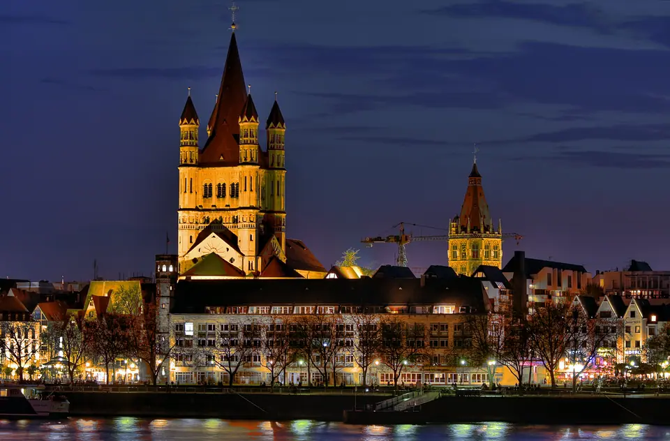
Photo: Raimond Spekking · CC BY-SA 4.0
Cologne on the Rhine: A City Built Above Roman Stones
A two-millennia portrait of Cologne: Roman street lines, twelve medieval churches, modest post-war brick, and self-contained Veedel districts along the Rhine.
Few cities in northern Europe display their urban history as plainly at street level as Cologne. Step outside Köln Hauptbahnhof onto the raised slabs of Domplatte and the black sandstone flanks of the Cathedral seize the sky. Beneath those paving stones lie Roman vaulted sewers and an ancient street grid that still channels foot traffic today. Following an earlier Ubii settlement around 38 BC, Emperor Claudius elevated Cologne to colony status as Colonia Claudia Ara Agrippinensium in AD 50 at the urging of Cologne-born Agrippina the Younger. That provincial blueprint fixed the straight lines of Hohe Straße and Schildergasse long before medieval merchants raised their guildhalls.
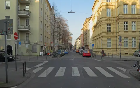
With roughly 1,025,523 primary-registered residents recorded at the end of 2025 across 405.15 square kilometres, Germany's fourth-largest city resists monumental stiffness in favour of local neighbourhood texture. Rather than sweeping ceremonial avenues, Cologne operates as an archipelago of close-knit quarters called Veedel. Each district turns around its own parish steeple, corner bakery, and modest oak-panelled tavern. Residents identify closely with their immediate blocks and rarely feel compelled to cross town when daily staples stand within steps.
Two Millennia Compressed Under Asphalt
Walking west from the Cathedral along Komödienstraße and Burgmauer leads straight to Cologne's surviving northwestern Roman bastion. At the corner of Zeughausstraße rises the round Römerturm, built around AD 70 to 90 along the fortified perimeter wall. Its polychrome inlays of sandstone, dark limestone, tuff, and pale trachyte trace crisp triangles, arches, and rosette shapes across curved masonry. Roman stonemasons treated even an outer defensive corner tower as public civic ornament.
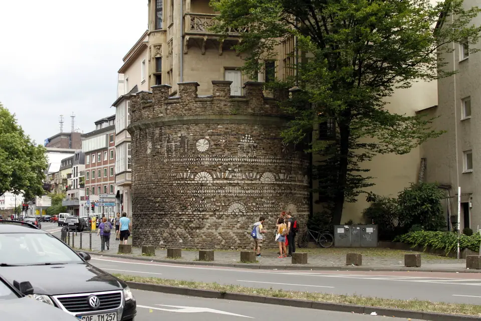
Centuries later, medieval Cologne wrapped a vast semi-circular curtain wall around that Roman heart. Prussian city planners cleared away most of those twelfth-century stone ramparts during the 1880s to carve out the wide Ringe boulevards. Today, sturdy freestanding gatehouses survive at major road intersections: Severinstorburg in the south, Hahnentorburg at Rudolfplatz, and Eigelsteintorburg in the north. Inside that old perimeter, twelve Romanesque basilicae stand beside modern retail lanes. Our Roman and Romanesque survey maps those scattered towers, church apses, and the interim Roman galleries housed at Belgisches Haus (Cäcilienstraße 46) into 2030.
Civic Architecture After Ruin
Initial impressions often surprise travellers expecting intact baroque gables like those in Munich or Vienna. Heavy Allied bombing across 262 air raids between May 1942 and March 1945 destroyed roughly 90 percent of the central residential core. That devastation left the Cathedral's primary frame (built 1248 to 1880 and inscribed by UNESCO in 1996) standing isolated over flattened lanes. After 1945, reconstruction director Rudolf Schwarz rejected grand modernist avenue grids. Instead, he respected Cologne's crooked medieval street lines and filled them with clean limestone, brick, and concrete blocks beneath modest pitched roofs.
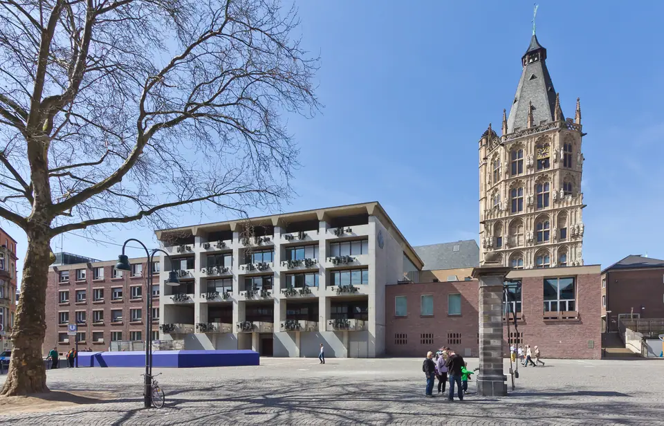
That dialogue between salvaged fragments and restrained 1950s concrete gives central Cologne calm architectural integrity. Across Alter Markt, the fifteenth-century Town Hall tower meets crisp post-war council wings over open cobbles, while excavations underneath advance toward the 2029 opening of the MiQua Jewish Museum. Two blocks west on Kolumbastraße, Swiss architect Peter Zumthor laid pale grey Danish bricks above bombed late-Gothic arches to enclose the Kolumba Diocesan Museum. Examining Cologne's post-war rebuilding plan turns plain shopping streets into readable civic history.
Cologne never hides what war removed; instead, Roman wall blocks, Romanesque apses, and 1950s concrete hold the same street corner without theatrical disguise.
The Rhine Spine and the Two Banks
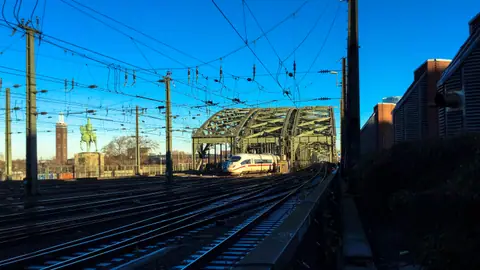
The broad River Rhine bends north-northwest through the city. It separates historic left-bank quarters from the flatter eastern plains of Deutz and Mülheim. Locals jokingly dub the right bank Schäl Sick, meaning the squinting or wrong side of the river. Deutz grew later around Prussian forts, freight tracks, and the sprawling Koelnmesse exhibition grounds. Walking east across the Hohenzollern Bridge toward dusk reverses that old joke cleanly, opening Cologne's clearest panorama back toward the twin spires and gabled Old Town roofs.
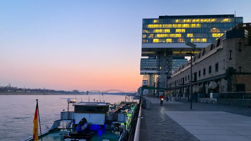
Working river commerce still animates the waterfront well beyond postcard terraces. Heavy cargo barges push north past stone jetties and gravel embankments day and night toward Rotterdam and the North Sea. South of the Altstadt, nineteenth-century port docks at Rheinauhafen now operate as an open waterfront promenade. Three glass-and-concrete towers called the Kranhäuser cantilever sharply above the harbour basin, echoing vintage dock gantries beside restored red-brick customs warehouses.
How the City Lives After Work
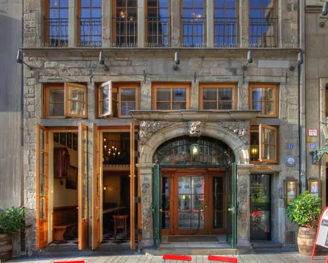
Much of Cologne's civic character unfolds on riverside terraces and tavern benches rather than behind palace gates. On mild summer evenings, students and office workers claim the stepped stone amphitheatre of the Deutz Rheinboulevard until late light fades. Down in Altstadt alleys, blue-aproned waiters thread through oak dining rooms carrying circular trays loaded with slim 0.2-litre (200 ml) Kölsch glasses. Once February arrives, civic energy breaks completely onto the pavement during Karneval parades.
Quiet daily rhythms run through smaller historic shops away from the waterfront too. Scent history lingers near Alter Markt, where Johann Maria Farina blended Eau de Cologne in 1709 long before rival 4711 adopted its 1794 French house number on Glockengasse. Under German Sonntagsruhe rules, supermarkets close on Sundays. Bakeries, corner kiosks inside Köln Hauptbahnhof, river cafés, and traditional Brauhäuser stay lively throughout the weekend.
Short distances keep daily itineraries unhurried across every season. Rather than racing from museum to museum, visitors read Cologne best by lingering between landmarks at eye level. Our five-stop riverfront walk connects the Dom, Museum Ludwig, Fischmarkt, and the Rheinauhafen quays cleanly inside half a day on foot. Evenings suit Belgisches Viertel cafés or Südstadt taverns, with effortless high-speed rail linking outward to Frankfurt, Dortmund, and Amsterdam whenever your Rhineland stay wraps up.
Where it is
- 1Cologne
- Cologne Bonn Airport (CGN) · about 15 km from Cologne in a straight line
- Directions in Google Maps
Stations and taxi ranks: OpenStreetMap. Airports: OurAirports. Distances are in a straight line.
Traveller tips
Real advice from people who have been to Cologne. Every tip is read by our team before it goes live.
No tips yet. Been here? Yours could be the first.
Thank you! Your tip will appear here after a quick review.
More in Cologne
Continue exploring Cologne with related neighbourhood, food, and planning guides