La Paz
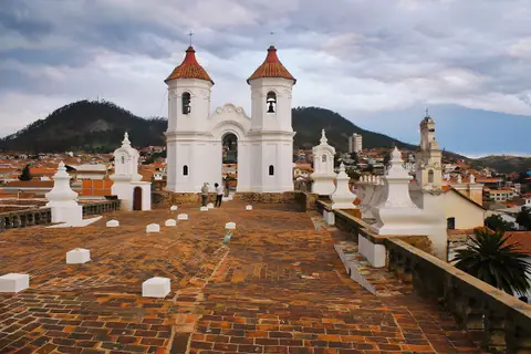
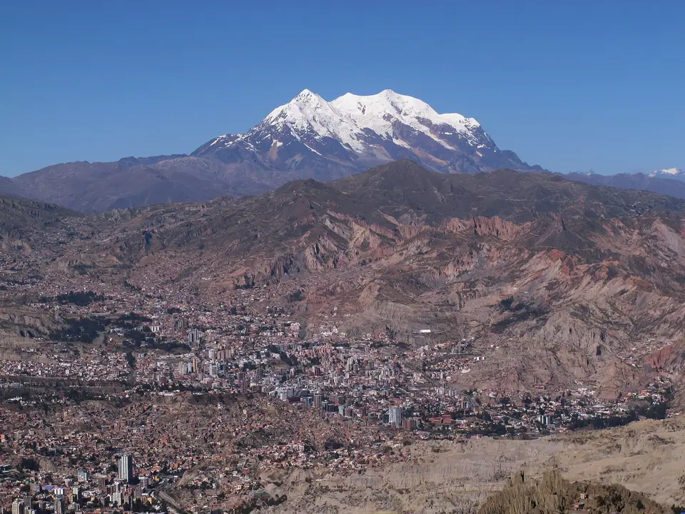
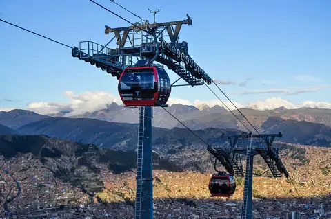
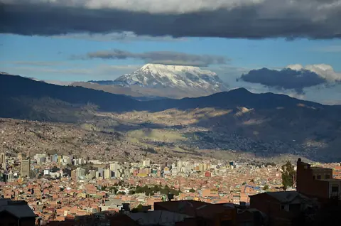
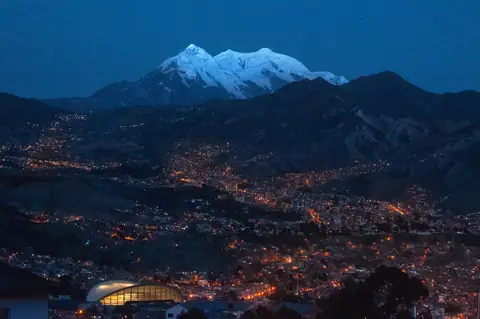
Cascading down a steep Andean river canyon from the 4,150-metre Altiplano rim to 3,200 metres beneath the glacier-clad peaks of Mount Illimani, Bolivia's seat of government pairs Mestizo Baroque churches and Aymara markets with the world's longest urban aerial cable car network.
Quick decisions
- How many days? Three to four days allow you to acclimatise smoothly in the historic canyon, ride the Mi Teleferico cable car lines up to El Alto, explore Valle de la Luna, and take day trips to Tiwanaku or Lake Titicaca.
- Where should I stay? Choose leafy Sopocachi (3,500 metres) for walkable cafés and Yellow Line cable car access, the Historic Centre (3,640 metres) for immediate proximity to San Francisco and Calle Jaen, or Zona Sur (3,200 metres) to sleep 400 metres lower in warmer air.
- Do I need a car? No. Ten colour-coded Mi Teleferico cable car lines, municipal PumaKatari buses, and registered radio taxis connect the canyon tiers far faster than self-driving.
- Best for: High-altitude Andean panoramas, aerial urban cable cars, Aymara cultural heritage, Neo-Andean cholet architecture, and pre-Columbian megalithic ruins.
- Before you go: Bolivia uses the Bolivian boliviano (BOB); carry crisp banknotes for markets and cable car tickets, and take your first 24 hours at a gentle pace to adjust to the altitude.
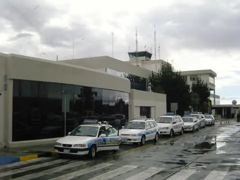
- Getting around: El Alto International Airport (LPB) sits on the plateau rim at 4,061.5 metres, while long-distance coaches operate from the Eiffel-designed Terminal de Buses.
- Continue your trip: Combine La Paz with an overland journey across Lake Titicaca to Cusco or flights to the Salar de Uyuni and Sucre.
Overview
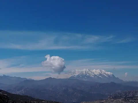
Founded on 20 October 1548 by Spanish conquistador Captain Alonso de Mendoza at Laja and transferred three days later into the sheltered canyon of the Choqueyapu River (known in Aymara as Chuquiago Marka), Nuestra Senora de La Paz serves as the executive and legislative seat of government of Bolivia, making it the highest administrative capital in the world. Home to 755,732 residents in the municipality and 2.2 million across the La Paz and El Alto metropolitan area, the city tumbles nearly 1,000 vertical metres from the 4,150-metre Altiplano rim down to the 3,200-metre valleys of Zona Sur, watched over to the southeast by the 6,438-metre triple-peaked glacier massif of Mount Illimani.
Getting there
El Alto International Airport (IATA: LPB), the world's highest international airport at 4,061.5 metres above sea level, sits 13 kilometres west of central La Paz on the Altiplano plateau. Overland travellers arrive at the historic Terminal de Buses de La Paz (whose metallic hall was designed by Gustave Eiffel's workshop) from Lake Titicaca, Uyuni, Sucre, and southern Peru.
Where to stay
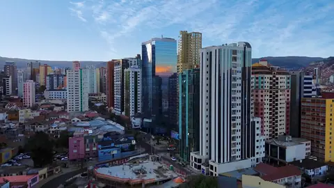
Stay in bohemian Sopocachi (3,500 metres) for tree-lined squares, specialty coffee shops, and direct Yellow Line cable car access, near Plaza San Francisco and Plaza Murillo (3,640 metres) for historic sights, or down in Zona Sur (Calacoto and San Miguel, 3,200 metres) for noticeably thicker, warmer air on your first nights.
Things to do
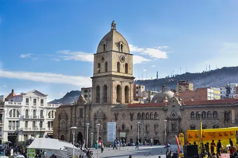
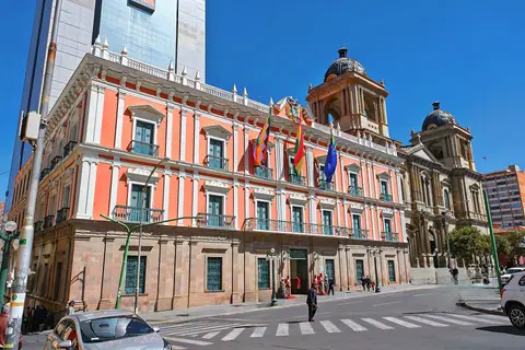
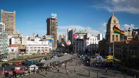
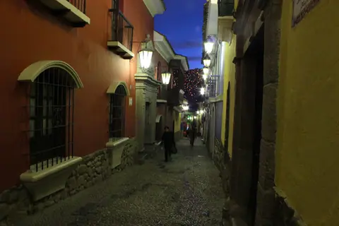
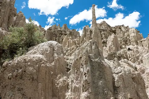
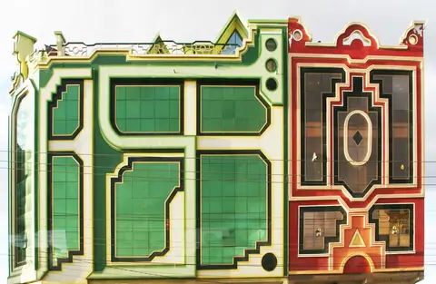
Begin on Plaza Murillo at the 1835 Cathedral Basilica, 1853 Palacio Quemado, and the counter-clockwise clock of the Legislative Assembly, then walk sixteenth-century Calle Jaen and the 1784 Mestizo Baroque Basilica of San Francisco before climbing into the Witches' Market. Soar across the canyon on the 10 lines of Mi Teleferico to see Freddy Mamani's Neo-Andean cholets in El Alto, hike the clay spires of Valle de la Luna, and take day trips to UNESCO-listed Tiwanaku, Mount Chacaltaya (5,395 metres), or Copacabana on Lake Titicaca.
Food and drink
Morning in La Paz starts between 08:00 and noon with a braided, broth-filled baked saltena or a cup of steaming purple corn api paired with a fried cheese pastel. At lunch and in the evening, sample flame-grilled beef-heart anticuchos drizzled with spicy peanut sauce, traditional plato paceno with giant choclo corn and fried sheep's cheese, creamy sopa de mani, and Chuflay cocktails mixed with high-altitude Bolivian Singani brandy.
Culture
Rooted deeply in indigenous Aymara cosmovision, everyday life in La Paz blends Spanish colonial plazas with offerings to Pachamama (Mother Earth) at the Witches' Market, the January miniature blessings of the Feria de la Alasita, and the UNESCO-listed Fiesta del Senor Jesus del Gran Poder, when 40,000 costumed dancers fill the steep canyon avenues.
Weather by month
La Paz is warmest in November, with average highs around 20°C, and coldest in July, when nights drop to about 3°C. January is the wettest month, with rain on about 21 days. For mild weather with fewer rainy days, aim for April, May, June, July, August and September.
| Month | Low | Range | High | Rain | Rainy days |
|---|---|---|---|---|---|
| Jan | 7°C | 19°C | 147 mm | 21 d | |
| Feb | 7°C | 19°C | 119 mm | 17 d | |
| Mar | 7°C | 19°C | 105 mm | 15 d | |
| Apr | 6°C | 19°C | 63 mm | 9 d | |
| May | 5°C | 19°C | 28 mm | 4 d | |
| Jun | 3°C | 18°C | 14 mm | 2 d | |
| Jul | 3°C | 17°C | 14 mm | 2 d | |
| Aug | 4°C | 18°C | 28 mm | 4 d | |
| Sep | 5°C | 19°C | 49 mm | 7 d | |
| Oct | 6°C | 20°C | 77 mm | 11 d | |
| Nov | 7°C | 20°C | 77 mm | 11 d | |
| Dec | 8°C | 20°C | 112 mm | 16 d |
Averages of daily values from 2015 to 2024. Rainy days are days with at least 1 mm of rain. Source: Open-Meteo · Compare destinations by month.
La Paz on the map
Every place we cover in La Paz. Tap a category or pin to explore.
In-depth La Paz guides
Browse the guides grouped by topic: sights, neighbourhoods, food, transport, day trips and trip planning.
Sights, Landmarks & Parks
Key monuments, viewpoints, museums and nature trails.
- Things to Do in La Paz: Mi Teleferico, Witches' Market, Cholets and TiwanakuExplore the essential sights of La Paz, from soaring above the canyon on Mi Teleferico and browsing the Witches' Market to visiting San Francisco Basilica, El Alto cholets, and Valle de la Luna.
- Plaza Murillo: The Cathedral Basilica, Palacio Quemado and Clock of the SouthStand at the political heart of Bolivia on Plaza Murillo (3,640 m), framed by the 1853 Palacio Quemado, the 1835 Cathedral Basilica of Our Lady of Peace, and the counter-clockwise Clock of the South.
- Basilica of San Francisco and the Witches' Market (El Mercado de las Brujas)Explore the 1784 Mestizo Baroque stone carvings and rooftop vaults of the Basilica of San Francisco, then climb cobbled Calle Linares into the Aymara stalls of the Witches' Market.
- Calle Jaen Museums, Casa de Murillo and MUSEF in the Casco ViejoWalk the sixteenth-century black-and-white river cobbles of Calle Jaen to visit four colonial museums including Casa de Murillo and the Pre-Columbian Gold Museum, then explore MUSEF.
- Mi Teleferico Cable Car Lines and Mirador Killi Killi ViewpointHow to ride the 10 colour-coded lines of Mi Teleferico, the world's longest urban aerial cable car network, and visit the 360-degree canyon viewpoint at Mirador Killi Killi.
- Valle de la Luna (Moon Valley) and Mount Chacaltaya (5,395 m)Pair two dramatic geological landscapes on the edges of La Paz: the eroded clay spires of Valle de la Luna at 3,400 metres and the 5,395-metre Andean ridge of Mount Chacaltaya.
Neighbourhoods & Where to Stay
Districts, historic quarters and the best bases for your stay.
- La Paz: Altitude, Canyon Neighbourhoods and Planning TipsEssential planning advice for La Paz, from understanding the 1,000-metre canyon elevation gradient and acclimatising smoothly to riding Mi Teleferico and using Bolivian bolivianos.
- Best Time to Visit La Paz: Dry Andean Winter Skies, Gran Poder and Climate NormalsMonth-by-month weather guide for La Paz using official SENAMHI climate normals, comparing crystal-clear dry winter skies (May to September) and the Gran Poder parade with the January Alasitas fair.
- Where to Stay in La Paz: Sopocachi, the Historic Centre and Lower-Altitude Zona SurCompare the three best areas to stay in La Paz by altitude and character: bohemian Sopocachi (3,500 m), the Historic Centre near San Francisco (3,640 m), and warmer Zona Sur (3,200 m).
- 3-Day La Paz Itinerary: Historic Canyon, Mi Teleferico, El Alto and TiwanakuA carefully paced 3-day La Paz itinerary designed for smooth high-altitude acclimatisation: Plaza Murillo, Calle Jaen and the Witches' Market on Day 1, Mi Teleferico, El Alto and Valle de la Luna on Day 2, and Tiwanaku or Lake Titicaca on Day 3.
- El Alto: Freddy Mamani's Neo-Andean Cholets and the Feria 16 de JulioRide Mi Teleferico up to 4,100 metres in El Alto, the world's highest major city, to explore Freddy Mamani's kaleidoscopic Neo-Andean cholet mansions and the Thursday and Sunday Feria 16 de Julio.
Food & Drink
Local dishes, markets, cafés and dining districts.

Getting Around & Arrival
Airport transfers, public transit, passes and driving rules.
Day Trips & Excursions
Easy half-day and full-day trips from the city.
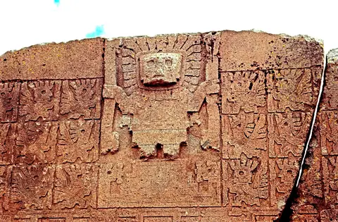
- Tiwanaku Archaeological Site and Puma Punku Day Trip from La PazExplore the UNESCO-listed pre-Columbian capital of Tiwanaku (AD 400 to 1000) 70 kilometres west of La Paz, including the Gate of the Sun, Kalasasaya Temple, 175 tenon heads, and Puma Punku.
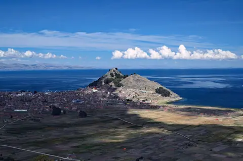
- Lake Titicaca (Copacabana & Isla del Sol) and the North Yungas Road Day TripsPlan two iconic excursions from La Paz: crossing the Strait of Tiquina to Copacabana and Isla del Sol on 3,812-metre Lake Titicaca, or mountain biking 3,500 vertical metres down the North Yungas Road.
Reviews
Log in to write a review.
No reviews yet.