


























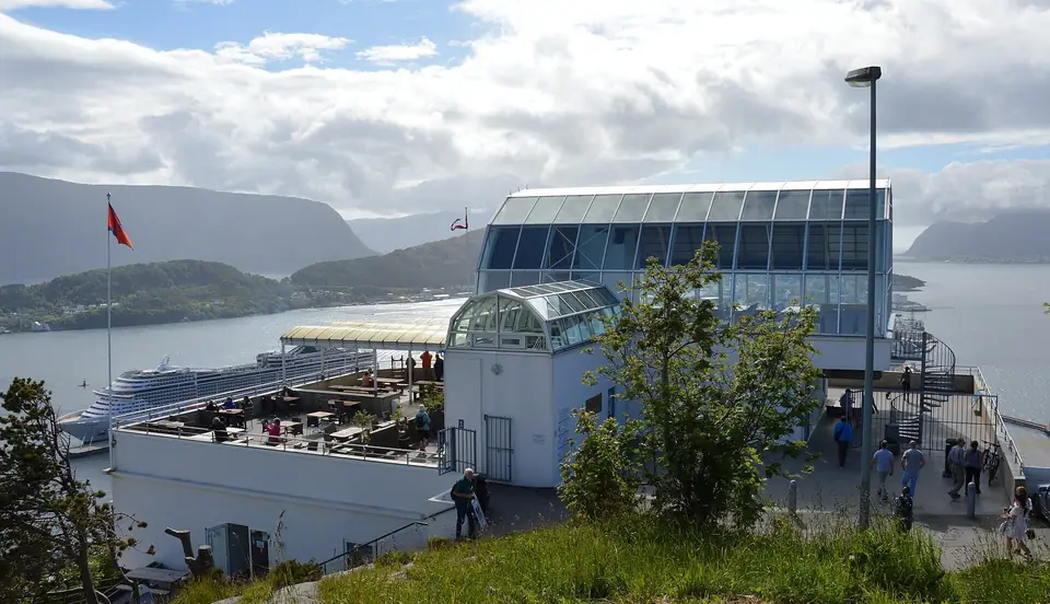
Mount Aksla, the 418 Steps, Fjellstua, and Byparken
Climb the 418 steps from Byparken up the 135-metre ridge of Mount Aksla to the Kniven lookout and Fjellstua terrace above Ålesund.
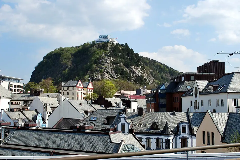
Rising 135 metres (443 feet) above the western end of Nørvøya immediately east of the town centre, Mount Aksla is Ålesund's natural balcony and wooded town mountain (byfjell). From its western cliff edge, the entire island geometry of Ålesund unfolds below: the S-curve of Brosundet separating Nørvøya from Aspøya, the stone gables and corner turrets of the 1904 to 1907 Jugendstil quarter, the twin harbour moles of Molja Lighthouse and Skateflua, the 314-metre (1,030-foot) cone of Sukkertoppen on Hessa to the west, the flat marble island of Giske and the mountain island of Godøya (497-metre Storhornet) to the northwest, and the snow-streaked peaks of the Sunnmøre Alps across Borgundfjorden to the south.
Byparken, the Gange-Rolv (Rollo) Statue, and the 1910 Kaiser Wilhelm Obelisk
The pedestrian ascent begins at the eastern edge of the town centre in Byparken, laid out on the sheltered lower slopes of Aksla above Storgata and Parkgata after the 23 January 1904 fire. Winding gravel paths, shade trees, and terraced lawns frame two historic monuments that link Ålesund to wider European history. Near the lower park stands a bronze statue of Gange-Rolv (Rollo), the 10th-century Viking founder of the Duchy of Normandy who according to Norse tradition hailed from the nearby island of Giske; gifted to Ålesund by the city of Rouen in France, the sculpture has twin casts standing in Rouen and in Fargo, North Dakota. Higher in the park stands the 1910 granite obelisk dedicated to German Emperor Wilhelm II, erected by the citizens of Ålesund to honour his immediate relief aid of four ships carrying food, medicine, and shelter materials after the 1904 conflagration removed roughly 850 wooden houses. Because Byparken sits right behind the pedestrian streets of western Nørvøya, reaching the foot of the mountain staircase takes only a few minutes on foot from Kongens gate, Skansekaia, or Hellebrua.
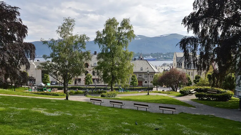
Climbing the 418 Steps Past Wartime Bunkers to the Kniven Overlook
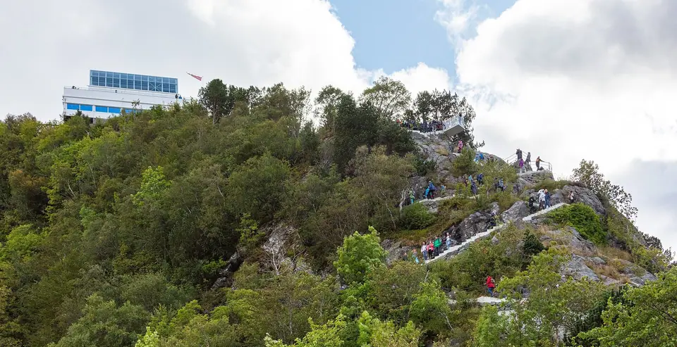
From the upper terrace of Byparken, a continuous staircase of 418 stone and concrete steps zigzags up the steep western rock face of Aksla. Equipped with sturdy steel handrails, rest benches at intervals along the switchbacks, and evening pathway lighting, the climb takes roughly 15 to 25 minutes on foot at a steady pace. Because the staircase faces due west toward the Norwegian Sea, the angle over the town changes with every switchback, gradually revealing the slate roofs along Kongens gate, the spire of the 1909 Ålesund Church on Aspøya, and the bridge of Steinvågsbrua leading to Hessa.
About two-thirds of the way up the slope, a short path leads out to a preserved Second World War German coastal defence emplacement (Kanone), part of the wartime fortifications built when occupied Ålesund served as the clandestine Shetland Bus resistance hub nicknamed Little London. Immediately above the bunker, the cantilevered steel-and-glass viewing platform at Kniven projects over the cliff face, giving walkers an unobstructed aerial angle down onto Kongens gate, Brosundet, and Aspøya. Even on breezy coastal days, the glass balustrade at Kniven shelters photographers while preserving a clear view from the harbour entrance at Molja to the inner islands of Borgundfjorden.
Fjellstua (1903), Road Access via Fjelltunvegen, and Sightseeing Options
At the top of the 418 steps on the 135-metre western brow of Aksla stands Fjellstua, founded in 1903 and recognised as the oldest restaurant and café establishment in Ålesund. Its broad outdoor viewing terrace and glass-fronted indoor café look straight down over the town rooftops and archipelago, making it a favourite stop for coffee or a traditional Sunnmøre svele after the climb. Visitors who prefer not to tackle the 418 steps on foot can reach the upper plateau by car, taxi, or seasonal sightseeing train from the Skansekaia cruise quay by following Borgundvegen and turning up Fjelltunvegen to the parking area immediately behind Fjellstua. In summer and autumn, late-evening light lingers across the islands well after dinner, while winter dusk illuminates the street grid along Brosundet against the dark fjord water. Many travellers staying in central Ålesund climb the stairs twice during a visit: once in clear morning light to trace the surrounding islands and fjords, and a second time at twilight when the harbour lamps reflect along the sound.
Ridge Trails East to Rundskue and Borgundgavlen
While many visitors stop at Fjellstua and descend the staircase back to Byparken, Mount Aksla extends four kilometres east as a wooded ridge laced with signposted gravel walking paths (turveier) used year-round by locals for running and afternoon strolls. Continuing east past the radio mast brings you to Rundskue, a circular stone orientation table with 360-degree views across Nørvøya, Ellingsøyfjorden, and Borgundfjorden, and onward down the eastern spine of the hill to Borgundgavlen, where you can visit the 55 historic buildings of Sunnmøre Museum and return to the centre by FRAM local bus. Along the ridge, sheltered pine woods alternate with rocky clearings where benches face south across the fjord toward the jagged skyline of the Sunnmøre Alps, allowing you to turn a short viewpoint climb into a peaceful half-day walk across the length of Nørvøya. Footpaths are well graded and lit along the main recreational loops, so walkers in sturdy everyday shoes can comfortably link Fjellstua, Rundskue, and Borgundgavlen in dry weather.
- Byparken Trailhead: Starts at the top of Storgata on Nørvøya, five minutes on foot from Hellebrua, Kongens gate, and the Skansekaia coastal steamer pier, passing the Rollo statue and 1910 Kaiser Wilhelm II obelisk.
- Kniven and Fjellstua (135 m): Reached via the 418 steps or by road along Fjelltunvegen, overlooking Brosundet, Aspøya, Hessa, Giske, and Godøya.
- Rundskue Viewpoint: Continues east along the wooded ridge trail with panoramic views over Nørvøya, Ellingsøyfjorden, and Borgundfjorden.
- Borgundgavlen Trail: Follows gravel paths along the spine of Aksla down to Sunnmøre Museum and medieval Borgund Church (4 kilometres east of the centre), with frequent local buses back to Brosundet.
- Fjelltunvegen Road Access: Paved hillside road ascending from Borgundvegen to the parking area behind Fjellstua for visitors arriving by car, taxi, or seasonal sightseeing train from Skansekaia.
- Wartime Emplacements and Bastions: Preserved Second World War concrete observation posts and coastal defence positions along the western brow of Aksla below Kniven and Fjellstua.
Traveller tips
Real advice from people who have been to Mount Aksla, the 418 Steps, Fjellstua, and Byparken. Every tip is read by our team before it goes live.
No tips yet. Been here? Yours could be the first.
Thank you! Your tip will appear here after a quick review.
More in Ålesund
Continue exploring Ålesund with related neighbourhood, food, and planning guides
Vigra Airport (AES), Hurtigruten, Rail-Bus Links, and Subsea Tunnels
Ålesund, Norway
Best Areas to Stay: Brosundet, Aspøya, Kongens gate & Skansekaia
Ålesund, Norway
Sunnmøre Coastal Climate, Fjord Seasons, and Slinningsbålet
Ålesund, Norway
Three-Day Ålesund, Atlantic Islands, and Fjord Itinerary
Ålesund, Norway
