Geirangerfjord UNESCO Cruise and Trollstigen Excursion
Take a full-day excursion from Ålesund into the 15-kilometre UNESCO-listed Geirangerfjord past the Seven Sisters waterfall and over Trollstigen.
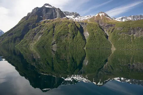
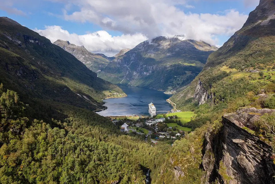
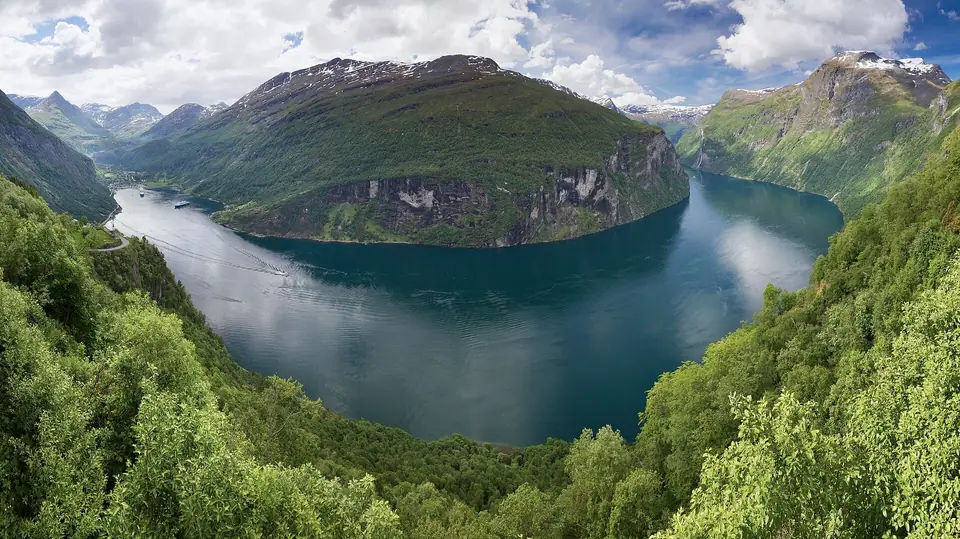
Roughly 100 kilometres inland from Ålesund at the innermost end of the Storfjorden and Sunnylvsfjorden system lies Geirangerfjorden, a 15-kilometre-long S-shaped fjord in Stranda Municipality that measures between 600 and 1,500 metres wide and reaches depths of 600 to 700 metres. On 14 July 2005, a 498-square-kilometre area encompassing Geirangerfjorden (jointly with Nærøyfjorden) was inscribed on the UNESCO World Heritage List as the West Norwegian Fjords. Since the first tourist steamer sailed into Geiranger in 1869, its sheer basalt and gneiss walls, hanging waterfalls, and cliff-ledge mountain farms have made it the classic full-day excursion from Ålesund.
The Seven Sisters, The Suitor, and the Bridal Veil Waterfalls
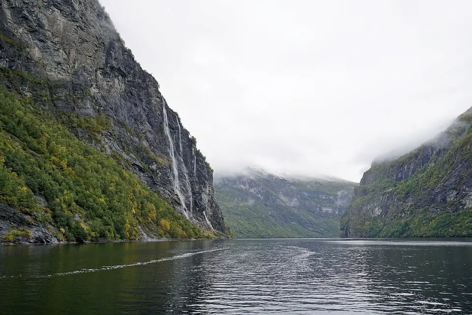
As passenger catamarans, coastal express ships, and car ferries glide through the 15-kilometre channel between Hellesylt at the mouth of Sunnylvsfjorden and Geiranger village at the head of the fjord, three celebrated waterfalls plunge directly down the near-vertical rock walls into the salt water. On the northern cliff face, the Seven Sisters (De syv søstrene, also called Knivsflåfossene) drop in seven separate silver ribbons side by side, reaching their fullest volume during the snowmelt of late May, June, and July. Directly opposite on the southern wall, The Suitor (Friaren) roars down a cleft in the dark gneiss in a bottle-shaped cascade, while further west toward Hellesylt the delicate Bridal Veil (Brudesløret) fans across a high rock shelf that catches the midday sun.
Abandoned Cliffside Farms: Knivsflå, Blomberg, and Skageflå
High above the fjord on narrow green ledges cling historic mountain farms where families cultivated barley, cut hay on precipitous slopes, and tethered children with ropes so they would not tumble over the cliff edge. Accessible only by steep zigzag footpaths and rope ladders pulled up when tax collectors approached, farms such as Knivsflå (abandoned due to rockfall risk above the Seven Sisters), Blomberg, Matvik, Horvadrag, and Skageflå (abandoned in 1916 and visited by King Harald V and Queen Sonja for their silver wedding anniversary in 1993) have been carefully restored by the voluntary association Storfjordens Venner. Hikers arriving in Geiranger can take a water taxi to Homlong or Skagehola and hike up to the timber buildings of Skageflå for views straight across to the Seven Sisters.
Flydalsjuvet, Geirangervegen (1889), and Ørnevegen (Eagle Road)
At the head of the fjord, the Geirangelva river tumbles past the octagonal wooden Geiranger Church and the Norwegian Fjord Centre into Geiranger village below two famous mountain road lookouts. To the south, the historic Geirangervegen (opened in 1889 toward Djupvasshytta and the 1,500-metre Dalsnibba viewpoint) climbs past Flydalsjuvet, a canyon ledge overlooking the entire village and inner basin. To the north, County Road 63 ascends the northern wall via Ørnevegen (the Eagle Road, opened in 1954 and kept open year-round) through 11 tight hairpin bends to the cantilevered waterfall platform at Ørnesvingen, where travellers look back down the full bend of Geirangerfjorden toward the Seven Sisters before descending through Eidsdal to the Eidsdal to Linge car ferry across Norddalsfjorden into Valldal.
Trollstigen's 11 Hairpin Bends and the 320-Metre Stigfossen Waterfall
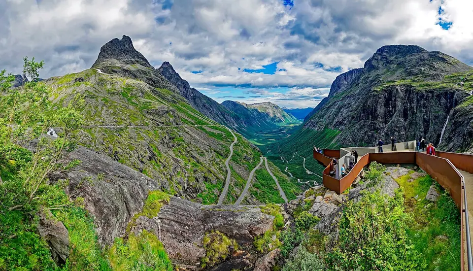
North of strawberry-growing Valldal along the Valldøla river and Gudbrandsjuvet gorge, County Road 63 climbs through glacial valleys to its 850-metre mountain pass at Alnesreset before descending Trollstigen (the Troll's Path, opened by King Haakon VII in 1936 after eight years of construction) toward Åndalsnes in Rauma Municipality. Engineered on a steep 10% gradient with 11 stone-walled hairpin bends carved into the cliff face and a narrow masonry bridge spanning the 320-metre Stigfossen waterfall, Trollstigen features a modern concrete-and-Corten-steel visitor plateau at 700 metres with cantilevered viewing balconies hovering above the switchbacks. Because of the tight turning radii on the 11 bends, vehicles longer than 12.4 metres are prohibited from driving Trollstigen.
Storfjorden Ferry Crossings and Ways to Visit from Ålesund
While Geirangerfjorden itself can be reached year-round by fjord cruise or via the Stranda to Liabygda and Eidsdal to Linge ferries, the upper mountain pass of Trollstigen on County Road 63 closes each autumn for winter snow and typically opens from mid-May to October; always check the official Norwegian Public Roads Administration (Statens vegvesen) status before setting out. On every regional fjord ferry crossing along the route, the onboard café serves freshly baked Sunnmøre sveler folded around buttercream or brunost.
- Direct Fjord Catamaran or Hurtigruten from Skansekaia: Sail directly from Skansekaia in Ålesund through Storfjorden and Sunnylvsfjorden into Geirangerfjorden without needing a car, passing Hellesylt, the Bridal Veil, the Suitor, and the Seven Sisters before docking at Geiranger village.
- Full-Day Car and Ferry Loop (Mid-May to October): Drive south from Ålesund via Hellesylt (or combine with Hjørundfjorden and Norangsdalen), take the scenic Hellesylt to Geiranger car ferry past the waterfalls, pause at Flydalsjuvet, climb the 11 bends of Ørnevegen, cross the Eidsdal to Linge ferry into Valldal, and continue over the 850-metre pass and 11 hairpin bends of Trollstigen toward Åndalsnes before returning west along E136.
- Key Stops Along County Road 63: Flydalsjuvet canyon ledge, the 1889 Geirangervegen climb, the Ørnesvingen waterfall balcony at the top of Ørnevegen's 11 bends, the Eidsdal to Linge ferry over Norddalsfjorden, Gudbrandsjuvet gorge in Valldal, and the 700-metre Trollstigen visitor plateau overlooking the 320-metre Stigfossen waterfall.
- Skageflå Cliff-Farm Hike: Take an early water taxi from Geiranger village out to Skagehola beneath the Seven Sisters waterfall and hike the steep mountain path up to the restored 1916 farmstead ledges at Skageflå before continuing back to Geiranger via Homlong.
When planning this full-day circuit from Ålesund, starting early in the morning allows you to reach Hellesylt or Valldal ahead of midday tour coaches and gives you time to walk out onto all the cantilevered viewing platforms at Flydalsjuvet, Ørnesvingen, Gudbrandsjuvet, and the Trollstigen plateau. Outside the mid-May to October opening window for the Trollstigen pass, travellers can still sail the full 15-kilometre length of Geirangerfjorden from Ålesund or drive County Road 63 via the Eidsdal to Linge ferry and the 11 hairpin bends of Ørnevegen right down into Geiranger village. Along the return drive on European route E136 from Åndalsnes along Romsdalsfjorden and over Ørskogfjellet back to Nørvøya and central Brosundet, evening views open across the northern side of Storfjorden toward the outer islands, rounding out a complete circuit of Sunnmøre and Romsdal between fjord level and alpine pass.
Traveller tips
Real advice from people who have been to Geirangerfjord UNESCO Cruise and Trollstigen Excursion. Every tip is read by our team before it goes live.
No tips yet. Been here? Yours could be the first.
Thank you! Your tip will appear here after a quick review.
More in Ålesund
Continue exploring Ålesund with related neighbourhood, food, and planning guides