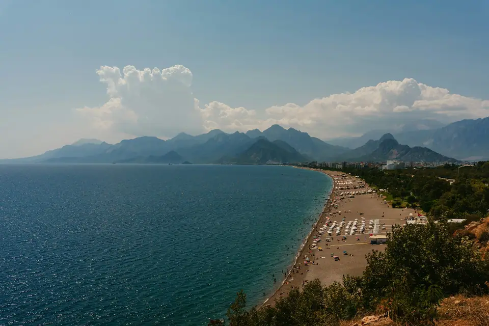
Photo by Igor Sporynin on Unsplash
Antalya Beaches Guide
A practical guide to choosing between urban pebble shores, soft sand dunes, and secluded ancient coves along Antalya's coastline.
Antalya's coastline measures 640 km including curves and 500 km in a straight line, offering varied bathing spots from city strands to ancient bays.
Urban pebbles along Konyaaltı
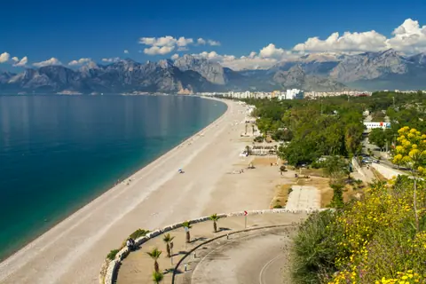
Konyaaltı Beach occupies the western edge of Antalya. The shoreline runs for 7 km between the city cliffs and the rising Beydağları Mountains. Official records note that Konyaaltı Beach begins 3 km west of the municipal core. The beach itself is a mix of sand and smooth pebbles. The backdrop of sheer mountain crests provides impressive scenery right from the water.
Because the foreshore consists of pebbles and shingle rather than fine silt, the sea stays remarkably transparent. Swimmers who value clear water often favour this western rim of the gulf. The coastal strip contains municipal zones together with serviced beach clubs. City transport runs frequently towards the promenade, making it easy to reach from central neighbourhoods. If you are deciding where to stay in Antalya, the western districts provide swift access to this shore.
Many Turkish swimming spots hold the Blue Flag designation. This voluntary sustainability programme evaluates beaches, marinas, and tourism boats. Qualifying for a Blue Flag requires satisfying environmental, educational, safety, and accessibility standards. Awarded sites must deliver environmental education activities. They also maintain displays detailing regional biodiversity, coastal ecosystems, and environmental phenomena. Swimmers must observe local beach safety notices, because a red flag indicates swimming is forbidden.
The rocky floor shelves steeply into deep water within a few paces. Wearing sturdy water shoes makes walking across the loose stones much easier.
Golden sands at Lara
Lara Beach lies about 12 km to the east of Antalya city centre. In contrast to the pebbled western shore, Lara presents an expansive coastal zone renowned for soft golden sand. The gentle slope into the sea makes it a favourite choice for swimmers who prefer fine ground underfoot.
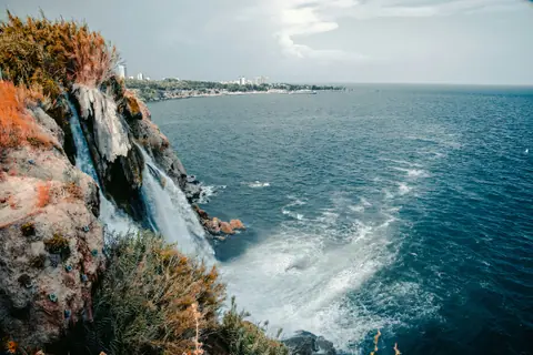
Lara also sits close to Lower Düden Waterfall. The cascade plunges into the Mediterranean from a travertine threshold approximately forty metres high. The water flowing through the upper drop originates upstream from the Kepez hydroelectric power plant. Travellers can consult our Antalya travel guide to see how regional geology influences these coastal landmarks.
City public transport vehicles link the historical centre directly with the Lara district. The wide sandy bank continues eastward towards resort hotels, but extensive public areas remain open to daytime visitors. The open sand absorbs considerable summer heat. Packing sun protection and suitable sandals is advisable when crossing the dunes in the middle of the day.
Regular sea breezes along this eastern flank offer welcome ventilation during hot afternoons. The soft shoreline allows comfortable sunbathing, though afternoon gusts can occasionally blow loose sand across open towels.
Ancient harbours of Phaselis
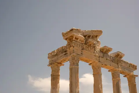
Phaselis is located 18 kilometres southwest of Kemer and about 58 kilometres southwest of Antalya. Settlers from Rhodes established this maritime outpost in the seventh century BCE. Today, the ruined harbour provides an atmospheric swimming setting where bathers enter the sea next to classical stone structures.
The archaeological park contains three sheltered marine basins. The North and Central ports sit adjacent to one another. Reaching the South Port involves a 10 to 15 minute walk through the ancient city ruins. Pine woods shade the forest avenues leading past aqueducts, stone agoras, and theatre steps. Bathing in the sea after viewing these Roman ruins gives pleasant relief on warm afternoons.
The enclosed coves keep the water exceptionally calm compared with open coastal stretches. Low gradients make the sandy coves gentle for wading. Swimmers must still exercise caution around submerged heritage masonry. Hidden rocks or shallow depths can cause serious injury or death, and people should not dive into unknown water. Moving carefully prevents scratches on underwater stones.
The fragrant pine groves run directly down to the tide line, offering natural shelter from bright sunshine. Exploring the area combines leisurely walking along packed earth paths with wading through calm coves.
Protected nature at Olympos and Adrasan
Olympos is located 85 kilometres southwest of Antalya city centre and 45 kilometres from Kemer district centre. Founded in the third century BC, the settlement provided a base for pirates in the first century BC due to its sheltered position. Roman commander Servilius Isauricus captured Olympos in 78 BC, turning it into a Roman city.
Its surviving ruins include an acropolis on a high hill, protective city walls, a theatre, and remnants of a bridge. The Olympos archaeological site is open every day, and the Museum Pass is valid for Turkish citizens. The Mediterranean coast here provides a natural spawning ground for Caretta carettas. The valley attracts travellers seeking a peaceful holiday away from crowded beaches and all-inclusive hotels, with accommodation in a tent or treehouse.
Just south of Olympos lies Adrasan Bay. The coastal crescent here features a 2-kilometer-long beach, while official surveys record that Adrasan spans 2.5 km of shore made mostly of sand and shingle. A clear blue sea fills the wide crescent. Underwater visibility can reach up to 25 metres on a clear day, attracting swimmers and snorkellers. Two kilometres offshore between the Adrasan coast and Taşlıkburnu lies Suluada. The island has no settlements, allowing all kinds of fish of the Mediterranean ecosystem to thrive in its surrounding waters.
The secluded setting of these southern bays retains a peaceful rural quality. Steep green peaks encircle the shingle shoreline, shielding bathers from heavy open sea swells.
Cleopatra Beach and Incekum in Alanya
Cleopatra Beach is famous for its golden sands on the eastern coast of Antalya, situated within Alanya. The beach is roughly 2 km long, very wide, and features fine sand with a shallow sea. Tradition recounts that this shore hosted Cleopatra and her lover the Roman General Mark Antony. The sands stretch along the western foot of the high promontory that carries Alanya Castle.
Alanya benefits from coastal breezes that permit water sports across every season. Windsurfing at Cleopatra Beach is particularly popular thanks to steady air currents off the Mediterranean. Anyone planning water sports should book activities at a licensed water sports centre. Complete the necessary paperwork, request a safety demonstration, and make sure you know how to call for help before setting out. Take care when swimming, as some beaches may have strong undercurrents.
About 20 km west of Alanya lies İncekum Beach. This natural strand offers fine sand backed by a pine forest. The seabed deepens very gradually, creating an accessible swimming area along the coastal highway. The surrounding trees release a fresh scent across the sandbars.
The combination of shallow depths and soft sand makes İncekum convenient for relaxed family bathing. Rocky headlands frame the ends of the cove, moderating the force of coastal waves.
Expansive sands at Patara and western bays
Patara Beach sits at the far western boundary of Antalya province. Official ministry data describes Patara as Turkey's greatest coastal expanse, running 15 kilometres in length and 800 metres across. Its sweeping dunes create an impressive coastal landscape that rolls directly into the Mediterranean surf.
Further east along the Lycian shore near Kaş, intimate coves replace open sand sheets. Big Pebble Beach is a 15-minute walk east from Kaş town centre. Across the harbour bay, Limanağzı Beach has 4 beach clubs that can be reached by a boat service from the Old Harbour. Further inland, Kalkan occupies land that belonged to the Lycian civilisation about 3,000 years ago.
Sea conditions change considerably along this western fringe. Every year people drown in the sea and swimming pools in Turkey. Always supervise children, even if they can swim or there is a lifeguard present. Deciding where to swim depends on personal preference for classical ruins, deep transparent water for snorkelling, or vast sand dunes.
The immense scale of Patara guarantees abundant space even during high summer. Consistent coastal winds generate rolling breakers, making sea bathing here more energetic than in sheltered bays.
Where it is
- 1Antalya
- Antalya International Airport (AYT) · about 8 km from Antalya in a straight line
- Directions in Google Maps
Stations and taxi ranks: OpenStreetMap. Airports: OurAirports. Distances are in a straight line.
Traveller tips
Real advice from people who have been to Antalya. Every tip is read by our team before it goes live.
No tips yet. Been here? Yours could be the first.
Thank you! Your tip will appear here after a quick review.
More in Antalya
Continue exploring Antalya with related neighbourhood, food, and planning guides