


























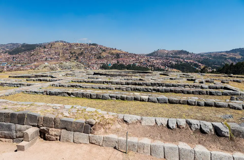
Sacsayhuamán, Q’enqo, Puka Pukara and Tambomachay Ruins
Visit the four Inca archaeological sites on the hills north of Cusco, Sacsayhuamán, Q’enqo, Puka Pukara, and Tambomachay, covered on Circuit I of the BTC.
Stretching across the high limestone plateau north of Cusco between 3,600 and 3,765 metres above sea level, four connected Inca sites guard the upper approaches from the Sacred Valley: Sacsayhuamán, Q’enqo, Puka Pukara, and Tambomachay. All four are included on Circuit I of the Boleto Turístico del Cusco (BTC) as well as the full 16-site General Ticket. The easiest and most scenic way to visit them in a single morning is to take a licensed taxi 8 kilometres up the Pisac highway to the highest ruin, Tambomachay, and walk downhill from site to site back into the historic centre.
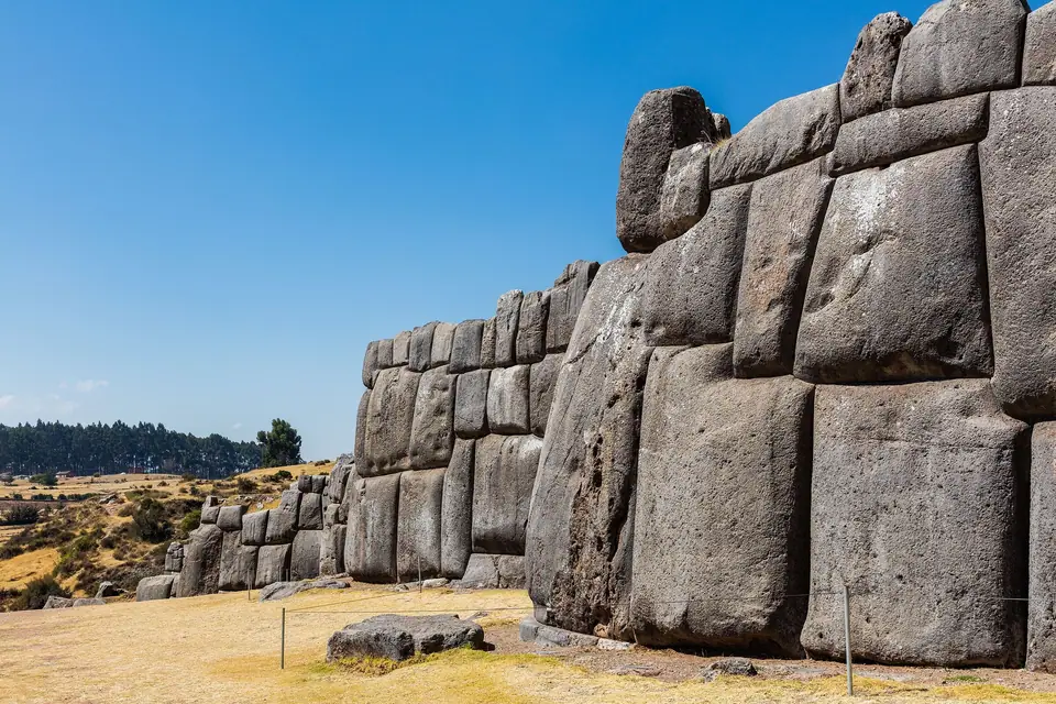
Sacsayhuamán (3,701 Metres)
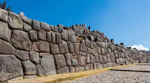
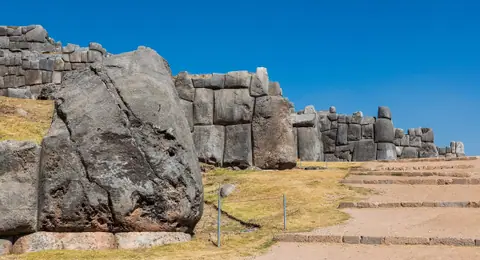
Located 2 kilometres north of Plaza de Armas, Sacsayhuamán (from Quechua Saksay waman, meaning royal falcon) was begun under Sapa Inca Pachacuti in the 15th century and completed under Topa Inca Yupanqui and Huayna Capac. In Pachacuti’s urban plan, which shaped Cusco in the silhouette of a crouched puma, Sacsayhuamán formed the puma’s jagged head. Spanish chroniclers Pedro Cieza de León and Inca Garcilaso de la Vega marvelled at its three parallel zigzag terrace walls, which run for nearly 400 metres along the northern side of a grassy ceremonial esplanade (Chuckipampa). The largest Yucay limestone monoliths in the lowest wall stand over 8.5 metres high and weigh more than 125 tonnes, bevelled and fitted without mortar.
Muyuq Marka and the Rodaderos
Above the bastions lie the circular stone foundations of Muyuq Marka, one of three towers torn down after the 1536 siege in which Manco Inca fought Juan Pizarro on these walls. Across the esplanade, polished diorite outcrops called Rodaderos form natural stone slides.
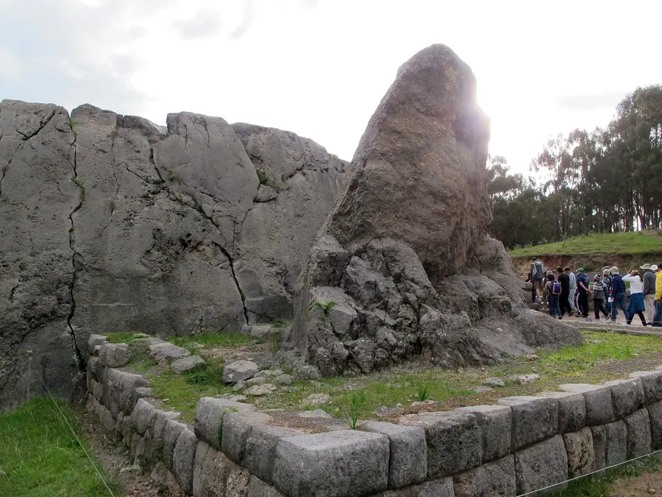
Q’enqo (The Carved Limestone Huaca)
Roughly 1.5 kilometres east of Sacsayhuamán along the ridge road, Q’enqo (Quechua for zigzag) is one of the largest natural rock sanctuaries (huacas) in the Cusco region. Rather than building freestanding walls, Inca stonecutters sculpted an existing limestone outcrop with serpentine libation channels, a semicircular amphitheatre lined with 19 trapezoidal niches, and a cool subterranean passage leading to a carved ceremonial altar used for solstice observations and mummification rituals.
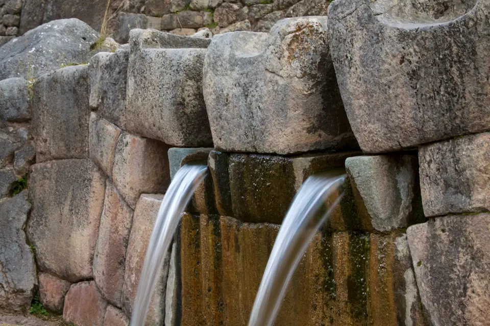
Puka Pukara and Tambomachay
Further up the highway at 3,680 to 3,765 metres sit two paired sites facing each other across the valley. Built of iron-rich limestone that glows reddish-pink in late-afternoon light, Puka Pukara (Red Fortress) served as a terraced military checkpoint, lodging house (tambo), and retinue quarters controlling the Antisuyu road into Cusco. Tucked into a quiet ravine 500 metres uphill, Tambomachay (El Baño del Inca) channels natural thermal and mountain springs through four stepped masonry terraces and three twin stone waterfalls that still flow at identical rates today, reflecting the Inca veneration of water. From Sacsayhuamán, follow the footpath past Cristo Blanco and San Blas back to the city.
Traveller tips
Real advice from people who have been to Sacsayhuamán, Q’enqo, Puka Pukara and Tambomachay Ruins. Every tip is read by our team before it goes live.
No tips yet. Been here? Yours could be the first.
Thank you! Your tip will appear here after a quick review.
More in Cusco
Continue exploring Cusco with related neighbourhood, food, and planning guides
Things to Do in Cusco: Inca Walls, Colonial Plazas and Andean Citadels
Cusco, Peru
How to Get to Cusco: Velasco Astete Airport, Trains and Taxis
Cusco, Peru
Best Time to Visit Cusco: Dry Andean Winters, Inti Raymi and Rainy Months
Cusco, Peru
Where to Stay in Cusco: Historic Centre, San Blas and San Cristóbal
Cusco, Peru
