


























Getting Around Mexico City: Metro, Metrobús, Tarjeta MI, Ecobici and Cablebús
How to use the Tarjeta de Movilidad Integrada across the twelve Metro lines, Metrobús Line 7 on Reforma, Ecobici bikes, Cablebús gondolas, and ride-hailing apps.
With more than twenty-one million people across the metropolitan valley, surface road traffic in Mexico City can grind to a crawl during morning and early evening commuting peaks and during summer afternoon rainstorms. Fortunately, the capital operates an integrated, inexpensive public transport network Unified under the Movilidad Integrada (MI) system, pairing deep-level Metro lines with dedicated-lane Metrobús corridors, aerial Cablebús gondolas, the southern Tren Ligero light rail, and Latin America's largest bike-share scheme.
The Tarjeta de Movilidad Integrada (MI Smartcard)
One rechargeable contactless smartcard, the Tarjeta de Movilidad Integrada, pays fares across the Metro, Metrobús, Cablebús, Tren Ligero, RTP buses, Trolebús, and Ecobici. Purchase and top up the card at automated vending machines inside any Metro or Metrobús station (including at Benito Juárez International Airport on Metrobús Line 4) or via the official App CDMX on NFC-enabled smartphones. The Metro has phased out paper tickets across all twelve lines, so keep your MI card loaded with pesos; a single card can be tapped sequentially for multiple passengers on the Metro and Metrobús, though having one card per traveller is smoother at turnstiles.
Navigating the Twelve-Line Mexico City Metro
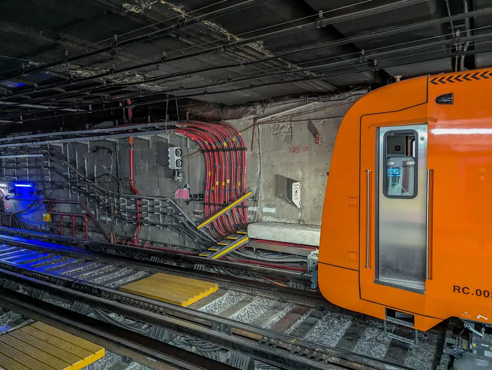
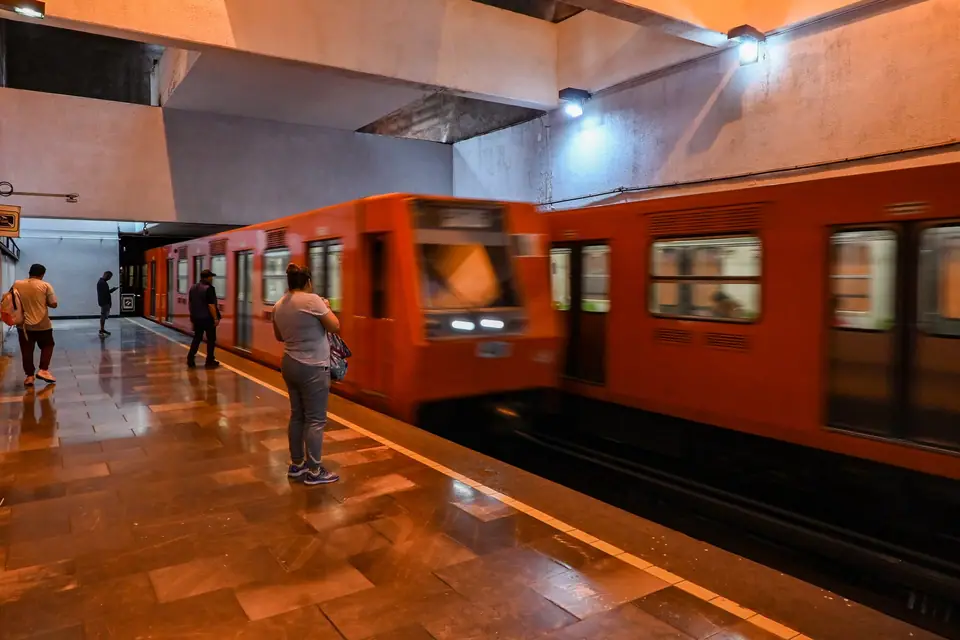
Inaugurated on 4 September 1969 and operated by the Sistema de Transporte Colectivo (STC), the Mexico City Metro spans twelve colour-coded and numbered lines (Lines 1 to 9, Line 12, and lettered Lines A and B) across 195 stations and roughly 226 kilometres of track, running quietly on pneumatic rubber tyres on most lines. Every station features a bold graphic pictogram designed originally under Lance Wyman's 1968 design programme to represent local history or landmarks (such as the grasshopper for Chapultepec or the eagle at Zócalo/Tenochtitlan). Four lines handle almost all visitor sightseeing:
- Line 1 (Pink): Runs east-west beneath Avenida Chapultepec and the historic centre from Pantitlán through San Lázaro (TAPO), Pino Suárez, Salto del Agua, Insurgentes (Roma Norte), Sevilla, and Chapultepec to Tacubaya and Observatorio.
- Line 2 (Blue): Links Cuatro Caminos through Hidalgo, Bellas Artes, Allende, and Zócalo/Tenochtitlan straight south to General Anaya, Coyoacán-area transfers, and Tasqueña (for the Tren Ligero to Xochimilco).
- Line 3 (Olive Green): Runs north-south from Indios Verdes and Deportivo 18 de Marzo through Hidalgo, Juárez, Balderas, Hospital General, Centro Médico, Coyoacán, and Viveros to Universidad (UNAM).
- Line 7 (Orange): Runs along the western edge of the city through Auditorio and Polanco stations in Polanco.
During weekday rush hours, the first carriages of every Metro train (and designated platform sections on the Metrobús) are reserved exclusively for women and children under twelve, clearly marked with pink signage on the platform floor.
Metrobús Lines 1 and 7, Cablebús and Tren Ligero
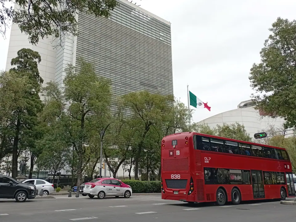
Above ground, red-and-white Metrobús bus rapid transit vehicles travel in physically segregated lanes that bypass car congestion. Two routes are particularly useful for travellers: Metrobús Line 1 runs straight north-south down Avenida de los Insurgentes from Indios Verdes past Reforma, Roma, Condesa, Coyoacán/San Ángel, and Ciudad Universitaria (UNAM), while Metrobús Line 7 uses red double-decker Alexander Dennis Enviro500 buses along Paseo de la Reforma from Campo Marte (past the National Museum of Anthropology and Chapultepec Castle) through the historic centre to the Basilica of Guadalupe at Garrido/Indios Verdes.
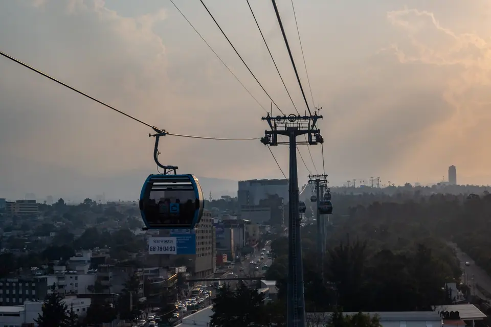
In 2024, the city opened Cablebús Line 3, a 5.5-kilometre aerial gondola linking Los Pinos/Constituyentes (at the edge of Chapultepec's First Section) across the Second, Third, and Fourth Sections of Chapultepec Park to Vasco de Quiroga. In the south, the Tren Ligero (Xochimilco Light Rail) runs thirteen kilometres across eighteen stations from Metro Tasqueña past Estadio Azteca to Xochimilco terminal.
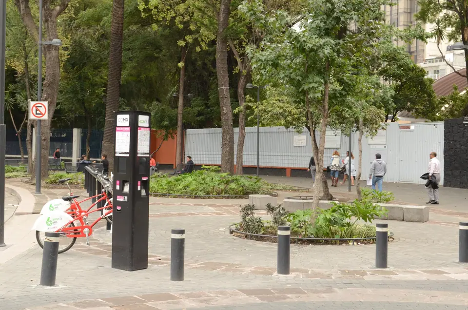
Ecobici Bike-Share, Muévete en Bici and Safe Taxis
Launched in February 2010, the Ecobici bicycle-sharing network operates more than nine thousand black-and-white bicycles across nearly seven hundred docking stations in Cuauhtémoc, Miguel Hidalgo, Benito Juárez, Coyoacán, Álvaro Obregón, and Azcapotzalco, with protected cycle lanes along Reforma, Avenida Chapultepec, Álvaro Obregón, and Nuevo León. Visitors can purchase one-day, three-day, or seven-day passes in the Ecobici app. Every Sunday morning, the city's Muévete en Bici programme closes Paseo de la Reforma and connecting avenues to cars for cyclists and pedestrians. After dark or when carrying luggage, do not hail roving pink-and-white street taxis; instead book via Uber, DiDi, or an official sitio dispatch stand.
Traveller tips
Real advice from people who have been to Getting Around Mexico City: Metro, Metrobús, Tarjeta MI, Ecobici and Cablebús. Every tip is read by our team before it goes live.
No tips yet. Been here? Yours could be the first.
Thank you! Your tip will appear here after a quick review.
More in Mexico City
Continue exploring Mexico City with related neighbourhood, food, and planning guides

What to Eat in Mexico City: Tacos al Pastor, Chilaquiles, Pozole, Tlacoyos and Churros
Mexico City, Mexico
Zócalo and Centro Histórico: Tenochtitlan's Templo Mayor, Cathedral and Palaces
Mexico City, Mexico
Chapultepec Park, Chapultepec Castle and the National Museum of Anthropology
Mexico City, Mexico
Coyoacán, Frida Kahlo Museum (La Casa Azul) and San Ángel Guide
Mexico City, Mexico
