Toronto Islands Guide
Ferry, beaches, bike paths and the classic skyline view across the harbour.
The Toronto Islands are a chain of low, sandy islands that shelter the harbour, and they are the easiest way out of the city without leaving it. They were a peninsula until a storm in the 1850s cut the channel, and they have since become parkland, a small residential community, an amusement park and a beach. Cars are not allowed, which is the whole point: the soundtrack is bike bells, gulls and the ferry horn, with a skyline hanging on the horizon.
Getting there and choosing a dock
Ferries leave from the Jack Layton Ferry Terminal at the foot of Bay Street, a few minutes from Harbourfront and reachable by streetcar from Union Station. Three routes serve three docks: Centre Island, Ward's Island and Hanlan's Point. Timetables, fares and winter service change, and boats can be delayed by wind, ice or mechanical problems, so use the City of Toronto's official page and allow slack. Queues build on warm weekends, so aim to be on the first sailings, particularly if you want to hire bikes.
Centre, Ward's or Hanlan's
Centre Island is the easy first choice. It has a long pier, a main boardwalk, bike and boat hire, a small amusement park for children, and a farm with animals. It is also the busiest dock on a summer day. Ward's Island, at the eastern end, is the quietest of the three and has a village of small cottages and flower gardens along car-free lanes, which feels like another town altogether. Hanlan's Point on the west has the lighthouse at Gibraltar Point, among the oldest surviving lighthouses in the Great Lakes, and a long beach with a clearly signposted clothing-optional section. Billy Bishop airport lies next to it, so low planes pass overhead.
Making a day of it
The paths are flat and linked, so a bicycle makes the whole chain manageable. A sensible plan is to ride in from Centre Island towards Ward's, stop for a swim or a picnic, then walk the boardwalk toward the east tip for the best skyline view. Do not expect much food variety; a few cafés and kiosks serve basic meals and queues are long on hot Saturdays, so bring a picnic and water.
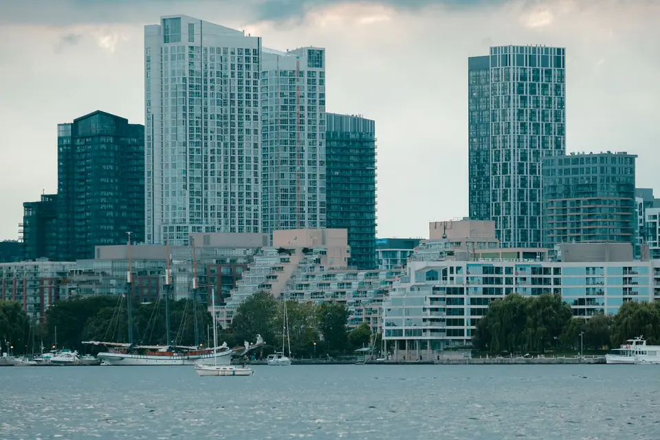
The classic photograph of the CN Tower and the downtown towers is taken from the island shore, which makes the crossing a better way to see the skyline than the tower itself. Late afternoon gives the warmest light, and the water view on the return sailing is the one visitors usually remember. Pack sunscreen and a refillable bottle, since shade is patchy on the open beaches and the paths between docks.
Weather and what to skip
Treat the Islands as a flexible day. In summer it can be sunny on the city side and breezy over the water, so pack a light layer; in spring and autumn the shoreline is cooler than downtown. Winter is possible, with frozen paths and empty beaches, but ferry service is thinner. Our best time to visit guide sets out the seasons. If forecasts are poor, move the day rather than going anyway; a grey ferry ride with no view is a poor use of half a day.
Skip the island if you only have a few spare hours, because the crossing and the walking eat the time. Families may prefer a day here to the aquarium in fair weather, while cyclists should consider combining it with a lakefront ride the next day. Read our getting around guide for how ferries, streetcars and cycling fit together, and remember that last boats back are fixed, so check the final sailing before you wander to the far end of the island.
Traveller tips
Real advice from people who have been to Toronto Islands. Every tip is read by our team before it goes live.
No tips yet. Been here? Yours could be the first.
Thank you! Your tip will appear here after a quick review.
More in Toronto
Continue exploring Toronto with related neighbourhood, food, and planning guides