Bryggene Wharves, the Nidelva River and Ravnkloa Canal
Discover Trondheim's four protected rows of 18th-century Bryggene wooden warehouses, the salmon-rich lower Nidelva river, and Ravnkloa square.
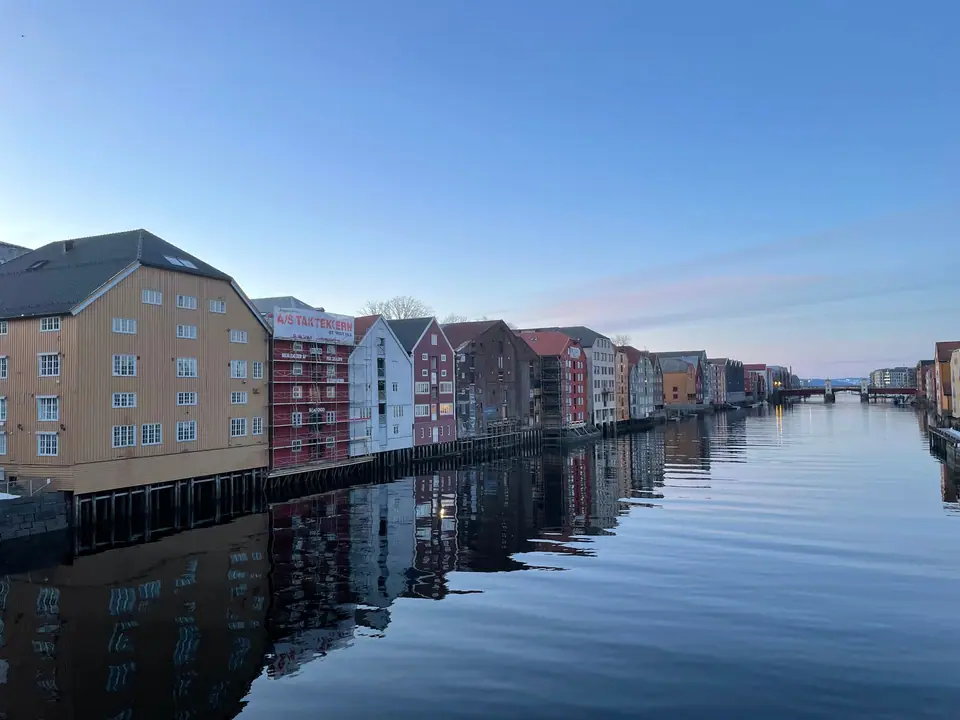
Along the final curve of the Nidelva river and the northern canal waterfront stand the Bryggene i Trondheim, four rows of historic timber maritime warehouses designated by the Norwegian Directorate for Cultural Heritage (Riksantikvaren) as a cultural environment of national interest. In Trøndelag, the word brygge denotes what other parts of Norway call a sjøbod: a multi-storey timber storehouse built directly at the water's edge on wooden pilings so cargo vessels could tie up beneath the gable hoists and unload fish, grain, salt, and timber straight into the lofts.
The Four Wharf Rows: Kjøpmannsgata, Bakklandet, Fjordgata, and Sandgata
Trondheim's surviving wharf rows take their names from the streets running behind them: Kjøpmannsgatebryggene on the west bank of the Nidelva, Bakklandsbryggene opposite them on the east bank, and Fjordgatebryggene and Sandgatebryggene facing the northern canal harbour.
Log Timber Construction and Symmetrical Hoist Gables
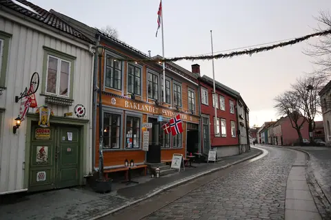
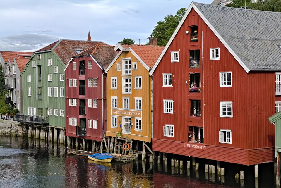
Built mostly of notched log timber (laftet tømmer) clad in vertical or horizontal weatherboarding painted ochre, iron-oxide red, terracotta, and sage green, every warehouse turns its narrow gable end toward the water and stretches back toward the street. Symmetrical water-facing gables feature central vertical rows of double loading doors topped by a pulley beam under pitched or half-hipped roofs. The oldest surviving river warehouses along Kjøpmannsgata and Bakklandet date from the first half of the 18th century following the fires of 1681 and 1708, forming a unique historic river-harbour ensemble in Norway.
The Nidelva River: From Selbusjøen to the Trondheimsfjord
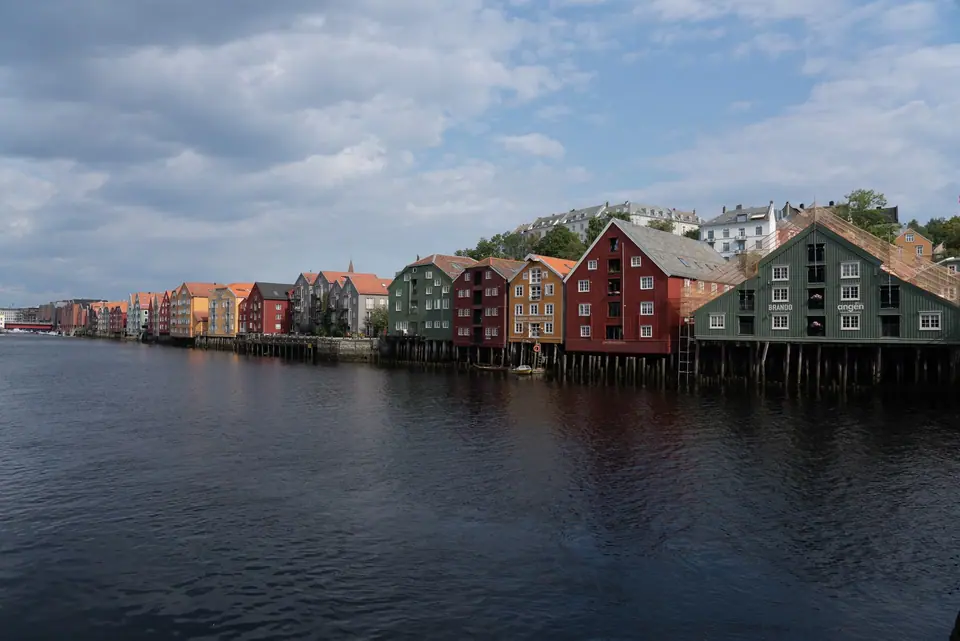
The waterway that shaped these wharves is the Nidelva, a 30- to 31.2-kilometre river that begins at the Hyttfossen waterfall below Bjørsjøen at the western end of Lake Selbusjøen. Serving as the lowest reach of the 176.56-kilometre Nea-Nidelvvassdraget watershed (draining a catchment of 3,117.98 square kilometres with a mean discharge of 94.07 cubic metres per second at its mouth), the Nidelva flows north through Klæbu, plunging through the deep Trongfossen ravine, and past Tiller and the Upper and Lower Leirfossen waterfalls, with six hydroelectric power stations along its course.
Atlantic Salmon Runs Through Central Trondheim
Below Nedre Leirfossen, the final eight kilometres of the river meander around Stavne and Midtbyen before entering the Trondheimsfjord beside Brattøra. Those lower eight kilometres right through the city centre form a prized Atlantic salmon run yielding between 3 and 10 tonnes of salmon annually, with fish over 20 kilograms caught almost every season and a record salmon of 31.8 kilograms landed in 1951.
Ravnkloa: Centuries of Fish Trading at the End of Munkegata
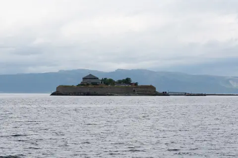
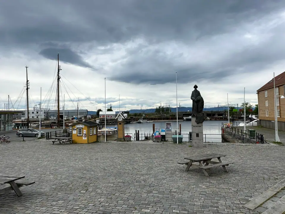
Where Munkegata meets the northern canal along the sightline between Nidaros Cathedral and Munkholmen lies Ravnkloa, Trondheim's historic fish market square. Named after Peder Raffnklau (recorded in 1619), the square hosted market trading from 1841, a fish market from 1896, and the current Ravnkloa Fish Hall opened in December 2000 (see our food guide). Paved in the mid-1990s around Nils Aas's sculpture Den siste viking and a replica of the Ravnkloa bell, the quay serves summer boats to Munkholmen and the rowboat ferry (Fløttmann) across the canal to Fosenkaia.
How Maritime Trade Shaped the Four Wharf Rows
For centuries after Cicignon's 1681 city plan, Trondheim's merchant economy relied on a dual system of buildings: wealthy trading families maintained their town residences, counting houses, and retail shops along broad avenues such as Kongens gate, Munkegata, and Kjøpmannsgata, while their timber storage wharves (brygger) stood directly along the water on the river and canal banks. Shallow-draught coastal vessels arriving from the Trondheimsfjord, Fosen, and northern Norway sailed into the lower Nidelva or the sheltered northern canal to berth alongside the wooden pilings. Using the wooden windlass and pulley beams projecting from the top of each gable, warehouse crews hoisted barrels of salted herring, dried cod (klippfisk and tørrfisk), grain, salt, hides, and cut timber straight into the upper storage lofts.
Although warehouse fires in the nineteenth and twentieth centuries destroyed portions of the waterfront and led to brick rebuilds in several spots along Fjordgata, the four protected wharf rows still preserve the continuous rhythm of narrow gables, small multi-pane windows, and traditional mineral pigments that define Trondheim's riverside silhouette:
- Kjøpmannsgatebryggene: Stretching along the western bank of the Nidelva between Gamle Bybro and Bakke bru, backed by the stone-and-earth fire embankment of Kjøpmannsgata that Cicignon designed to shield Midtbyen from riverfront flames.
- Bakklandsbryggene: Standing directly opposite on the eastern shore in Bakklandet, smaller in scale and closely integrated with the cobbled residential lane of Nedre Bakklandet.
- Fjordgatebryggene: Facing north across the harbour canal toward Brattøra and Trondheim Central Station, marking the northern waterfront edge of Midtbyen.
- Sandgatebryggene: Extending further west along the canal basin toward Ila, illustrating the transition from mercantile storehouses to coastal boat workshops and maritime trades.
To photograph and inspect the wharves from water level and above, follow a loop around the lower river and canal. The classic view opens from the deck of Gamle Bybro looking north through the red wooden portals of Lykkens Portal, where both Kjøpmannsgatebryggene and Bakklandsbryggene reflect in the slow-moving current below the spire of Nidaros Cathedral. Walking downstream to Bakke bru provides the reverse angle looking south along the wooden pilings, while strolling west along the canal quayside from Ravnkloa lets you cross via the seasonal Fløttmann rowboat ferry to Fosenkaia for an unobstructed facade view of the Fjordgata and Sandgata rows.
Combining a morning walk along the river wharves with a seafood lunch at Ravnkloa and an afternoon boat crossing to Munkholmen creates a full maritime day; see our three-day itinerary and orientation guide for step-by-step routing across the peninsula.
Beyond sightseeing on foot, the lower Nidelva and the canal basin also draw kayakers and urban anglers during the warmer months. Paddling quietly beneath the timber pilings between Elgeseter Bridge, Gamle Bybro, and the canal gives a water-level view of the heavy timber foundations and notched log corner joints that have supported these riverfront structures against tides and winter ice since the eighteenth century. Along the street side of Kjøpmannsgata and Fjordgata, several restored ground-floor warehouse bays now house traditional restaurants, craft galleries, and maritime offices where visitors can inspect the hand-hewn pine beams from inside.
Traveller tips
Real advice from people who have been to Bryggene Wharves, the Nidelva River and Ravnkloa Canal. Every tip is read by our team before it goes live.
No tips yet. Been here? Yours could be the first.
Thank you! Your tip will appear here after a quick review.
More in Trondheim
Continue exploring Trondheim with related neighbourhood, food, and planning guides