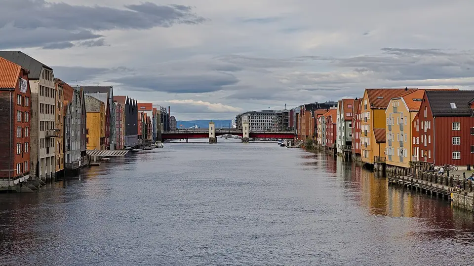
Orientation and City Layout
Navigate Cicignon's 1681 Baroque street grid in Midtbyen, the Nidelva river loop, Bakklandet, Brattøra, and the Gråkallbanen tram into Bymarka.
Trondheim occupies a low peninsula at 63°25′N where the last loop of the 30-kilometre Nidelva river meets the 130-kilometre Trondheimsfjord in Trøndelag county. Founded in 997 as a trading post by the Viking king Olav Tryggvason, the settlement, known in Old Norse as Kaupangen i Nidaros (trading place at the mouth of the Nid), served as the capital of Norway during the Viking Age until the seat of royal administration moved south in 1217. From 1152 until the Lutheran Reformation in 1537, the city was the seat of the Roman Catholic Archdiocese of Nidaros, drawing pilgrims from across northern Europe to the shrine of King Olav Haraldsson (St. Olav). Today Trondheim is Norway's third largest municipality with 212,660 residents recorded in the third quarter of 2022, and the main seat of the Norwegian University of Science and Technology (NTNU), which enrols approximately 42,000 students.
Cicignon's 1681 Baroque Plan and the Midtbyen Peninsula
Almost all of the historic city centre, called Midtbyen, is enclosed on three sides by the Nidelva river and on the north by the harbour canal along Fjordgata and Brattøra. Because Trondheim was built largely of wood, it suffered repeated major fires in 1598, 1651, 1681, 1708, 1717, 1742, 1788, 1841, and 1842. After the Horneman Fire of 18 and 19 April 1681 destroyed most of the town, King Christian V sent the Luxembourg-born military engineer Major General Johan Caspar de Cicignon, assisted by Quartermaster General Anthony Coucheron, to design a fire-resistant Baroque city plan. Cicignon laid out broad, straight avenues, led by north-south Munkegata and east-west Kongens gate intersecting at Torvet, to stop flames jumping across narrow medieval alleys (veiter), several of which still survive between the main streets.
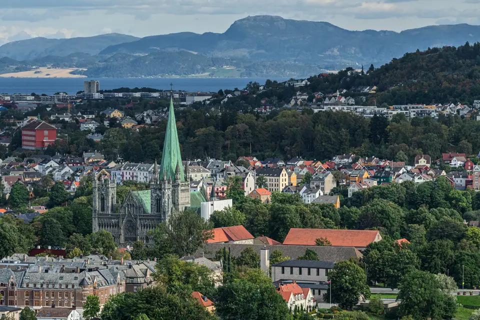
Five Distinct Districts Around the River Loop
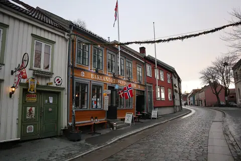
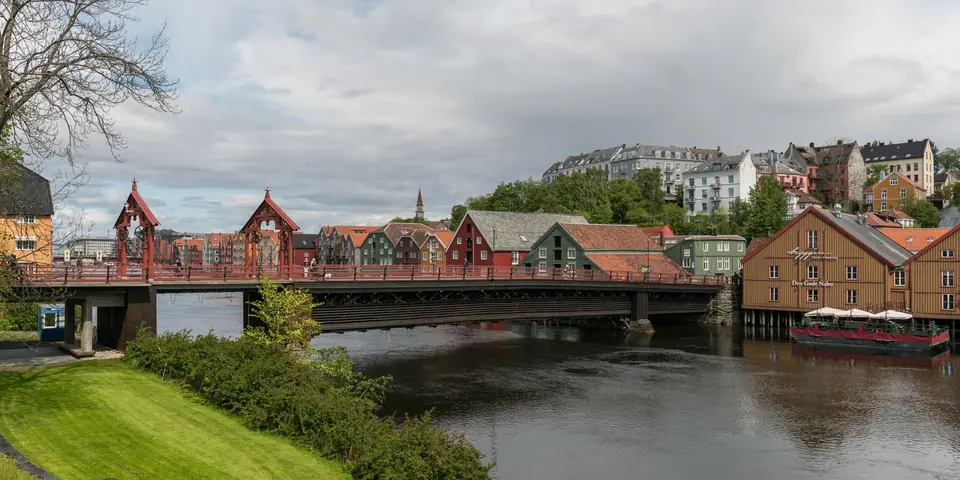
New visitors can divide Trondheim into five walkable zones. At the southern bend of the Nidelva stand Nidaros Cathedral and the Archbishop's Palace (Erkebispegården). North along Munkegata lie Torvet square, the 140-room wooden royal residence of Stiftsgården, and the Ravnkloa fish market on the canal. Crossing the Nidelva over Gamle Bybro brings you into Bakklandet, an east-bank suburb of 18th- and 19th-century wooden houses below the hillside ramparts of Kristiansten Fortress. North of Bakklandet, the former Trondhjems Mekaniske Værksted shipyard at Nedre Elvehavn (Solsiden) faces the reclaimed port island of Brattøra across the Verftsbrua footbridge. To the west, the 8.8-kilometre Gråkallbanen tram climbs into the 80-square-kilometre Bymarka nature reserve.
Practical Transport and Seasonal Rhythm
Arriving via Trondheim Airport, Værnes in Stjørdal (19 kilometres east) is straightforward: regional trains on the Trøndelag Commuter Rail run directly from the airport platform to Trondheim Central Station at Brattøra, a short walk across the canal from Midtbyen. Because the Fosen peninsula shelters the inner fjord from open Atlantic storms, Trondheim's climate stays moderate for 63°N, with July highs averaging 20 °C (19.9 °C) and January lows averaging -4 °C (-4.1 °C). Pair this overview with our things to do guide and 3-day Trondheim itinerary.
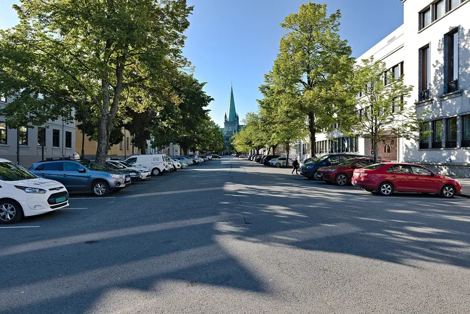
How the Medieval Veiter, Bridges, and Baroque Avenues Fit Together
Walking through Midtbyen reveals two distinct layers of urban history side by side. While Cicignon's 1681 intervention carved wide rectilinear firebreaks across the peninsula to protect the royal and administrative quarters, the interior of several city blocks still preserves narrow, winding medieval footways known locally as veiter. Stepping off Kongens gate, Dronningens gate, or Nordre gate into these quiet passages shows how tightly packed the pre-fire merchant town once stood before the seventeenth-century engineers imposed geometric order across the peninsula.
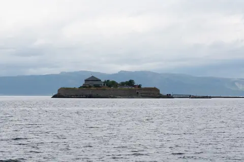
The axial alignment of Munkegata was conceived with deliberate visual drama: looking south from Ravnkloa and Torvet, the broad tree-lined avenue frames the stone spire and west front of Nidaros Cathedral, while looking north directs the eye straight out across the canal waters to the circular profile of Munkholmen in the fjord. Kongens gate forms the corresponding east-west spine, carrying pedestrians and city buses toward the western gate at Ila and the eastern bridges across the river. Meanwhile, the broad street of Kjøpmannsgata along the eastern edge of Midtbyen was engineered as a protective masonry-and-earth embankment separating the inner residential blocks from the wooden cargo warehouses lining the riverfront.
Because water wraps around Midtbyen on three sides, bridges define how locals and visitors move from quarter to quarter without needing motorised transit. Understanding which crossing leads where saves considerable walking time during a short stay:
- Elgeseter Bridge: Marking the southern approach into the peninsula near the cathedral grounds, parklands, and student neighbourhoods, on the historic alignment where medieval travellers once crossed the river mouth.
- Gamle Bybro (Old Town Bridge): The timber pedestrian and cycling span connecting the southern end of Kjøpmannsgata directly with cobbled Nedre Bakklandet and the foot of Brubakken below the fortress ridge.
- Bakke bru: Carrying road traffic, buses, and wide footpaths between northern Midtbyen and the transition zone where Bakklandet meets the former shipyard basins of Nedre Elvehavn.
- Verftsbrua (Blomsterbrua): A foot and cycle bridge spanning the river mouth between the Solsiden promenade at Nedre Elvehavn and the harbourside hotels and museums of Brattøra.
- Ravnkloa and Canal Bridges: Short crossings along the northern canal that connect the fish market and Fjordgata wharves with Trondheim Central Station and the open fjord boardwalk.
One of Trondheim's defining practical strengths is how effortlessly a visitor can shift between historic interiors and open nature without booking long transfers. In the morning you can study twelfth-century Anglo-Norman stonework in the cathedral transepts or inspect eighteenth-century notched log construction along the river pilings; after lunch on local Trøndelag specialities, a short ride on the metre-gauge tram from St. Olavs gate places you among upland lakes, spruce woods, and timber trail lodges in Bymarka. Choosing a well-placed base from our neighbourhood accommodation guide ensures that every sector of the city remains within easy reach on foot throughout the year.
For travellers orienting themselves on arrival, the pedestrianized retail spine of Nordre gate runs parallel to Munkegata one block east, linking Dronningens gate and Kongens gate with small independent bookshops, outdoor outfitters, and bakeries. Along the western edge of the peninsula, where the river curve approaches the canal near Skansen and Ila, quiet residential streets and coastal parks open onto views of the outer fjord and the Fosen hills, completing a compact urban ring that you can traverse on foot from end to end in less than half an hour.
Traveller tips
Real advice from people who have been to Orientation and City Layout. Every tip is read by our team before it goes live.
No tips yet. Been here? Yours could be the first.
Thank you! Your tip will appear here after a quick review.
More in Trondheim
Continue exploring Trondheim with related neighbourhood, food, and planning guides