


























Kristiansten Fortress and Tyholttårnet Views
Climb to the 1682 to 1684 bastion ramparts and whitewashed donjon of Kristiansten Fortress and visit the 124-metre Tyholttårnet observation tower.
Two high points east of the Nidelva give visitors sweeping views over the Midtbyen peninsula, Nidaros Cathedral, Munkholmen island, and the Trondheimsfjord. Directly above Bakklandet crowns the 17th-century bastion walls and whitewashed stone donjon of Kristiansten Fortress, while further east on the Tyholt ridge rises the concrete telecommunications tower of Tyholttårnet.
Kristiansten Fortress: Construction After the 1681 Fire
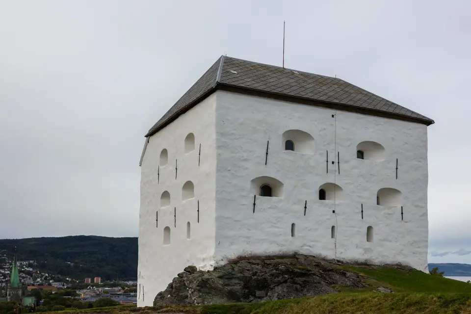
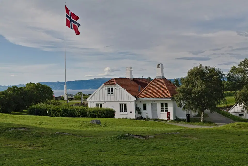
Before the late 17th century, the steep eastern ridge overlooking Trondheim was a tactical weakness: during the Swedish occupation of 1658, Danish-Norwegian troops had bombarded the city from these hills. After the Horneman Fire of April 1681, King Christian V instructed Major General Johan Caspar de Cicignon and Quartermaster General Anthony Coucheron to crown the ridge with a star-shaped artillery fortress. Built between 1682 and 1684 and expanded in the 1690s, the fortress enclosed its perimeter behind ramparts (vollmurer) and vaulted casemates (kasematter) on the northern courtyard side that housed barracks, kitchens, prison cells, and stores. Around 1740 the fortifications received their present layout, and in 1746 brothers Rasmus and Andreas Banch carved the soapstone gate (Festningsporten). Inside stand three buildings: the donjon, the single-storey Commander's Residence (Kommandantboligen, c. 1777), and the pyramid-roofed guardhouse (Vakthuset).
The Donjon, the 1718 Siege, and Second World War Memorial
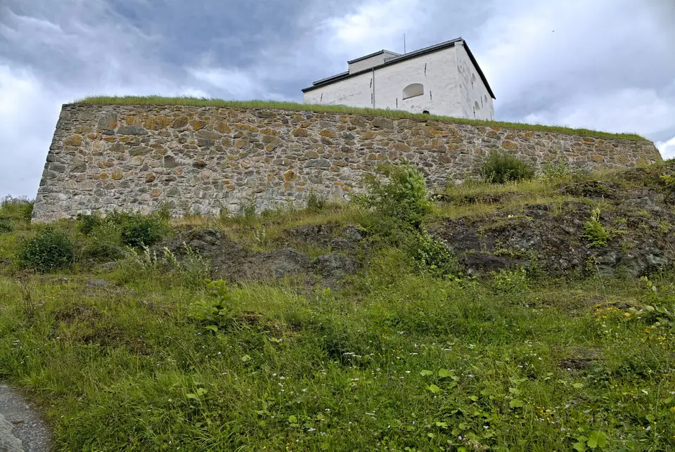
The whitewashed stone donjon (Donjonen) was built as a self-contained artillery keep with an original footprint of 17 by 12.5 metres; its wall facing the city was later thickened to reach four metres in thickness. Above two brick-vaulted gunpowder magazines in the basement rise three timber-beamed floors supported by a central brick pillar: the ground floor served as the commander's quarters, while the second and third storeys carried cannon ports shuttered with iron hatches. During the Great Northern War in late 1718, General Carl Gustaf Armfeldt's Swedish army besieged Trondheim, but the garrison under General Vincents Budde held the city until King Charles XII fell at Fredriksten Fortress and Armfeldt retreated across the Tydal mountains. Decommissioned by King Carl III Johan in 1816, the fortress was later the site where 31 Norwegian resistance fighters and hostages were executed during the 1940 to 1945 occupation prior to liberation on 8 May 1945; check the official site for summer hours.
Tyholttårnet: Revolving Panorama 74 Metres Above the Ridge
Two kilometres east of Kristiansten at Otto Nielsens vei 4 on Tyholt hill (base elevation 112.5 metres above sea level), Tyholttårnet is a concrete and steel radio tower designed by architect Nils Christian Ottesen and inaugurated on 22 May 1985. The tower consists of a 76.6-metre concrete shaft (7.2 metres in diameter) topped by a steel mast reaching 120 to 124 metres above the ground (234 metres above sea level). At 70 metres above the ground (184 metres above sea level) sits an observation deck, while the 12-sided glass Egon restaurant at 74 to 75 metres completes one full 360-degree revolution every hour.

Walking the Bastions and Comparing Both Eastern Viewpoints
Approaching the fortress up the steep cobbles of Brubakken from Bakklandet and passing through the 1746 soapstone portal carved by Rasmus and Andreas Banch, visitors enter a broad grassed parade ground framed by low stone-and-earth ramparts. Because the ridge stands roughly 70 metres above sea level right behind the eastern riverbank, the western bastions act as a natural balcony over the entire historic city. Looking straight down from the cannon emplacements, you can trace the full loop of the Nidelva river, the octagonal choir and west towers of Nidaros Cathedral, the straight axis of Munkegata running through Torvet to the canal, and the circular stone fortress on Munkholmen out in the fjord.
Beyond the freestanding four-storey whitewashed donjon, the northern side of the courtyard is bordered by vaulted casemates built into the rampart wall to shelter garrison troops, stores, and kitchens from artillery fire. The single-storey timber Commander's Residence (Kommandantboligen, dating from around 1777) and the small pyramid-roofed guardhouse (Vakthuset) complete the preserved eighteenth-century military ensemble. On Norwegian royal anniversaries and national holidays, ceremonial salutes are still fired from the fortress batteries across the valley, echoing a military tradition that dates back to the defense of the city in 1718.
While Kristiansten Fortress and Tyholttårnet both sit on the eastern hills of Trondheim, they offer very different visual perspectives and visitor experiences across the landscape:
- Kristiansten Fortress Ridge: Reached on foot in a short climb up Brubakken from Gamle Bybro; close enough to Midtbyen to distinguish individual timber wharves along Kjøpmannsgata, church spires, university buildings on Gløshaugen, and harbour boats in clear architectural detail.
- Tyholttårnet Observation Gallery (70 metres up): Reached by local AtB bus or an uphill walk of two kilometres further east onto the Tyholt ridge; high enough to take in the entire 130-kilometre sweep of the inner and middle Trondheimsfjord, the Lade peninsula, the forested hills of Bymarka to the west, and the agricultural valleys of Trøndelag.
- The Revolving Restaurant Level: Positioned above the fixed viewing gallery inside a twelve-sided glass enclosure whose outer floor ring turns slowly through one complete 360-degree rotation each hour while guests dine, allowing you to watch the light shift from the fjord waters to the mountain skyline without leaving your table.
Because both viewpoints face west and northwest across the peninsula and fjord, late afternoon and evening light illuminates the stone facades of Midtbyen and sets the fjord waters glowing behind Munkholmen. In midsummer, when daylight lasts over 20 hours (see our seasonal daylight guide), the fortress grounds remain a favourite evening walk for locals long after museum hours end. You can easily pair both viewpoints with Bakklandet and Ringve using our three-day Trondheim itinerary.
For walkers who enjoy linking green spaces on foot, a pleasant ridge route connects Kristiansten Fortress eastward through quiet twentieth-century wooden villa neighbourhoods to Tyholttårnet, or northward down the slope toward the former shipyard basins at Nedre Elvehavn (Solsiden) and Brattøra. Carrying a pair of binoculars up to either vantage point makes it easy to spot coastal express ships rounding the fjord headland and passenger boats crossing between Ravnkloa and Munkholmen. Inside the fortress grounds, interpretive plaques beside the casemates and the chapel memorial also explain how the hilltop site functioned during both the eighteenth-century border campaigns and the Second World War liberation.
Traveller tips
Real advice from people who have been to Kristiansten Fortress and Tyholttårnet Views. Every tip is read by our team before it goes live.
No tips yet. Been here? Yours could be the first.
Thank you! Your tip will appear here after a quick review.
More in Trondheim
Continue exploring Trondheim with related neighbourhood, food, and planning guides

How to Get to Trondheim: Værnes Airport, Rail Lines and Port
Trondheim, Norway
Where to Stay: Midtbyen, Bakklandet, Solsiden and Brattøra
Trondheim, Norway
Best Time to Visit: Monthly Weather, Daylight and Seasons
Trondheim, Norway
Three-Day Trondheim Itinerary: Cathedral, Fjord and Bymarka
Trondheim, Norway
