Kjerag, Kjeragbolten, Flørli 4,444 Steps and Lysebotn
Tackle the 984-metre Kjeragbolten boulder hike from Øygardsstølen, climb the 4,444 wooden steps at Flørli, and drive Lysebotn's 27 hairpin bends.
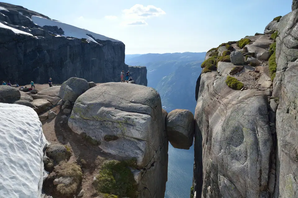
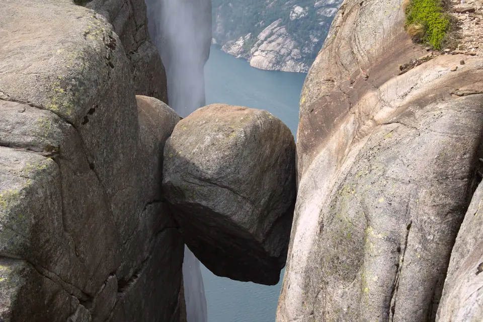
At the eastern end of Lysefjorden in Sandnes Municipality, the granite plateau of Kjerag rises to 1,132 metres above sea level while its northern cliff face at Nesatindane plunges 984 metres almost vertically into the fjord alongside the Kjeragfossen waterfall. Just 300 metres southwest of Nesatindane sits Kjeragbolten, a 5-cubic-metre glacial erratic boulder of gneiss weighing an estimated 10 to 15 tonnes that became wedged in a narrow mountain crevice during post-glacial rebound and hangs suspended above a 984-metre abyss, with a direct 241-metre vertical drop to the upper rock ledge and a 735-metre steep gradient down to the water of Lysefjorden.
Whereas the western entrance of Lysefjorden around Forsand and Preikestolen is fringed by low birch woods and coastal farms, the inner reaches around Flørli, Kjerag, and Lysebotn belong to an austere sub-alpine world of ice-scoured granite domes, snowfields, and roaring hydroelectric penstocks.
Hiking to Kjeragbolten from Øygardsstølen
First photographed in the summer of 1925 by Stavanger bank director and mountaineer Thomas Peter Randulff (who climbed up via Flørlistølen and published the image in the 1925 Stavanger Turistforening yearbook, and had earlier taken early photographs from Preikestolen in 1896), Kjeragbolten attracts around 70,000 hikers annually. The trail starts at the Øygardsstølen visitor centre and restaurant at the top of the Lysevegen mountain road (roughly a two-hour drive from Stavanger) and requires 2.5 to 3 hours of strenuous walking each way (5 to 6 hours round trip) over three steep granite ridges and two intervening valleys. Because snow covers the high plateau for much of the year, the Lysevegen road and Kjerag trail are open from late May or June until September.
Steel chain handrails anchored into the smooth granite slabs assist hikers up and down the steepest rock faces between the valleys, before the path levels out across the high cairn-marked plateau and descends a final rocky gully to the wedged boulder. Because weather at this elevation changes rapidly and fog or wind can sweep in off the mountain plateau without warning, hikers must carry warm layers, windproof outer shells, food, and sturdy mountain boots.
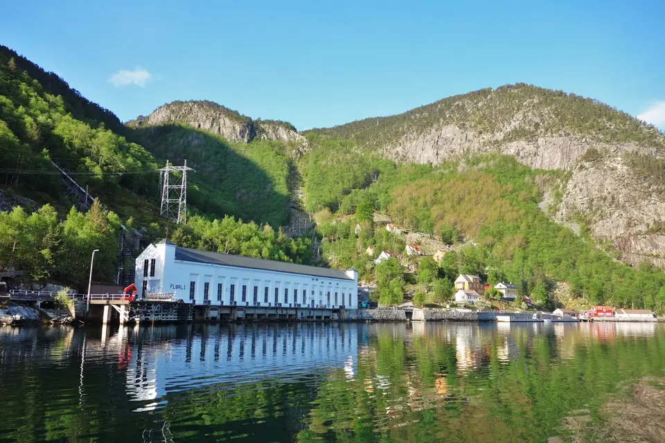
Flørli and the 1918 Hydroelectric Settlement
Halfway along the southern shore of Lysefjorden lies Flørli, a roadless hamlet of 13 residential houses built around the white Flørli hydroelectric power station constructed between 1913 and 1918 (where 119 workers, 28 women, and 37 children lived in 1916, and which was bought by Stavanger Municipality in 1927 before automating in 1999). Today the former turbine hall holds exhibitions and a seasonal café, while modern power generation continues inside a replacement plant blasted deep into the bedrock.
Climbing the 4,444 Wooden Steps to Ternevatnet
Alongside the twin steel penstocks that carried water down to the turbines runs a maintenance staircase of 4,444 wooden steps climbing from the fjord quay straight up the mountainside to Ternevatnet lake at 741 metres above sea level, cited as the world's longest wooden staircase. Flørli is reached only by boat via the year-round Kolumbus express boat MS Lysefjord or seasonal fjord ferries from Stavanger and Lauvvik.
Climbing the staircase requires sustained calf and knee effort up steep gradients where wooden treads and wire cables follow the pipeline track through birch forest and onto open mountain rock. At the top near Ternevatnet dam, a marked mountain path loops back down to the fjord village across high valleys, allowing hikers to avoid descending the steep wooden stairs.
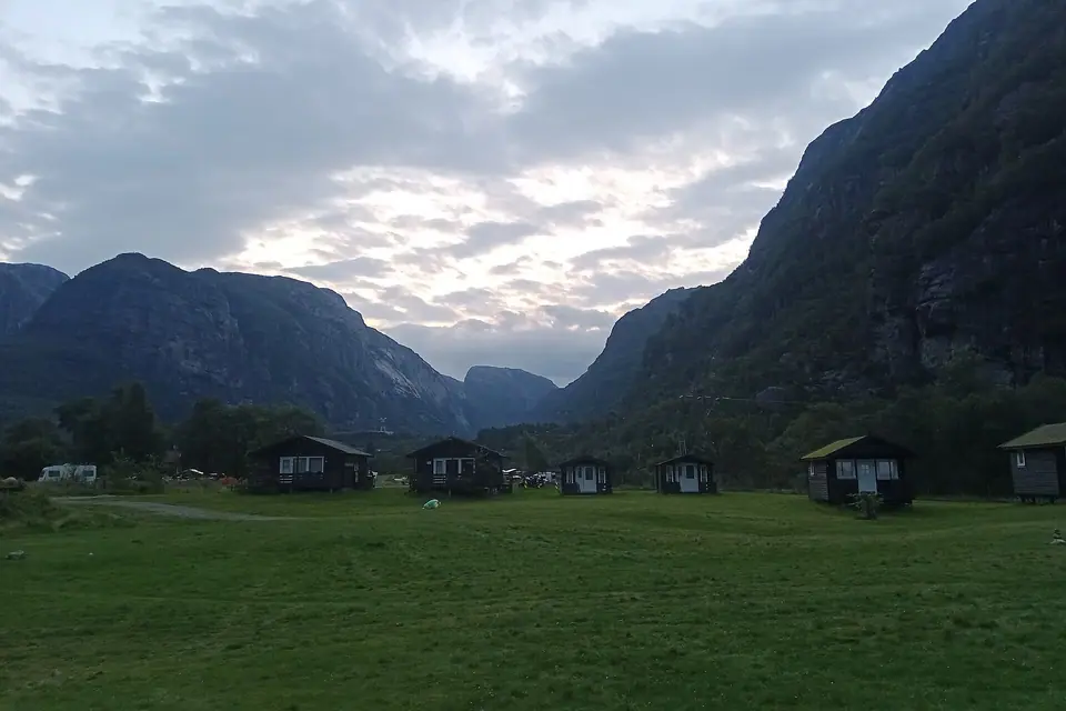
Overnight Stays in Flørli Village
Travellers who wish to split the staircase climb and mountain walks across two days can stay overnight in the restored timber engineers' and workers' houses, which provide over 60 beds at Flørli 4444 alongside 32 beds at the self-service Stavanger Turistforening cabin Flørli Turiststasjon at 80 metres elevation.
Lysebotn Power Plants and Hydroelectric Engineering
At the far eastern head of the fjord sits the village of Lysebotn, home to the underground Lyse (620-metre drop, 210,000 kW) and Tjodan (896-metre drop, 110,000 kW) hydroelectric plants supplying electricity to more than 100,000 people. Situated on a green alluvial fan between towering rock walls, Lysebotn serves as the eastern ferry pier for Lysefjorden vessels and a base for summer mountain trekkers.
Driving Lysevegen to Øygardsstølen
From the valley floor, the single road out, Lysevegen (opened in 1984), climbs almost 900 vertical metres through 27 hairpin bends, including a long hairpin tunnel blasted inside the cliff wall, stopping directly at the Øygardsstølen trailhead for Kjerag. Visitors without a car can ride morning sightseeing ferries from Vågen harbour to Lysebotn and connect with seasonal mountain coaches up the hairpin road.
Planning an excursion to the inner reaches of Lysefjorden requires careful attention to transport timetables and seasonal mountain conditions. Because the high plateau trail to Kjerag crosses exposed bedrock ridges where snowdrifts linger through spring, hikers should verify that the Lysevegen mountain road is open for the season and check wind and visibility forecasts before setting out from Stavanger. Wearing grippy mountain boots, carrying spare thermal layers and gloves in a daypack, and allowing generous time for the chain-assisted ascents and descents across the intermediate valleys keep the trek safe and rewarding.
At Flørli, the combination of industrial heritage and steep fjord topography offers a completely different mountain outing that opens earlier in spring than the higher Kjerag plateau. As you climb the wooden maintenance steps beside the penstock pipes, the view back down toward the white power station building and the wooden pier grows progressively steeper until the entire bend of Lysefjorden unfolds below. Visitors who prefer a gentler visit to Flørli can skip the full staircase climb and instead follow lower woodland trails near the shoreline, inspect the historic turbine machinery inside the power hall, and relax at the quayside café while waiting for the afternoon express boat or ferry back down the fjord toward Lauvvik and Stavanger.
Together, Lysebotn, Flørli, and Kjerag showcase how twentieth-century hydroelectric engineers and mountain pathbuilders opened one of western Norway's rugged fjord landscapes to travellers. Whether you stand beside the wedged gneiss boulder above the northern cliff wall, count the timber steps ascending to Ternevatnet, or wind up the hairpin turns of Lysevegen, the upper fjord delivers a memorable full-day adventure from the coast.
Traveller tips
Real advice from people who have been to Kjerag, Kjeragbolten, Flørli 4,444 Steps and Lysebotn. Every tip is read by our team before it goes live.
No tips yet. Been here? Yours could be the first.
Thank you! Your tip will appear here after a quick review.
More in Stavanger
Continue exploring Stavanger with related neighbourhood, food, and planning guides