Sverd i fjell (Swords in Rock), Hafrsfjord and Iron Age Farm
See Fritz Røed's three bronze Viking swords at Møllebukta on Hafrsfjord and step inside three reconstructed Migration Period longhouses on Ullandhaug.
Five kilometres southwest of central Stavanger in the borough of Madla, the 9-kilometre inlet of Hafrsfjord forms the border between Stavanger Municipality and Sola Municipality and marks the site of the naval Battle of Hafrsfjord. Traditionally dated to the year 872 by nineteenth-century historian Rudolf Keyser and dated by modern scholars to between 870 and 900 (most likely the 880s), the battle saw Viking King Harald Fairhair (Harald Hårfagre) defeat a coalition of southwestern chieftains led by Eirik of Hordaland, Sulke of Rogaland, and Kjotve the Rich of Agder to unite Norway under a single monarch, as recorded in Þorbjörn Hornklofi's contemporary skaldic poem Haraldskvæði and Snorri Sturluson's Heimskringla.
Because the narrow threshold at Prestaskjær controlled ship passage into the sheltered inner basin of Hafrsfjord, the inlet was a strategic maritime stronghold throughout the Iron Age and Viking Age. Today, a paved coastal walking and cycling path follows the grassy shoreline around Møllebukta, making it easy to combine the Viking monument with the archaeological sites on nearby Ullandhaug in a single half-day outing.
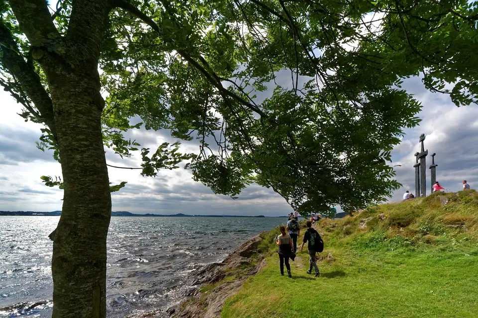
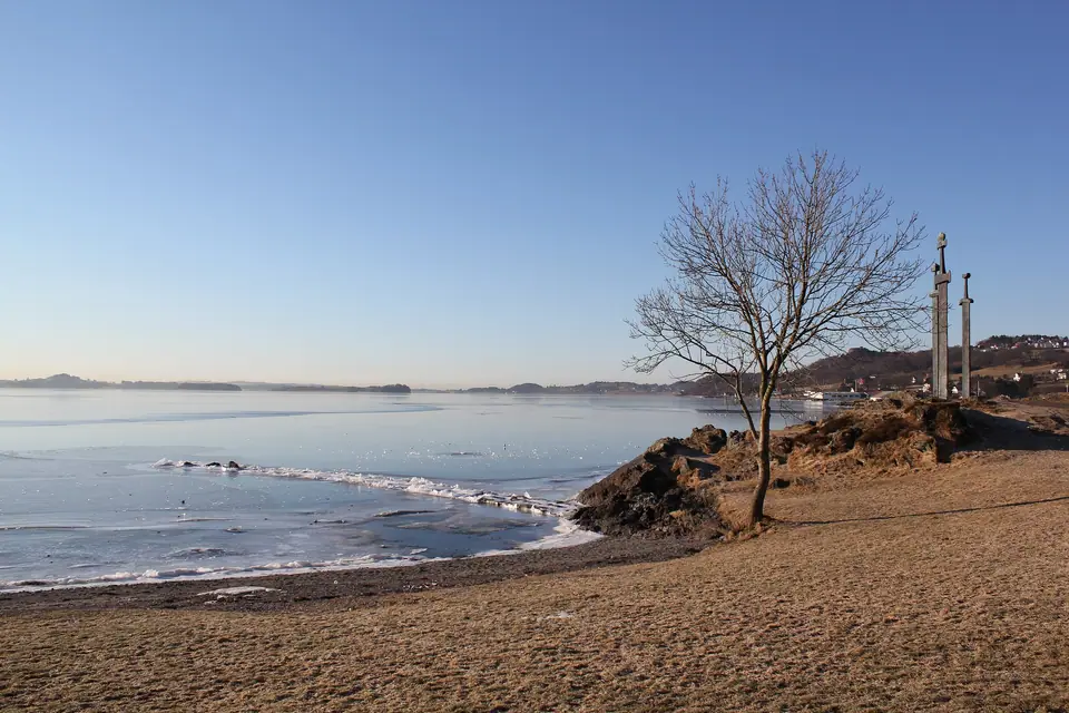
Sverd i fjell at Møllebukta
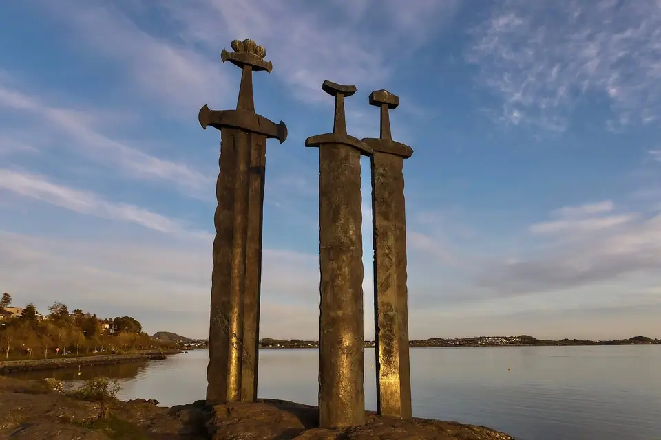
On the rocky promontory of Mølleberget beside the sandy bathing cove of Møllebukta at the northeastern end of Hafrsfjord stands Sverd i fjell ('Swords in Rock'), sculpted by Bryne artist Fritz Røed and unveiled by King Olav V in 1983. The three bronze swords rise up to 9.2 metres (often rounded to 10 metres with their stone base) and are modelled on three types of Viking-age swords found across Norway. The largest sword represents the victorious King Harald Fairhair, while the two slightly shorter blades represent the defeated petty kings, each topped by a crown symbolising the three participating districts. Because the blades are planted deep into solid rock so they may never be removed for battle, the monument also serves as a national symbol of peace.
Visitors can walk right out onto the low gneiss outcrop beneath the hilts to examine the cast bronze textures and look out across the calm waters of Hafrsfjord toward Sola. Because the monument stands in an open public park beside the beach at Møllebukta, there are no admission gates, and the western orientation across the water makes late afternoon and sunset especially atmospheric for photography.
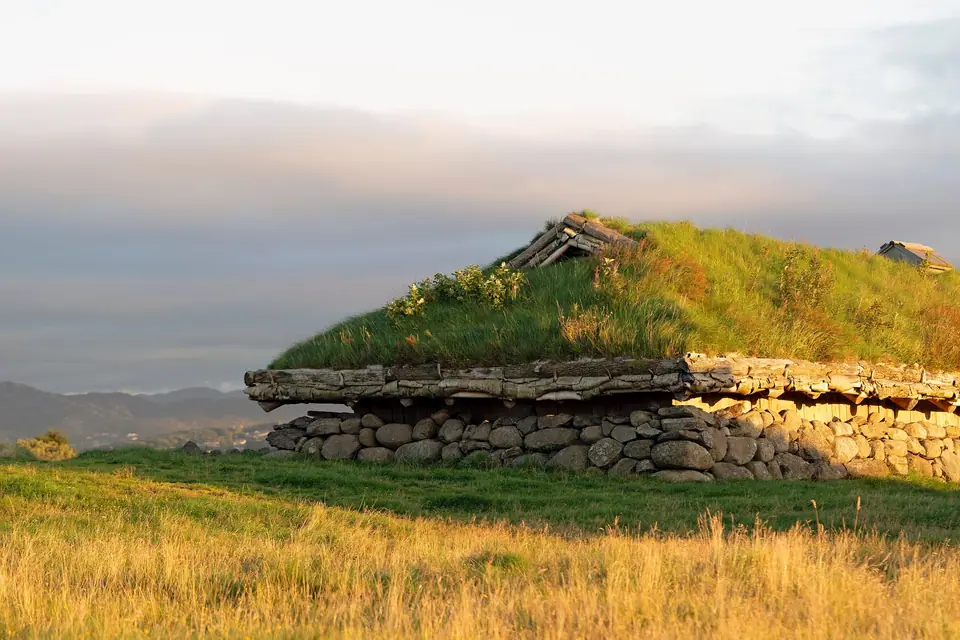
Jernaldergården (The Iron Age Farm) on Ullandhaug
Two kilometres east of Møllebukta, on the hilltop of Ullandhaug (about 3 kilometres south of central Stavanger), stands Jernaldergården, a reconstructed Migration Period farm complex dating from roughly 350 to 550 AD. Nearly 200 deserted Migration Period farms have been recorded across Flat-Jæren. Mapped by Stavanger Museum curator Tor Helliesen in 1900 and excavated by archaeologist Bjørn Myhre in 1967 and 1968, the original Ullandhaug farm burned down in the mid-500s AD and lay deserted for over 1,400 years before the three turf-roofed timber-and-stone longhouses with earthen floors and internal post rows (grindbygg) were rebuilt atop the original foundations and opened in 1975 under the Museum of Archaeology in Stavanger.
Stepping through the low wooden doorways into the smoky, hearth-lit interiors reveals how extended Iron Age families stalled their livestock under one end of the roof while weaving wool, grinding grain, firing clay pots, and cooking over open stone firepits in the main living hall. Surrounding stone field walls (steingjerder) and burial mounds show how early farming communities cleared and cultivated the breezy ridges of northern Jæren centuries before the Viking ship battles on Hafrsfjord.
Ullandhaugtårnet Panoramas and Botanical Gardens
Sharing the Ullandhaug ridge just above the Iron Age Farm is Ullandhaugtårnet, a 64-metre telecommunications tower erected by Televerket in 1964 on the site of the 1896 Haraldstårnet memorial (which had been damaged in the Second World War and demolished in 1963). Because the natural summit stone at its base sits at 138.95 metres above sea level, the tower top reaches 202 metres above the sea, and its public viewing deck offers sweeping views over Hafrsfjord, Nord-Jæren, and the Ryfylke mountains. Since 7 December 2001, the tower's Christmas lights have been ceremonially switched on every year on the first Sunday of Advent. On the adjacent hillside slopes, the Stavanger Botanical Garden cultivates alpine plants, herb beds, and arboretum collections open daily to walkers.
Linking Hafrsfjord and Ullandhaug by Bus or Bicycle
Regular Kolumbus buses from Byterminalen and Breiavatnet serve both Madla near Møllebukta and the University of Stavanger campus at Ullandhaug. A well-signed walking path connects Jernaldergården and Ullandhaugtårnet downhill to the shoreline at Møllebukta, allowing visitors to tour the Migration Period longhouses first, descend to Sverd i fjell on Hafrsfjord, and then continue southwest toward the coastal dunes of Solastranden.
Walking between Ullandhaug and the shores of Hafrsfjord helps visitors visualise how topography shaped early settlement and political power in southwestern Norway. From the elevated ridge of Ullandhaug, Iron Age chieftains and farmers looked out over both the fertile agricultural moraine of northern Jæren and the coastal sea lanes approaching Boknafjorden, giving them early warning of approaching vessels as well as rich grazing land for cattle and sheep. Inside the reconstructed longhouses at Jernaldergården, interpretive guides in period wool garments demonstrate ancient textile spinning, iron smithing, and hearth cooking during the main visitor season, explaining how archaeologists pieced together postholes, charred grain seeds, and pottery shards uncovered during the excavations.
Down by the water at Møllebukta, the sheltered sandy bay beside the rocky outcrop of Sverd i fjell serves as a popular local recreation area in warm weather, with grassy picnic lawns, swimming areas, and shoreline trails extending north and south along Hafrsfjord. Looking closely at the three bronze blades designed by Fritz Røed, you can see the distinct decorative hilt patterns drawn from archaeological sword finds across different Norwegian regions, uniting scholarly archaeology with modern public sculpture.
Combining the hilltop longhouses, the panoramic viewing gallery at Ullandhaugtårnet, and the lakeside promenade at Møllebukta with a visit to the Museum of Archaeology near central Stavanger gives a complete picture of prehistoric and Viking Rogaland. Because city buses run frequently along both Madlaveien and the university ridge, travellers without a car can complete the entire loop between the city centre, Ullandhaug, and Hafrsfjord in an easy morning or afternoon, pausing for coffee or lunch at the visitor centre overlooking the burial mounds and dry-stone field walls.
Traveller tips
Real advice from people who have been to Sverd i fjell (Swords in Rock), Hafrsfjord and Iron Age Farm. Every tip is read by our team before it goes live.
No tips yet. Been here? Yours could be the first.
Thank you! Your tip will appear here after a quick review.
More in Stavanger
Continue exploring Stavanger with related neighbourhood, food, and planning guides