Orientation and City Layout
Navigate Stavanger's twin harbour basins, medieval cathedral core, subsea Ryfast tunnels, and Jæren commuter rail with verified local logistics.
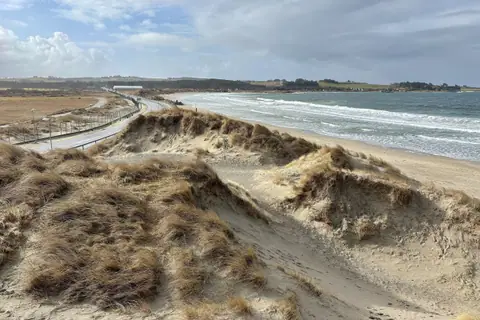
Stavanger occupies a low rocky peninsula in Rogaland county where the Boknafjorden meets the North Sea on the southwestern coast of Norway. Although Stavanger Municipality covers 262 square kilometres and houses 149,048 residents across eight boroughs (Eiganes og Våland, Finnøy, Hillevåg, Hinna, Hundvåg, Madla, Rennesøy, and Tasta), virtually every historic landmark in the city centre lies within a compact fifteen-minute walk between the Vågen harbour inlet and Breiavatnet lake. To the south, the urban corridor merges with neighbouring Sandnes across the northern end of Jæren, Norway's largest flat lowland plain covering roughly 700 square kilometres, creating a metropolitan area of 239,055 inhabitants.
Because the historic peninsula grew initially around medieval church lands and later around herring salteries and sardine canneries, the street pattern follows sheltered coves and low ridges rather than a rigid geometric grid. Visitors arriving by rail, airport coach, or coastal vessel step directly into a walkable waterfront zone where timber cottages, stone churches, and modern museum halls sit side by side along calm harbour waters. Even during brief coastal rain showers, the short distances between quayside cafés, cultural galleries, and sheltered shopping arcades make exploring on foot straightforward throughout the year.
Reading the Harbour and Lake Layout
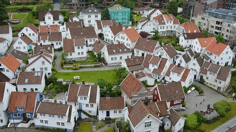
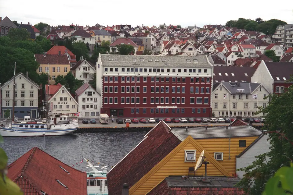
Vågen cuts south into the core of the city, dividing central Stavanger into two distinct historic shores. The western hillside rises into Gamle Stavanger (Straen), where 173 protected wooden buildings from the late eighteenth and nineteenth centuries line cobbled lanes above the former sardine canneries. The eastern shore follows Skagenkaien and Østervåg, where merchant warehouses now hold waterfront restaurants, the Norwegian Petroleum Museum juts out on the artificial island of Kjeringholmen, and the 1853 watchtower Valbergtårnet crowns the ridge above Øvre Holmegate. At the southern head of Vågen, the market square of Torget steps directly up to Stavanger Cathedral, Byparken, and the spring-fed waters of Breiavatnet, with Stavanger Station and the main bus terminal along the lake's southern edge.
Orienting yourself between these two water basins keeps city navigation intuitive in any season. Whenever you stand along the quayside of Strandkaien or Skagenkaien, the open fjord lies to the north and the cathedral spires rise to the south, while the octagonal stone tower on Valberget marks the eastern ridge and the white gables of Straen mark the western slope. Pedestrian walkways wrap completely around Breiavatnet, linking the railway platforms and bus stops with the cathedral square and the harbour promenade without steep climbs or complicated road crossings. Narrow pedestrian shopping lanes such as Kirkegata and Søregata branch northward from the cathedral precinct, lined with independent bookshops, bakeries, and outdoor gear outfitters.
Outer Boroughs, University Hills, and Green Lakes
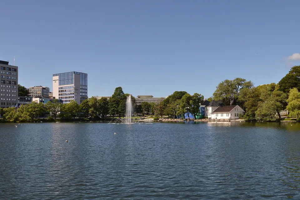
Beyond the tight harbour core, residential neighbourhoods fan outward across gentle hills and freshwater lakes. Walking west from Breiavatnet along Eiganesveien leads past patrician nineteenth-century villas and royal manor gardens toward Mosvatnet, a popular lakeside circuit bordered by woodland paths, birdlife habitats, and art galleries. Further south rises the ridge of Ullandhaug, where botanical gardens, university buildings, reconstructed ancient farmsteads, and a hilltop telecommunications tower look out across the flat farmland of northern Jæren and the sheltered inlet of Hafrsfjord.
To the east and north, the municipality encompasses populated islands and fjord peninsulas joined to the mainland by bridges and deep road tunnels. Neighbourhoods such as Storhaug and Hundvåg retain a strong maritime character with boat clubs, sheltered swimming coves, and coastal walking trails that face the shipping lanes of Boknafjorden and the mountain silhouettes of Ryfylke. Further south along Gandsfjorden, former industrial fabrication yards at Hinna have been redeveloped into waterside housing, office parks, football stadiums, and commuter rail stops.
Bridges, Subsea Tunnels, and Regional Links
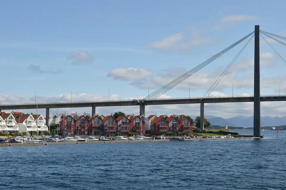
Stavanger's geography was transformed by the 1,067-metre cable-stayed city bridge Bybrua, opened on 31 January 1978 across Strømsteinsundet to Grasholmen and Hundvåg with a 185-metre main span and 26-metre sailing clearance, and more recently by the Ryfast subsea tunnel system. Completed between December 2019 and April 2020, Ryfast carries National Road 13 through the 5.5-kilometre Hundvåg Tunnel and the 14.3-kilometre Ryfylke Tunnel, the world's longest and deepest undersea road tunnel at 292 metres below sea level, cutting the drive to Strand Municipality and the Preikestolen trailhead to about 40 minutes without a ferry.
Connecting the Coastline and Fjord Terminals
Whereas road travellers rely on the subsea tunnels to head east into Ryfylke or north along the coastal highway toward Klosterøy, foot passengers can board express catamarans and car ferries right in the city centre. The quays along Strandkaien and Fiskepiren serve commuter islands, botanical garden boats, and sightseeing vessels bound for Lysefjorden, while the rail platforms beside Breiavatnet connect the peninsula with southern beaches and intercity trains. Because the bus terminal, train station, and passenger quays sit within a short stroll of one another, transferring between regional transport modes requires minimal effort even when carrying luggage or daypacks. Clear digital departure boards at Byterminalen and Fiskepiren display platform assignments and regional connections in real time.
Essential Local Logistics
- Weather preparation: Stavanger has mild winters for Norway, but measurable precipitation of at least 1.0 mm falls on 165 days per year (1,256.1 mm total). Bring a hooded waterproof jacket and wind-resistant layers in every season so coastal breezes never interrupt waterfront walks or fjord deck viewings.
- Walking and transit: Cobblestones in Gamle Stavanger and steep steps on Valberget require flat rubber-soled shoes; use Kolumbus buses and Jæren Line trains for trips to Hafrsfjord, Ullandhaug, Sola Beach, and Sandnes.
- Museum network: Museum Stavanger operates the Norwegian Canning Museum, Norwegian Printing Museum, Stavanger Maritime Museum, Stavanger Museum on Muségata, Ledaal, Breidablikk, Stavanger Art Museum, and Utstein Monastery; check the official site for combined day admission rules before starting your tour.
- Cashless payments and shopping: Public buses, commuter trains, harbour ferries, cafés, and museum ticket desks operate almost entirely by contactless payment card or mobile application, while most independent shops around Østervåg and Søregata close on Sundays.
When planning daily routes across the peninsula, remember that wind direction off the North Sea shapes how different parts of the waterfront feel from hour to hour. If a westerly breeze sweeps across the outer harbour mole near Kjeringholmen and Sandvigå, the sunken lanes of Øvre Holmegate, the sheltered courtyard gardens of Kongsgård, and the tree-lined paths around Breiavatnet remain calm and comfortable for walking. Keeping your itinerary flexible between the exposed quaysides and the protected inland streets lets you enjoy Stavanger's coastal architecture in any weather.
Traveller tips
Real advice from people who have been to Orientation and City Layout. Every tip is read by our team before it goes live.
No tips yet. Been here? Yours could be the first.
Thank you! Your tip will appear here after a quick review.
More in Stavanger
Continue exploring Stavanger with related neighbourhood, food, and planning guides