


























Riffelsee Mirror Lake, Gorner Glacier and Monte Rosa Hut Guide
How to walk from Rotenboden station to the Riffelsee reflection lake at 2,757 metres, overlook the Gorner Glacier system, and view the Monte Rosa massif.
Just one stop below the summit of the Gornergrat Railway, Rotenboden station (2,815 metres) serves as the high-alpine gateway to two contrasting glacial landscapes: to the west, the calm alpine tarn of the Riffelsee mirrors the pyramid of the Matterhorn; to the east and south, the ice streams of the Gorner Glacier and Grenzgletscher sweep down from the 4,634-metre Monte Rosa massif past the futuristic Monte Rosa Hut.
Photographing the Matterhorn Reflection at Riffelsee (2,757 m) and Walking to Riffelberg
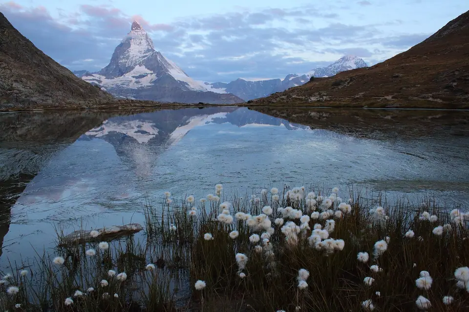
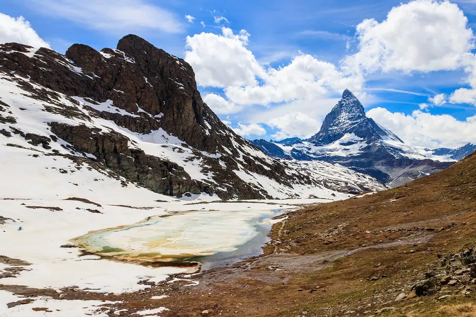
Stepping off the cogwheel train at Rotenboden (2,815 metres), a gentle gravel footpath descends 58 vertical metres in five to ten minutes into a shallow glacial hollow at the foot of the 2,928-metre Riffelhorn (a steep serpentine rock peak used by mountaineers for training climbs). Here lies the Riffelsee at 2,757 metres above sea level, covering 0.45 hectares. Because the Riffelhorn shelters the water from southerly winds, the lake surface frequently acts as a natural mirror for the east and north faces of the Matterhorn (4,478 metres), framed in July and August by white tufts of alpine cottongrass (Wollgras). A smaller, unnamed second tarn sits two minutes further down the path and often remains even calmer when a breeze ripples the main lake. From the Riffelsee, an easy 45-minute downhill hike continues across open alpine tundra to Riffelberg station (2,582 metres), where you can rejoin the train or walk further down toward Riffelalp and Zermatt.
The Gorner Glacier System, Dufourspitze (4,634 m) and the 2009 Monte Rosa Hut
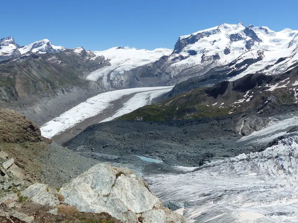
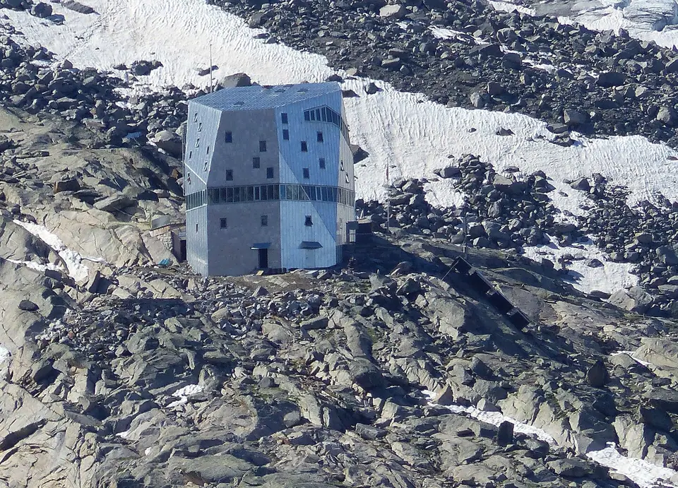
Looking southeast from Rotenboden and the Gornergrat ridge, you face the Gorner Glacier (Gornergletscher) system, which spans roughly 12.4 kilometres in length and covers an area of around 35 to 53 square kilometres, making it the second-largest contiguous glacial area in the Alps after the Great Aletsch Glacier. Fed by snowfields descending from the Dufourspitze (4,634 metres, first climbed from Zermatt on 1 August 1855 by a party led by guides Matthäus and Johannes Zumtaugwald and Ulrich Lauener and named in 1863 after General Guillaume-Henri Dufour), the Signalkuppe (4,554 metres), Liskamm (4,527 metres), Castor (4,228 metres), and Pollux (4,092 metres), the system is a rare polythermal alpine glacier whose cold upper ice comes down via the Grenzgletscher (Border Glacier). Perched on the rocky rib of Untere Plattje above the glacier at 2,883 metres gleams the five-storey polygonal Monte Rosa Hut of the Swiss Alpine Club: designed by ETH Zurich architect Andrea Deplazes to replace the 1895 Bétemps hut and inaugurated in September 2009, its timber spiral interior wrapped in a silver aluminium shell generates 90 percent of its own energy from solar panels and accommodates 120 mountaineers (reached from Rotenboden by experienced alpine hikers equipped for glacier crossings).
Light Conditions, Wind Patterns and Photography Around the Tarns
Capturing a crisp reflection of the Matterhorn in the water depends on timing your visit to match daily mountain wind cycles. On clear summer days, the high tarn is calmest on early morning trains arriving on the cogwheel railway before solar heating warms the valley slopes and generates an upslope breeze that ripples the open surface. Early morning light also illuminates the triangular eastern face of the mountain directly from behind your camera, turning the upper rock and snow walls warm gold against a deep blue sky.
If a light breeze does ruffle the upper lake when you arrive, walk two minutes further down the path to the sheltered lower tarn tucked into the grassy hollow below. Surrounded by low banks of earth and alpine sedge, this smaller pool stays mirror-still long after wind disturbs the main shoreline, and in mid-summer its shallow edges are lined with white plumes of cottongrass that add foreground texture to wide-angle photographs. Late afternoon and sunset bring a completely different mood, throwing the mountain into dramatic silhouette while pink alpenglow touches the snow domes of Monte Rosa behind you.
Trail Conditions, Footwear and Connecting Walks
The short descent from the railway stop to the lakeshore and the continuation walk across the open hillside to the next station below follow well-graded mountain paths suitable for any walker in sturdy trail shoes or hiking boots. Because the basin sits high above the tree line, winter snow and ice cover the tarns until late spring; the open water reflections described in our seasonal climate guide appear once the ice melts in early summer and last until autumn frosts return. Hikers looking for a longer day on the mountain can combine this western tarn walk with the eastern lake trail at Sunnegga and Blauherd as outlined in our three-day itinerary, comparing how the profile of the peak shifts between the two ridges.
By contrast, the high-alpine route descending from the ridge onto the crevassed ice of the Gorner Glacier toward the Monte Rosa Hut is a demanding mountain trek reserved for experienced hikers carrying proper equipment or accompanied by a certified mountain guide. Casual visitors can admire the gleaming silver polygon of the hut and the sweeping medial moraines of the glacier safely from the rock viewpoints along the railway ridge without stepping onto the ice itself.
Along the gentle grassy slope between the reflection pools and the lower station at Riffelberg, keep an eye out for high-alpine wildflowers and dark serpentine boulders polished by ancient ice movement. Because the trail stays entirely in the open with continuous views toward the southwestern peaks and the deep trench of the Mattertal below, even a relaxed stroll with frequent photo pauses leaves plenty of time to catch a midday cogwheel train down to Riffelalp or back into the village for lunch.
Looking closely at the glacier basin from the ridge above Rotenboden also reveals how rapidly alpine ice has retreated over recent decades, exposing bare bedrock walls, lateral moraine ridges, and meltwater channels that feed the roaring Gornera river down through the Gorner Gorge on the valley floor. Bringing a pair of compact binoculars or a telephoto lens lets you spot roped mountaineering teams crossing the upper snowfields and trace the crystalline architecture of the mountain hut perched on its rocky rib above the ice, rounding out an inspiring morning above the valley.
Traveller tips
Real advice from people who have been to Riffelsee Mirror Lake, Gorner Glacier and Monte Rosa Hut. Every tip is read by our team before it goes live.
No tips yet. Been here? Yours could be the first.
Thank you! Your tip will appear here after a quick review.
More in Zermatt
Continue exploring Zermatt with related neighbourhood, food, and planning guides
What to Eat in Zermatt: Raclette du Valais, Trockenfleisch and Cholera
Zermatt, Switzerland
How to Get to Zermatt: Täsch Shuttle, Visp Trains and Glacier Express
Zermatt, Switzerland
Where to Stay in Zermatt: Bahnhofstrasse, Winkelmatten & Riffelalp
Zermatt, Switzerland
Best Time to Visit Zermatt: Climate Normals, Hiking & Ski Seasons
Zermatt, Switzerland
