Zermatt
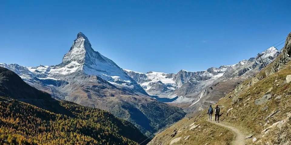
A car-free mountain resort at 1,620 metres at the upper end of the Mattertal in the canton of Valais, framed by the 4,478-metre pyramid of the Matterhorn, the 4,634-metre Dufourspitze of Monte Rosa, and Europe's highest open-air rack railway and aerial cableway.
Quick decisions
Overview
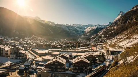
Zermatt lies at 1,620 metres above sea level at the southern head of the 40-kilometre Mattertal (Nikolaital) in the German-speaking district of Visp in the canton of Valais, about 10 kilometres north of the 3,292-metre Theodul Pass on the Italian border. With a permanent population of 5,820 across a 242.91-square-kilometre municipal territory, it is the southernmost municipality of the closed German-speaking region (Sprachraum) and sits surrounded by 22 Swiss main summits above 4,000 metres, led by the Dufourspitze (4,634 metres, Switzerland's highest peak in the Monte Rosa massif), the Dom (4,545 metres), the Liskamm (4,527 metres), the Weisshorn (4,505 metres), and the Matterhorn (4,478 metres).
Documented in 1280 as Pratoborno and on a 1495 map as Zur Matte (at the meadow), the farming settlement rose to international prominence after British climber Edward Whymper and six companions made the first ascent of the Matterhorn on 14 July 1865. Start your planning with our Zermatt travel guide, our overview of things to do in Zermatt, and the 3-day Zermatt itinerary.
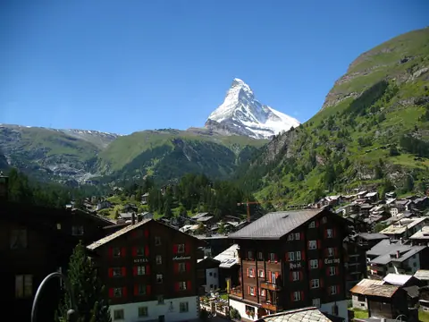
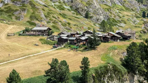
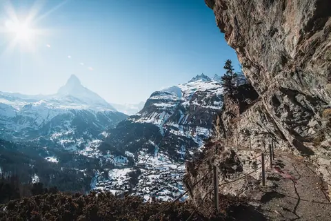
Because the narrow valley corridor runs deep into the Pennine Alps between towering crystalline massifs, the landscape shifts rapidly from sheltered larch and stone-pine woods on the valley floor to permanent snowfields and crevassed ice streams higher up. Traditional dark-timber farmhouses and grain barns built by German-speaking Walser settlers still stand beside grand nineteenth-century mountaineering hotels and contemporary alpine chalets, giving the settlement a layered architectural character where rural mountain heritage coexists with modern electric cableways and rack railways. Walking from the station plaza toward the southern meadows lets you watch the triangular rock peak dominate the upper end of the valley above stone-roofed barns and rushing glacial streams.
Getting there
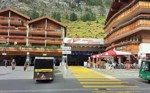
Because Zermatt is a strictly car-free resort, getting to and around Zermatt revolves around the metre-gauge Matterhorn Gotthard Bahn (MGB), opened as the Visp-Zermatt-Bahn on 18 July 1891. Travellers arriving by train transfer at Visp or Brig in the Rhône Valley for the climb up the Mattertal, or board the 291-kilometre Glacier Express (founded 1930) from St. Moritz and Andermatt. Motorists leave their vehicles 5 kilometres north at the Matterhorn Terminal in Täsch and ride the 12-minute shuttle train into Zermatt station (1,604 metres).
Convenient cross-platform rail connections in the Rhône Valley make travelling without a car simple even with winter ski gear or hiking packs. Electric shuttle trains run back and forth throughout the day from the covered park-and-ride terminal down-valley, discharging passengers onto the level station plaza where battery-powered hotel vehicles, municipal electric buses, and pedestrian promenades connect directly to every neighbourhood and valley lift station without exhaust fumes or traffic noise.
Where to stay
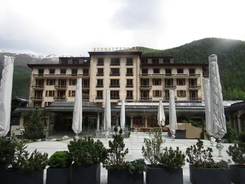
Deciding where to stay in Zermatt comes down to which lift terminal or mountain vista you want outside your window. Central Bahnhofstrasse and Kirchplatz put you beside the 1855 Hotel Monte Rosa, the 1879 Grand Hotel Zermatterhof, and the Gornergrat and Sunnegga valley stations. On the southern terrace at 1,670 metres, Winkelmatten offers quiet chalet streets and direct views of the Matterhorn near the Matterhorn Express gondola, while Riffelalp (2,222 metres) perches above the larch forest halfway up the Gornergrat railway.
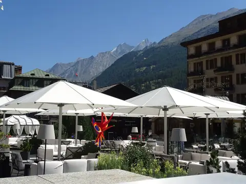
Because private motor traffic ends north of the village, every accommodation zone enjoys quiet evening streets and clean mountain air. Staying near the railway square or church plaza suits visitors who prioritise immediate access to morning cogwheel trains, bakeries, and evening dining rooms, whereas the elevated southern meadows appeal to travellers seeking sun-drenched balconies and rapid access to the southern gondola network. Those staying on the mountain ridges trade village nightlife for quiet alpenglow and early access to high trails before day visitors arrive.
Things to do
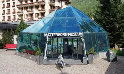
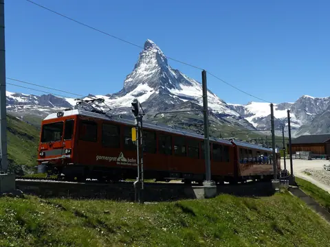
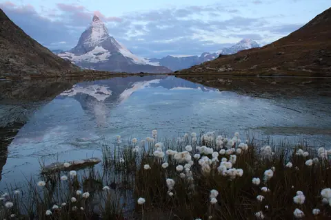
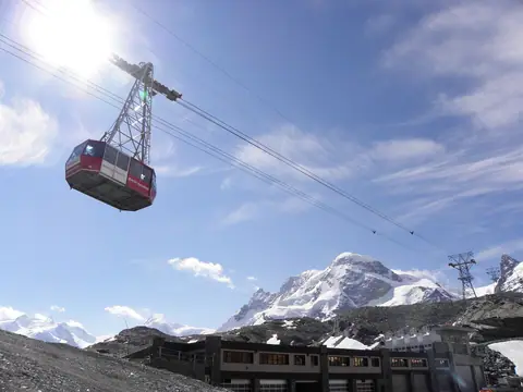
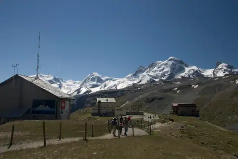
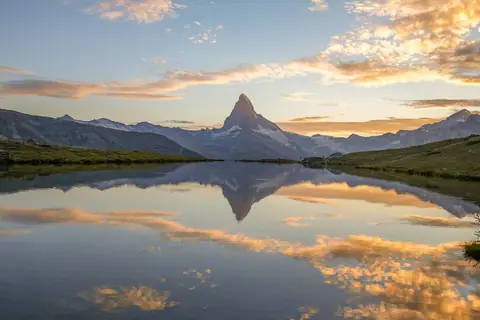
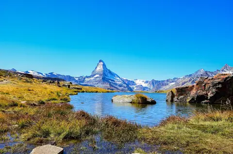
On the valley floor, stroll Bahnhofstrasse, the Hinterdorf timber barns, and the Matter Vispa river, then step beneath the glass pyramid on Kirchplatz into the Matterhorn Museum (Zermatlantis) and Mountaineers' Cemetery. Three mountain transport corridors radiate above the village: the 1898 Gornergrat rack railway past the Riffelsee and Gorner Glacier to 3,089 metres; the Matterhorn Express to Schwarzsee (2,583 metres) and Hörnli Hut continuing to Klein Matterhorn (3,883 metres); and the 1980 Sunnegga funicular to the Stellisee and Grindjisee. Below the peaks, walk through the Gorner Gorge (Gornerschlucht) and the hamlets of Zmutt and Findeln.
Each mountain sector reveals a different angle on the surrounding glaciers and rock walls. Riding the eastern cogwheel railway brings you face to face with vast ice rivers flowing off Monte Rosa, whereas ascending the southern cableways takes you directly beneath overhanging seracs and across high border snowfields toward Italy. On the sunnier northeastern slopes, gentle pasture paths link clear alpine tarns that mirror the triangular peak across open meadows and larch groves, while valley footpaths trace shadowy river canyons and traditional timber hamlets.
Food and drink
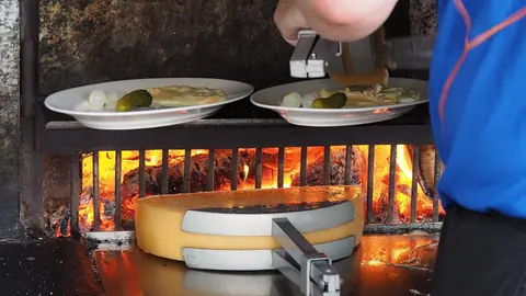
Traditional food in Zermatt showcases the high-altitude preservation methods of the canton of Valais. Order raw-milk Raclette du Valais AOP scraped from a half-wheel onto boiled potatoes, platters of air-dried Walliser Trockenfleisch IGP with sourdough Walliser Roggenbrot AOP, and baked Cholera pastry pies stuffed with potatoes, leeks, apples, and mountain cheese.
High-mountain dining here is rooted in centuries of self-sufficiency, when winter snow cut off the upper valley and households relied on curing, drying, and cellar storage. Alongside melted raw-milk cheeses and paper-thin air-dried meats, local kitchens prepare golden potato Rösti topped with mountain cheese and fried eggs, rich barley soups simmered with smoked bacon, and spiced fruit tarts, accompanied by dry white and red wines pressed from steep stone-terraced vineyards downstream along the Rhône Valley.
Culture
Consulting the best time to visit Zermatt helps you match your trip to the 1991 to 2020 MeteoSwiss climate normals (elevation 1,638 metres). July and August bring mild 20.0 °C and 19.6 °C afternoon highs when high-altitude lakes and the Hörnli Hut trail are snow-free, while winter brings 325 centimetres of average annual snowfall alongside year-round glacier skiing below the Gobba di Rollin (3,899 metres).
This sheltered inner-alpine position between high mountain barriers blocks moisture from both northern and southern weather systems, creating sunnier skies and lower annual rainfall than most northern Alpine valleys. Summer visitors enjoy crisp mornings for ridge walks and mild afternoons beside glacier-fed lakes, autumn hikers walk beneath golden larch needles in quiet crisp air, and winter skiers benefit from dry, cold snow preservation across high-altitude pistes and cross-border glacier runs. Checking morning summit cameras before choosing between a glacier ascent and a sheltered valley gorge walk helps you make the most of changing alpine weather.
Weather by month
Zermatt is warmest in July, with average highs around 20°C, and coldest in January, when nights drop to about -7°C. May is the wettest month, with rain on about 2 days.
| Month | Low | Range | High | Rain | Rainy days |
|---|---|---|---|---|---|
| Jan | -7°C | 1°C | 6 mm | 1 d | |
| Feb | -7°C | 2°C | 6 mm | 1 d | |
| Mar | -4°C | 6°C | 5 mm | 1 d | |
| Apr | -1°C | 10°C | 6 mm | 1 d | |
| May | 3°C | 14°C | 10 mm | 2 d | |
| Jun | 7°C | 18°C | 10 mm | 2 d | |
| Jul | 8°C | 20°C | 9 mm | 2 d | |
| Aug | 8°C | 20°C | 10 mm | 2 d | |
| Sep | 5°C | 15°C | 7 mm | 1 d | |
| Oct | 1°C | 11°C | 7 mm | 1 d | |
| Nov | -3°C | 5°C | 7 mm | 1 d | |
| Dec | -6°C | 2°C | 7 mm | 1 d |
Averages of daily values from 2015 to 2024. Rainy days are days with at least 1 mm of rain. Source: Open-Meteo · Compare destinations by month.
Zermatt on the map
Every place we cover in Zermatt. Tap a category or pin to explore.
In-depth Zermatt guides
Browse the guides grouped by topic: sights, neighbourhoods, food, transport, day trips and trip planning.
Sights, Landmarks & Parks
Key monuments, viewpoints, museums and nature trails.
- Things to Do in Zermatt: Matterhorn Views, Railways and LakesA structured guide to Zermatt's top experiences across three high-alpine lift networks, mirror lakes, glacier gorges, and historic larch-wood alleys.
- Matterhorn Museum (Zermatlantis), 1865 Ascent and Mountaineers' CemeteryInside the subterranean village of Zermatlantis on Kirchplatz, documenting the tragic 14 July 1865 first ascent of the Matterhorn and Alpine history.
- Gornergrat Railway (3,089 m), Kulmhotel and Riffelalp Tram GuideEverything you need to plan your ride on the 1898 Gornergrat Railway to 3,089 metres, including the Kulmhotel observatories and Europe's highest tram.
- Riffelsee Mirror Lake, Gorner Glacier and Monte Rosa Hut GuideHow to walk from Rotenboden station to the Riffelsee reflection lake at 2,757 metres, overlook the Gorner Glacier system, and view the Monte Rosa massif.
- Klein Matterhorn (3,883 m), Glacier Paradise and 3S Cableway GuideHow to ascend from Zermatt via Furi and Trockener Steg to Klein Matterhorn at 3,883 metres, Europe's highest cableway viewpoint and year-round glacier ski zone.
- Schwarzsee (2,583 m), Maria zum Schnee Chapel and Hörnli Hut HikeHow to visit Schwarzsee lake and the whitewashed Maria zum Schnee chapel at 2,583 metres, and hike up the northeast ridge to the Hörnli Hut at 3,260 metres.
- Sunnegga Funicular, Stellisee, Grindjisee and Five Lakes Walk GuideHow to reach Sunnegga (2,280 m) and Blauherd (2,571 m) in minutes and hike Zermatt's classic Five Lakes Walk past the Stellisee and Grindjisee.
- Gorner Gorge (Gornerschlucht), Zmutt and Findeln Hamlets GuideExplore Zermatt's best low- and mid-altitude valley walks, from the serpentinite chasm of the Gorner Gorge to the historic chapels of Zmutt and Findeln.
Neighbourhoods & Where to Stay
Districts, historic quarters and the best bases for your stay.
- Zermatt: Car-Free Valley Layout and Four-ThousandersHow car-free Zermatt is organised along the Matter Vispa river at 1,620 metres, and how its three mountain railway and cableway networks fit together.
- Bahnhofstrasse, Hinterdorf Timber Barns and Matter Vispa WalkHow to explore Zermatt's historic village core, from the sun-darkened larch granaries of Hinterdorf to St. Mauritius Church and the Kirchbrücke bridge.
- Where to Stay in Zermatt: Bahnhofstrasse, Winkelmatten & RiffelalpA practical neighbourhood guide to Zermatt's three main valley lodging zones and its historic high-alpine hotels at Riffelalp and Gornergrat.
- Best Time to Visit Zermatt: Climate Normals, Hiking & Ski SeasonsMonth-by-month MeteoSwiss climate normals for Zermatt at 1,638 metres, comparing the summer hiking window with winter and glacier skiing.
- 3-Day Zermatt Itinerary: Village, Gornergrat, Lakes and MatterhornA balanced three-day plan linking Zermatt's three mountain sectors, mirror lakes, glacier viewpoints, and historic larch-wood village quarters.
Food & Drink
Local dishes, markets, cafés and dining districts.
Getting Around & Arrival
Airport transfers, public transit, passes and driving rules.
Need your embassy or consulate in Switzerland? See embassies and consulates in Switzerland.
Reviews
Log in to write a review.
No reviews yet.