Milan Public Transport
Understand Milan’s metro lines and plan journeys across the city.
Milan has one of the most complete public transport networks in Italy, and we rarely feel the need for a car or a taxi. The city's transport company, ATM, runs five metro lines, a large tram network and buses, while suburban trains connect the centre with the wider region. Most visitors combine short metro rides with plenty of walking, since the historic centre is compact and full of streets that are pleasant to explore on foot.
The five metro lines
The metro has five colour-coded lines. M1, the red line, opened in 1964 and runs from the northeast through the centre to Sesto and Rho Fiera, passing Duomo, Cairoli for the castle and Conciliazione for the Last Supper. M2, the green line, links the main stations Centrale, Garibaldi and Cadorna, and reaches Porta Genova for the Navigli. M3, the yellow line, crosses the centre from Centrale through Duomo to Porta Romana and Rogoredo. M5, the lilac line, is driverless and serves Isola, Monumentale and the San Siro stadium. M4, the blue line, opened fully in 2024 and runs from Linate airport through San Babila and Sant'Ambrogio to San Cristoforo in the southwest.
Tickets and contactless
The same tickets work on metro, trams, buses and suburban trains within the urban area. The simplest option for most visitors is to tap a contactless bank card or phone on the reader at the metro gates or on board trams and buses, using the same card each time; the system calculates the fare and caps it daily. Single tickets, day passes and multi-day passes can also be bought from machines, newsagents and the ATM app. Inspectors do check tickets, and fines for travelling without one are high.
Trams
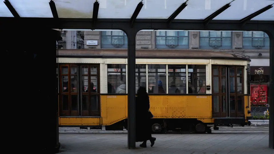
Milan's trams are part of its character. The orange Carrelli trams, known as Ventotto because they were introduced in 1928, still run on several lines, with wooden seats and brass fittings. Line 1 crosses the centre past La Scala and is a pleasant way to see the city from street level. Modern trams serve longer routes to the suburbs. Trams are slower than the metro, but they reach streets far from stations and let you watch the city go by.
Suburban trains and bikes
The suburban S lines run through an underground railway called the Passante, with stations at Porta Garibaldi, Repubblica, Porta Venezia and Porta Vittoria, among others. They are useful for crossing the city quickly and for reaching nearby towns. Milan also has the BikeMi bike-sharing scheme, with docking stations across the centre, and a growing number of cycle lanes, although traffic in some areas requires care.
Accessibility
Newer metro lines, M4 and M5, are fully step-free, and many stations on the older lines have lifts, though not all. Low-floor modern trams and buses are accessible, while the historic trams have high steps. The ATM website and app show step-free stations and report lifts that are out of service.
Walking the centre
For the Duomo, the Galleria, La Scala, Brera and the castle, walking is often quicker than waiting for a train, and our central Milan walking route links them in one loop. We use the metro for longer journeys, such as from the centre to the Navigli, Isola or CityLife, and save the trams for routes where the view is part of the pleasure.
Our view
Milan's transport is efficient, clean and easy to use once you know the colours of the lines. Tap your card, keep it handy for the exit gates, and stand on the right on escalators. For arrivals from the airports, our airports and arrival guide explains which connection suits each airport and how to continue into the city.
Traveller tips
Real advice from people who have been to Milan Public Transport. Every tip is read by our team before it goes live.
No tips yet. Been here? Yours could be the first.
Thank you! Your tip will appear here after a quick review.
More in Milano
Continue exploring Milano with related neighbourhood, food, and planning guides